A journey along Chile's Route of Parks

written by
Steph Dyson

updated 17.11.2020

Chile has long lured the intrepid traveller but in 2018 things stepped up a level. The newly created Route of Parks – a string of Patagonian national parks – links up the country’s most remote corners, from snow-tipped volcanoes to blue-tinged hanging glaciers. Steph Dyson reports from the road.

Thumb out to the road and sat astride my dusty rucksack, I’m ready to channel my inner Bruce Chatwin. During his visit to Patagonia in the early 1980s – a journey that became the basis for his book In Patagonia – he often thumbed a lift with the locals. If only the Southern Highway had existed back then, I’m sure he would have revelled in the chance to do it here.

It wasn’t until 1988 when the 770-mile Carretera Austral, as it’s best known, was completed. This ambitious infrastructure project dates back to the Pinochet dictatorship, when 10,000 soldiers carved a line of dust into the wild, unexplored terrain of southern Chile.

Nowadays, the Carretera Austral’s up there with the Pan American when it comes to road trips – just wilder and affording an acute sense of venturing beyond the limits of civilisation.

Coyhaique and Carretera Austral © sunsinger/Shutterstock

Coyhaique and Carretera Austral © sunsinger/Shutterstock

Back in March 2017, Kris Tompkins, on behalf of Tompkins Conservation and her late husband, Doug Tompkins, made the largest donation of privately-held land in the world. Handing over one million acres to the Chilean government, who matched it with an additional nine million of federal land, overnight Patagonia became home to 85 per cent of the country’s protected lands.

The route reflects a growing focus on protecting Patagonia’s pristine landscapes, with tourism slotting carefully into this.

This act laid the foundations for the Route of the Parks; superficially, a rebranding of 1700-mile chain of seventeen national parks, from Alerce Andino National Park on the northern tip of the Carretera Austral to Cape Horn National Park at the extreme southern end of Chile. But the route, which will see swathes of private parks transformed into national parks, reflects a growing focus on protecting Patagonia’s pristine landscapes, with tourism slotting carefully into this.

As Hernán Mladinic, the Executive Director of Tompkins Conservation in Chile tells me: “tourism is a consequence of good conservation. It is only good conservation that can allow sustainable tourism.” He adds “there would be no Route of Parks, if it did not rest on a solid and vibrant national park system.”

pumalin-national-park-patagonia-michinmahiuda-volcano-chile-shutterstock_791527339

Southern Patagonia © Shutterstock

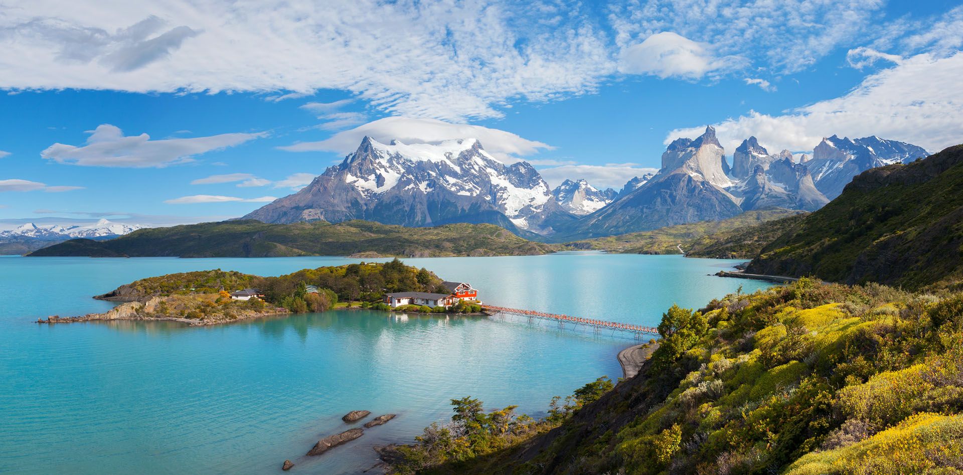
For those who’ve visited Patagonia’s poster child, Torres del Paine National Park, carefully managing rapidly growing tourism is increasingly important. In 2017, over 260,000 visitors piled onto its narrow trails with many complaining of being unable to secure a camping spot or bed in the refuges, despite seeking to book months in advance. It’s no longer the wild, isolated trek that many might imagine before they arrive.

In Cerro Castillo, a three-hour hike brings you to a gleaming, lapis-coloured lake mirroring jagged, snow-tipped spires that recall Torres del Paine further south – just with barely a glimpse of another tourist.

Instead, the Route of the Parks proves there are ample new treasures to discover. From Coyhaique where I start my travels, I’m picked up by a retired couple from Santiago, who trade transport for my offer of GPS-guided navigating skills. It’s an hour and a half’s drive – lined by thick forests of hardy endemic species of ñirre and lenga, and undergrowth dense with prickly calafate bushes – before we reach Cerro Castillo, the route’s newest national park. In Cerro Castillo, a three-hour hike brings you to a gleaming, lapis-coloured lake mirroring jagged, snow-tipped spires that recall Torres del Paine further south – just with barely a glimpse of another tourist.

argentina-llamas-shutterstock_514122538

Llamas in nature © Shutterstock

Another 150 miles and you reach a flagship project of Tompkins Conservation, Patagonia Park, with its six hiking trails, campgrounds and even luxury lodge accommodation, making it one of the most “tourist ready” of all the parks in the region.

But for a truly off-the-beaten-path experience, Patagonia has never felt wilder or more remote than at its southernmost tip.

Tierra del Fuego, an island separated from mainland Chile by the Strait of Magellan, is the epitome of inhospitable terrain, characterised by ragged mountains that slide dramatically into deep valleys lined with rust-coloured peat bogs and glacial lakes. This is where Yendegaia National Park, one of the route’s most southern parks, is located.

Nowhere else along the 1700-mile route are you left feeling quite so remote, so close to the ends of the earth.

On its doorstep, after a seven-hour drive down Chilean Tierra del Fuego’s only road (the island is neatly divided into Argentine and Chilean territory by the arching backbone of the Andes Mountains), Estancia Lago Fagnano makes a good base from which to absorb the wildness at the end of the Route of the Parks.

Cerro Castillo Chile © VGranta/Shutterstock

Cerro Castillo Chile © VGranta/Shutterstock

German and his wife Marisela offer me tea and freshly-baked bread rolls in their modest cabin on the skirts of Lago Fagnano, while Marisela talks about their journey here, over twenty years ago: “everything we needed to build the first cabin came on horseback all the way from Punta Arenas,” she tells me. “It took years before the road followed”.

The Route of Parks might have given a name and an identity to a seemingly disjointed squiggle of protected lands on the map, but it’s certainly not taken away any of the thrill of journeying to them.

I drive to Caleta Maria, an old harbour on the edge of Admiralty Sound near to where the end of the road currently lies (although the army is continuing to blast their way through the rock to etch a route south to link Tierra del Fuego with Isla Navarino).

This is the closest I’m getting to Cape Horn, the final national park and one that is only accessible by boat.

It’s here that I experience what Hernán Mladinic told me about the vision of the Route of the Parks: “it’s without a doubt a challenging invitation to live adventures in a mythical territory… but also a place to reconnect with oneself in the solitude of these places.”

Lake Fagnano ©  Pola Damonte/Shutterstock

Lake Fagnano © Pola Damonte/Shutterstock

Nowhere else along the 1700-mile route are you left feeling quite so remote, so close to the ends of the earth. The Route of Parks might have given a name and an identity to a seemingly disjointed squiggle of protected lands on the map, but it’s certainly not taken away any of the challenge – or thrill – of journeying to them.

Header image: Coyhaique and Carretera Austral © sunsinger/Shutterstock

Steph Dyson

written by
Steph Dyson

updated 17.11.2020

  • Nature & Wildlife
  • National Parks & Reserves
  • Off the Beaten Track
  • Walking Hiking Trekking
  • Inspiration
  • Chile

Planning your own trip? Prepare for your trip

Use Rough Guides' trusted partners for great rates

Ready to travel and discover
Chile?

Get support from our local experts for
stress-free planning & worry-free travels

Plan my trip ⤍