Travel advice for USA
From travel safety to visa requirements, discover the best tips for visiting USA
Plan and book your private, tailor-made tour with vetted local experts
Think of the United States as several countries rolled into one. In a single trip you can move from the neon lights of Las Vegas to the misty forests of the Pacific Northwest, or from live jazz in New Orleans to the cliffs of Yosemite. The country stretches across six time zones, covering beaches, deserts, arctic wilderness, bustling cities, and small towns. This makes planning a US itinerary a bit difficult.
Planning a US itinerary takes some thought because distances are huge and seasons vary a lot. What you choose depends on your interests. You might want to dive into East Coast history, spend time in the national parks, follow the music of the South, or explore the creative side of the West Coast. A clear itinerary helps you use your time well and avoid wasting days on the road.
When you are ready to start mapping it out, Rough Guides’ local experts can put together a trip that fits your interests while taking care of the logistics.
Most people plan around 7, 10, or 14 days. A week is enough to focus on one region, while two weeks give you space to see more of the country. It all comes down to what you want most from your trip and how much time you have. Each length of time lets you experience the country differently.
Thinking about the details? Our US local travel experts can have them covered.

Bostin in the fall in the US © Shutterstock
This week-long US itinerary through the East Coast (also known as New England) takes you through Boston’s history, Maine’s coast, and Vermont’s mountains. Seven days is enough time to enjoy each destination without rushing.
Begin your trip in Boston, known for it’s historical landmarks. After breakfast, start the Freedom Trail at Boston Common. The red-brick path leads to the State House with its golden dome, Park Street Church known as “Brimstone Corner,” and the Granary Burying Ground, where Samuel Adams and other Revolutionary figures are buried.
Break for lunch at Faneuil Hall or Quincy Market, which has plenty of food vendors and often live performers. Continue into the North End and visit the Old North Church, where Paul Revere’s lanterns once signaled the British advance. In the evening, have dinner at Regina Pizzeria or Giacomo’s Ristorante, then take a walk along the harbor as the city lights reflect on the water.
Insider tip: A Boston CityPASS helps you skip admission lines and save money on major attractions.
For day 2 of this week long US itinerary, take the subway across the Charles River to Harvard Square. Walk through Harvard Yard to see Harvard Hall and the Widener Library. The John Harvard Statue is a popular stop, its bronze toe shiny from visitors touching it. The campus is known for it’s historic buildings with the energy of students moving between classes.
From here, have lunch at a casual cafe in Harvard Square. In the afternoon, visit the Museum of Fine Arts to see pieces that range from Monet’s Water Lilies to a large collection of Egyptian artifacts, and stay in the Fenway area for dinner. You might take a guided tour of Fenway Park to learn about baseball history or go to the Samuel Adams Brewery for a tasting.

Travel time: about 2 hours
On day 3, you’ll drive north on I-95, passing New Hampshire’s short stretch of coastline before entering Maine. If you want to pause along the way, Portsmouth is an easy stop for coffee and a walk downtown.
Once in Portland, head to the Old Port district with its cobblestone streets, galleries, and cafes. Your first stop is the Holy Donut, known for potato-based donuts. From there, take a walk to the Eastern Waterfront for views of Casco Bay. For seafood, J’s Oyster Bar is a classic choice for a lobster roll. If you like beer, you’ll want to visit Allagash Brewing Company to try their Belgian-style ales.
Insider tip: Order a lobster roll “Connecticut style,” served warm with butter instead of mayo, for a richer version.
Start 4th your day at Portland Head Light in Cape Elizabeth. Built in 1791, it has guided ships along Maine’s rocky shoreline for more than two centuries and even inspired Longfellow’s poetry. Fort Williams Park surrounds the lighthouse with old military ruins, and the small museum explains more about maritime navigation.
Back in Portland, J’s Oyster Bar is a classic choice for lunch. From here, walk along the Eastern Promenade for views of Casco Bay and its many islands. The Arts District has galleries, theaters, and the Portland Museum of Art. A good end of the evening would be dinner downtown followed by a walk along the waterfront as the fishing boats come back in.

© Shutterstock
Travel time: 2.5 hours
Leaving Portland, head west into rural Maine before crossing into New Hampshire’s White Mountains. Route 16 takes you to North Conway, which is a small town with outlet stores and great mountain scenery.
From there, drive the Kancamagus Highway through White Mountain National Forest. Lower Falls has natural pools carved into the rock, Sabbaday Falls drops through a narrow gorge, and Rocky Gorge shows the force of the Swift River over time. Finish the day with a traditional inn dinner built around seasonal produce, maple syrup, and apple cider.
Diana’s Baths is a moderate hike near North Conway. The path leads through forest to a chain of waterfalls flowing over granite ledges, with clear pools that are popular for swimming in summer. The combination of rushing water, shaded forest, and sunlight on the rocks makes it a memorable walk.
Spend the afternoon back in North Conway. Browse local shops for maple products and handmade goods, or relax with mountain views. Dinner at a traditional inn usually includes hearty stews, fresh bread, and produce from nearby farms, reflecting the region’s long food traditions.

Rocky Gorge, white mountains, New England © Shutterstock
Travel time: 3 hours
Drive west into Vermont along Interstate 89. The road passes through hills, valleys, dairy farms, and maple groves, with villages that have kept their traditional character.
In Burlington, Church Street Marketplace is a pedestrian-only street with performers, small shops, and restaurants focused on local food. Just outside town, the Shelburne Museum has an extensive collection of folk art and Americana displayed in historic buildings moved here from across New England.
For sunset, go to Battery Park overlooking Lake Champlain and the Adirondacks. Finally, end your trip with a visit to Switchback Brewing or a farewell dinner built around Vermont cheese, maple syrup, and produce from nearby farms.
Insider tip: Order a cheese plate with Cabot aged cheddar and local honey for a classic Vermont flavor.
Prefer a personalized approach? Our local travel experts craft custom itineraries and stay on hand for full support.

Burlington, Vermont, USA © Shutterstock
Driving Route 66 is one of the best ways to see how much variety there is across the United States. In 10 days you can cover about 2,400 miles (3,860 km) from Chicago to Santa Monica. That’s enough time to stop for roadside landmarks, historic towns, and museums without rushing through the trip.
Start the drive at Lou Mitchell’s, a diner that has been feeding travelers since 1923. They keep the tradition of handing out donut holes and Milk Duds at the door, which makes the wait for a table a little sweeter. From downtown, pass the bronze lions outside the Art Institute of Chicago before heading southwest.
In Wilmington you’ll find the Gemini Giant, a fiberglass spaceman built in 1965 that towers 30 feet (9 m) over the roadside. Continue to Pontiac to see the Illinois Route 66 Hall of Fame inside a restored firehouse. End the day in Springfield at Abraham Lincoln’s Home National Historic Site, where he lived before his presidency.
Start with breakfast at Cozy Dog Drive-In, where the corn dog on a stick was created in 1946. Pay a visit to Lincoln’s Tomb in Oak Ridge Cemetery, then continue south to Henry’s Rabbit Ranch in Staunton. It has both live rabbits and rows of old VW Rabbits lined up outside.
Before reaching St. Louis, walk across the Chain of Rocks Bridge, a mile-long bridge with a distinctive 22-degree bend and views of the Mississippi River. End the day under the Gateway Arch, a stainless steel monument that rises 630 feet (192 m) and marks the beginning of the American West.

Route 66 © Shutterstock
Take a guided tour through Meramec Caverns, a cave system that has been tied to stories of Jesse James. It stays at a steady 60°F (15°C) year-round, so bring a jacket. In Cuba, Missouri, you can see the World’s Largest Rocking Chair, which measures 42 feet (13 m) tall.
Stop at the Fanning 66 Outpost to browse Route 66 memorabilia and vintage gas pumps. In Lebanon, the neon sign at the Munger Moss Motel has been glowing since 1946. The town’s Route 66 Museum displays historic cars, photographs, and exhibits on how the highway shaped American travel.
Travel time: about 4 hours
This drive crosses Missouri, Kansas, and Oklahoma, with Ozark hills gradually giving way to open prairie. Much of the road follows I-44, but you can still find preserved stretches of old Route 66. In Carthage, the Precious Moments Chapel displays murals and sculptures created by Samuel Butcher.
In Kansas, stop at the Rainbow Curve Bridge, built in 1923 and carefully restored. Nelson’s Old Riverton Store, dating back to 1925, sells sodas and nostalgic road snacks. Near Tulsa, the Blue Whale of Catoosa, built in the 1970s, has become one of the highway’s most recognizable landmarks. End the day at Cyrus Avery Centennial Plaza, where sculptures commemorate the man often called the Father of Route 66.

Oklahoma City, Oklahoma © Sean Pavone/Shutterstock
Travel time: about 2 hours
With a shorter drive today, you’ll have time to stop along the way. In Arcadia, the Round Barn built in 1898 is now a museum with Route 66 exhibits. Nearby, Pops is easy to find with its 66-foot (20 m) neon soda bottle. Inside, the shelves are stacked with hundreds of soda varieties. In Clinton, the Oklahoma Route 66 Museum traces eight decades of history with cars and interactive displays.
In Oklahoma City, visit the National Cowboy and Western Heritage Museum for artifacts and art from the frontier period, or head to Bricktown, a former warehouse district that has been redeveloped with restaurants and shops along a canal.
Travel time: Approximately 4.5 hours
This drive takes you across the open plains of the Texas Panhandle, passing farming towns and oil fields. In Hydro, Lucille’s Service Station has been preserved as a small museum. Lucille Hamons ran it for nearly sixty years, and it has become a Route 66 landmark.
Groom is home to the Leaning Water Tower, which tilts at an odd angle and makes for a memorable roadside stop. The MidPoint Café in Adrian marks the halfway point of the highway’s 2,448 miles, and its “ugly crust” pies are part of the tradition. The day ends in Amarillo at the Big Texan Steak Ranch, known for its 72-ounce steak challenge and Western-style dining hall.

Albuquerque, New Mexico © Sean Pavone/Shutterstock
Cadillac Ranch is one of Amarillo’s most recognizable stops. Ten Cadillacs from the 1940s to the 1960s are buried nose-first in a field, and visitors add spray paint to the cars, keeping the installation in constant change.
Palo Duro Canyon State Park offers hiking trails with wide desert views and colorful cliffs. Back in Amarillo, the American Quarter Horse Hall of Fame tells the story of this important horse breed through exhibits and demonstrations. The antique district downtown has historic buildings filled with shops where you can browse for cowboy memorabilia and Route 66 collectibles.
Travel time: Approximately 4 hours
Driving west into New Mexico, the land opens into high desert. Tucumcari is home to the Blue Swallow Motel, which has welcomed travelers since 1958 with its vintage motor court style and neon sign. The town’s Mural Mile covers walls with paintings that celebrate Route 66 and regional culture.
In Santa Rosa, the Route 66 Auto Museum houses dozens of restored cars and other memorabilia. Albuquerque’s Old Town, founded in 1706, has adobe buildings that now hold restaurants, galleries, and shops. The KiMo Theatre nearby still hosts live shows and screenings.

Scenic highway in Monument Valley Tribal Park in Arizona-Utah border © Edwind Verin/Shutterstock
Travel time: Approximately 5 hours
The drive into northern Arizona climbs nearly 4,000 feet (1,220 m) and brings a change from desert flats to pine-covered mountains. Near Joseph City, the Jackrabbit Trading Post became famous through roadside billboards that once stretched for miles.
Petrified Forest National Park lies along the way, with fossilized trees more than 225 million years old, colorful desert scenery, and ancient petroglyphs. In Flagstaff, the historic downtown still shows its railroad past, with old hotels, restored buildings, and glowing neon signs. At 7,000 feet (2,130 m), the cooler air is a welcome change from the desert heat.
Travel time: Approximately 7 hours
The last stretch of Route 66 crosses the Mojave Desert before reaching the Pacific Ocean. In Seligman, Angel Delgadillo’s barber shop and gift store have become the heart of town since the 1950s and even inspired Radiator Springs in Pixar’s Cars.
Farther west, Elmer’s Bottle Tree Ranch in Oro Grande creates a desert forest from thousands of glass bottles mounted on metal poles. In Amboy, the Roy’s Motel and Café sign still stands tall as a reminder of the highway’s heyday. The route finishes at Santa Monica Pier in California, where the “End of the Trail” sign marks the close of Route 66’s 2,448 miles.
Ready to make this trip your own? Our local experts design personalized itineraries and back them with full support.

Santa Monica pier, California, beautiful sunsets © Shutterstock
This two weeks itinerary in the American West will take you across fantastic desert and mountain landscapes. This route connects five national parks with long drives and steady days on the trails. It is paced so you can experience each place without rushing.
Begin in Las Vegas by picking up your rental car and stocking up on food and water. The drive to Springdale, Utah, takes you out of the city and into red rock country.
Springdale is right outside the entrance to Zion National Park and works well as a first base. In the evening, walk through the visitor center area to learn how the shuttle system runs and look over the trail options. An early dinner and a good night’s rest prepare you for tomorrow.
Insider tip: Buy an America the Beautiful National Parks Pass at your first park entrance. It covers every stop on this trip and saves money quickly.
Take the shuttle to the Temple of Sinawava and follow the Riverside Trail, an easy walk beside the Virgin River with steep canyon walls on both sides.
Afterward, ride back toward the Emerald Pools trailhead. Hike to the Lower and Middle Pools where small waterfalls drop into shaded alcoves. For more background, stop at the Zion Human History Museum to learn about the geology and the people who have lived here.
Insider tip: Start at the last shuttle stop and work your way back. The farther stops are usually less crowded.

Zion Park, USA © Shutterstock
Today is for hiking Angels Landing in Zion. A permit is required. The trail begins with steep switchbacks called Walter’s Wiggles and reaches Scout Lookout. From there, the last half-mile climbs a narrow ridge with chains for support.
At the top you stand 1,500 feet (457 m) above the canyon floor with wide views. Later, take time to rest in Springdale and browse the small galleries and shops. Prepare your gear for tomorrow’s river hike.
Insider tip: Begin before 7 a.m. The trail is cooler, less crowded, and safer in the chain section.
The Narrows takes you directly into the Virgin River. Cliffs rise above you as the walls close in to about 20 feet (6 m). Depending on the season, the water can be ankle deep or chest deep. The light changes through the day as it filters down from above, making the canyon feel different around each bend.
Once you finish, dry off and drive northeast to Bryce Canyon. The 2-hour trip climbs to higher ground where the air cools and the landscape changes to plateau country.
Insider tip: Rent water shoes and neoprene socks in Springdale. Hiking boots are heavy and slippery when soaked.

Bryce Canyon National Park in Utah, USA © arkanto/Shutterstock
Bryce Canyon’s natural amphitheaters are crowded with orange and red rock spires called hoodoos. Start at Sunrise Point, where the first light slowly changes the colors across the formations. The Navajo Loop Trail takes you down between the hoodoos and through narrow passages. Link it with the Queen’s Garden Trail to form a figure-8 route that combines broad views with time among the rock formations. For wide perspectives, Inspiration Point and Bryce Point both show the scale of the canyon.
Insider tip: Bring layers. At over 8,000 feet (2,438 m), temperatures can drop by 40°F (22°C) from day to night.
Before leaving Bryce, walk part of the Fairyland Loop for quieter views of the hoodoos. Pick up supplies at the Bryce Canyon General Store, then take Highway 12 toward Capitol Reef. The road moves through plateaus, canyons, and badlands, each section giving a different look at the region’s geology.
Along the way, small towns maintain their Old West character. The drive itself is part of the experience.
Insider tip: Download offline maps because cell service cuts out along Highway 12.

Temple of the Sun in Capitol Reef National Park © ToTheHeightsPhoto
In Capitol Reef, sttart at the visitor center to learn about the white Navajo sandstone domes.The Petroglyphs Trail leads to Fremont Indian carvings that are more than 1,000 years old.
The Scenic Drive takes you past red cliffs and pale domes that shape the park’s identity. In the Fruita Historic District, orchards planted by Mormon settlers still produce apples, pears, and cherries in season. The short hike to Hickman Bridge leads to a natural stone arch created by erosion.
Insider tip: Bring small bills or coins if you want fruit. The orchards use an honor system for payment.
Begin with a walk through Cohab Canyon, a narrow passage with tall sandstone walls that glow with reflected light. It is a quieter start to the day. On the way to Moab, stop at Goblin Valley State Park. Here, thousands of mushroom-shaped formations cover the desert floor, shaped by erosion of soft mudstone.
The main route on Interstate 70 crosses open desert with mountain ranges in the distance before dropping toward the Colorado River. The Goblin Valley stop adds about an hour but introduces a landscape unlike anywhere else.

Delicate Arch in Arches, Utah © Shutterstock
Arches National Park contains more than 2,000 natural stone arches as well as fins and balanced rocks. Delicate Arch is the most recognized, reached by a three-mile (4.8 km) round-trip hike across slickrock. The arch stands alone at the edge of a canyon with the La Sal Mountains behind it.
The Windows Section brings together several large arches, including North and South Windows and Turret Arch. The Park Avenue Trail runs between sandstone walls that rise like skyscrapers.
The Fiery Furnace is only accessible with a ranger-led tour. It takes you through a maze of sandstone fins, where you scramble through narrow passages and climb over rock to reach hidden arches. Balanced Rock shows how erosion can leave a boulder perched on a thin pedestal. Sand Dune Arch and Broken Arch give you quieter trails away from the park’s busiest areas.
Insider tip: Book Fiery Furnace tours early since spaces are limited and go quickly.

Moab Utah, Arches and Canyonlands National Parks © B Norris/Shutterstock
The Island in the Sky district of Canyonlands rests on a high mesa surrounded by deep canyons carved by the Colorado and Green Rivers. A short pre-dawn walk leads to Mesa Arch, where the sunrise lights the underside of the rock and frames the La Sal Mountains.
Grand View Point stretches across the Colorado River canyon, while the White Rim Overlook Trail takes you to a quieter edge with a different perspective on the cliffs. Upheaval Dome is also worth seeing. It is a circular formation that geologists debate may have come from a meteor strike or shifting underground salt.
The trip from Moab to the Grand Canyon’s South Rim takes about 4.5 hours and passes through red rock desert, high plateaus, and pine forest. Flagstaff is a convenient stop for lunch and supplies, with a historic Route 66 main street and the San Francisco Peaks rising in the background.
The final stretch on Highway 64 builds anticipation as the road winds through juniper and ponderosa before the canyon suddenly appears. Watching the sun go down at Hopi Point is a fantastic introduction, with the rock walls glowing in the last light.

Grand Canyon Skywalk © nootprapa/Shutterstock
For day 13 of this two week US itinerary, start the day at Mather Point. The early sun here reaches across to the North Rim and highlights the depth of the canyon.
The South Kaibab Trail is a good choice for a short hike. Even walking to Ooh Aah Point or Cedar Ridge gives a sense of the scale and rock layers. Desert View Road connects several overlooks such as Lipan Point and Moran Point, each are worth your time. At the far end, the Desert View Watchtower, designed by Mary Colter, was inspired by ancient Puebloan architecture. Inside are murals showing Native traditions, and from the top you can see across the canyon.
Insider tip: Begin hikes early in the morning and turn around at the marked points. Going down is easier than coming back up, which usually takes twice the time.
On your last morning of this US itinerary, take a walk down the Bright Angel Trail to the Mile-and-a-Half Resthouse. It is a manageable distance that gives you a look into the iinner canyon without committing to a full day.
Along the way, the plant life changes with each layer of rock. Back on the rim, Kolb Studio and Lookout Studio are a good place to see Grand Canyon photography and to give different perspectives on the landscape. Before leaving, have a final meal with canyon views before driving to Las Vegas or Flagstaff for your departure.

Grand Canyon from Desert View Point, South Rim with the Colorado © Josemaria Toscano/Shutterstock
There is no single right way to travel in the United States. What makes sense depends on what you want most. Rough Guides’ local experts can build a trip around your interests, whether that means civil rights history, craft beer, or time in nature with a camera.
They also take care of the details, from hotels and trains to activities. If you want a table at a barbecue place in Kansas City or tickets for a Broadway show in New York, they can arrange it. You also have 24/7 support during your trip, so there is always someone to call if your plans change.
You can add private guides too. In Memphis that might mean hearing stories about jazz musicians, while in the Grand Canyon it could mean learning how the layers of rock formed. These experiences add depth and help you connect with the places you visit.
When you are ready to plan, reach out to Rough Guides’ experts and start shaping a trip through the United States that feels right for you.

Redwood National Park in California © 2009photofriends/Shutterstock
The US is a huge country, and truly you could spend many years here without seeing it all. That means you have quite a few choices when it comes to what to see while you are here. Here are some other US itineraries that are worth taking.
This 12-day trip takes you through California and the Pacific Northwest, connecting cities, mountains, forests, and coastline. You’ll begin in San Francisco, continue through Yosemite, then head north to Portland and the Columbia River Gorge. From there you can explore Olympic National Park before ending in Seattle with a side trip to Mount Rainier.

Bourbon St, New Orleans, Louisiana, USA © Sean Pavone/Shutterstock
This 12-day trip takes you through the cultural heart of the American South. You’ll hear the roots of jazz, blues, and country, and see how music and history shaped the region. Along the way, you’ll move between cities, quiet mountains, and towns where the past is still very present.

Historic buildings along Spring Street on a bright sunny day in Manhattan, New York City © Ryan DeBerardinis/Shutterstock
A week in New York lets you see the city from different angles. This itinerary will cover crowded streets, quiet parks, and neighborhoods that each carry their own character. Museums, theater, and food fill your days.

Fabulous Las Vegas sign © AdobeStock
Here’s some of the most common questions we get from our readers when planning a US itinerary.
If it’s your first trip and you want to see a lot of the US, two to three weeks is a good amount of time. That gives you room to handle jet lag, cover the big distances, and actually enjoy each place instead of rushing.
In that time, you could spend a few days on the East Coast in New York and Washington DC, then fly west to see National Parks like Yellowstone or the Grand Canyon, and finish in California. Another idea is to mix the music cities of the South with the desert scenery of the Southwest.
The country is huge. There are six time zones, and the landscapes range from Alaska’s glaciers to Hawaii’s beaches, Maine’s rocky shore to Florida’s swamps. Each state feels different, with its own culture, accents, and even laws. What feels normal in Oregon might be unusual in Alabama.
If you only have a week, stick to one region. The Northeast corridor, California, or a road trip through Arizona and Utah all work. Less than five days usually means you’ll only get to know one city, which can be worth it in and of itself.

Dry Tortugas National Park in Florida © Varina C/Shutterstock
Spring and fall are usually the best time to visit the US for moving around the country. October is when the Northeast shows its fall colors, while spring is a good time for the desert Southwest.
Summer is great for Alaska and the Pacific Northwest, but the South becomes hot and humid. Winter splits the country in two: ski season in places like Montana or Colorado, and warm weather escapes in Florida and Southern California.
Hurricane season runs June through November along the Gulf Coast and Atlantic. If you’re traveling then, keep an eye on forecasts and think about insurance.
Big events change things too. Mardi Gras in New Orleans in February or SXSW in Austin in March can make hotels scarce and expensive. The Mountain West is open most of the year, though you may need time to adjust at higher elevations.
Flying is the fastest way between major cities. A coast-to-coast flight takes about six hours. Budget airlines can be cheaper, though they often charge extra for luggage.
Road trips are classic, but distances are bigger than many visitors expect. Texas on its own is larger than France. The Interstate system makes driving long distances straightforward. Greyhound buses connect most cities and are affordable but slow and uncomfortable.

Mammoth Lakes in the California Sierra Nevada Mountains © trekandshoot/Shutterstock
Having a car gives you flexibility to explore small towns, scenic drives, and National Parks. Outside of big cities parking is usually free. In cities, though, parking can run $50 a day or more, and traffic in Los Angeles or Atlanta can be frustrating. You’ll need insurance, and many international travelers also need an International Driving Permit with their license.
Transit depends on the city. New York’s subway runs all night and takes you almost everywhere. Chicago’s ‘L’, Washington DC’s Metro, Boston’s ‘T’, and San Francisco’s BART work well for visitors. Seattle, Portland, and Philadelphia also have growing rail networks.
Los Angeles has improved, but most people still drive. Houston, Phoenix, and Las Vegas have limited systems, and smaller cities usually just have buses.
Apps like Citymapper or Transit help with directions. In big, spread-out places like Miami or Dallas, you’ll likely mix public transport downtown with rideshares elsewhere. University towns often surprise travelers with decent bus systems since many students don’t have cars. Uber and Lyft are found in most places in the country.

Joshua Tree National Park, USA © Martin Froyda/Shutterstock
Amtrak is best for the experience, not speed or budget. Routes like the California Zephyr through the Rockies or the Southwest Chief across the desert are unforgettable. But a cross-country trip takes three days, often costs more than a flight, and delays are common because freight trains get priority.
The Northeast Corridor between Boston, New York, Philadelphia, and DC is the exception. The Acela train competes well with flying once you factor in airport lines. Short scenic routes are also worth it, like the Pacific Surfliner along California’s coast or the Empire Builder to Glacier National Park. Sleeper cars are comfortable if you book early. Just remember that trains are often older and more noisy than trains in other parts of the world.
The US is mid-range compared with other destinations. It’s pricier than Mexico, similar to Western Europe, and cheaper than Switzerland or Scandinavia. That said, what you pay will vary greatly depending on what part of the country you are in. San Francisco and New York City will cost quite a bit more smaller cities.

BBQ © Joshua Reshua/Shutterstock
If you’re from a Visa Waiver Program country like the UK, EU nations, Japan, or Australia, you’ll need an ESTA. It costs $21 and usually gets approved quickly. Apply at least 72 hours before your flight. It allows a stay of up to 90 days. Canadians don’t need an ESTA or a visa.
Travelers from other countries need a B-2 tourist visa, which means an embassy interview and wait times that can stretch to weeks. Book early. At immigration, be ready to explain your trip, show proof of funds, and have a return ticket. Officers can deny entry if they aren’t satisfied.
Don’t joke about working or overstaying, and remember leaving briefly doesn’t reset your 90 days. If you’ll visit often, Global Entry can make arrivals smoother.
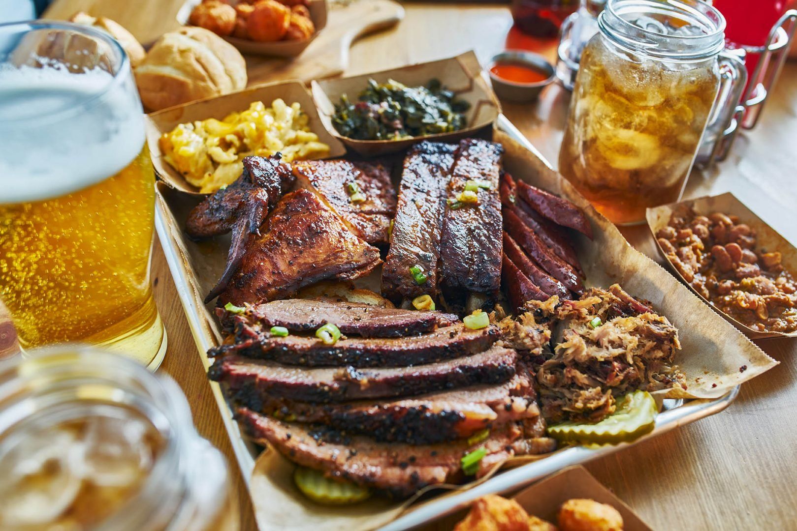
Tipping isn't optional in America - it's how service workers pay rent. Servers earn as little as $2.13 hourly before tips, so that 20% isn't generosity, it's their wage. General amounts are:
You don’t tip at fast food counters, gas stations, or retail shops. Some restaurants add gratuity automatically for groups of six or more, so always check your bill. Poor service might warrant 15% instead of 20%, but never stiff completely unless something egregious happened. Cash tips are preferred but cards work most places.
Planning your trip doesn’t need to be stressful. Rough Guides’ local travel experts will design your route, book your stays, and keep everything running smoothly with round-the-clock support. You just enjoy the journey. Learn more about our tailor made trips.
From travel safety to visa requirements, discover the best tips for visiting USA
written by
Dre Roelandt
updated 17.09.2025
Dre Roelandt is originally from the United States but lives and works in Berlin, Germany. Dre is a freelance writer and artist with a passion for travelling. They are an in-house Senior Content Editor at Rough Guides.
Arrange your trip, hassle-free, with local travel experts
Arrange your trip with local travel experts