Trip ideas for Peru
Crafted with by local experts

10 days
Northern Peru hidden gems tour
The Northern Peru hidden gems tour invites discerning travelers to experience one of the most authentic Peru trips available. Trade crowded routes for quiet archaeological wonders, dramatic coastal and Andean landscapes, and meaningful cultural encounters that reveal the country’s true spirit.Designed as a tailor-made journey, this experience is shaped around your pace, passions, and values. Work closely with our local experts to craft a personalized itinerary, from community visits to off-the-beaten-path sites rarely included in traditional Peru trips.Ready to create unforgettable memories? Contact our specialist team to begin planning your custom Northern Peru adventure.
view trip ⤍
9 days
Coast, Andes, and Amazon trip in Peru
Answer the call of Peru with a coast, Andes, and Amazon journey designed around your passions. Among the most inspiring Peru trips, this carefully crafted itinerary brings together the country’s dramatic landscapes and rich cultures in one seamless experience. Picture private encounters with local communities, sunrise light illuminating ancient stone, and the gentle sounds of the river beneath a canopy of deep green.Designed for travelers who seek meaning as well as beauty, this Peru trip unfolds at your pace and reflects your interests and curiosity. Every detail is thoughtfully arranged, from distinctive stays to immersive experiences, so you can explore Peru with depth, comfort, and confidence.
view trip ⤍
15 days
Exploring Southern Peru trip
Transform your curiosity into an unforgettable cultural journey with one of our most immersive Peru trips through the south of the country. Designed for travelers who value authenticity and vibrant local traditions, this experience blends private performances, hands-on culinary sessions, and atmospheric Andean evenings that bring heritage to life.Meet local storytellers, share meaningful community encounters, and enjoy personalized timing with special access tailored to your interests. Ready to create a vibrant, custom-crafted adventure? Contact us to design your Peru trip and secure your preferred dates for a journey shaped entirely around your passions.
view trip ⤍
9 days
The enigmatic sites of Peru trip
Explore the enigmatic sites featured in this thoughtfully designed journey, one of our most immersive Peru trips for discerning travelers seeking a deeper connection to the country’s timeless landscapes and living cultures. This itinerary blends expert local guides, seamless private transfers, and carefully selected stays that balance comfort with authenticity.Rich in meaningful encounters and paced for discovery, this experience highlights seasonal moments and special access opportunities that elevate your understanding of Peru. Connect with our Peru specialists to personalize your departure and begin planning an unforgettable adventure.
view trip ⤍
14 days
Andes to Amazon trip in Peru
Experience the raw beauty of Colca Canyon as condors glide overhead and ancient terraces line the valley walls. Part of our most immersive Peru trips, the Andes to Amazon journey is designed for travelers seeking authentic, tailor-made experiences across dramatic landscapes, living traditions, and soothing hot springs.Customize your route to include remote canyon viewpoints, cultural encounters, and Amazon rainforest exploration at your own pace. Choose a small group departure or a private itinerary and begin planning your unforgettable journey through Peru.
view trip ⤍
14 days
Tailor-made essential Peru trip
Let this essential journey stand out among our most meaningful Peru trips, transforming your travels into a deeply personal exploration of living traditions, mountain light, and bold flavors. Designed for travelers who value authenticity and thoughtful detail, each itinerary is carefully crafted with expert local guides, artisan encounters, and private experiences that reveal Peru far beyond the postcard.Ready to go deeper? Connect with our travel designers to customize your dates, experiences, and pace, and secure your preferred departure for an unforgettable journey through Peru.
view trip ⤍
11 days
Sacred Valley and Peru Amazon tour
Set your sights on one of our immersive Peru trips, a Sacred Valley and Peru Amazon tour designed to turn travel into personal discovery. This thoughtfully crafted itinerary connects you with highland farming communities, misty cloud forest trails, and the sacred landscapes of the Andes before leading you deep into the rich ecosystems of the Amazon rainforest.Guided by knowledgeable local experts, each day is shaped around your interests, creating space for meaningful encounters and unhurried exploration. This journey invites you to travel with intention, make mindful choices, and experience Peru in a way that feels both authentic and personal.Begin planning today and create an unforgettable adventure that reflects the way you want to see the world.
view trip ⤍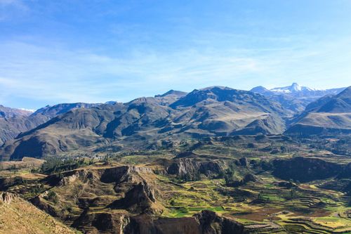
13 days
Inca heritage tour in Peru
Ready to transform travel into a personal journey? Our Inca heritage tour is one of our most enriching Peru trips, created for discerning travelers who value authentic, tailor-made experiences. Connect with living traditions, dramatic Andean landscapes, and the enduring legacy of the Inca civilization.Collaborate with local specialists to design an itinerary that reflects your interests, preferred pace, and personal values. Reserve your dates today and begin crafting a Peru adventure shaped by meaningful encounters, expert guidance, and unforgettable moments.
view trip ⤍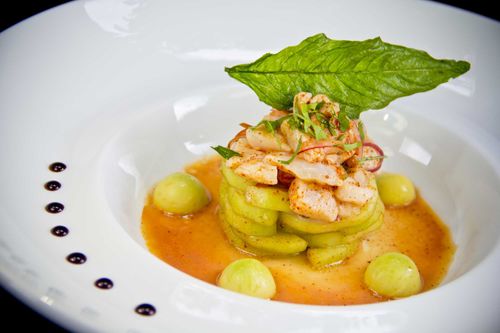
8 days
Tailor-made culinary Peru trip
Claim your place on one of our most flavorful Peru trips, where cuisine becomes a gateway to culture in the luminous Sacred Valley of the Incas. Savor ceviche crafted from fresh market ingredients, learn traditional Andean techniques alongside local chefs, and design menus that reflect your personal tastes and passions.Support community producers while gaining intimate access to living traditions through interactive workshops and private dining in historic surroundings.Reserve your curated culinary adventure today. Contact us to customize your dates, dietary preferences, and special requests, and transform this journey into the personal gastronomic odyssey you have been waiting for.
view trip ⤍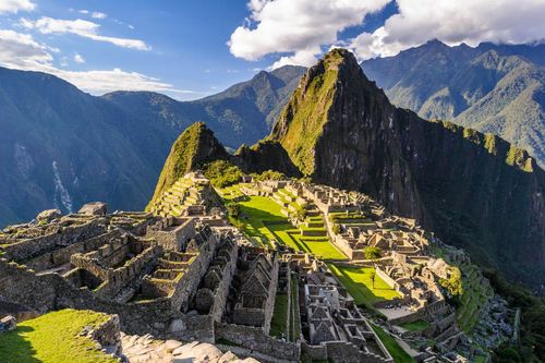
7 days
Peru express trip
Choose a Peru express journey crafted around your passions and discover why our tailored Peru trips go beyond the ordinary. Designed for travelers who value authentic, personalized moments, this experience connects you with expert local guides, thoughtfully curated encounters, and meaningful cultural immersion.Reserve your dates today and let our team custom-design every detail, so you arrive with curiosity and leave with memories that feel uniquely yours.
view trip ⤍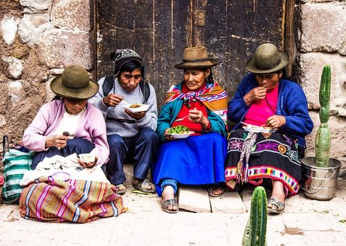
12 days
Peru adventure tour: Andes, Amazon and Lake Titicaca
Discover an extraordinary Peru adventure tour that journeys through the Andes, the Amazon, and the shores of Lake Titicaca. Designed for travelers seeking meaningful Peru trips, this experience blends vibrant culture, dramatic landscapes, and authentic encounters along the way.Savor bold Peruvian cuisine, explore sacred valleys and ancient traditions, and feel the rhythm of the Amazon through carefully crafted moments. Ready to design your journey? Share your dates and travel style with our specialists, and we will create a seamless itinerary that turns inspiration into unforgettable memories.
view trip ⤍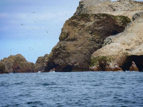
8 days
Inca Empire and Nazca culture tour in Peru
Are you a traveler who values authentic, tailor-made journeys? Our Inca Empire and Nazca culture experience is one of our most immersive Peru trips, designed for those who seek deeper meaning behind every destination.Uncover ancient mysteries, connect with local artisans, and enjoy carefully curated moments shaped around your curiosity. With private access, living traditions, and thoughtful pacing, each detail is crafted to create a seamless and enriching journey.Start planning today. Share your travel style and preferred dates, and we will design a personalized itinerary that transforms wonder into lasting memory.
view trip ⤍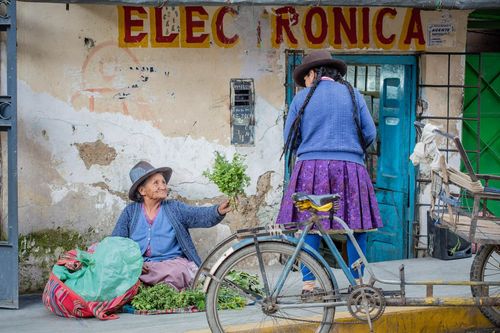
8 days
Female empowerment Peru tour
Step into a female empowerment journey created especially for women who seek meaningful connection and personal growth. As part of our curated Peru trips in Peru, this experience highlights inspiring local women and authentic, tailor-made encounters.Deepen your cultural understanding, support women-led initiatives, and return home energized and inspired. Reserve your dates and begin shaping a travel story that truly matters.
view trip ⤍
19 days
Peru highlights tour | Classic Peru trip
Step into authentic Peru and discover one of our most inspiring Peru trips, designed around meaningful connection and discovery. Walk ancient trails, breathe crisp mountain air, and engage with local communities through experiences shaped by your interests.This tailor-made journey blends living traditions, timeless landscapes, and private guiding to create moments that transform the way you travel. Shape each day alongside knowledgeable local hosts and explore Peru at your own pace. Ready to design your personal Peru experience? Contact us to begin planning your unforgettable adventure.
view trip ⤍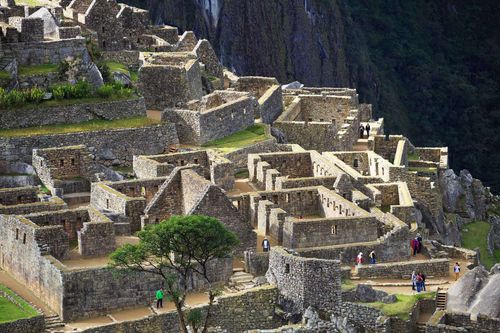
8 days
Inca Civilization tour | Peru trip
Let the Inca Civilization tour lead you into the heart of the Sacred Valley, where living history unfolds through hidden terraces, ancient pathways, and vibrant village life. As one of our most immersive Peru trips, this journey blends handcrafted experiences with meaningful cultural encounters guided by local experts.Choose a tailor-made itinerary that supports family-run lodges, honors authentic rituals, and invites you to share Andean cuisine in welcoming homes. Shape each day around your curiosity and pace, and discover a style of Peru travel designed for genuine connection and lasting memories.
view trip ⤍

16 days
Peru trekking tour in Sacred Valley
Join our Sacred Valley hiking tour and transform your journey into one of the most rewarding Peru trips for active, curious travelers. Designed for those who value authentic, tailor-made experiences, this adventure combines expert local guides with flexible private arrangements, allowing you to set the pace and focus of each day.Choose your travel dates, personalize your route with the guidance of specialists who know the Andes intimately, and secure a departure that reflects your comfort and curiosity. Begin planning a Peru trip that inspires connection, deepens cultural understanding, and reshapes the way you experience the Sacred Valley.
view trip ⤍
4 days
Tailor-made active Peru Machu Picchu tour
Create your own active Peru Machu Picchu tour with one of our thoughtfully crafted Peru trips, designed to combine authentic community stays, invigorating outdoor experiences, and meaningful cultural immersion. Every element can be tailored to your interests while supporting local hosts and traveling with intention.Choose the dates, pace, and activities that match your curiosity and fitness level, then secure a personalized itinerary that transforms an iconic destination into a deeply personal journey. Take the first step today and craft a Peruvian experience that honors culture, challenges your spirit, and rewards you with a lasting connection.
view trip ⤍
5 days
Chachapoyas and Kuelap tour | Peru trip
Answer the call of Peru’s cloud forests and ancient stone cities with the Machu Picchu and Chachapoyas journey, one of our most distinctive Peru trips for travelers seeking authentic connections and meaningful discovery. Guided by local experts, you will explore iconic sites and lesser-known landscapes while shaping experiences around your interests.From private cultural encounters to remote scenic hikes, every detail can be tailored to your pace and passions. Secure your custom itinerary today and turn your curiosity into lasting memories.
view trip ⤍
7 days
Classic Peru luxury tour | Peru in style
Step into an elevated world of refinement and culture on a Peru luxury tour, thoughtfully designed among our most inspiring Peru trips. Here, history, music, and artistry unfold in exceptional style. Created for discerning travelers who value privacy and tailor-made experiences, this journey blends live Andean performances, curated culinary moments, and privileged access to Peru’s most remarkable settings.Share your passions with our team, and we will craft every detail with precision, from hand-selected luxury accommodations to private expert guides, creating a personalized Peru luxury tour that leaves you inspired, connected, and truly indulged.
view trip ⤍
10 days
Inca Wonders Peru trip
For travelers seeking authentic, tailor-made experiences, the Inca Wonders journey stands out among our most immersive Peru trips, revealing the country’s living history and breathtaking landscapes. Move beyond postcards into thoughtfully crafted moments, from private encounters with local artisans to sunrise stillness above ancient stone and guided explorations tailored to your pace.Let us design a personal itinerary that honors local culture while satisfying your curiosity. Request your custom plan today and begin shaping a journey through Peru that feels uniquely yours.
view trip ⤍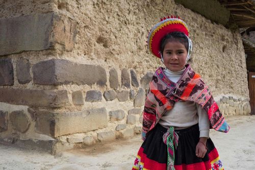
9 days
Family trip to Peru: Cusco, Sacred Valley and Machu Picchu
Turn curiosity into a shared adventure with a thoughtfully designed family trip to Peru. Part of our collection of memorable Peru trips, this journey brings families closer to the country’s culture through meaningful encounters with local guides, welcoming communities, and hands-on experiences across the Andes and beyond.Cook in family kitchens, meet skilled artisans, and explore Peru’s landscapes at a pace that works for all ages. Every detail is carefully arranged to balance discovery, comfort, and connection. Schedule your free planning call to begin crafting a family trip to Peru that reflects your interests and creates lasting memories together.
view trip ⤍ written by
Rough Guides Editors
For over 40 years, Rough Guides has been a trusted name in travel, offering expert-curated guides, inspiring articles, and tailor-made trips. Our passionate team of writers and local travel specialists provide in-depth insights into destinations worldwide, from iconic landmarks to hidden gems. We help you travel smarter and experience the world authentically.