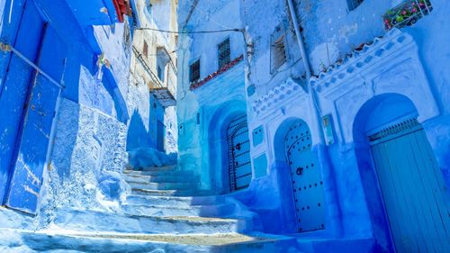
Chefchaouen to Al Hoceima
One of Morocco’s most memorable journeys is the 210-kilometre mountain road from Chefchaouen to Al Hoceima which weaves along high on the crests of the Rif mountains. Snow may occasionally block the road in winter but snowploughs soon restore the flow of traffic. The views for most of the year, however, are spectacular. Paul Bowles describes the route well in “The Rif, to Music” chapter of Their Heads Are Green – “mountains covered with olive trees, with oak trees, with bushes, and finally with giant cedars”.
The road from Chefchaouen sweeps steadily upwards through attractive countryside with olive farms, cork oaks and flowery hedgerows to reach the village of Bab Taza, where, suddenly, the feeling of being at altitude kicks in. Beyond Khamis Medik, the road runs through woods of various oak species with the richest cultivation in the Rif on the impressively deep slopes below, dotted with farms and the expensive and isolated villas that are testimony to the wealth generated by the cannabis trade. The road reaches its highest level at Bab Besen (1600m) where the landscape is covered in magnificent cedar forests.
Abd el Krim and the Republic of the Rif
Until the establishment of the Spanish Protectorate in 1912, the tribes of the Rif existed outside government control. They were subdued temporarily by harkas, the burning raids with which sultans asserted their authority, and for a longer period under Moulay Ismail; but for the most part, bore out their own name of Imazighen, or “Free Ones”.
Closed to outside influence, the tribes developed an isolated and self-contained way of life. The Riffian soil, stony and infertile, produced constant problems with food supplies, and it was only through a complex system of alliances (liffs) that outright wars were avoided. Unique in Morocco, the Riffian villages are scattered communities, their houses hedged and set apart, and where each family maintained a pillbox tower to spy on and fight off enemies. They were different, too, in their religion: the salat, the prayers said five times daily – one of the central tenets of Islam – was not observed. Djinns, supernatural fire spirits, were widely accredited, and great reliance was placed on the intercession of local marabouts.
It was an unlikely ground for significant and organized rebellion, yet for over five years (1921–27) the tribes forced the Spanish to withdraw from the mountains. Several times they defeated whole Spanish armies; first and most memorably at Annoual in 1921. It was only through the intervention of France, and the joint commitment of nearly half a million troops, that the Europeans won eventual victory.
In the intervening years, Abd el Krim el Khattabi, the leader of the revolt, was able to declare a Republic of the Rif and to establish much of the apparatus of a modern state. Well educated, and confident of the Rif’s mineral reserves, he and his brother, Mohammed, manipulated the liff system to forge an extraordinary unity among the tribes. Impressively, the brothers managed to impose a series of social reforms – including the destruction of family pillboxes and the banning of kif – which allowed the operation of a fairly broad administrative system. It was the first nationalist movement in colonial North Africa, and although the Spanish were ready to quit the zone in 1925, it was politically impossible for the French to allow that. Defeat for the Riffians – and the capture of Abd el Krim at Targuist – brought a virtual halt to social progress and reform. The Spanish took over the administration en bloc but there was no road-building programme nor any of the other “civilizing benefits” introduced in the French zone. Many of the Riffian warriors were recruited into Spain’s own armies, allowing General Franco to build up a power base in Morocco. It was with Riffian troops that he invaded Andalusia in 1936, and it was probably their contribution that ensured the Fascist victory in the Spanish Civil War.
When, in April 1957, the Spanish finally surrendered their protectorate, the Berbers of the former Spanish zone found themselves largely excluded from government. Administrators were imposed on them from Fez and Casablanca, and in October 1958, the Rif’s most important tribe, the Beni Urriaguel, rose in open rebellion. The mutiny was soon put down, but necessitated the landing at Al Hoceima of then Crown Prince Hassan and some two-thirds of the Moroccan army.
The Rif is still perhaps the most unstable part of Morocco, remaining conscious of its under-representation in government and its historical underdevelopment. However, King Mohammed VI seems sympathetic to this situation and over the past decade the region has witnessed substantial school-building programmes, improved road, air and ferry accessibility, large agricultural projects in the plains south of Nador and Al Hoceima, and continues to see an increase in tourism development along its coast.
Kif in Morocco
Although many of the Riffian tribes in the mountains had always smoked kif, it was the Spanish who really encouraged its cultivation – probably as an effort to keep the peace. This situation was apparently accepted when Mohammed V came to power, though the reasons for his acceptance of the status quo aren‘t obvious. There is a story, probably apocryphal, that when he visited Ketama in 1957, he accepted a bouquet of cannabis as a symbolic gift.
In the early 1970s the Rif became the centre of a significant drug industry, exporting to Europe and America. This sudden growth was accounted for by the introduction, by an American dealer, of techniques for producing hash resin. Overnight, the Riffians had access to a compact and easily exportable product, as well as a burgeoning world market for dope. Inevitably, big business was quick to follow and to this day Morocco is reckoned to be the world’s leading producer of cannabis, supplying the vast majority of Europe’s demand, and with well over a million people said to depend on the crop for their existence, providing the economic base for much of the country‘s north. The government, with help from EU and US grants, has tried to reduce cultivation – a project near Rafsaï has replaced cannabis with 600,000 olive trees, for example – and the authorities claim that cultivation has decreased by almost thirty percent over the past decade. However, these figures are estimations gleaned from satellite photographs and are reckoned by European experts to be highly dubious. While the government’s stated aim to eradicate cannabis cultivation by 2008 clearly failed, there has recently been a steady increase in the number of police-supervised clearing of crops, many of them well publicized to no doubt please Morocco’s European neighbours. The bare fact remains, however, that farmers earn immeasurably more from cannabis than they would from growing legal crops.
Some (non-government) experts are saying that the eradication cause is a lost one, and believe it’s better to encourage farmers to rotate cannabis with other crops to avoid ruining their land with overuse of chemical fertilizers – whatever European hippies might like to think, cannabis grown in the Rif is anything but “organic” – rather than waste resources on trying to stop the industry altogether.
It’s worth noting here that Moroccan law forbids the sale, purchase and possession of cannabis. These laws are enforced on occasion with some vigour, so don’t be seduced by the locals: police roadblocks are frequent, informers common. Cannabis in the Rif is obviously big business and potentially dangerous for casual visitors to get mixed up in.
Al Hoceima
Coming from the Rif, Al Hoceima can be a bit of a shock. It may not be quite the “exclusive international resort” the tourist board claims, but it is truly Mediterranean and has developed enough to have little in common with the farming hamlets and tribal markets of the surrounding mountains. Relaxed and friendly throughout the year, Al Hoceima is at its best in late spring or September, when the beaches are quiet and not so crowded under the midsummer weight of Moroccan families and French and German tourists.
Al Hoceima was developed by the Spanish after their counteroffensive in the Rif in 1925, and was known by them as Villa Sanjuro. The name commemorated the Spanish general José Sanjuro, who landed in the bay, under the cover of Spanish and French warships, with an expeditionary force. Coincidentally, it was at Al Hoceima, too, that then Crown Prince Hassan led Moroccan forces to quell the Riffians’ revolt in 1958, following independence.
Al Hoceima’s compact size is one of its charms. Until the 1950s, it consisted of just a small fishing port to the north of the bay, and a fringe of white houses atop the barren cliffs to the south. At the heart of this older quarter is the atmospheric Place du Rif, enclosed by café-restaurants and pensions.
Al Hoceima National Park
Al Hoceima National Park, whose entrance is on the N16 about 20km east of Al Hoceima, is a fantastic spot for walking and mountain biking. Covering 285 square kilometres, the park’s rocky canyons and pine forests harbour several rare species of birds and reptiles, as well as jackals and wild boar. It can add a strong outdoor element to 10-day Morocco trips that reach the Mediterranean coast.
Alongside three accessible bird hides, 30km of well-marked tracks crisscross the park, most of them negotiable by tourist vehicle. You can also scramble down to a few isolated beaches, where you may be lucky enough to spot dolphins. A few Berber settlements are dotted around the park, where you can see traditional crafts such as pottery and basket weaving in action.
Accommodation is offered in four attractive gîtes, sleeping between two and twelve people and equipped with a kitchen and hot water. These cost around 200–400dh and can be organised through the very helpful Anissa el Khattabi, who can also arrange guides and suggest itineraries. Without your own transport, you’ll need to take a grand taxi from Al Hoceima, which costs about 150dh.
Berkane and the Zegzel Gorge
The route east from Nador to Oujda along the N2 is well served by buses and grands taxis. It holds little of interest along the way, but if you’ve got the time (and ideally a car), there’s a pleasant detour around Berkane into the Zegzel Gorge, a dark limestone fault in the Beni Snassen mountains – the last outcrops of the Rif.
Berkane is a handy transport hub for the far east of the country. Drivers should be wary of buying plastic bottles of cheap petrol from roadside stalls; it’s often watered down.
A note on Algeria
Throughout the 1990s and into the early 2000s Algeria was effectively off-limits to all foreign visitors. During the civil war between 1992 and 1998, over 150,000 people were killed in attacks and reprisals by Islamic fundamentalists and the army; foreigners, as well as Algerian intellectuals, journalists and musicians, were particular targets. After elections in 1999 the situation improved somewhat, although there were still occasional skirmishes with militant Islamic extremists. 2007 saw a worrying resurgence of violence, with Al-Qaeda in the Islamic Maghreb (AQIM) implicated in attacks in Algeria and Morocco that left many dead. The kidnapping of Westerners in southern Algeria, again said to be the work of AQIM, is also on the increase. Three aid workers (two Spaniards and one Italian) were abducted in 2011, from a refugee camp near the border with Morocco‘s disputed Western Sahara region. A year later, the two Spaniards were still being held captive.
Algeria and Morocco have disputed their borders since Algerian independence in 1963. The border was closed in 1975 following Morocco’s “Green March” into Spain’s former colony of Western Sahara – the Algerians supported Polisario, the Saharan independence movement. The border reopened some years later but was closed again in 1994 when Morocco imposed strict visa restrictions on Algerians following a terrorist attack in Marrakesh.
In 2004, in an attempt to improve relations, Morocco lifted all visa entry requirements for Algerians, a move the Algerians then reciprocated, but the borders remained closed. In 2008, Morocco, citing their “common past and shared destiny”, called on Algeria to normalize relations and reopen the border – it is estimated that the border closure costs Morocco $1bn a year in lost trade and tourist revenues. There was then a brief breakthrough in the impasse in February 2009 when the border was opened to allow the passage of an aid convoy heading for the Gaza Strip, and in 2012 both countries’ foreign ministers stated a desire to open the border amid a greater post-Arab Spring plan to revitalize the Arab Maghreb Union (comprising Algeria, Libya, Mauritania, Morocco and Tunisia). However, most political commentators believe that the Western Sahara issue will need to be resolved to Algeria’s satisfaction before the border gates open again. It’s possible for non-Moroccans to obtain entry visas for Algeria at the embassy in Rabat, but as the situation currently stands, entry to Algeria from Morocco is still only possible by air, flying out of Casablanca.
Zegzel Gorge
The Zegzel Gorge is actually a series of gorges 10km long, that dramatically define the eastern edge of the Rif mountain range. The gorges offer wonderful hiking following the seasonal riverbed of the Oued Zegzel, terraced and cultivated at its wider points with citrus and fruit trees. 3km south from the Grotte du Chameau, a rough track branches off the main dirt road, only suitable for hiking and sturdy 4WD vehicles and perennially subject to rock avalanches and flash-floods. As the track crisscrosses the riverbed, the gorges progressively narrow, drawing your eye to the cedars and dwarf oaks at the summit, until you eventually emerge (22km from Taforalt) onto the Berkane plain.
The Cirque du Jebel Tazzeka
A loop of some 123km around Taza, the Cirque du Jebel Tazzeka is a scenic, serpentine circuit through forests of cork, oak and cedar, with sweeping vistas over both the Rif and Middle Atlas ranges. Along the way is the immense Gouffre du Friouato (Friouato Caves) and the whole route is fertile ground for birdwatching and other wildlife (see Wildlife in the Jebel Tazzeka). If you don’t have transport, grand taxi circuits can be arranged from most accommodation in Taza, starting at 250dh for the day.
Heading in an east–west direction from Taza, the road starts out curling around below the Medina before climbing to a narrow valley of almond and cherry orchards. Twelve kilometres out of Taza, the Café Ras el Ma is worth a pit stop for the aerial views of the village afforded by its shaded terrace. Beyond here, the road, prone to rock avalanches but generally in good condition, loops towards the first pass (at 1198m), passing some great picnic spots and eventually emerging onto the Chiker Plateau. Here, in exceptionally wet years, the Dayat Chiker appears as a broad, shallow lake. More often than not, though, it is just a fertile saucer, planted with cereals; geographers will recognize its formation as a classic limestone polje.
Wildlife in the Jebel Tazzeka
The Jebel Tazzeka National Park is one of northern Morocco’s most rewarding wildlife sites, positioned, as it is, at the point where the Rif merges with the Middle Atlas. The range’s lower slopes are covered in cork oak, the prime commercial crop of this area, and interspersed with areas of mixed woodland containing holm oak, the pink-flowered cistus and the more familiar bracken.
These woodland glades are frequented by a myriad of butterflies from late May onwards; common varieties include knapweed, ark green fritillaries and Barbary skippers. The forest floor also provides an ideal habitat for birds such as the multicoloured hoopoe, with its identifying crest, and the trees abound with the calls of wood pigeon, nuthatch, short-toed treecreeper and various titmice. The roadside telegraph lines also provide attractive hunting perches for such brightly coloured inhabitants as rollers and shrikes, both woodchat and great grey, who swoop on passing insects and lizards with almost gluttonous frequency.