Brief history of Petra
The history of Petra – a Greek word meaning “rock” – encompasses more than a hundred centuries of human settlement. In prehistory, the Petra region saw some of the first experiments in farming. The hunter-gatherers of the Paleolithic Age gave way, over nine thousand years ago, to settled communities living in walled farming villages such as at Beidha, just north of Petra. Nomadic tribes passed through the Petra basin in the millennia following, but the spur to its development came with attempts at contact between the two great ancient powers of Mesopotamia and Egypt. The desert plateaux of Mesopotamia, to the east of the King’s Highway, were sealed off by high mountains from the routes both across the Naqab (Negev) to Gaza and across the Sinai to Egypt; somehow a caravan route across the barrier had to be found if contact was to be made. Petra, where abundant springs tumble down into the Wadi Araba through a natural fault in the mountains, was prime choice, marking the spot on the north–south King’s Highway where an east–west passage could connect the two empires.
The Biblical era
The first significant mention of Petra is in the Old Testament, as the Israelites approached Edom after their forty years in the desert. Local legend – running against the geographical evidence – maintains that it was in the hills just above Petra that God ordered Moses to produce water for the Israelites by speaking to a rock. Moses instead struck the rock, and the spring that gushed is today named Ain Musa (Spring of Moses), its outflow housed beneath a small domed building at the eastern entrance to the town of Wadi Musa. King Reqem of Edom (Reqem was the Semitic name for Petra, and he was probably just a local chieftain) refused permission to the Israelites to pass through his territory, but before they departed Moses’ brother Aaron (Haroun in Arabic) died, and was buried supposedly on top of Jabal Haroun overlooking Petra. A white shrine atop the mountain is still a site of pilgrimage.
Just after 1000 BC, the Israelite King David moved to take control of Petra and the whole of Edom – by now rich on the proceeds of copper production as well as trade. His son Solomon consolidated the Israelite grip on trade and technology, and for fifty years diverted Petra’s profits into his own coffers. However, after his death, the Israelite kingdom collapsed and feuding erupted. Some Edomites withdrew to a settlement on top of the impregnable Umm al-Biyara mountain overlooking central Petra and to a village at Tawilan above Ain Musa. Fluctuations in regional power soon after led to Petra passing from Edomite hands to Assyrian to Babylonian to Persian: such instability left the way open for a new people to stamp their authority on the land and stake a claim to its future.
The Nabateans
The first mention of the Nabateans was in 647 BC, when they were listed as one of the enemies of Ashurbanipal, last king of Assyria; at that stage, they were still a tribe of bedouin nomads inhabiting northern and northwestern Arabia. When the Babylonians depopulated much of Palestine during the sixth century BC, many Edomites came down from Petra to claim the empty land to the west. In turn, the Nabateans migrated out of the arid Arabian desert to the lusher and more temperate mountains of Edom, and, specifically, to the well-watered and easily defended prize of Petra. Whereas the Edomites had occupied the hills above Petra, the Nabateans quickly saw the potential for developing the central bowl of the valley floor. The migrants arrived slowly, though, and for several centuries it seems that most stuck to their bedouin lifestyle, building little other than a temple and refuge atop Umm al-Biyara. However, displaying the adaptability that was to become their trademark, the Nabateans soon gave up the traditional occupation of raiding the plentiful caravans that passed to and fro in favour of charging the merchants for safe passage and a place to do business. It was probably around this time that the first organized, permanent trading emporium was established at Petra, and Edom became known as Arabia Petrea.
The Roman author Diodorus Siculus reports that the Greek Seleucid ruler of Syria, Antigonus, attacked the Nabateans in 312 BC – though whether at Petra itself or another well-defended rocky hideout nearby is unknown; Sela is a candidate. Either way, his troops sneaked in under cover of darkness, and found that all the Nabatean men were away. The Greeks slaughtered a few women and children and made off with as much booty as they could carry – silver, myrrh and frankincense. However, someone managed to raise the alarm, since within an hour, the Nabateans were in pursuit. They rapidly caught up with the complacent army, massacred all but fifty, recovered the valuables and returned home. In true merchant style, though, the Nabateans instinctively recognized that war would do no good to their flourishing business, and so sent a mollifying letter of explanation to Antigonus. The general let some time pass before attacking again – only to be easily repelled. Comfortably ensconced in their unassailable headquarters, the Nabateans this time acted the wealthy tycoon: they bought peace from the humiliated Greeks.
Growth of Nabatean power
Over the following two centuries, the battling between Seleucid Syria and Ptolemaic Egypt for control of Alexander’s empire enabled the Nabateans to fill the power vacuum in Transjordan and extend their kingdom far beyond Petra. By 80 BC they controlled Damascus. Petra grew ever more wealthy on its profits from trade, standing at the pivots between Egypt, Arabia and Syria, and between East Asia and the Mediterranean. Traditional commodities such as copper, iron and Dead Sea bitumen, used for embalming in Egypt, were losing ground to spices from the southern Arabian coast – myrrh, balsam and frankincense, the last of which was central to religious ritual all over the Hellenistic world. Pepper, ginger, sugar and cotton arrived from India for onward distribution. Chinese documents even talk of imports of silk, glass, gold, silver, henna and frankincense from a place known as Li-Kan, taken to be a corruption of “Reqem”. Nabatean power seemed limitless. When Pompey sent troops against Petra in 62 BC, the Nabateans were even able to buy peace from the Roman Empire. Petran prosperity grew and grew.
Petra’s golden age
The first centuries BC and AD saw Petra at its zenith, with a settled population of perhaps as many as thirty thousand. The Roman author Strabo describes it as a wealthy, cosmopolitan city, full of fine buildings and villas, gardens and watercourses, with Romans and other foreigners thronging the streets, and a democratic king. “The Nabateans,” reported Strabo, “are so acquisitive that they give honours to those who increase their possessions, and publicly fine those who lose them.”
However, the writing was on the wall. The discovery of the monsoon winds had begun to cause a shift in trade patterns: overland routes from Arabia were being abandoned in favour of transport by sea. In addition, Rome was diverting inland trade away from the upstart Petra, instead directing it into Egypt and Syria, presaging the rise of Palmyra. The pressure on Nabatea was inexorable. The last Nabatean king, Rabbel II, tried moving his capital from Petra north to Bosra, but eventually had to strike a deal with Rome. On his death in 106 AD the entire Nabatean kingdom passed peacefully into Roman hands.
The Romans and after
After the Roman annexation, Petra became a principal centre of the new Provincia Arabia, and seems to have undergone something of a cultural renaissance, with the theatre and Colonnaded Street both being renovated. The city was important enough to be visited by Emperor Hadrian in 130 AD, and possibly also by Emperor Severus in 199. However, the tide of history was turning, and by 300 Petra was in serious decline, with houses and temples falling derelict through lack of maintenance. Palmyra, an oasis entrepôt in the eastern Syrian desert, was on the ascendant, and sea trade into Egypt was well established; Petra was stuck between the two, and there was no reason to keep it alive. Roman patronage began to drift away from the city, and money followed.
Petra’s decline was drawn out. Christianity was adopted as the official religion of the empire in 324, but for many decades afterwards the proud Nabateans mingled elements of the new faith with remnants of their own pagan heritage. An earthquake in 363, according to the contemporary bishop of Jerusalem, levelled half of Petra, although the city limped on for another couple of centuries. In 447, the Urn Tomb was converted into a huge church, and both the lavishly decorated Petra Church and plainer Ridge Church were built within the following century or so. Nonetheless, by the time of the seventh-century Islamic invasion, Petra was more or less deserted, and the earthquake of 749 probably forced the final stragglers to depart the crumbling city.
The Crusader era
On their push through Transjordan in the early twelfth century, the Crusaders built small forts within Petra at Al-Habees and Wu’ayra, though these were tiny outposts of their headquarters at nearby Shobak and were abandoned less than a century later. In 1276, the Mamluke sultan Baybars – on his way from Cairo to suppress a revolt in Karak – entered Petra from the southwest and proceeded through the deserted city “amidst most marvellous caves, the facades sculptured into the very rock face”. He emerged from the Siq on June 6, 1276, and, as far as records show, was the last person, other than the local bedouin, to see Petra for over five hundred years.
Petra in the nineteenth century
On August 22, 1812, a Swiss explorer, Jean Louis Burckhardt, entered the Siq in heavy Arab disguise in the company of a local guide. His short visit, and the notes and sketches he managed to make, brought the fable of Petra to the attention of the world once again. In 1818, two commanders of the British Royal Navy, Charles Irby and James Mangles, spent some days sightseeing in the ancient city, but it was the visits of Léon de Laborde in 1826 and the British artist David Roberts in 1839 that first brought plentiful images of Petra to the West. Laborde’s engravings were often fanciful and over-romanticized, but Roberts’s drawings were relatively accurate. As well as helping to shape the legend of Petra in Western minds – Burgon’s oft-quoted line about the “rose-red city” appeared within a few years – they also launched tourism to the place. The second half of the nineteenth century saw a steady trickle of earnest visitors, even though Petra could still be reached only with extreme hardship by horse or camel from Jerusalem. Serious archeological investigation began at the turn of the century, with specialists cataloguing all Petra’s monuments in 1898 and producing the first accurate maps in 1925. The adjacent village – long known as Elji, then Wadi Musa (Moses Valley) – got its first telephone line in 1926.
The modern era
In 1931 the Thomas Cook travel company set up a camp in Petra for European tourists, offering the choice of tent or cave accommodation. It was followed in the 1950s by the first tourist hotel, the government-run Rest House. Nonetheless, until a regular bus service from Amman began in 1980, facilities around the site remained minimal. Wadi Musa town was a backwater, despite the designation of Petra as a national park. In the early 1980s the government ordered the Bdul tribe, who had been resident in Petra’s caves for as long as anyone could remember, to move out to Umm Sayhoun, a purpose-built settlement of small breezeblock houses 4km away. The prospect of electricity, running water, health care and better education for the kids proved irresistible, and, in dribs and drabs, the Bdul departed. Development of the site and archeological exploration then took off: Petra was named a UNESCO World Heritage Site in 1985, and four years later a group of concerned local establishment figures set up the Petra National Trust (PNT; w petranationaltrust.org),a not-for-profit NGO campaigning on issues of the environment, antiquities and the region’s cultural heritage.
Today a buffer zone of over 750 square kilometres of land, from Shobak to well south of Rajif, is formally protected, while a core 264 square kilometres around the site itself is defined as the strictly regulated Petra Archeological Park (w visitpetra.jo).Recent years have seen a host of new projects, ranging from ongoing digs at several locations to major engineering works repaving the Siq, installing upgraded tourist facilities around the site and beautifying Wadi Musa town.
Petra's Ancient City
After you’ve finished coping with the practicalities of bed and board in Wadi Musa, Petra comes as an assault on the senses.
As you leave the entrance gate behind, the sense of exposure to the elements is thrilling. The natural drama of the location, the sensuous colouring of the sandstone, the stillness, heat, and clarity of light all make it a defining moment on a Jordan highlights trip.
Along with this comes a lingering, under-the-skin quality of supernatural power that seems to seep out of the rock, making Petra an unforgettable adventure.
Whether you’re in a group or alone, you’d do well to branch off the main routes every now and again. These days Petra sees somewhere around three thousand visitors a day in peak season. The place is physically large enough to absorb that many (although archeologists and environmentalists are both lobbying for controls on numbers), but the central path that runs past the major sights can get busy between about 10am and 4pm. Taking a ten- or fifteen-minute detour to explore either side of the path or wander along a side-valley is a good idea, since not only does it get you out of the hubbub, but it’s also liable to yield previously unseen views and fascinating little carved niches or facades. All over Petra, the Nabateans carved for themselves paths and signposts, shrines and houses in what seem to us remote and desolate crags.
If you have the option, you should also plan to start out as early as possible. The first tour groups set off by 8.30 or 9am, which brings them noisily through the echoing Siq to the Treasury as the sun strikes the facade (which you shouldn’t miss). However, the experience of walking through the Siq in silence and alone is definitely worth at least one 6am start.
The Bab as-Siq
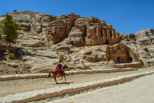
From the Petra entrance gate, a modern gravel path – one side for horses, the other for pedestrians – leads down through a lunar landscape of white rocky domes and looming cliffs known as the Bab as-Siq (“Gate of the Siq”). The bed of the Wadi Musa, carrying water during the winter and early spring, curves alongside. In all but the bleached-out midday hours, the light is soft enough to pick up earth tones of browns and beiges in the rock, but it’s only with the last rays of the sunset that there’s any hint of the pink that Petra is famous for.
Almost immediately, you can see evidence of Nabatean endeavour: three huge god-blocks, six to eight metres high, loom next to the path just round the first corner, carved probably to serve as both representations of and repositories for the gods to stand sentinel over the city’s vital water supply. Twenty-five such god-blocks exist in Petra, deemed by the locals to have been the work of jinn, or genies, and so also termed jinn-blocks; another name is sahrij, or water-tanks (which has been loosely interpreted to mean tanks holding divine energy next to flowing water). The middle one has shaft graves cut into it, implying that it may also have served as some kind of funerary monument. Opposite the god-blocks are caves, one of which has an obelisk carved in relief, representing the soul of a dead person. Such carved shrines abound in every corner of Petra’s mountains, and, for those with time to explore, the small side-valleys off this section of the Bab as-Siq are filled with tombs, water channels, niches and shrines: behind the blocks, the area of domes known as Ramleh is cut through by parallel wadis, one of which is Wadi Muthlim, and is equally explorable.
The Obelisk Tomb and Bab as-Siq Triclinium
The first major Nabatean monuments are a few metres further on, and – being on an exposed corner – badly eroded. Although apparently the upper and lower halves of a single monument, the Obelisk Tomb and Bab as-Siq Triclinium may be separate entities, carved at different times. Above, four pyramidal obelisks guard the entrance to a cave in the rock; such freestanding obelisks may have been like the god-blocks, representing a god and storing divine energy in a material form. Between the four is an eroded figure in a niche; the cave behind holds graves. Below, the triclinium, or dining room, is a single chamber with stone benches on three walls, for holding banquets in honour of the dead. On the opposite side of the path, 5m off the ground, a bilingual inscription in Nabatean and Greek records that one Abdmank chose this spot to build a tomb for himself and his children, although it’s not certain that this refers to the monuments opposite.
Madras
Just past the Obelisk Tomb is a path leading to the hidden Petran suburb of Madras, tucked into the hills to the left (south), from where it’s possible to cross the hilltops over the Jabal al-Jilf plateau, avoiding the Siq, to the top of the high, narrow Danqur al-Khazneh valley leading down to the Treasury; the views are stunning, and the sense of isolation is worth the scramble if you’ve already seen the Siq. However, the route is far from clear, relying on worn Nabatean rock-cut stairs, and you’ll need a guide.
The dam and tunnel
Back on the path, the curving northern bank of the wadi is liberally pockmarked with caves and niches, round to the point where the path is taken over the wadi bed by a bridge and the Wadi Musa itself is blocked by a modern dam; this is almost exactly the same configuration as was built by the Nabateans in about 50 AD, and for the same reasons: to divert the floodwaters of the Wadi Musa away from the Siq so that the principal entry into the city could remain clear year round. On the opposite bank of the wadi are four obelisks, one mentioning a man who lived in Reqem (Petra) but died in Jerash.
It’s here, at the mouth of the Siq, that all horseriders must dismount. Entrance tickets are sometimes checked.
To the right, the Nabatean-carved, 8m-high tunnel – guarded by another, solitary god-block – enabled the floodwaters to feed into the Wadi Muthlim leading north around the gigantic Jabal al-Khubtha. Today, this is an alternative way into Petra.
Nabatean religion
As much as they created a blend of Arab culture with Mediterranean, the Nabateans also blended inherited elements of the ancient religions of Egypt, Syria, Canaan, Assyria and Babylon with elements of the Greek and Roman pantheons, to create specifically Petran forms of worship.
Central to their religion was rock. Jehovah, the god of the Israelites, was said to inhabit a blank rock called Bet-El (“House of God”) – and this insistence on non-figurative representation was shared by many Levantine and Arabian peoples. It was passed on to the Nabateans, in contrast to the Egyptians’ and Assyrians’ lavish portrayals of gods and goddesses. Concepts such as “the Lord is my rock” also appear many times in the Old Testament, implying an extension of the “House of God” idea so that the rock actually represents the deity itself. Nabatean deities were thus often represented simply by squared-off rocks, termed “god-blocks”. In addition, a later development gave the rock a third aspect: that of the altar, the contact point between the divine and the material.
At the head of the Nabatean pantheon was Dushara, “He of the Shara” (the mountains around Petra), later identified with the Greek god Zeus and the Syrian Hadad. The fact that his name is so closely tied to the locality indicates that he may originally have been an Edomite, rather than a Nabatean, god. To the Nabateans, Dushara was the sun, the Creator, and he was often represented by an obelisk – the visual materialization of a beam of light striking the earth. With the mingling of Semitic and Mediterranean ideas, Dushara also came to be associated with Dionysus, god of wine, and so began to assume human form, bedecked with vines and grapes (as at the Nabatean temple on Jabal Tannur).
At Dushara’s side were Atargatis, the goddess of fertility, of grain, fruit and fish; Allat (which means simply “The Goddess”), who represented the moon; Manat, the goddess of luck and fate, suggested to have been the patron deity of Petra and possibly the goddess worshipped at the Treasury; and al-Uzza (“The Mighty One”), assimilated with the Egyptian goddess Isis and the Roman goddesses Diana, deity of water and fertility, and Venus, embodied by the evening star and representing spiritual and erotic love. Allat, al-Uzza and Manat are all mentioned by name in the Quran, implying that their cult was still active and popular in Mecca as late as the seventh century, the time of the Prophet Muhammad.
The Nabateans also had many smaller gods, including al-Kutbay, god of writing; She’a-al-Qawm, the patron deity of caravans; Qos, originally an Edomite god; and Baal-Shamin, a Phoenician god especially popular in northern Nabatea, who had a temple somewhere near the modern mosque in the centre of Wadi Musa town.
The Wadi Muthlim route
Although you should definitely follow the Siq into Petra at least once (and probably more than once, at different times of day), if you’ve allocated several days to a visit, the beautiful Wadi Muthlim is a good alternative entry route through stunning scenery, but taking no less than two hours to deliver you to the Nymphaeum in the city centre. Due to the very real danger of flash floods, you shouldn’t attempt it at all during the rainy season – roughly November to March – and even as late as May, there may be difficult-to-avoid standing pools of water harbouring water snakes: wading would be a mistake.
Before beginning the walk, you can take a small detour from the dam at the Siq entrance up to the Eagle Niche, set in the rocks 400m to the northwest. Cross the wadi over the roof of the tunnel and head left up the second side-valley; it’s a short scramble over the smooth, hot rock up to a set of small niches carved in the right-hand wall, one of which features a strikingly carved eagle with wings outspread.
Back at the tunnel, Wadi Muthlim – full of oleanders, but with high walls cutting out all sound bar the occasional birdsong – is easily passable up to the remains of another Nabatean dam; beyond here, the path gets steadily narrower until you reach a point where a massive boulder all but blocks the way. It’s possible to squeeze past, and the path continues to narrow until, with the wadi floor no wider than your foot, you reach a T-junction; arrows on the solid walls all around will point you left. This cross-wadi is the Sidd Maajn, equally narrow, but beautifully eroded by flowing water. As you proceed, seemingly moving through the heart of the mountain, you’ll notice the Nabateans were here before you: there are dozens of carved niches, some featuring pediments, other curving horns. It’s around here that the way might be blocked by rockpools.
Eventually, you’ll emerge into the open Wadi Mataha, about 600m northeast of Dorotheos’ House, and the best part of 2km northeast of the Nymphaeum.
The East Cliff
About 250m beyond the theatre, just before the Wadi Musa makes its sharp left turn, modern steps lead to the East Cliff, looming up to the right. This whole elbow of Jabal al-Khubtha is ranged with some of Petra’s most impressive facades, collectively known as the Royal Tombs. If you have anything more than half a day in Petra, you should fit them in; on 6-day Jordan trips, that usually means giving Petra enough time for the Royal Tombs as well as the headline route through the Siq to the Treasury. The climb is easy and the views are marvellous. From down below, in the direct, reddish light of late afternoon, the entire cliff seems to glow with an inner translucence, and is one of the sights of Petra. However, it’s probably best to aim to be up here in the morning shadows, with the sun lighting up the valley and the mountains opposite.
From right to left, the first tomb on the cliff – separate from the big ones, and missable if you’re short of time – is the Tomb of Unayshu, viewed in profile from the Outer Siq and easiest to get to by scrambling up the rocks opposite the High Place staircase. This is part of a complete Nabatean tomb complex, and features a once-porticoed courtyard in front, with a triclinium to one side.
The Urn Tomb
Heading north from the Tomb of Unayshu above the main path, past another well-preserved tomb facade, you join the modern steps leading up to the soaring facade of the Urn Tomb, with its large colonnaded forecourt partially supported on several storeys of arched vaults. The Bdul know the tomb as Al-Mahkamah, “the Court”, dubbing the vaults As-Sijin, “the Jail”. Whether or not it was later used in this way, the whole structure would seem originally to have been the tomb of somebody extremely important, quite probably one of the Nabatean kings – but who exactly isn’t known. Set into the facade high above the forecourt between the engaged columns are spaces for three bodies; this is a unique configuration in Petra, since such loculi are normally inside the monument, and they seem to have been placed here as an indication of the importance of their occupants. The central one – possibly that of the king himself – is still partially sealed by a stone which formerly depicted the bust of a man wearing a toga. The urn which gave the tomb its name is at the very top.
Due, no doubt, to its dominating position in the city’s landscape, the Urn Tomb was later converted into a major church, possibly Petra’s cathedral; the large interior room features, near the left-hand corner of the back wall, a Greek inscription in red paint recording the dedication of the church by Bishop Jason in 447 AD. Probably at the same time, two central recesses of the original four were combined to make a kind of apse, and myriad holes were drilled in the floor to support all the relevant ecclesiastical furniture: chancel screens, a pulpit, maybe a table, and so on.
The view from the forecourt, which takes in the full sweep of the valley (and even the urn atop the Monastery), is one of Petra’s best.
The Silk Tomb
Working your way around the cliff from the Urn Tomb, you’ll come to the Silk Tomb, unremarkable but for its brilliant colouring. It was named for its streaks of vibrant colour, from pinks and blues to yellows and ochres, which appeared to archeologists and historians similar to the rippled sheen of moire (watered or “shot” silk).
The Corinthian Tomb
Next to the Silk Tomb, the facade of the Corinthian Tomb (named by a nineteenth-century visitor, though it’s Nabatean, not Corinthian) is something like a squat, hybrid Treasury. It has the Treasury’s style on the upper level – a tholos flanked by a broken pediment – but below, it’s a mess, the symmetry thrown out by extra doors on the left. It has also suffered badly at the hands of the wind. However, such an exposed position on the corner of the cliff – directly in line with the Colonnaded Street – points to the fact that, like the Urn Tomb, this may well have been the tomb of another Nabatean king, visible from everywhere in the city.
The Palace Tomb
Adjacent to the Corinthian Tomb is an even more ramshackle jumble, the very broad Palace Tomb, boasting one of Petra’s largest facades. It has at least five different storeys, the top portions of which were built of masonry because the cliff turned out to be too low, and so subsequently collapsed. The unevenly spaced line of engaged columns on the second row clashes nastily with the orthodox lower level. Protected by the cliff, the extreme right-hand edge of the facade still has some sharply carved detail surviving.
The Sextius Florentinus Tomb
From the Palace Tomb, tracks lead west towards the city centre. Continue hugging the cliff northeast to find the peaceful Sextius Florentinus Tomb, positioned facing north where a finger of the cliff reaches the ground. Sextius Florentinus was a Roman governor of the Province of Arabia who died about 130 AD, and must have chosen to be buried in Petra rather than in the provincial capital of Bosra. The facade of his tomb, with a graceful semicircular pediment, is one of the most charming in the city.
The Carmine Tomb
A few metres north of Sextius Florentinus, behind a tree, stands the spectacular Carmine Tomb, girt with breathtaking bands of colour, but, by virtue of its position, hardly ever noticed. Wadi Zarnug al-Khubtha, which divides the two, holds a path which gives reasonably easy, if steep, access to little-visited High Places and a few scattered ruins perched atop the massive Jabal al-Khubtha, the main barrier standing between Petra and Wadi Musa town. The views from on top are tremendous – especially of the theatre – but you’d have to be keen (and sure-footed) to try it.
We cover the continuation of this path, northeast along the Wadi Mataha.
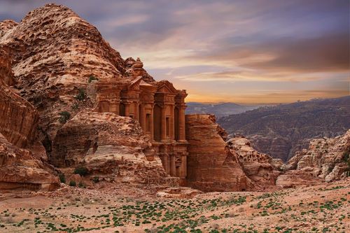
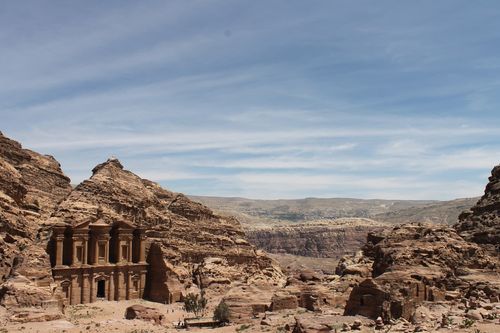
Jabal Haroun (Mount Aaron)
Jabal Haroun – Aaron’s Mountain – is the holiest site in Petra and one of the holiest in Jordan, venerated by Muslims as the resting place of Prophet Haroun, as well as by Christians and Jews (Haroun is Aaron, brother of Moses). Some local resistance to tourists casually climbing the mountain simply for the views, or to gawk, still persists: you should bear in mind that this is a place of pilgrimage. The trip there and back takes at least six hours from Petra city centre, involving a strenuous climb of almost 500m (a donkey can take you for all but the last twenty minutes), and you shouldn’t attempt it without a guide, six to eight litres of water, some food, respectable clothing and a sense of humility. Don’t bother if you’re expecting an impressive shrine (it’s small and unremarkable) or outstanding views (they’re equally good from the Monastery and Umm al-Biyara). If you choose to visit, you should consider bringing a sum of money with you to leave as a donation.
Rosalyn Maqsood, in her excellent book on Petra, explained the power of Jabal Haroun well:
Believers in the “numinous universe” accept that certain localities can be impregnated with the life-giving force of some saint or hero – transforming the sites into powerhouses of spiritual blessing. Traces of their essential virtue would cling to their mortal leavings even though their spirits had passed to another and better world. Holiness was seen as a kind of invisible substance, which clung to whatever it touched. So the virtues (the Latin word virtu means “power”) of saints would remain and be continually renewed and built up by the constant stream of prayer and devotion emanating from the pilgrims who found their way there. These places are visited to gain healing, or fertility, or protection against dangers psychic and physical, or to gain whatever is the desire of the heart. Jabal Haroun is such a place… There is nothing there, really, and no one to watch you – so why should you remove your shoes, or leave an offering? Only you can answer this.
From the cultivated area near the Snake Monument, a path leads down into the Wadi Magtal ad-Dikh. A little beyond a cemetery on the right-hand side, and past a rock ledge called Settuh Haroun (Aaron’s Terrace) at the foot of the mountain, where pilgrims unable to climb make an offering (Burckhardt slaughtered his goat here in 1812), there is a reasonably clear path up the mountain. Check in the tent at the bottom of the mountain whether the guardian will be around to open the shrine at the top; if not, you should collect the keys from him before heading up. Read a detailed account of the route at w walkingjordan.com.
The summit
A plateau just below the summit was the location of a Byzantine monastery dedicated to Aaron; excavations here are ongoing. The small domed shrine of Haroun on the peak – visible from all over Petra and Wadi Musa – was renovated by the Mamluke sultan Qalawun in 1459, replacing earlier buildings which had stood on the same site. Up until then, the caretakers had been Greek Christians, and it was in the late sixth century that the Prophet Muhammad, on a journey from Mecca to Damascus, passed through Petra and climbed Jabal Haroun with his uncle. The Christian guardian of the shrine, a monk named Bahira, prophesied that the boy – then aged 10 – would change the world. Today, pilgrims bedeck the shrine with rags, twined threads and shells, the Muslim equivalent of lighting a candle to the saint.
Petra city centre
As you round the corner of the path leading from the theatre, the city centre of Petra, focused along the Cardo Maximus, or Colonnaded Street, stretches out ahead, framed by the barrier range of mountains – and the flat-topped giant Umm al-Biyara – behind. Although there are excavations continuing on the flat, rounded hills to either side, the overall impression is of rocky desolation; nonetheless, in Petra’s prime, the landscape in all directions was covered with buildings – houses big and small, temples, market-places – all of them long since collapsed. Many archeologists theorize that most of Petra is in fact still hidden beneath the dusty soil, and that all the facades and what few buildings have so far been exposed are the tip of the iceberg.
Until you reach the Temenos at the far end of the Colonnaded Street, the only monument actually on the street is the Nymphaeum, although both the northern (right-hand) and southern (left-hand) slopes hold plenty of interest.
The Nymphaeum
One of the few trees in the city centre – a huge, lush pistachio – stands proudly over the ruined Nymphaeum, originally a Roman public fountain, these days more popular as a shady hangout for the bedouin police than anything else. Virtually nothing remains of the ancient superstructure, and even the retaining wall is modern. However, its location is key, at the confluence of the Wadi Musa, flowing from east to west, and the Wadi Mataha, bringing the water diverted by the dam at the Siq entrance into the city from the northeast. It may also have been the terminus for the terracotta pipes and channels bringing water through the Siq itself. The sight and sound of water tumbling from such a monument must have been wonderful in such a parched city centre.
The Nymphaeum is where you’ll end up if you’ve walked the Wadi Muthlim route from the dam; it’s equally possible to walk the route in reverse, although the initial stretch will be down in the wadi bed, and less appealing than following the East Cliff around to join Wadi Mataha further north. You should allow around three hours from the Nymphaeum to circumambulate Jabal al-Khubtha and get back to the gate.
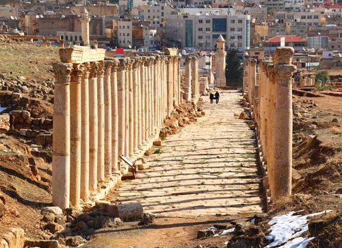
The Colonnaded Street
From the Nymphaeum all the way along the paved Colonnaded Street westwards, columns on your left (south) stand in front of what have been dubbed Petra’s markets. Ranged along street level, to either side of grand staircases, were small shops, which may have been refitted in the Byzantine period; some have been renovated, but work to excavate the floors and outbuildings remains ongoing.
To your right (north), slopes – formally dubbed Jabal Qabr Jumayan – host the Petra Church, with its superb mosaics, and a clutch of smaller Byzantine sites on the hills above, as well as one of the city’s longest-running excavations, the Temple of the Winged Lions.
If you walk dead ahead down the Colonnaded Street, without diverting to either side, you reach a ruined gateway giving into Petra’s sacred temple precinct, the Temenos.
The Petra Church
Above and behind the Nymphaeum stands a modern shelter protecting the Byzantine Petra Church, as it’s been called. This is a large tripartite basilica, roughly 26m by 15m, with three apses to the east and three entrances to the west, accessed from a stone-paved atrium. It was built in the late fifth century, and remodelled about fifty years later. Around 600 it was burned, and remained derelict until earthquakes shook it down shortly afterwards. Surviving in both aisles of the church, though, are superbly detailed floor mosaics depicting the bounty of creation, dated stylistically to the early sixth century. The presence of such a large church so richly decorated – and the discovery of the Petra scrolls – merely highlights how little is known about Byzantine Petra, and how much awaits discovery. Much of the stone used to build the church was pilfered from the ruined Nabatean and Roman monuments all around, and now lies tumbled down the slopes in front.
From beside the Petra Church, fine views extend over the valley. To the left is the East Cliff; ahead is the Great Temple; and to the right you can clearly see the unusual Unfinished Tomb, carved into the base of Al-Habees.
The interior
The spectacular south-aisle mosaics are in three rows, the central line of personifications of the seasons flanked by rows of animals, birds and fish. From door to altar, the middle line features fishermen and hunters interspersed with Ocean (with one foot on a fish), a delightfully clear-faced Spring, and Summer with her breast bared and holding a fish. The north-aisle mosaics depict people and indigenous and exotic animals and birds, including a camel-like giraffe, a hyena, boar, bear and leopard. Archeologists also found thousands of gilded glass tesserae, indicating that lavish wall mosaics once adorned the church, and they managed to reconstruct – from more than a hundred pieces – a huge marble tub with panthers for handles (which is now in the Basin Museum).
At the rear (west) of the atrium is a superbly well-preserved fifth-century Baptistry, with a cruciform font surrounded by four limestone columns.
The Blue Chapel
On a ridge just above the Petra Church is the partially reconstructed fifth-century Blue Chapel, so named for its bluish Egyptian granite columns, which were moved here presumably from a destroyed nearby monument or building. It’s tiny, and seems to have had access only via a small staircase from above, leading archeologists to theorize that this may have been the private chapel of a resident bishop, rather than a public building.
The Ridge Church
A short climb to the top of the hill that peaks behind the Petra Church brings you to the austere Ridge Church, another small building (some 18m by 13m) perched on a ridge at the northwestern edge of Byzantine-era Petra, overlooking the Wadi Turkmaniyyeh behind and the whole of the city centre in front. Its position suggests it may originally have been a military lookout post, which was converted in the late fourth century into a church. Much of the interior paving survives, but there’s no decoration. What’s most interesting about the place is that archeologists found almost no remnants of the building’s superstructure nearby, although they did find a hoard of water-washed stones in the church courtyard brought up from the wadi below. From this confusing evidence, they came up with an elaborate theory for the church’s destruction. At a time of increasing political instability, they postulate, the Petrans deliberately dismantled the church – which lay hard up against the city wall – in order to use its stones as missiles against invaders approaching from below. When the church had been razed, they collected more stones from the wadi to hoard against future attacks, but these were forgotten as, possibly, the city was overrun from a different direction. Any truth in this tale has yet to be confirmed.
The Temple of the Winged Lions
Overlooking the Temenos Gate west of the Petra Church is the Temple of the Winged Lions, the principal building of the northern slope. It was named for unusual column capitals featuring winged lions (one of which is in the Basin Museum), but would – so the excavator suggests – have been more appropriately named the Temple of al-Uzza, for it seems to have been dedicated to her. Dated approximately to the early first century AD, the building was approached via a bridge across the Wadi Musa, parts of which you can still see on the banks. Worshippers would have proceeded across ascending terraces, an open colonnaded courtyard and a portico into the temple itself, featuring close-packed columns and an altar platform. The floors were paved in contrasting black, brown and white marble, and the walls decorated with painted plaster. Archeologists uncovered both a painter’s workshop – with paints and pigments still in their ceramic pots – and a marble-cutter’s workshop adjoining the temple.
One of the most spectacular discoveries, also now on display in the Basin Museum, was a small rectangular stone idol, complete with a stylized face and a hole between the eyes (possibly for a set of horns, the symbol of the goddess Isis, to be inserted); the inscription along the base reads “Goddess of Hayyan son of Nybat”. Adjacent to the temple to the east is a large unexcavated area of rubble deemed to have been a royal palace, also with a bridge over the wadi, but no work has as yet been done on it.
The Garden Terrace
Across on the southern side of the Colonnaded Street, on the slopes above street level, an area has been recently identified as an expanse of ornamental gardens, dubbed the Garden Terrace. This was laid out in Petra’s “golden age” – the late first century BC – as a place of refuge in the city centre, tucked in amongst the grand public buildings and busy shops all around. In front, nearest the street, was a flat area that comprised the gardens themselves. Behind, occupying the whole southern part of the terrace, was a large pool, 43m long by 23m wide (and about 2.5m deep), surrounded by a colonnade. Occupying an island in the centre of the pool was a small, rectangular pavilion. The beauty of such a site can only be imagined.
The Great Temple
Alongside the Garden Terrace at the western end of the street, and accessed by a set of steps leading up from the street, is a late first-century BC building that has been dubbed the Great Temple, though not even the deity who was worshipped here is known. Ongoing excavation work by a US team suggests that this extremely grand affair, one of the largest complexes in the city at seven thousand square metres, might not have been a temple at all. Originally designed perhaps as some kind of gathering place or trade centre, then later adapted into a council chamber or even quasi-religious performance space, it seems as though the building – whatever it was – went through several incarnations, from one function to another, over centuries.
In its final, grandest phase access was via a staircase from street level through a monumental gateway onto a hexagonally paved lower courtyard, featuring triple colonnades to east and west culminating in semicircular benched alcoves.
Steps climbed again to the temple itself – if that’s what it was – some 25m above street level, fronted by four enormous columns which were originally stuccoed in red and white. Within stands a renovated Nabatean theatre, about 7m in diameter, which would have seated up to six hundred people, perhaps for performances, perhaps as a debating hall of sorts. The whole building is extremely complex, set on different levels, with internal and external corridors flanking it on east and west. Columns and chunks of architectural elements (many of them beautifully carved) all point to the fact that this was one of Petra’s most important monuments. You can even spot capitals here carved with the heads of Indian elephants – a symbol, perhaps, of just how cosmopolitan and well-connected the Nabatean traders were in their heyday.
Scramble to the highest point of the walls for views west to the arches of the Crusader fort atop Al-Habees, north across the wadi to the Temple of the Winged Lions, behind which lie the valley tombs of Wadi Muaysreh ash-Shargiyyeh, and northeast to the Petra Church, with Umm Sayhoun behind it and Mughur an-Nassara to one side.
The Theatre
Just past the Street of Facades sits Petra’s massive Theatre. Obviously classical in design and inspiration, it’s nonetheless been dated to the first century AD, before the Romans annexed Nabatea but at a time when links between the two powers must have been strong. Though the Romans refurbished the building after they took over in 106, the basic design is Hellenistic, with seats coming right down to the orchestra’s floor level. As many as 8500 people could be accommodated, more even than in the vast theatre at Amman. Aside from the stage backdrop and the ends of the banks of seating, the entire edifice was carved out of the mountainside; one whole row of tombs was wiped out to form the back wall of the auditorium, leaving some of their interiors behind as incongruous gaps. Recent renovation work has built up the stage area, with its niches in front and elaborate scaenae frons behind (tumbled in the earthquake of 363), the high back wall of which would have sealed off the theatre from the street outside.
The path continues past cafés and stalls on both sides down to a point at which the Wadi Musa turns sharp left (west) into the city centre. Straight ahead the valley opens up towards Beidha, with the Wadi Mataha coming in from the northeast, while way up to the right, some of Petra’s grandest monuments have been etched into the East Cliff.
Pharaoh’s gold
The name “Treasury” is not Nabatean, and derives from the local name for such a seemingly inexplicable construction – Khaznet al-Faraoun (“Treasury of the Pharaoh”). Unaware of classical history, and unable to fathom why anyone should carve such a monument, the bedouin tagged it as the work of the pharaoh, lord of black magic. In pursuit of the Israelites after the Exodus (the legend goes), the pharaoh was slowed down by having to carry all his treasure, so he created the Treasury and deposited his riches in the urn at the very top of the facade, out of human reach. For centuries after Petra’s abandonment, bedouin marksmen tried to shatter the urn, and so release the treasure, but to no avail: their only success was in blasting chunks off the solid urn.
Wadi Turkmaniyyeh
Joining the Wadi Musa between the Qasr al-Bint and the Basin Restaurant, Wadi Turkmaniyyeh – also often called Wadi Abu Ullaygeh – is a very pleasant walking route to follow out of Petra to the north, a small sandy valley with the 100m-high jagged cliffs on your left contorted into weird shapes. Along the bank runs the only driveable track into and out of Petra, currently forbidden to non-locals without written permission from the Wadi Musa tourist police (though plans are afoot to consolidate the road and open it to tourist traffic).
Along the way there are two groups of tombs: if you enter the Wadi Muaysreh ash-Shargiyyeh, which joins Wadi Turkmaniyyeh on the left barely five minutes from the restaurant, after about 350m you’ll come to a dense gathering of facades. Back in Wadi Turkmaniyyeh, after five minutes’ walk further northeast you’ll see, ranged up on the Muaysreh Ridges to your left, plenty more rock-cut facades, with niches, double-height courtyards and a tiny High Place dotted among them. Either of these areas would repay scrambled exploration, well away from the crowds. Both Wadi Muaysreh ash-Shargiyyeh and its neighbour Wadi Muaysreh al-Gharbiyyeh provide walks (7km; 2hr 30min) linking Petra with Little Petra, emerging from Petra’s valley onto a cultivated plateau 4km southwest of Little Petra (which is concealed behind a small hill).
The Turkmaniyyeh Tomb
About 1km along Wadi Turkmaniyyeh from the Basin restaurant you’ll see the facade of the Turkmaniyyeh Tomb on the left, with the entire bottom half broken away. Between the two pilasters is the longest inscription in Petra in Nabatean, a dialect of Aramaic, dedicating the tomb and the surrounding property to Dushara. All the gardens, cisterns and walls mentioned in the inscription must have been swept away by the floodwaters of the wadi, as, indeed, the facade almost has been.
From here, the road begins 1500m of tight switchbacks as it climbs the ridge to the police post on the outskirts of the modern Bdul village of Umm Sayhoun. Buses shuttle regularly from the village’s main street into Wadi Musa town, about 4km away, curling around the head of the valley.
The bedouin named for changing
From time immemorial, the caves and dens of Petra have been occupied by one of Jordan’s poorest and most downtrodden tribes, the Bdul. Surrounded by tribes living traditional tent-based lifestyles (the Saidiyeen to the south and west, the Ammareen to the north, and the Liyathneh to the east), the Bdul remain a community apart, looked down upon for their poverty, small numbers (only about three hundred families) and cave-centred lifestyle.
Most bedouin tribes can trace their lineage back to a single founding father (whether real or fictitious), but mystery surrounds the origin of the Bdul. Some Bdul, naturally enough, claim descent from the Nabateans, but this may just be wishful thinking. Most claim that the name Bdul derives from the Arabic word badal, meaning to swap or change, and was given to the tribe after the survivors of a massacre at the hands of Moses and the Israelites had agreed to convert to Judaism; at some point in the centuries following, the tribe converted again, this time to Islam. Much more plausible is the possibility that the Bdul earned their name from being a nomadic tribe that decided to settle in the ruins of Petra, changing their habits to suit a more stable existence.
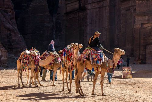
The Bdul were slow to benefit from the growth in tourism in Petra, largely because of cut-throat competition with the more cosmopolitan and better-educated Liyathneh of Wadi Musa. When the Resthouse hotel opened in the 1950s, Liyathneh were hired as construction workers, hotel staff, book- and postcard-sellers and even to provide horses for rides into Petra; their near-monopoly on tourist facilities in Wadi Musa has persisted to this day. Adding insult to injury, a USAID report dating from the establishment of Petra as a National Park in 1968 acknowledged that the Bdul held traditional rights over park lands, but nonetheless recommended that they be resettled elsewhere. This sparked a twenty-year battle to oust the Bdul from Petra, which saw the tribe’s traditional lifestyle of agriculture and goatherding decimated, income instead dribbling in from the refreshment cafés within Petra and the few individuals offering crafts and antiquities – real and fake – to tourists. In the mid-1980s, tempted by material comforts in the new, purpose-built village of Umm Sayhoun, many Bdul families finally left the caves of Petra for the breezeblock houses on the ridge. Some still herd a few goats, others cultivate small plots, but most Bdul make their living providing services to tourists. You’ll meet Bdul adults and kids in all corners of Petra, running the tent cafés or offering tea and trinkets in the hills, and often happy to chat (in surprisingly fluent English). The “bedouin named for changing”, as archeologist Kenneth Russell dubbed them, are embracing change yet again.
More information
The best modern account of Bdul life in Petra is Married to a Bedouin by Marguerite van Geldermalsen. There’s some excellent background on the Bdul by anthropologist Rami Sajdi at w acacialand.com – and also see Ruth Caswell’s pages about the tribes of Wadi Musa at jordanjubilee.com.
Images of Nabatean Petra
It is often very difficult to grasp what Petra must have looked like in its Nabatean “golden age”, when it was an extravagantly wealthy city, home to tens of thousands of people. What today are rubbly excavation sites were once grand temples and public buildings, soaring to their full height. Watercourses flowed to irrigate lush gardens in what looks now like dusty waste-ground. Natural earth tones in the landscape were tempered with brightly coloured plasterwork adorning many of the buildings.
Many architects and artists have tried to depict Petra’s ancient reality, with varying degrees of accuracy. One in particular – Chrysanthos Kanellopoulos, an archeologist in his own right – has worked over many years with a number of teams in Petra and around Jordan. Google his name to find his vivid, full-colour renderings of what Petra would have looked like two thousand years ago. As an impression of original Nabatean architecture, they are remarkable – though bear in mind that since archeological work is ongoing, some details may now have been superseded by new discoveries.
Married to a bedouin
When New Zealander Marguerite van Geldermalsen came to Petra on holiday in 1978, she fell in love with a local souvenir-seller – and then stayed with him to get married, settle down and raise a family. In 2006 she published Married To A Bedouin, a wonderfully evocative account of their life together. Here, Marguerite reflects on the changes she has witnessed.
“I started writing Married To A Bedouin when I realised how much our way of life had changed.
When Mohammad and I were married in Petra in 1978, about seventy families lived in the ancient site; some in tents of woven goat-hair and others, like us, in 2000-year-old caves. They herded goats, planted winter crops and sold trinkets and old coins to the tourists. I learned to live like them – carting water from the spring, baking bread on an open fire and using kerosene for our lamps.
In 1985 we were moved to the overlooking hillside of Umm Sayhoon, partly to protect the archeological site but also to improve our quality of life with running water and electricity. Our children attended the village school and we became commuters – going into Petra to tend our souvenir and coffee shops, then riding home on camels and donkeys to turn on our televisions, put laundry into our washing machines and, eventually, hook up to the internet.
Mohammad and I had been married 24 years when he died. Soon after, I left Jordan. I felt my reason for living there had gone.
Now I understand that I left to write my story; I needed the distance to see clearly. Although Mohammad is no longer in Petra, through him I have become woven into the fabric of the place. In 2007 I returned – and settled straight back in.”
Today Marguerite – known as Umm Raami – still lives and works in Petra. You might see her jewellery stall by the path as you walk down from the theatre. It offers a perfect opportunity (among many) to inject a little cash into the local economy.