Sligo, Leitrim and Roscommon Travel Guide

Counties Sligo, Leitrim and Roscommon are renowned for the rhythmic sway and gentle flamboyance of their traditional music, characterized by flutes and fiddles and often known as the North Connacht style of playing. Topographically, however, they have less in common, with Sligo possessing the most allure, though it might feel less wild and remote than nearby Mayo and Donegal. The county’s hub, lively Sligo town has the best facilities for visitors and good access to the local countryside. Easy trips from here include the bracing seaside resorts of Strandhill and Rosses Point, as well as megalithic sites Carrowmore Cemetery and Medb’s Cairn, set atop Knocknarea Mountain, though you’ll need your own transport to reach them. Majestic Lough Gill, and its celebrated island Innisfree is, along with a number of sites in the north of Sligo, inextricably linked with W.B. Yeats, an appreciation of whose writing is enhanced by a visit to Drumcliffe, the place of his burial, set below Benbulben Mountain, or the entrancing waters of Glencar Lake, while essential insights into the poet’s social world are provided by a tour of Lissadell House, north of Drumcliffe. Yeats’s brother, the painter Jack B., was also inspired by the county’s dramatic land- and seascapes, which continue to its northern tip with fine beaches such as at Mullaghmore. Western Sligo offers great surfing opportunities at Easkey and another stupendous beach at Enniscrone, while to the south you’ll find staggering megalithic remains at Carrowkeel, as well as the county’s musical heartland, centred upon Tubbercurry and Gurteen.

Ireland’s least populated county by some stretch, Leitrim crams a dizzying diversity into its ever-attractive countryside, though lacks any really notable sights. Bordering no fewer than six counties, Leitrim extends some 80km from its southeastern border with Longford to a narrow strip of Atlantic shoreline in the northwest, with the expansive Lough Allen at its core. In the south the River Shannon is the principal feature, not least in the county town, Carrick-on-Shannon, while rolling countryside to the river’s east, especially between Keshcarrigan and Ballinamore, is sprinkled with tiny lakes and drumlins.

County Roscommon is renowned as one of Ireland’s dullest counties, thanks to its largely uninspiring scenery. In its far north, however, the Arigna Mountains provide a wild and vivid contrast to the flat landscape that defines most of the county, and can be explored from the lively, historic town of Boyle towards Roscommon’s northern extremity. Further south, sites around Tulsk are intrinsically associated with major events in Celtic mythology, and the planned town of Strokestown features a memorable Georgian mansion with a hugely impressive museum devoted to the Great Famine. Southern Roscommon, however, including its eponymous county town, provides little to warrant investigation.

Lough Gill

To the east of Sligo town lies one of Ireland’s most entrancing lakes, Lough Gill, set beneath wooded slopes which provide the backdrop to almost all its 40km shoreline. The best route around the lough, and one easily navigable in less than a day’s cycling, is to follow the shore clockwise by following the R286 from Sligo town, and taking in the plantation Parke’s Castle, just inside County Leitrim, from where you can board a cruise boat and catch a sight of idyllic Innisfree.

Parke’s Castle

Some 11km northeast of Sligo, towards the eastern extremity of Lough Gill, Parke’s Castle is a picturesque plantation fort erected by Captain Robert Parke in the 1620s and elegantly restored in the late twentieth century by the Office of Public Works. A moated tower house once stood here, home of the Irish chieftain Brian O’Rourke, who in 1588 was charged with high treason after sheltering Francesco de Cuellar, one of the few survivors of the Armada ships wrecked off the Sligo coast. O’Rourke was hanged at Tyburn in 1591 and his lands confiscated, later being distributed to the Leitrim planters, whose number included Parke. Reconstructed inside are some of the features of the inner courtyard, such as a blacksmith’s forge, a well and a water gate. You can wander around the battlements, admire expansive views of the lough and also take in an exhibition on the remodelling of the castle with displays on other notable vernacular buildings.

Innisfree

From the pier beside Parke’s Castle the Wild Rose of Innisfree waterbus operates a tour of Lough Gill, taking in views of Yeats’s beloved isle of Innisfree, and featuring recitals of the poet’s works by the skipper, almost certainly including the poet’s Lake Isle of Innisfree:

I will arise and go now, and go to Innisfree,

And a small cabin build there, of clay and wattles made:

Nine bean-rows will I have there, a hive for the honey-bee,

And live alone in the bee-loud glade.

Alternatively, head a few kilometres southwards through Dromahair and pick up the R287. About 4km along this a signposted lane leads down to the water where there’s a fabulous view of the lough and Innisfree in all its serene beauty.

North Sligo

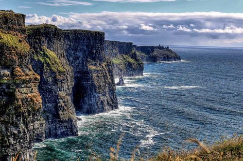
The majority of North Sligo’s attractions are easily accessible from the county town. Much of the landscape is irrevocably associated with W.B. Yeats, particularly Benbulben Mountain, under whose green-tinged slopes and surmounting tableland the poet is buried at Drumcliffe. To the mountain’s south lie the magical waters of Glencar Lake with its exhilarating waterfall, while to its west is Lissadell House, home to Yeats’s friends, Eva Gore-Booth and Constance Markiewicz, tours of which provide valuable insights into the poet’s social milieu. The coastline is less stimulating, though does include a fine beach at Mullaghmore, a quaint harbour village not far from one of Ireland’s major funerary monuments, Creevykeel Court Tomb.
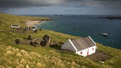
Rosses Point

Eight kilometres northwest of Sligo town, off the N15, ROSSES POINT is a picturesque seaside resort which has not moved with the times and is all the better for its lapse. There’s a grand beach, ideal for swimming, and splendid views across the bay, both of which provided inspiration for Jack B. Yeats, the poet’s artist brother. From here there are fine, often blustery walks around the headland.

Drumcliffe

Eight kilometres due north of Sligo along the N15, the tiny seaside village of DRUMCLIFFE is the site of a monastery established in 574 by St Colmcille, though only a round tower and an eleventh-century high cross, set on opposite sides of the main road, remain today. The graveyard of the adjacent and somewhat stark nineteenth-century church is where the poet W.B. Yeats is buried and, as a consequence, is very much on the tourist trail. Yeats died in 1939 in Roquebrune, France, but before doing so requested that his body be interred locally for “a year or so” before being returned to Sligo. His wishes were granted in 1948 when his remains were transferred from France to Drumcliffe, where his great-grandfather had been rector, and buried, as one of his last poems stated, “Under bare Ben Bulben’s head”. His headstone, which also marks the resting place of his wife George, bears the last three lines of that poem, Under Ben Bulben:

Cast a cold Eye

On Life, on Death.

Horseman, pass by!

Glencar Lake

Heading east from Drumcliffe along minor roads you’ll come to Glencar Lake after some 8km, gorgeously set amid tree-lined slopes. Near the eastern extremity of its northern shore a signposted footpath leads up to an impressive fifteen-metre-high waterfall, cascading down into a deep pool from the rocky mountainside above, which provided the inspiration for part of Yeats’s poem The Stolen Child:

Where the wandering water gushes

From the hills above Glencar,

In pools above the rushes that

Scarce could bathe a star.

Mullaghmore Head

MULLAGHMORE is an enticing village set around a secluded, walled harbour with a glorious expanse of sandy beach just to its south, offering fabulous views north to the mountains of Donegal and back towards Benbulben.

West Sligo

Sligo’s western shoreline, stretching from near Sligo town almost as far as Mayo’s Ballina, is probably the least visited in the county. Yet set against the looming southern backdrop of the Ox Mountains, it offers plenty of diversions including bracing seascapes at Aughris, exhilarating surfing at Easkey and a dazzling beach at Enniscrone. A little way inland, the memorable funerary sepulchres at Skreen are well worth a detour en route.

Easkey

The somewhat decaying small village of EASKEY, 15km west of Aughris, began life as a monastic community, much later becoming the base for the MacDonnells, originally gallowglasses who served the ruling O’Dowd clan and built seaside Roslee Castle (now ruined) in the fifteenth century. Thanks to the constancy of its waves, Easkey is a popular surfing centre and houses the headquarters of the Irish Surfing Association (wwww.isasurf.ie).

Enniscrone

Some 14km southwest along the coast from Easkey, ENNISCRONE is blessed with a gorgeous, five-kilometre arc of golden strand. Its other main draw is Kilcullen’s Bath House, where you can wallow in a bath full of seaweed – the iodine-rich water is not only sheer relaxation but is also reckoned to offer relief for rheumatism and arthritis – before enjoying a hot steam in a cedarwood cabinet.

South Sligo

South Sligo’s attractions are spread over a wide area, ranging from the glorious Lough Arrow in the east, via megalithic sites, such as Heapstown Cairn and the atmospheric Carrowkeel Cemetery, set in the Bricklieve Mountains, to the equally gorgeous Lough Talt in the west. Above all, however, the area is renowned for its traditional music, especially within the triangle formed by the towns of Ballymote, Gurteen and Tubbercurry.

Castlebaldwin and Carrowkeel Cemetery

From Castlebaldwin, on the N4, minor roads of diminishing width and reliability lead towards the Bronze Age Carrowkeel Cemetery. The last kilometre or so has to be negotiated on foot, but your efforts will be rewarded by a spellbinding panoramic view of the surrounding countryside. Here on the uplands of the Bricklieve Mountains is a remarkable collection of fourteen cairns, plus an assortment of other stonework. Excavation in 1911 produced a wealth of jewellery and relics, and several of the cairns, consisting of roofed, cruciform passage graves, can be entered. The most striking is cairn K, which, in complete contrast to County Meath’s Newgrange, is illuminated by the sun’s rays during the summer solstice (June 21).

Ballymote

The largest place in southern Sligo is BALLYMOTE, 20km from the county town. Richard de Burgo built a castle here in 1300 which, switching ownership numerous times during its history, proved to be a veritable straw in the wind of Irish politics. In 1317 it fell to the O’Connors and remained in Irish hands until captured by Bingham, the governor of Connacht, in 1584. It was soon afterwards reclaimed by the McDonaghs who then sold it to Red Hugh O’Donnell – he marched from here to catastrophic defeat at Kinsale in 1601. Later taken by Cromwell’s army, it fell yet again to the O’Connors in 1690, before they in turn surrendered the castle to Williamite troops who determined to put an end to the whole farrago by tearing down much of the building and filling in the moat. The ruins lie just west of the town centre, and the stripped interior can be visited by acquiring a key from the Enterprise Centre on Grattan Street. Towards the end of the fourteenth century, the Book of Ballymote was assembled here, significant not just for the vast deal of information on Irish lore and history it contains, but also because it unlocks the secrets of the carved ogham letters that appear on numerous neolithic standing stones. The book is held by the Royal Irish Academy in Dublin.

Book things and tours in Dublin

Gurteen

South of Ballymote the R293 runs parallel to the Dublin railway line before drifting away through fertile farmland and reaching the crossroads village of GURTEEN after 11km. Gurteen sits at the heart of South Sligo’s traditional-music scene, and its greatest son was the fiddler Michael Coleman. Right by the crossroads stands the Coleman Irish Music Centre (wwww.colemanirishmusic.com), which stages traditional music and dance shows, has a small interactive exhibition area, and a shop selling a very good range of books and CDs, including several collections of recordings from its own archives. Gurteen hosts the Coleman Traditional Festival over the last weekend in August, while regular sessions are held in the Teach Murray (Mon) and Roisín Dubh (Tues & Sat) pubs.

Tubbercurry

Some 30km southwest of Sligo, TUBBERCURRY is a rather docile small town but traditional music thrives here, focused on the week-long South Sligo Summer School (wwww.sssschool.org) held in mid-July, with various classes, pub sessions and concerts. Tubbercurry’s origins date back to the late fourteenth century when the O’Connors built a fortress here, but it remained a sleepy little settlement until becoming a stop on one of Bianconi’s coaching routes in 1853. The burgeoning town was all but destroyed by fire during a zealous Black and Tan reprisal in 1920, and little remains from earlier times.

Boyle and around

Rising gently above its own namesake river, engaging BOYLE is an easygoing town, pleasant to stroll around, with plenty of congenial bars, a couple of sites of noteworthy historical interest and a lively arts festival. It also makes an excellent base for exploring not only Roscommon’s northern attractions, such as Lough Key Forest Park, but neighbouring Leitrim and South Sligo too.

Some history

Boyle’s origins lie in the establishment of a Cistercian monastery in 1161, but as it was situated on an important trading route, the abbey became embroiled in numerous internecine and Irish–English skirmishes and was sacked on a number of occasions. It lingered on for several decades after the Dissolution – its last abbot was executed in 1584 for refusing to disavow allegiance to Rome – and from 1599 until the end of the eighteenth century it was used as a barracks by the English and known as Boyle Castle. In 1603 the building passed into the hands of Sir John King and remained in the family’s possession until 1892. It was Staffordshire-born King who transformed Boyle, constructing a grand mansion to the west of the abbey and an avenue (now the town’s Main Street) leading up to it. At the same time he began to amass thousands of acres of land, which would eventually become the largest estate in County Roscommon, Rockingham.

Douglas Hyde

Fourteen kilometres southwest of Boyle lies the village of Frenchpark, where the former Church of Ireland parish church is home to the Douglas Hyde Interpretive Centre. The centre recounts the life of Douglas Hyde (1860–1949), one of the key figures in the Irish cultural revival, with numerous informative displays and an entertaining video.

Born in Castlerea, 13km south of Frenchpark, to Anglo-Irish Ascendancy stock, Hyde learnt Irish at an early age and developed a lifelong interest in the nation’s rich vernacular tradition and folklore. After attending Trinity College he became professor of Modern Irish Language and Literature at the National University of Ireland and produced numerous articles, essays and reviews in Irish, as well as collaborating on a number of Irish-language plays with Lady Gregory. Hyde also travelled the country widely, gathering material, much of which was transcribed in collections such as the highly influential Love Songs of Connaught. In 1893, he was a co-founder of the Gaelic League, which aimed to enhance Irish culture via a revival of musical and linguistic traditions, though Hyde later became concerned by the League’s increasing links with the Independence movement and resigned as its president in 1915. Elected to the Irish Senate in 1925, he retired from public life in 1932 until he was appointed the country’s first president in 1938.

After his death Hyde was interred in the graveyard of his father’s former parish – his grave is the last of eight family members in the corner behind the statue erected in his honour.

The Arigna Mountains

The far north of County Roscommon stretches up to Lough Allen where gentle farmland ascends to the moors and lakes of the Arigna Mountains. Albeit small-scale, this was once one of the few areas of Ireland to play a role in the Industrial Revolution, based first on iron extraction for a fifty-year period after 1788 – the local ironworks forged pikes in preparation for the 1798 Rebellion – and, subsequently, coal, which was worked here until 1990. The Arigna Miners Way is a waymarked 120-kilometre walking trail through the area, linking up with both the Leitrim Way and a historical trail taking in Boyle and parts of Sligo. Nearby, the appealing village of Keadue is worth a visit for its musical heritage.

Arigna Mining Experience

From the dusty village of Arigna itself, a little further north, a winding lane leads a couple of kilometres upwards, past a smokeless fuel plant, to the Arigna Mining Experience. Perched high on a hilltop and commanding stunning views of Lough Allen and the surrounding countryside, this brilliantly designed and utterly enthralling museum is based around one of the last working pits in the area. The history of local coal mining is well documented in the reception area, but, once equipped with hard hat, it’s the forty-minute tours of the mine that are most informative and thought provoking. Led by ex-miners, these are rich in anecdote and thoroughly explore both the industry’s nature itself and the atrocious and exploitative working conditions the miners endured. The tour is packed with atmosphere: the tunnels are dark and foreboding, and the sound of dripping water and footsteps amplified by the acoustics. Especially astonishing was the ability of the miners to squeeze themselves into the tightest of seams in the quest for coal.

Tulsk

Located around the village of TULSK, 15km southeast of Frenchpark, is a rich array of earthworks, ring forts, standing stones and caves betokening one of Ireland’s major mythological areas. According to The Annals of the Four Masters it was here that Medb, the warrior queen and earth goddess who features heavily in the Táin Bó Cúailnge, sited her palace Cruachan, the location of the epic’s opening and gory conclusion. Away from the world of legend, Tulsk was certainly the seat of the Kings of Connacht, and the ruins of their medieval castle are visible in the village. A map of the sites is available from the Cruachan Aí visitor centre (pronounced “crew-han ee”), just west of the crossroads in Tulsk, and it’s essential to ask the staff about which are currently accessible.

Strokestown

Just 11km east of Tulsk is one of Ireland’s most striking planned towns, STROKESTOWN, whose story embodies Ireland’s troubled history in microcosm. The land on which the town lies and the surrounding area, known as Corca Achlann, belonged for more than a thousand years to the MacBranan clan, underlords of the powerful O’Connor kings who ruled Connacht, until dispossessed by Cromwell in the 1650s. Subsequently, part of their territory was granted by Charles II to Nicholas Mahon, whose kin later amassed more than thirty thousand acres for their huge estate, second only in size to Rockingham in Roscommon, becoming one of the great landed families of Ireland in the process. In the early nineteenth century, his descendant Lieutenant-General Thomas Mahon, Second Lord Hartland, requiring a grandiose symbol reflecting the extent of his property, determined to have constructed a central avenue wider than Vienna’s Ringstrasse. This tree-lined mall leads a couple of hundred metres both east and west from the town centre. At its western end sits an octagonal church, now housing the County Roscommon Heritage and Genealogy Company, which conducts research for anyone seeking to trace their Roscommon roots; the eastern end of the mall terminates in a three-arched gateway, marking the entrance to Mahon’s massive estate.

Strokestown Park House

The magnificent Georgian Strokestown Park House was the seat of the Mahon family from its completion in 1696 for almost three hundred years. This huge palladian mansion originally consisted of a two-storey central block and basement until the 1740s when Thomas Mahon, MP for Roscommon, hired the architect Richard Castle to construct a third storey and two extra wings. Mahon’s son, Maurice (who became the First Lord Hartland in 1800), made subsequent additions including the library and many decorative features, such as cornices and chimneypieces, while the Second Lord Hartland added the porch and its huge pilasters. The house remained in Mahon ownership until 1979 when it was sold, along with its contents, to a local garage owner who undertook restoration work and opened it to the public in 1987.

Few Irish “big houses” retain their original owners’ property (in this case ranging from furniture to children’s toys), which is a vital factor in making the guided tours so entertaining. The main hall features early eighteenth-century wood panelling while the spacious dining room, decorated in rich rose-pink damask wallpaper, is equipped with furniture from the early 1800s and a mammoth turf-bucket. The library was originally a ballroom – hence the bowed space at one end, which housed musicians – and has glorious Chippendale bookcases, while the smoking room was converted into a laboratory and photographic darkroom by Henry Pakenham-Mahon in the 1890s. The house’s north wing includes a superb kitchen, replete with spits and ovens, and, looking upwards, you’ll see a balustraded gallery, the only surviving example in Ireland of a kind favoured by Castle, from which the housekeeper could keep an eagle eye on business down below and, according to Strokestown legend, drop menus for the week’s meals down to the cook.

THE IRISH FAMINE MUSEUM

Among the property passed on by the Mahons were numerous documents and letters relating to the family’s role in relation to the Great Famine of 1845–51. The former stables of Strokestown Park House, marvellously vaulted buildings in their own right, house an often chilling and ever stimulating museum detailing the Famine’s effects upon the Mahons’ tenants and its wider impact across Ireland. The intricate but ever informative displays and films focus on the concatenation of factors in Ireland – the growth of the rural population, the conacre system of agricultural tenancy, the reliance on the potato crop and the spread of the potato blight – that combined with Britain’s economic policy of non-interference to have such a devastating effect on human life. Exhibits also highlight the role in local events of Major Denis Mahon, who had inherited the Strokestown estate after the death of the third and last Lord Hartland in 1845. The malevolent major not only evicted the majority of his tenants, but contracted dangerously unseaworthy vessels (the infamous coffin ships) to transport some of them in atrocious conditions to North America. Displays document contemporary newspaper reports condemning his actions and, in 1847, his assassination by vengeful ex-tenants.

Book tickets, tours and activities for EPIC Irish Immigration Museum

Carrick-on-Shannon

Other than messing about on the water, CARRICK-ON-SHANNON, Leitrim’s county town, does not offer a vast amount to see or do, but with plenty of facilities it’s a pleasant enough focus for investigating the area, despite ugly sprawling commercial developments on its fringes. The town owes much of its prosperity to its proximity to the water, and its busy marina is often jam-packed with barges and cruisers. Carrick grew up around a strategic crossing point on the River Shannon, the importance of which was recognized by the English who began building a planned settlement that was incorporated as a borough in 1613. Nothing remains from those times and modern Carrick only began to develop after the 1840s when the Shannon navigation scheme reached the town. Its stone bridge and quays date from this period.

Around Carrick

From Carrick the Shannon meanders northwards before entering the vast Lough Allen just by pleasant Drumshanbo, a place with a rich musical tradition. It’s a fine base for investigating the local countryside, which with rivers, streams and, to the east, a collection of tiny lakes provides plenty of opportunities for watersports enthusiasts.

Drumshanbo and Lough Allen

Some 12km north of Carrick, DRUMSHANBO is a lively village at the tip of Lough Allen’s southern shore. Right in its centre, the Sliabh an Iarainn Visitor Centre is a good source of detailed background information on local customs and history, including the iron-and-coal mining industries centred on Arigna in County Roscommon, as well as a reconstruction of a typical sweathouse. Drumshanbo has a strong musical tradition and, in the third week of July, holds the seven-day Joe Mooney Summer School, offering traditional music classes and concerts. At the beginning of June it also hosts the An Tostal Festival, with a variety of music and street entertainment.

From Drumshanbo roads lead north along both eastern and western shores of Lough Allen. The western route crosses into County Roscommon and skirts the Arigna Mountains, while its alternative to the east heads up through bleak flatlands below Slieve Anierin. The waymarked 48-kilometre Leitrim Way (map available from local tourist offices) follows Lough Allen’s shoreline before taking in higher ground on its way to the remote village of Dowra, the starting point for the Cavan Way. At Ballinaglera, 13km north of Drumshanbo, the Lough Allen Adventure Centre offers a variety of activities, such as windsurfing, kayaking and hill-walking.

Keshcarrigan

KESHCARRIGAN, about 8km east of Drumshanbo on the Shannon–Erne Waterway, is worth a stop (even though the village has been blighted by inappropriate modern housing developments) for its amiable bars, the Canal Stop, right beside the canal, which also serves hearty meals, and McKeon’s, across the road.

Ballinamore

BALLINAMORE is a focus for cruising on the Shannon–Erne Waterway, with barges available from Riversdale Barge Holidays (wwww.riversdalebargeholidays.com). There’s little to see in the town itself, but it still offers a pleasant overnight stop.

Sligo town

Bustling SLIGO town rose to prominence following the Anglo-Norman invasion of Connacht in 1235, its strategic importance linked to its location at the point where the River Garavogue enters the sea. A Dominican friary was founded here in 1252, but the town’s shape was largely developed following the building of a castle by Richard de Burgo in 1310. However, this edifice lasted but five years before it was destroyed by the O’Donnell clan which retained control of the burgeoning settlement over the next few centuries. The town’s prosperity owed much to the the neighbouring herring shoals, though it was undermined by Cromwell’s invasion and assaults by both sides during the Williamite war.

After the terrible times of the Great Famine, Sligo re-emerged as a busy port and mercantile centre in the late nineteenth century and nowadays is a thoroughly absorbing place. The town has long been renowned for its traditional music, but is also firmly on the tourist trail thanks to its numerous associations with the poet W.B. Yeats, a lively arts scene (which spawns several festivals) and its location as a splendid base for exploring the county’s numerous attractions.

The Model

On Sligo's Mall stands one of Ireland’s finest art galleries, The Model. Behind a drab Victorian facade, the spacious and airy modern extension houses a range of temporary exhibitions veering towards the experimental, as well as selections from the Niland Collection, including works by Jack B. Yeats and Paul Henry. There’s also a small theatre-cum-cinema and an excellent café.

Around Sligo town

West of Sligo town lies the famous surfing beach at Strandhill, a grand base for exhilarating coastal walks, while inland is one of Europe’s most significant collections of passage graves at Carrowmore Megalithic Cemetery. Both the resort and the graveyard are overlooked by the numinous Knocknarea Mountain, on whose summit sits the mystical Medb’s Cairn.

Strandhill

Seaside STRANDHILL, 8km west of Sligo town, remains remarkably unexploited despite its gorgeous position, the village and its beach set against the backdrop of the looming Knocknarea Mountain. On the way into the village look out for Dolly’s Cottage, a tiny thatched dwelling named after its last occupant, Dolly Higgins, who died in 1970. Maintained as it was, with a turf fire and a tiny pouch bed, the cottage now sells various handicrafts, as well as home-made jams and preserves. Strandhill’s beach is its most renowned feature, a wild stretch pounded by huge Atlantic breakers. Though it’s absolutely unsafe for swimming, it’s massively popular with surfers and regularly witnesses the Sligo Open Championship over the first weekend in August.

Carrowmore Cemetery and Medb’s Cairn

Four kilometres southwest of Sligo town, Carrowmore Megalithic Cemetery presents a remarkable array of some thirty megalithic passage tombs, one of the biggest prehistoric graveyards in Europe. This oval-shaped cluster of monuments spreads out within a 1km-by-600m field and ranges from the most basic, a small circle of stones surrounding a central roofed chamber, through to the largest, known as Listoghill, covered by an impressive rounded cairn. Excavations have uncovered cremated human remains as well as jewellery carved from bones and antlers; it’s suggested that some of the tombs were created as far back as 3800 BC, though they continued to be used for burial over the next three millennia.

Carrowmore is made all the more atmospheric for being set below one of Ireland’s most significant burial places, the massive Medb’s Cairn, standing on the summit of Knocknarea Mountain – 60m wide and 10m high, and surrounded by a three-metre-high earthen bank. Whether Medb, the legendary queen of Connacht and one of the protagonists of the Táin Bó Cúailnge, is actually buried here is unknown, since the site has not been excavated, but it’s well worth making the trek, not only for views of the cairn itself, but for spectacular outlooks north to Donegal and west to Mayo. To get here from Carrowmore head west for 1km, take a right turn at the junction with the R292, then left at the first crossroads – after another kilometre a lane leads right towards the car park at the base of the mountain, from which it’s a steep four-kilometre hike to the summit. On your way up to the top pick up a stone and leave it by the cairn, making a wish as you do so and, as local legend has it, the force of Queen Medb may be with you.

Planning your own trip? Prepare for your trip

Use Rough Guides' trusted partners for great rates

Rough Guides Editors

written by Rough Guides Editors

updated 8.06.2021

Ready to travel and discover
Ireland?

Get support from our local experts for
stress-free planning & worry-free travels

Plan my trip ⤍