


Planning your own trip? Prepare for your trip
Use Rough Guides' trusted partners for great rates
written by
Rough Guides Editors
Reykjavík and the Reykjanes peninsula together form the southern edge of Faxaflói, the sweeping bay that dominates Iceland’s west coast and any journey north of the capital – the Ringroad clings to its shores as far as the small commercial centre of Borgarnes before striking off inland on its way towards Brú and the north coast. Although the scenery is not Iceland’s most dramatic, it provides visitors travelling clockwise around the country with their first taste of small-town Iceland and as such makes a satisfying introduction to the rest of the country. In summer the views of flower meadows dotted with isolated farms sheltering at the foot of cloud-topped mountains are picture-postcard pretty.
Travelling north, the first town you come to is Akranes. With its concrete factory and fish-processing plants, it’s certainly no beauty, but its museum quarter can make an interesting diversion on the way to Borgarnes. Besides having an excellent museum, the town serves as a jumping-off point not only for tours inside Iceland’s second-largest glacier, Langjökull, and the country’s biggest hot spring, Deildatunguhver, both near Húsafell, but also the historical riches of Reykholt, the setting for Egill’s Saga and home to the only saga writer known by name, the thirteenth-century politician Snorri Sturluson.
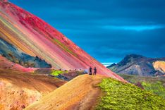
The “pyramid of eternal snow” which Dufferin referred to when he sailed his yacht Foam to Iceland in 1856 was the glacier, Snæfellsjökull, which sits majestically on top of a dormant volcano at the tip of Snæfellsnes, a long arm of volcanic and mountainous land jutting out into the sea, which is the highlight of any trip up the west coast. Divided by a jagged mountain ridge, the peninsula not only marks the northern edge of Faxaflói bay but also the southern reaches of the more sheltered Breiðafjörður, with its hundreds of islands and skerries, over which lie the table mountains of the West Fjords. On a clear day the snowcap is clearly visible across the water from both Reykjavík and the West Fjords.
A gem of a place on the peninsula’s north coast, Stykkishólmur is not only the main town hereabouts but also one of Iceland’s most attractive, with its brightly painted wooden houses nestling by a vibrant harbour busy with chugging fishing vessels. It’s from here that the ferry sails for the pastoral delights of Flatey, the largest island in Breiðafjörður. From Arnarstapi on the peninsula’s southern coast it’s possible to take a snowmobile up onto Snæfellsjökull for some of the most exhilarating driving – and vistas – you’ll ever experience. For splendid isolation, nearby Búðir can’t be beaten, its wide sandy bay home only to an unusually charismatic hotel complete with creaking floorboards and ocean views. Occupying a sheltered spot in the neck of land which links the West Fjords with the rest of the country, Laugar in Sælingsdalur has some hot springs and a few cultural diversions, and makes a good place to break the long journey from Reykjavík to the West Fjords.
What the west coast may lack in scenic splendour, it makes up for in historical and cultural significance – landscapes here are steeped in the drama of the sagas. Close to Búðardalur, to the north of Snæfellsnes along Route 586, Haukadalur valley was the starting point for Viking expansion westwards, which took explorers first to Greenland and later to the shores of North America as heroically recounted in the Saga of Eirík the Red. He and his wife lived at Eiríksstaðir and, having been outlawed from Iceland, together they pioneered the settlement of Greenland. It’s also thought that Leifur Eiríksson, the first European to set foot in North America, was born on a farm that has now been expertly reconstructed on the original site. More saga history can be found in Laxárdalur valley, northeast of Búðardalur, where characters from the Laxdæla Saga lived out their feud-torn lives.
The west coast is dominated by the towns of Borgarnes and Reykholt, both strongly associated with the sagas, while the Snæfellsnes Peninsula, with views of the monster glacier at its tip, is one of the country’s most accessible hiking destinations. Arguably Iceland’s most dramatic scenery is found in the far northwest of the country, the West Fjords, where tiny fishing villages nestle at the foot of table-top mountains. Ísafjörður is the only settlement of any size here and makes a good base from which to strike out on foot into the wilderness of the Hornstrandir Peninsula.
The Ringroad (Route 1) cuts right through the region to Brú, covered year-round by Reykjavík–Akureyri buses via Borgarnes. From Borgarnes, Route 54 and more year-round buses head northwest to Snæfellsnes; while for the Búðardalur area you need to turn north off the Ringroad up Route 60 at Bifröst, a route served by buses (all year) heading for Hólmavík in the West Fjords, where connections are available for Ísafjörður (summer only). Note that despite the growing importance of Húsafell as an activities hub, it is not served by buses.
In some ways it’s worth seeing the west coast as a stepping stone to the West Fjords: another point of entry is the regular ferry from Stykkishólmur on Snæfellsnes to Brjánslækur, from where there are bus connections to other West Fjord locations; the Búðardalur bus presses on to Hólmavík in the West Fjords, though you can only travel beyond this in your own vehicle.
Tip from Rough Guides: also learn about the best ways to get to Iceland.
Once beyond Reykjavík and its adjacent overspill town, Mosfellsbær, the Ringroad weaves northwards around the towering form of Mount Esja to Hvalfjörður (whale fjord), the biggest in southwest Iceland, named after the large number of whales seen here by the original settlers. During World War II, the fjord’s deep anchorages made it one of the most important bases in the North Atlantic, when British and American naval vessels were stationed here, providing a port and safe haven for supply ships travelling between Europe and North America. As the fjord kinks some 30km inland, however, it was something of an obstacle to road travel, until the opening of an impressive 6km submarine tunnel in 1998. It was completed despite concerns from the people of Akranes that the shorter distance to the capital (49km through the tunnel compared with a massive 108km round the fjord) would kill off their local shops and services – fortunately their fears have proved unfounded. Twenty-four-hour tollbooths are in place at both ends charging 1000kr per car, which is well worth it to save a tedious detour.
Just beyond the exit from the Hvalfjörður tunnel, Route 51 strikes off west from the Ringroad for Akranes, the west coast’s biggest town with a population of 6500. Fishing and fish processing account for roughly half the town’s income, and there’s a busy, commercial air to the place. Akranes is also renowned for its sporting prowess – the local football team, Íþróttabandalag Akraness (ÍA), are frequent national champions – and its two sports halls, swimming pools and soccer stadium are of a correspondingly high standard. Yet Akranes is hard to like: it’s gritty, entirely without architectural charm and can be a terribly cold spot even in summer, as icy winds straight off the sea howl round street corners sending the hardiest locals scurrying for cover. However, it’s a good base from which to do some decent hikes around the heights of easterly Mount Akrafjall or, when the sun is shining, to explore the long sandy beach, Langisandur, a fifteen-minute walk from the town centre. Once you’ve exhausted the beach and the harbour area with the town’s lighthouse just beyond, it’s best to press on to the Museum Centre, where you can get to grips with the history of the 1970s Cod Wars and admire some of Iceland’s sporting heroes.
On approaching Akranes from the Ringroad you’ll have driven by Akrafjall mountain; at 643m, it dominates 200m higher than Reykjavík’s Mount Esja, and dominates the skyline east of town. The mountain offers one of the best panoramas in the west of Iceland, with spectacular views not only of Akranes but also, on a clear day, of Reykjavík. On a sunny day you’ll find most of the town out here, either climbing the flat-topped mountain itself or picnicking in the lush meadows at its foot – during summer you’ll also find copious numbers of seabirds, especially kittiwakes, nesting on Akrafjall’s craggy sides. Of the mountain’s two peaks, the southern one, Háihnúkur (555m), is easier to climb thanks to a well-defined path leading to the summit from the car park below. The higher northern peak, Geirmundartindur, is split from the other by a river valley, Berjadalur, through which most of Akranes’ water supply flows.
From Mount Akrafjall, Route 47 winds its way east around the northern shore of Hvalfjörður towards Iceland’s highest waterfall, Glymur. The falls drop nearly 200m from the boggy ground to the west of Hvalvatn lake, but it can be difficult to find a vantage point from where to see the spectacle at its best. A rough track leads up through Botnsdalur valley at the head of Hvalfjörður towards the falls – allow about an hour from the road. Incidentally, according to Icelandic folklore, a mythical creature, half-man, half-whale, which once terrified locals from its home in the dark waters of Hvalfjörður, was tricked into swimming out of the fjord, up the river and the Glymur falls, before dying in the waters of Hvalvatn – where, oddly, whale bones have been found.
Another site mentioned in the sagas, the farm of Borg á Mýrum, is easily reached by buses to the Snæfellsnes peninsula. First settled by Skallagrímur Kveldúlfsson, Egill’s father, Borg á Mýrum is, to Icelanders at least, of double historical significance because of its association with one of Iceland’s greatest writers, Snorri Sturluson. It’s a popular spot with misty-eyed home-grown tourists, though few remain more than ten minutes or so, because the original farmhouse is long gone and there’s precious little to see here today other than a small white church, the borg (or large rock), after which Skallagrímur’s original farm was named, and a sculpture by Ásmundur Sveinsson entitled Sonatorrek, after Egill Skallagrímsson’s moving poem. Like so many of Iceland’s historical sites, archeological remains are thin on the ground, so you’ll have to arm yourself with the facts and let your imagination do the rest.
Skallagrímur Kveldúlfsson ended up at Borg á Mýrum very much by chance after falling foul of his king, Harald Fairhair of Norway. Together with his father, Kveldúlfur (“Evening Wolf”, so-called because he grew violent and supernaturally strong as dusk came on), he fled the wrath of King Harald and set sail westwards for Iceland. However, during the lengthy and stormy voyage, Kveldúlfur fell ill and ordered that, on his death, his coffin be tossed overboard and his grieving family settle wherever it washed up. Following his father’s instruction, Skallagrímur first set foot in Iceland in an area rich in bogs, forests and salmon rivers, at Borg á Mýrum (Rock in the Bogs), where he raised his family, naming the surrounding area, accordingly, Borgarfjörður (Rocky Fjord).
The third great man to live at Borg was Snorri Sturluson. At the age of 19 Snorri married the only daughter of Father Bersi the Wealthy, of Borg, and moved to the farm following his father-in-law’s death in 1202 to run the estate as his heir. However, his marriage was not a happy one and just four or five years later, around 1206, he decided to move inland to Reykholt, leaving his wife behind.
Route 518 runs 25km east from Reykholt to the pastoral hamlet of Húsafell, a favourite activity centre for holidaying Icelanders and a fantastic place to fetch up for a couple of days of hiking and sightseeing. Though the main draw here was always the vast lavafield Hallmundarhraun, things are changing fast in little Húsafell, which has big aspirations thanks to its proximity to Iceland’s second-biggest glacier, Langjökull. A stylish new hotel has been built in the village, there are plans to revamp the swimming pool and transform it into a spa, and a new bistro has also opened. Although the locals are coy about all these developments, it’s plain to see that they’re linked with what’s been happening up on the glacier. Húsafell is now the departure point for adventure tours which not only go up onto the ice cap – nothing new there – but, quite extraordinarily, into it, as well .
Clearly, as thousands upon thousands of tourists flood in to shy and retiring Húsafell, the village is changing and, naturally, opinion is split across Iceland about whether offering tours inside a glacier is the right thing to do. Be that as it may, in Húsafell everyone wants a piece of the cake and more development will surely follow.
In addition to tours into Langjökull, Húsafell also makes a good base for some excellent hiking trails leading off into the Húsafellsskógur forest and, more adventurously, up to two other nearby glaciers, Eiríksjökull and Okjökull. In summer, you can also push further out from here for a taste of Iceland’s Interior, by following the Kaldidalur route (Route 550) southwest to Þingvellir. Public buses can get you as far as Reykholt, but from here you really need your own vehicle to explore.
Set amid dwarf birchwoods, the village itself consists of little more than a church, originally built in 1170 but today dating only from 1905, and a hundred or so private summer cottages, mostly owned by the trade unions (whose employees use the cottages in rotation) and individual families. Note that there are no street addresses in Húsafell – just head to the hotel and all services are located adjacent to it.
One of Iceland’s smaller glaciers, Okjökull (Ok) is perfect for a day-hike from Húsafell. At a height of 1141m, the glacier sits in a dolerite shield volcano and is easily reached from Húsafell by first following the western edge of the Bæjargil ravine up to the Drangsteinabrún ridge. Cross to the eastern side of the small ponds which lie south of the ridge and continue straight up to Ok. On a clear day the views from here are truly spectacular – west you can see to the coastline and the town of Borgarnes, while inland there are sweeping vistas of the Interior. Allow five or six hours and take enough food and drink to last for a day.
Immediately east of Húsafell, the peak of Eiríksjökull (1675m), on the glacier of the same name, is the highest mountain in western Iceland and the long hike here should only be undertaken by seasoned walkers. Before setting out, get detailed information from the service centre in Húsafell, where you can also get helpful maps; the following description, however, should help you trace your route along them. Head along the hard, dry grass of the northern slope of Strútur mountain, northeast of Kalmanstunga farm, from where there are difficult trails east across Hallmundarhraun to Hvítárdrög at the foot of the glacier. Begin the climb itself by hiking up the prominent ravine on the western edge of the glacier, remembering your route to help your descent – it can be very disorientating up here. Beyond the ravine, the going gets considerably easier, but watch out for crevasses. Allow a full day and bear in mind that sun-melt can make the hike a lot harder.
Six kilometres west of Húsafell on Route 518, the waterfalls of Hraunfossar and Barnafoss are two of the best-known natural features in Iceland. Although both are on the Hvítá, it’s Hraunfossar (Lava Falls) that make for the best photographs; however, don’t expect thundering white torrents – the falls here are gentle cascades of bright, turquoise water, emerging from under the moss-covered lava to tumble down a series of rock steps into the river. From here, a track leads upstream to Barnafoss (Children’s Falls), which is far more lively – it was here that two children fell to their deaths when crossing a narrow stone arch that once spanned the river. A modern footbridge now affords an excellent view of the water churning violently as it channels through the ravine below.
From Húsafell, Route 550 (Kaldadalsvegur) winds its way southwest through the haunting beauty of the Kaldidalur valley on its way to the information centre and campsite at Þingvellir, a distance of around 60km. If you’re short of time but want a taste of the barren expanses of the Icelandic Interior, this is a good option: you’ll come face to face with four glaciers – Eiríksjökull, Okjökull, Langjökull and Þórisjökull, a small oval-shaped ice cap rising to a height of 1350m – and pass through a vast grey desert where ferocious sandstorms can appear in seconds, transforming what was once a clear vista of majestic ice caps and volcanic sands into an impenetrable cloud of grit and dirt. As the neck of land carrying the road narrows to pass between the Ok and Þórisjökull glaciers, the route climbs and rides along the straight Langihyrggur ridge affording spectacular views of Þórisjökull opposite.
The Kaldidalur route is unsealed and rough, though generally open to conventional vehicles from mid-June until late August – you’ll need to check road conditions in advance through vegag.is.
Just 20km southeast of Húsafell, in an isolated location on the western edges of the Interior, lies Iceland’s second-largest ice cap, Langjökull (Long Glacier). Covering 950 square kilometres, the glacier resembles a narrow protruding finger wedged between the Hallmundarhraun lavafield and Kjölur, and is visible for miles around. It’s now the subject of the tour that everyone in Iceland is talking about – a trip inside a glacier. Until now, at various locations across the country, it’s been possible to take a trip by special vehicle up onto a glacier, but never to go inside a live, moving glacier. In June 2015 that all changed and Húsafell is at the forefront of this ground-breaking development.
Tours begin either at the service centre in Húsafell (next to the bistro), or at the so-called base camp where the gravel road up towards the glacier peters out; the exact location changes depending on the extent of the glacier so you should always check when you book where you should meet the tour if you decide to make your own way to the start point. Here, you transfer to a converted mobile rocket launcher, formerly in service with NATO, equipped with huge tyres which can be automatically deflated or inflated depending on the ice conditions. Having trundled up the glacier to a height of 1260m above sea level, you’re now at the entrance to the series of tunnels which have been hollowed out from the icecap. It takes roughly an hour to walk through the 600m of tunnels which form a circular loop – at the furthest extent you’ll be around 200m inside the glacier with 30m of snow and ice above and 300m below you. Since the glacier moves at around 20–30cm per year and the tour is in its infancy, it’s not yet known what will happen to the tunnels over time, though it’s expected some renovation work will be required to keep them open. In total, the tour lasts around two hours, though the descent by glacial truck back down the glacier is much faster than the ascent.
Should you decide not to take the tour, you can still see Langjökull if you take either the Kjölur or Kaldidalur Interior routes, since both roads pass close to its foothills.
Between Borgarnes and Brú, a distance of 85km along the Ringroad, there is little to detain you. However, if you fancy a spot of hiking amid lavafields or lush river valleys, or scaling a couple of extinct volcanic craters before hitting the north coast, there are a couple of diversions worthy of your attention. The first is the village of Varmaland, a small and uneventful place northwest of Reykholt popular with holidaying Icelanders. Other than its geothermally heated swimming pool and the market-gardening centre, Laugaland, where mushroom production began in Iceland, there’s little to the place, but it is the starting point of a decent hike to Bifröst.
Around 30km northeast of Borgarnes, the minuscule settlement of Bifröst amounts to little more than a filling station on the Ringroad. A couple of kilometres to the south and spread either side of the Ringroad, you’ll find the heather-encrusted Grábrókarhraun lavafield, formed three thousand years ago when lava spewed from three craters on the north side of the main road: Grábrók, Grábrókafell and a third cone that has now been dug up to provide gravel for road building. Otherwise, the forested shores of Hreðavatn, 1km southwest of Bifröst, make for a pleasant stroll and a picnic if the weather’s playing along; there’s also trout fishing here. Look out for plant fossils in the rocks around the lake.
Northeast of the village, the Grábrók crater can be ascended by means of a marked trail, as can the Baula rhyolite mountain (934m), 11km from Bifröst and reached along Route 60; if you don’t fancy walking from the Ringroad, you can take one of the buses heading for Búðardalur. Although the sides of this cone-shaped mountain are steep and scree-covered, there are no particular obstacles to the ascent and once at the summit there’s a small shelter made of rocks.
The 13km day-hike to Bifröst follows one of the country’s best salmon rivers: the Norðurá. Originating high on the moors of Holtavörðuheiði south of Brú, the river flows southwest to meet up with western Iceland’s biggest river, the glacial Hvítá, at the head of Borgarfjörður where it finally empties into the sea. From Varmaland, you follow the river upstream: head north along Route 527 to Einifell farm, where the road downgrades into a jeep track as it heads to a T-junction west of Höll farm. From here, head west around the foot of Hallarmúli hill (260m) towards the Laxfoss waterfalls in the Norðurá. Continue past the abandoned farm, Veiðilækur, on to the farmstead at Svartagil and the Glanni waterfalls. Here you pick up Route 528 and fork left, crossing the Norðurá and Bjarnardalsá rivers, over the Grábrókarhraun lavafield to join the Ringroad a kilometre or so east of Bifröst.
North of the Snæfellsnes peninsula and some 45km from Bifröst, the wide and sheltered Hvammsfjörður lies protected from the open sea at its mouth by dozens of small islands. Accessed via Bifröst on Route 60, or from Route 54 along the north coast of the Snæfellsnes peninsula, its main service centre is Búðardalur, an uninspiring place that is best passed over in favour of the rich saga country close by. Running northeast from Buðardalur is Laxárdalur, the valley around which one of the best-known Viking romances, the Laxdæla Saga, was played out. South of here, Eiríksstaðir, in Haukadalur, was home to Eirík the Red, discoverer of Greenland, and the birthplace of his son, Leifur, who went on to discover North America.
Búðardalur is home to just 250 people, and provides limited banking, postal and retail services to the surrounding rural districts. It’s an unkempt place, consisting of little more than a collection of a dozen or so suburban streets, and the only reason to break your journey here is to pop into the museum en route to the nearby saga sites.
Búðardalur’s one and only attraction is Leifsbúð, a modest museum dedicated to Leifur Eiríksson and his voyage to North America from Greenland. Despite such a rich historical theme to draw upon, the museum will barely whet your appetite with its disappointing collection of wooden models and uninspiring photographs.
Twenty kilometres southeast of Búðardalur and reached by Route 586 (8km from the junction with Route 60) into Haukadalur valley, the former farm of Eiríksstaðir is one of the most historically significant locations in Iceland. This was the starting point for all westward expansion by the Vikings, first to Greenland and later to the shores of North America. Following a couple of earlier failed archeological digs, a third attempt was made between 1997 and 2000 to excavate this site, which experts believe to be the most likely home of Eiríkur Þorvaldsson, better known as Eirík the Red and father of Leifur, who became the first European to set foot in North America. During the dig archeologists found the remnants of a 50-square-metre hall dated to 890–980 AD, and, although no timber was unearthed, they did come across doorways, clearly marked out with stone paving.
An evocative reconstruction of Eiríkur’s original longhouse now stands in front of the ruins and is a must for anyone interested in the Viking period. Its turf walls, 12m long by 4m wide, are huddled around a dirt floor and support a roof made of rafters covered over with twigs atop a layer of turf. Story-telling guides, evocatively dressed as Vikings, expertly bring the period to life and will also point out the significant features of the ruins. To the untrained eye they can be hard to find (they’re located immediately behind the small statue of Leifur; from the statue take the gravel path to the right up the hillside heading towards the waterfall).
A little further up Route 60 from the Hvammur junction and about 2km west, Laugar in Sælingsdalur valley was the birthplace of Guðrún Ósvifsdóttir. Remains of the old baths where she had frequent meetings with Kjartan can still be seen at Laugar farm; follow the signs to it along Route 589. This valley is also where her husband Bolli was ambushed and murdered by Kjartan’s brothers. In Guðrún’s day, the geothermal springs here were an important landmark for travellers on the long journey to and from the West Fjords. Today they feed a wonderful outdoor swimming pool and small steam room which forms part of the Edda Laugar hotel.
The Laxdæla Saga has three main characters – the tall, blond and heroic Kjartan; the beautiful Guðrún Ósvífsdóttir; and Kjartan’s cousin Bolli, who lurks in the background to complete a classic love triangle. It takes thirty or so chapters before the three figures are centre stage, but before they have met, a wise man predicts that Guðrún will have four husbands. After seeing Kjartan and Bolli swimming together, he later predicts that one day Bolli will stand over the dead Kjartan, and be killed for his deeds; and thus the inescapable template for the characters’ lives is set out to the reader.
Guðrún is married to her first husband against her will and divorces him after two years. She then marries Þord, who incurs the enmity of a family of sorcerers and is drowned as a result. Guðrún then meets Kjartan, and they become close, but Kjartan decides to seek his fortune abroad, and asks Guðrún to wait three years for him, but she refuses.
While in Norway, Kjartan is held hostage, but still finds time to have an affair with the beautiful princess Ingibjorg. Bolli, who has been on Viking expeditions with his cousin during Kjartan’s courtship with Ingibjörg, now returns to Iceland and tells Gudrún that Kjartan intends to settle in Norway, whereupon Gudrún’s family persuade her to marry Bolli. Kjartan subsequently returns and marries another woman, Hrefna, giving her a priceless headdress as a wedding gift, a gift actually bestowed on him by Ingibjorg, who had told him to give it to Gudrún as a wedding present.
There is no love lost between the two neighbouring households, and things only worsen when the headdress is stolen. In revenge, Kjartan lays siege to Guðrún and Bolli and humiliates them by not letting them go to the lavatory for three days. Eventually, Guðrún goads Bolli and his brothers to try to kill Kjartan – Bolli is reluctant but eventually joins the fight, dealing a death blow to a barely injured but exhausted Kjartan, who gives himself to be killed by Bolli and dies in his arms. Guðrún gloats over his death but Bolli is inconsolable. Kjartan’s brothers avenge him by eventually killing Bolli – Guðrún is pregnant at the time, and one of the killers wipes his sword on her dress.
Eventually Guðrún gives birth to a son whom she names Bolli, after his father. She decides she won’t marry again until her husband is avenged, and makes a promise to Þorgils Hölluson that she will marry no other man in the land than him if he kills her husband’s murderer. This he does, at which point Guðrún reveals she is betrothed to another, Þorkel Eyjólfsson, who is abroad. She does indeed marry Þorkel, but he drowns, after which Guðrún becomes a nun. She dies a hermit at Helgafell but before she dies, her son Bolli asks her which man in her life she loved the most, to which she replies “I was worst to him I loved the most” – one of the best-known lines of saga literature.
Although Icelanders don’t like to admit it, Eirík the Red and his father were actually Norwegian. According to the Book of Settlements, Landnámabók, they left Norway to settle in the Hornstrandir region of the West Fjords, where they lived until Eirík’s father died. It’s believed that Eirík moved to Haukadalur from Drangar in Hornstrandir after marrying Þjóðhildur, whose parents already lived at nearby Vatn in Haukadalur. However, he was an unruly man, and, after getting into a row and murdering several of his neighbours, he was driven out of the valley having lived there for ten to twenty years. Eirík then set up home on Suðurey (part of Brokey) and Öxney, two islands east of Stykkishólmur in Breiðafjörður, where he once again fell out with his neighbours and was outlawed as a result – it was then, with a ship full of friends, that he set sail, charting a course south of Snæfellsnes, for new land and adventure. He eventually discovered land in 985 and, according to the sagas, promptly named it Greenland, “because it would encourage people to go there if the land had a good name”. He settled at Brattahlíð in a fjord he named after himself, Eiríksfjörður, near present day Narsarsuaq. No doubt inspired by his father, Leifur set out to the west from his new home, Greenland, first reaching barren, rocky land that he named Helluland (Baffin Island), from where he continued south to an area of flat wooded land he named Markland (Labrador), in 1000 AD. After another two days at sea he reached more land, where, the sagas have us believe, grapes grew in abundance. Leifur named this land Vínland, which some experts believe could mean “Wineland”. However, since two days’ sailing from Labrador would only take him as far south as current-day New England, not exactly known for its wines, speculation remains as to where Viking Vínland is.
Top image: Arnarstapi © Pakorn Chunhaswasdikul/Shutterstock
Use Rough Guides' trusted partners for great rates
written by
Rough Guides Editors


.jpg)