Trip ideas for Iceland
Crafted with by local experts

5 days
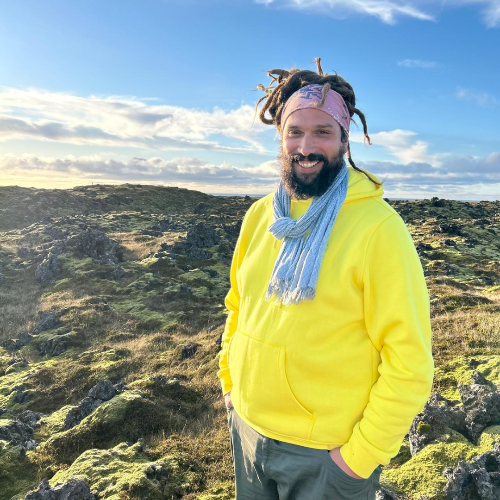
North Iceland express trip
Choose a tailor-made North Iceland trip and let dramatic fjords, steaming hot springs, and crisp Arctic light shape each day. Work with local travel designers to tailor your route, pace, and accommodations, and add meaningful encounters with fishermen, farmers, and regional storytellers.Designed for travelers who value authenticity and comfort, our Iceland trips can include small-scale guesthouses, private guides, and flexible routing that follows the season and your interests. Secure your dates now and start planning a truly personal northern adventure.
view trip ⤍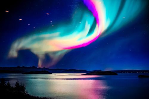
14 days
Iceland Ring Road and Westfjords trip
Stand on cliffs carved by ancient ice, feel the thunder of waterfalls, and linger in villages where time slows. The Iceland Ring Road and Westfjords trip is designed for curious travelers who want authentic, tailor-made experiences, covering the highlights at a lively pace while keeping comfort and flexibility.Perfect for trips to Iceland that feel personal, you choose your dates, share your must-see moments, and we craft a private route that balances bold landscapes with restful stays. Book a planning consultation today and turn an Iceland idea into a truly personalized adventure.
view trip ⤍
9 days
Iceland Classics trip
Inspired by Iceland’s raw light and volcanic stillness, the Iceland Classics trip is tailor-made for travelers who want genuine encounters, not rushed checklists. You set the pace and priorities, and we shape the route around them with curated local stays, private guides, and flexible day plans that adapt as you go.Our Iceland trips are designed to feel personal from start to finish. Tell us what matters most to you, and we will craft a classic Iceland journey you will never forget.
view trip ⤍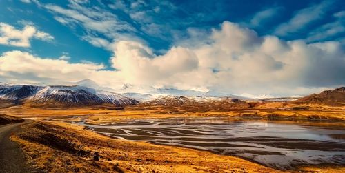
16 days
Total immersion luxury tour in Iceland
Choose a luxury tour in Iceland designed for travelers who expect seamless service, refined comfort, and deeply personal experiences. This tailor-made journey goes beyond standard routes, combining private guides, premium accommodations, and exclusive access to the country’s most striking landscapes.Set the pace with a dedicated vehicle and expert local insight, enjoy handpicked countryside stays and elevated dining rooted in Icelandic tradition, and keep your evenings flexible for aurora viewing when conditions align.If you are seeking Iceland trips defined by privacy, comfort, and thoughtful detail, this experience is crafted entirely around you.
view trip ⤍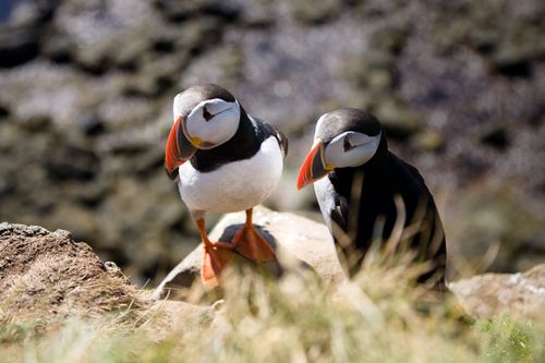
7 days
Iceland hiking tour in the Westfjords
Choose the Iceland hiking tour in the Westfjords for an active journey through one of the country’s most remote and dramatic regions. Designed around fjordside trails, coastal ridgelines, and quiet mountain paths, this experience centers on exploring the Westfjords on foot, far from the crowds found on typical Iceland trips.Each day brings guided hikes across raw landscapes shaped by glaciers and sea cliffs, with carefully selected countryside stays that place you close to nature. From seabird cliffs to isolated valleys, this tour offers solitude, sweeping views, and a deeper connection to Iceland’s wild terrain.
view trip ⤍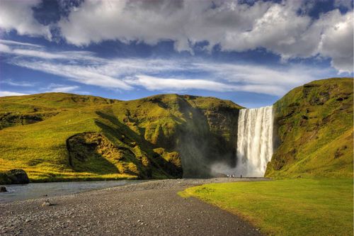
5 days
Iceland trip: Golden Circle and South-West Coast
Stand beside smoking craters, trace fresh lava flows, and sink into geothermal pools on this volcano's journey, designed for adventurous Iceland trips. This express route through the Golden Circle and the South West Coast pairs volcanic ridgelines with raw black sand shores, letting you feel Iceland’s energy underfoot.For travelers seeking authentic, tailor-made experiences, start now by requesting a custom itinerary and securing your dates, so every stop, walk, and soak fits your pace and interests.
view trip ⤍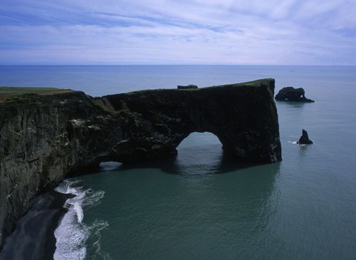
9 days
Ice cave tour in Iceland | Winter glacier adventure
Experience Iceland’s winter landscapes on an Ice cave tour in Iceland designed for travelers seeking unforgettable Iceland trips with a glacier focus. This journey follows the South Coast and beyond, combining dramatic shorelines, volcanic terrain, and the crystalline beauty of natural ice caves formed deep within Europe’s largest glacier.Travel at your own pace with a rental car and carefully selected stays, while a local specialist helps refine your route and seasonal experiences. From black sand beaches to blue ice formations, the result is an immersive winter adventure through Iceland’s most striking and remote landscapes.Start planning today and request your personalized plan for authentic exploration.
view trip ⤍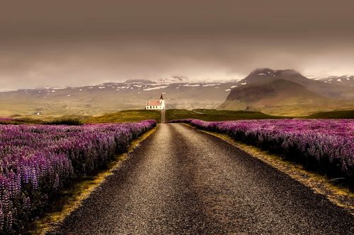
5 days
North Iceland trip: Tailor-made adventure
Choose a North Iceland journey designed for travelers who want authentic, tailor-made Iceland trips. Skip cookie-cutter tours in favor of private routes, local hosts, and hidden waterfalls that most visitors miss.Set your own pace, add bespoke experiences, and leave with stories shaped by real Icelandic life. Ready to create your northern escape? Start customizing today and turn a short break into a lifelong memory.
view trip ⤍
8 days
Whale watching tour in Iceland’s north and west
Choose a whale watching tour in Iceland designed for travelers who want coastal adventure woven into authentic, tailor-made Iceland trips. This journey follows the northern and western shores, where nutrient-rich Arctic waters attract humpbacks, minkes, dolphins, and even blue whales in season.Travel at your own pace with a rental car and local guidance that connects you to Iceland’s most rewarding whale habitats, from Húsavík and Eyjafjörður to the dramatic Snæfellsnes coastline. Bring your camera, customize your route, and turn a scenic getaway into a marine-focused exploration of Iceland’s wild seas and rugged landscapes.
view trip ⤍
12 days
Ring Road Iceland trip
Choose the Ring Road journey and turn your wanderlust into one of the most memorable trips to Iceland, crafted around your interests. Skip cookie-cutter tours in favor of curated encounters with volcanic landscapes, remote fishing villages, and the soft glow of midnight light, guided by local experts who shape each day to your pace.This is an invitation to create moments that matter, from private hikes and cozy farm stays to unexpected cultural exchanges. Reserve your dates, share your curiosities, and we will design an authentic route that feels effortless and full of awe.
view trip ⤍
11 days
North and West Iceland trip
Choose North and West Iceland and design a tailor-made road adventure with trips to Iceland that bring you face to face with glacier tongues, black sand beaches, lava fields, and hidden waterfalls. Pick up your rental car, settle into handpicked boutique guesthouses, and add locally led activities so every day reflects your pace and passions.For travelers who value authentic, tailor-made travel and private moments, start planning now to secure the best guides, refine your route, and turn curiosity into your own Icelandic story.
view trip ⤍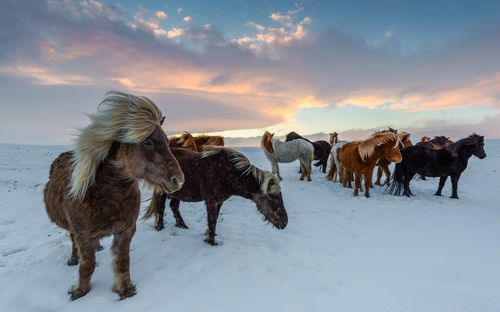
7 days
Northern Lights tour in Iceland
Experience the raw power of Lake Mývatn and the ever-changing coastlines of Snæfellsnes on an unforgettable Northern Lights tour in Iceland. One of our most immersive Iceland trips, this North Iceland and Snæfellsnes journey is crafted for travelers seeking an authentic, tailor-made adventure through volcanic landscapes, hidden waterfalls, dramatic fjords, and pristine dark-sky regions ideal for aurora viewing.Travel at your own pace, choose private guides, and stay in handpicked accommodations full of character. By day, explore Iceland’s most striking natural wonders; by night, venture out in search of the Northern Lights. Book your bespoke journey and transform Iceland’s wild scenery into memories that feel entirely your own.
view trip ⤍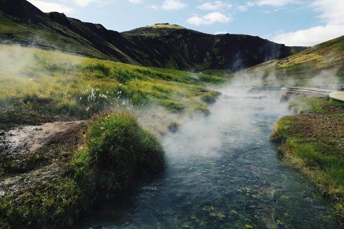
6 days
Golden Circle and South Coast Iceland trip
Transform your travel dreams into a personal Iceland story with our Golden Circle and South Coast journey. Created for travelers who want authentic, tailor-made travel, this is one of our trips to Iceland that is handcrafted around your pace, priorities, and passions. Choose the experiences that matter most, and our local specialists will shape every detail so you discover Iceland beyond the postcards.Ready to turn inspiration into a real plan? Contact our team to personalize your dates, activities, and comforts, and reserve your place on an unforgettable adventure.
view trip ⤍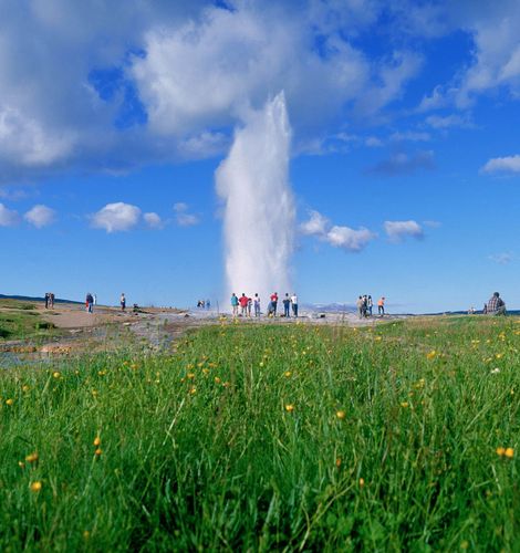
7 days
South Coast and Westman Islands Iceland trip
Make your journey personal with the South Coast and the Westman Islands, a trip created for travelers who want authentic, tailor-made experiences. Among our trips to Iceland, this one is ideal if you want to slow down, connect with local stories, and add an extra day devoted to island life.Share your interests and preferred pace, and we will craft the details, secure your dates, and arrange genuine encounters that feel natural, not staged. Reserve your custom departure and start shaping an Iceland experience that is unmistakably yours.
view trip ⤍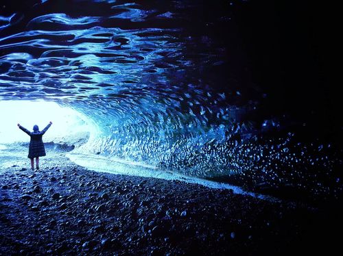
7 days
The South Coast and Snaefellsnes Iceland trip
Choose the South Coast and Snaefellsnes journey for a tailored taste of Iceland, where basalt cliffs, thundering waterfalls, and wild black sand beaches set the scene. Designed for travelers who want authenticity without a fixed script, this is one of our trips to Iceland that adapts to your pace, interests, and travel style.Tell us what matters most to you, and we will handle the details, from character-filled accommodations to trusted local guides and standout experiences. Share your must-haves and preferred rhythm, and we will craft a week that feels personal, seamless, and unmistakably yours.
view trip ⤍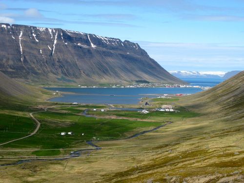
8 days
Wild West Iceland road trip
Answer the call of Iceland’s remote Westfjords and the untamed Snaefellsnes Peninsula on a Wild West road trip designed for travelers who want authentic, tailor-made Iceland trips. Discover lava fields, solitary craters, and red sand beaches that feel like your own private landscape.Take the next step and shape the journey around your style. Choose the pace, add local guides, and stay in handpicked places with real character. Lock in your dates for a small group or fully private adventure that brings your vision of Iceland to life.
view trip ⤍
10 days
Iceland Ring Road tour
Turn the Iceland Ring Road tour into a custom, deeply authentic journey that reveals raw landscapes and local life. Our Iceland trips are designed around your pace and passions, with private access to hidden natural sites, local guides who share stories beyond the guidebook, flexible routes that favour slow discovery, and handpicked stays that feel like home.We shape every detail around your preferences, so each day feels personal, effortless, and unforgettable. Ready to create an Iceland adventure that matches your taste? Tell us your travel priorities, and we will craft a bespoke itinerary that brings you closer to the land and its people.
view trip ⤍
9 days
Iceland East-to-West trip
Let Iceland reshape the way you travel with our East to West trip, a tailor-made journey for curious travelers drawn to raw landscapes and local stories. It is one of those trips to Iceland where you set the pace. Add guided hikes, private seafood tastings, and photography stops, and let our local planners shape each day around your interests.Follow winding coastal roads, pause beneath waterfalls, and stay near black sand beaches, knowing the logistics are handled from start to finish. Reserve your dates now, and we will design the route, guides, and thoughtful details that turn a trip into a lifelong memory.
view trip ⤍6 days
Wild West Iceland adventure tour
Choose a Wild West Iceland adventure tour and discover some of the country's untouched corners on one of the most memorable trips to Iceland. A tailored route takes you through towering mountains, deep blue fjords, and thunderous waterfalls, where raw landscapes invite quiet wonder.Created for travelers who value authentic, personalized travel, every detail is shaped around your pace and passions.Book now to access guides, flexible routes, and unforgettable experiences across the Westfjords and the Snæfellsnes Peninsula.
view trip ⤍10 days
The North and the West Iceland trip
Discover Iceland’s hidden heart with our North and West route, one of those Iceland trips that still feels genuinely off the radar. Your tailor-made plan guides you to volcanic lakes, quiet fjords, and the wild Snæfellsnes coastline, with time to wander and linger.Travel at your own pace, meet locals along the way, and adjust your route whenever inspiration strikes. Add guided hikes and private transfers for a smooth, comfortable journey. Start planning now for an authentic adventure that brings you closer to the real Iceland.
view trip ⤍7 days
Classic Iceland South Coast tour
Make Iceland personal with this Iceland South Coast tour, designed for travelers seeking authentic, tailor-made experiences beyond photos and the usual checklist. Set your pace and priorities, tap into local knowledge, and turn powerful landscapes into intimate memories that reflect your style.From routing and timing to meaningful add-ons and insider moments, we’ll shape the details that make trips to Iceland feel effortless and one of a kind. Choose your dates now and start designing a journey with thoughtful service and unforgettable discoveries at every turn.
view trip ⤍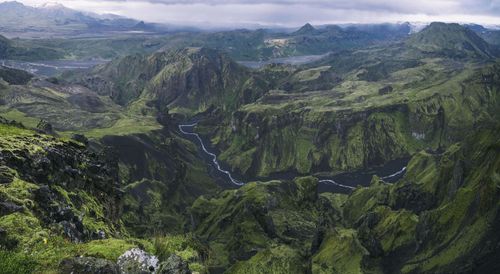
11 days
The Ring Road with Thórsmörk Iceland trip
Choose the Icelandic Ring Road with the Thórsmörk trip and step into the wild heart of the country with one of our most active Iceland trips. This tailor-made journey focuses on immersive hiking in Thórsmörk and the Laugavegur region, with flexible day-by-day choices, expert local guides, and comfortable private arrangements throughout.Ready to design a route that matches your pace and passions? Contact us to personalize your dates, add guided hikes, and shape a truly transformative Iceland experience.
view trip ⤍11 days
Glacier tour in Iceland | Multi-glacier adventure
Experience the power of ice and fire on a glacier tour in Iceland designed for travelers seeking unforgettable Iceland trips shaped around dramatic landscapes and active exploration. This carefully crafted journey follows the Ring Road and beyond, bringing you onto Europe’s largest glaciers for guided hikes, ice formations, and sweeping views across volcanic terrain.Travel at your own pace with a private, customized plan, handpicked stays in scenic coastal towns, and glacier experiences led by certified local guides. Ready to transform a classic Iceland route into a focused glacier adventure? Connect with our specialist to tailor your dates, activities, and comfort level for an unforgettable journey across Iceland’s frozen giants.
view trip ⤍7 days
Golden Circle tour in Iceland
Choose one of our Golden Circle tours in Iceland and turn the country’s classic highlights into a personal, unhurried journey. Designed for travelers who value authentic, tailor-made Iceland trips, this experience balances breathtaking landscapes with slower days, local insight, and carefully curated details.Share your rhythm and interests, and we’ll shape hidden stops, private moments, and meaningful encounters along the Golden Circle and South Coast. Reserve your dates and begin crafting a truly personal Icelandic story.
view trip ⤍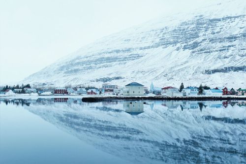
7 days
East to West Iceland self-drive tour
Let the hush and wonder of the Eastfjords open your journey on our East to West Iceland self-drive tour, created for travelers who want a more personal, unhurried, and local way to explore. Spend time in small fishing towns, soak in lesser-known hot springs, and follow the shifting light as it moves across fjords, lava fields, and black sand beaches.Choose your dates and share what matters most to you, from nature and culture to comfort, or a blend of all three. We will craft a tailor-made route with trusted local connections and distinctive stays.If you are dreaming of Iceland trips that trade checklists for real encounters, this is where it begins. Start planning now, and turn scenic drives into quiet, lasting moments across Iceland.
view trip ⤍Find even more inspiration for Iceland here
Discover Iceland's most captivating stories
written by
Rough Guides Editors
For over 40 years, Rough Guides has been a trusted name in travel, offering expert-curated guides, inspiring articles, and tailor-made trips. Our passionate team of writers and local travel specialists provide in-depth insights into destinations worldwide, from iconic landmarks to hidden gems. We help you travel smarter and experience the world authentically.