The Dodecanese Travel Guide

Curving tightly against the Turkish coast, almost within hailing distance of Anatolia, the Dodecanese (Dhodhekánisos) are the furthest island group from the Greek mainland. They’re hardly a homogeneous bunch. The two largest, Rhodes (Ródhos) and Kos, are fertile giants where traditional agriculture has almost entirely been displaced by a tourist industry focused on beaches and nightlife. Kastellórizo, Sými, Hálki, Kássos and Kálymnos, on the other hand, are essentially dry limestone outcrops that grew rich enough from the sea – especially during the nineteenth century – to build attractive port towns. Níssyros is a real anomaly, created by a still-steaming volcano that cradles lush vegetation, while Kárpathos is more variegated, its forested north grafted onto a rocky limestone south. Tílos, despite its lack of trees, has ample water, Léros shelters soft contours and amenable terrain, and further-flung Pátmos and Astypálea offer architecture and landscapes more reminiscent of the Cyclades.

Major Dodecanese attractions include the beaches on Rhodes and Kos; the wonderful medieval enclave of Rhodes Old Town; the gorgeous ensemble of Neoclassical mansions that surrounds the harbour on Sými; the rugged landscapes of Kálymnos, Kárpathos and Níssyros; the cave and monastery on Pátmos, where St John had his vision of the Apocalypse; and the hilltop village of Hóra on Astypálea. Each island has its own subtler pleasures, however; every visitor seems to find one where the pace of life, and friendly ambience, strikes a particular chord.

Thanks to their position en route to the Middle East, the Dodecanese – too rich and strategic to be ignored, but never powerful enough to rule themselves – have had a turbulent history. The scene of ferocious battles between German and British forces in 1943–44, they only joined the modern Greek state in 1948 after centuries of rule by Crusaders, Ottomans and Italians.

That historical legacy has given the islands a wonderful blend of architectural styles and cultures; almost all hold Classical remains, a Crusaders’ castle, a clutch of vernacular villages and whimsical or grandiose public buildings. For these last the Italians, who held the Dodecanese from 1912 to 1943, are responsible. Determined to turn them into a showplace for Fascism, they undertook ambitious public works, excavations and reconstruction.

Italian architecture in the Dodecanese

The architectural heritage left by the Italian domination in the Dodecanese has only recently begun to be appreciated. Many structures had been allowed to deteriorate, if not abandoned, by Greeks who would rather forget the entire Italian legacy.

Although the buildings are often dubbed “Art Deco”, and some contain elements of that style, most are properly classed as Rationalist (or in the case of Léros, Stream Line Modern). They drew on various post-World War I architectural, artistic and political trends across Europe, particularly Novecento (a sort of Neoclassicism), the collectivist ideologies of the time, and the paintings of Giorgio di Chirico. The school’s purest expressions tended to have grid-arrays of windows (or walls entirely of glass); tall, narrow ground-level arcades; rounded-off bulwarks; and either a uniform brick surface or grooved/patterned concrete. As well as in Italy and Greece, examples can still be found as far afield as Moscow or London (underground stations and blocks of flats), Los Angeles (apartment buildings) and Ethiopia (cinemas).

Italy initially attempted to create a hybrid of Rationalist style and local vernacular elements in the Dodecanese, both real and semi-mythical, to evoke a supposed generic “Mediterranean-ness”. Every Italian-claimed island had at least one specimen in this “protectorate” style, usually the gendarme station, post office, covered market or governor’s mansion, but only on the most populous or strategic islands were plans drawn up for sweeping urban re-ordering.

The years from 1936 to 1941 saw an intensified Fascist imperial ideology, an increased reference to the heritage of the Romans and their purported successors the Knights, and the replacement of the “protectorate” style with that of the “conqueror”. This involved “purification”, the stripping of many public buildings in Rhodes (though not, curiously, in Kos) of their orientalist ornamentation, its replacement with a cladding of porous stone to match medieval buildings in the old town, plus a monumental severity – blending Neoclassicism and modernism – and rigid symmetry to match institutional buildings (especially Fascist Party headquarters) and public squares across Italy.

Hálki

The little island of Hálki, a waterless limestone speck west of Rhodes, continues to count as a fully fledged member of the Dodecanese, even if its population has dwindled from three thousand to barely three hundred in the century since its Italian rulers imposed restrictions on sponge-fishing.

While visitation has brought the island back to life, except at the height of summer Hálki tends to be very quiet indeed. That said, in the middle of the day in high season, when day-trippers from Rhodes vastly outnumber locals in its broad quayside-cum-square, Emborió can feel more like a stage set than a genuine town.

Kássos

The southernmost Dodecanese island, less than 48km northeast of Crete, KÁSSOS is very much off the beaten tourist track. Ever since 1824, when an Egyptian fleet punished Kássos for its active participation in the Greek revolution by slaughtering most of the 11,000 Kassiots, the island has remained barren and depopulated. Sheer gorges slash through lunar terrain relieved only by fenced smallholdings of midget olive trees; spring grain crops briefly soften usually fallow terraces, and livestock somehow survives on a thin furze of scrub. The remaining population occupies five villages facing Kárpathos, leaving most of the island uninhabited and uncultivated, with crumbling old houses poignantly recalling better days.

Tílos

Stranded midway between Kos and Rhodes, the small, usually quiet island of TÍLOS is among the least frequented and most unpredictably connected of the Dodecanese. For visitors, however, it’s a great place simply to rest on the beach, or hike in the craggy hinterland.

Tílos shares the characteristics of its closest neighbours: limestone mountains like those of Hálki, plus volcanic lowlands, pumice beds and red-lava sand as on Níssyros. With ample groundwater and rich volcanic soil, the islanders could afford to turn their backs on the sea, and made Tílos the breadbasket of the Dodecanese. Until the 1970s, travellers were greeted by the sight of shimmering fields of grain bowing in the wind. Nowadays the hillside terraces languish abandoned, and the population of five hundred dwindles to barely a hundred in winter.

While recent development has turned the port of Livádhia ever more towards tourism, Tílos remains low-key. This is still a place where visitors come to get away from it all, often for extended stays. If you’re here to walk, little may seem striking at first glance, but after a few days you may have stumbled on several small Knights’ castles studding the crags, or found some of the inconspicuous, often frescoed, often locked medieval chapels that cling to the hillsides.

Níssyros

The volcanic island of Níssyros is unlike its neighbours in almost every respect. It’s much lusher and greener than dry Tílos and Hálki to the south, blessed with rich soil that nurtures a distinctive flora, and it supported a large agricultural population in ancient times. In contrast to long flat Kos to the north, Níssyros is round and tall, with the high walls of its central caldera rising abruptly from the shoreline around its entire perimeter. And Níssyros conceals a startling secret; behind those encircling hills, the interior of the island is hollow, centring on a huge crater floor that’s dotted with still-steaming vents and cones.

For most visitors, the volcano is Níssyros’ main attraction. It’s easy enough to see it on a day-trip from Kos, so few bother to spend the night. That’s a shame, because it’s a genuinely lovely island, very short on beaches but abounding in spectacular scenery. The port and sole large town, Mandhráki on the northwest coast, is an appealing tight-knit community with some fine ancient ruins, while two delightful villages, Emboriós and Nikiá, straddle the crater ridge.

These days, much of the island’s income is derived from the offshore islet of Yialí, a vast lump of pumice, all too clearly visible just north of Mandhráki, that’s slowly being quarried away. Substantial concession fees have given the islanders economic security.

Níssyros also offers good walking, on trails that lead through a countryside studded with oak and terebinth (pigs gorge themselves on the abundant acorns, and pork figures prominently on menus).

The interior

If you’ve come to Níssyros to see the volcano, you’re already there – the whole island is the volcano. Beyond and behind the steep slopes that climb from the shoreline, the entire centre of the island consists of a vast bowl-shaped depression. The hills end in a slender ridge that’s the rim of the caldera, meaning that the two hilltop villages that survive, Emboriós and Nikía, are long thin strips that enjoy stupendous views both out to sea and down into the maw. The interior is etched almost in its entirety with ancient agricultural terraces, mostly long abandoned but giving a very real sense of the much greater population in antiquity. A side road just beyond Emboriós offers the only road access, and continues south to the craters at the far end.

Hiking on Níssyros island

Níssyros is a fabulous destination for hikers, with enticing trails to suit all abilities. The one drawback is that hiking to and from the volcano from Mandhráki is for most walkers too much to attempt in a single day. It’s not so much the distance that’s the problem as the fact that you have to climb back out of the island interior on your way home. SKAI publish a good topographical map (shop.skai.gr).

Psérimos

Were it not so close to Kos and Kálymnos, the little island of PSÉRIMOS, filled with remote beaches, might be idyllic. Throughout the season, so many excursion boats arrive that they’ve had to build a second jetty at little AVLÁKIA port. In midsummer, day-trippers blanket the main sandy beach that curves in front of Avlákia’s thirty-odd houses and huge communal olive grove; even during May or late September you’re guaranteed at least eighty outsiders daily (versus a permanent population of 25). Three other beaches are within easy reach: the clean sand-and-gravel strand at Vathý is a well-marked, thirty-minute walk east, starting from behind the Taverna Iy Psérimos. It takes 45 minutes of walking north along the main trans-island track to get to grubbier Marathoúnda, composed of pebbles. Best of all is Grafiótissa, a 300m-long beach of near-Caribbean quality half an hour’s walk west of town.

Astypálea

Geographically, historically and architecturally, Astypálea really belongs to the Cyclades – on a clear day you can see Anáfi or Amorgós far more easily than any of the other Dodecanese. Its inhabitants are descended from colonists brought from the Cyclades during the fifteenth century, after pirate raids had left the island depopulated, and supposedly Astypálea was only reassigned to the Ottomans after the Greek Revolution because the Great Powers had such a poor map at the 1830 and 1832 peace conferences.

Astypálea’s main visitor attractions include a beautiful old citadel – not just the castle itself, but also the whitewashed village of Hóra beneath it – as well as several good, easily accessible beaches. The island may not immediately strike you as especially beautiful: many beaches along its heavily indented coastline have reef underfoot and periodic seaweed, while the windswept heights are covered in thornbush or dwarf juniper. Hundreds of sheep and goats manage to survive, while citrus groves and vegetable patches in the valleys signal a relative abundance of water. Besides the excellent local cheese, Astypálea is renowned for its honey, fish and lobster.

There is no package tourism on Astypálea, and its remoteness discourages casual trade. During the short, intense midsummer season (mid-July to early Sept), however, visitors vastly outnumber the 1500 permanent inhabitants. The one real drawback is that transport connections are so poor.

The west

The shape of Astypálea is often compared to a butterfly, in that it consists of two separate “wings” joined by a low narrow isthmus. The only major population centre, made up of the built-up strip that joins the waterfront villages of Péra Yialós and Livádhia by way of hilltop Hóra, is on the southeast coast of its western half, well away from both the ferry port and the airport.

Lipsí

The largest, most interesting and most populated of the islets north and east of Pátmos, LIPSÍ also has the most significant tourist trade. Returning regulars make showing up in peak season without reservations unwise. During quieter months, however, Lipsí still provides an idyllic halt, its sleepy pace almost making plausible a dubious link with Calypso, the nymph who held Odysseus in thrall. Once a dependency of the monastery on Pátmos, Lipsí is still conspicuously sown with blue-domed churches. Deep wells water small farms and vineyards, but there’s only one flowing spring, and although plenty of livestock can be seen, the non-tourist economy is far from thriving.

Arkí

Roughly two-thirds the size of Lipsí, ARKÍ is a far more primitive island, lacking proper shops or a coherent village. A mere fifty or so inhabitants eke out a living, mostly fishing or goat/sheep-herding, though servicing yachts attracted by the superb anchorage at Avgoústa Bay – named for the half-ruined Hellenistic/Byzantine Avgoustínis fortress overhead – is also important.

Excursion-boat clients swim at the “Blue Lagoon” of Tiganákia at the southeast tip, but other beaches on Arkí take some finding. The more obvious are the carefully nurtured sandy cove at Pateliá by the outer jetty, or tiny Limnári pebble-bay (fitting five bathers at a pinch) on the northeast coast, a 25-minute walk away via the highest house in the settlement.

Agathoníssi

The small, steep-sided, waterless islet of AGATHONÍSSI is too remote – closer to Turkey than Pátmos, in fact – to be a popular day-trip target. Intrepid Greeks and Italians form its main tourist clientele, along with yachts attracted by excellent anchorage. Even though the Nissos Kalymnos (and a summer catamaran) appear regularly, schedules mean you should count on staying at least two days.

Despite the lack of springs, the island is greener and more fertile than apparent from the sea; lentisc, carob and scrub oak on the heights overlook two arable plains in the west. Fewer than a hundred people live here full time, but they make a go of stock-raising or fishing (or rather, fish-farming), and few dwellings are abandoned or neglected.

Most of the population lives in Megálo Horió hamlet, just visible on the ridge above the harbour hamlet of ÁYIOS YEÓRYIOS and at eye level with tiny Mikró Horió opposite. Except for a small shop and two café-restaurants working peak-season nights only in Megálo Horió, all amenities are in the port.

With no rental scooters, exploring involves walking along the cement-road network, or following a very few tracks and paths – bring plenty of water. If you won’t swim at the port, home to the largest sandy beach, hike ten minutes southwest to shingle-gravel Spiliás, or continue another quarter-hour by path over the ridge to Gaïdhourávlakos, another gravel cove.

Bays in the east, all reached by paved roads, include tiny Póros (45min distant), fine sand with lentisc-tree shade at the back; Thóli (25min further) in the far southeast, with good snorkelling and some morning shade; and Pálli across the same bay, a small but pristine fine-pebble cove reached by a fifteen-minute walk down from the trans-island road.

Kálymnos

Despite its size and beauty, the island of KÁLYMNOS has long been overshadowed by Kos. Kálymnos fought in the Trojan War as a vassal of its southern neighbour, and to this day its tourist industry remains largely dependent on the overspill – and the airport – of Kos.

In most respects, however, Kálymnos is very unlike Kos. It’s much more mountainous, consisting of three high limestone ridges that fan away from the continuous rugged cliffs of its west coast, to create two long sloping valleys that hold most of its settlements and agricultural land.

The island’s capital and largest town, the busy port of Póthia, faces Kos from the midpoint of its southern shoreline. Most visitors head instead for the west coast, where a handful of small resorts have struggled to survive the collapse of a short-lived experiment in mass tourism. The pick of the pack, Myrtiés, stands close to some attractive little beaches. This craggy shoreline has found deserved fame among climbers and hikers, who keep businesses ticking along in the cooler spring and autumn months.

For a beach holiday, you’d do better to head for the separate islet of Télendhos, (a spectacular sight at sunset), or further north up the coast to Emboriós.

The prosperity of Kálymnos traditionally rested on its sponge industry, but blights have now wiped out almost all of the eastern Mediterranean’s sponges. Only a few boats of the island’s thirty-strong fleet remain in use, and most of the sponges sold behind the harbour are imported from Asia and the Caribbean.

Télendhos

The towering pyramid-shaped islet of TÉLENDHOS, silhouetted at sunset a few hundred metres west of Myrtiés, was severed from Kálymnos by a cataclysmic earthquake in 554 AD. Car-free, home to a mere handful of year-round inhabitants, and blissfully tranquil, it’s the single most compelling destination for Kálymnos visitors, and the short row of hotels and restaurants on its east-facing shore makes it a great place to spend a few nights. Regular little boat-buses shuttle across the narrow straits between Myrtiés and Télendhos (every 30min 8am–midnight; €2); it’s said that somewhere far below, an ancient town lies submerged.

It only takes a few minutes to explore the little built-up strip that stretches in both directions from the boat landing. A narrow beach of reasonable sand runs along the straight seafront, and the calm shallow water is ideal for kids. Kayaks and beach toys are available for rent, while tousled tamarisks provide shade.

To find a more secluded beach, simply keep walking. A few hundred metres north – head right from the boat landing, and keep going after the paved coastal roadway peters out to become a dirt path – nudist Paradise beach is peaceful and sheltered, but at its best in the morning, before the sun disappears for good behind the mountain. A ten-minute walk southwest of the village, following a footpath over the ridge, will bring you to the pebble beach at Hokhlakás, a scenic but more exposed spot where the sea tends to be much rougher.

While all the shoreline buildings are of modern construction, abundant ruins are scattered slightly further afield. Closest to the village, north of the boat landing, a seafront field holds the ruined outline of the thirteenth-century monastery of Áyios Vassílios. On the hillside immediately above Hokhlakás, Ayía Triádha was originally an enormous basilica, though now just a few stones survive. Further up the slopes, wherever you look, giant Cyclopean caves burrow deep into the foot of the central massif.

Setting out to hike right round Télendhos would be a mistake; it’s a long and exposed walk with little reward. Devote an hour or two, however, to investigating the islet’s southwest corner, a little low-lying afterthought. Follow the footpaths through the woods, signed to “Early Christian Necropolis”, and in addition to some intact arched sixth-century tombs you’ll come to a perfectly sheltered sandy cove that’s ideal for swimming and snorkelling.

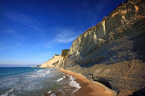
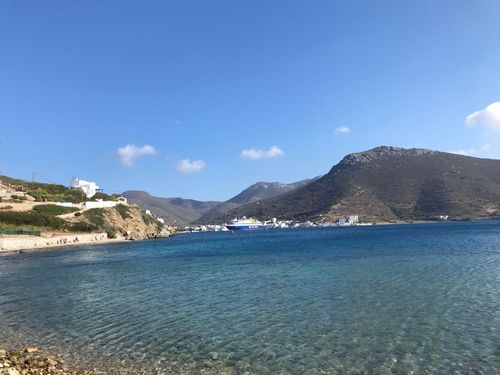
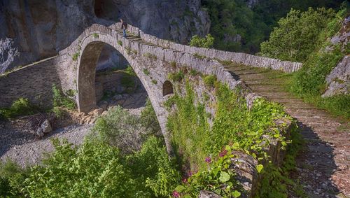
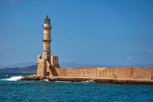
Sponges and sponge-diving

Sponges are colonies of microscopic marine organisms that excrete a fibrous skeleton. The living sponges that can be seen throughout the Aegean as black, melon-sized blobs, anchored to rocks in three to ten metres of water, are mostly “wild” sponges, impossible to clean or shape with shears. Kalymnian divers seek out “tame” sponges, which are much softer, more pliable, and dwell thirty to forty metres deep.

Sponge-fishers were originally free divers; weighted with a rock, they’d collect sponges from the seabed on a single breath before being hauled back up to the surface. Starting in the late nineteenth century, however, divers were fitted with heavy, insulated suits (skáfandhro). Breathing through an air-feed line connected to compressors aboard the factory boats, they could now attain depths of up to 70m. However, this resulted in the first cases of the “bends”. When divers came up too quickly, the dissolved air in their bloodstream bubbled out of solution – with catastrophic results. Roughly half of those early pioneers would leave with the fleets in spring but fail to return in autumn. Some were buried at sea, others, it’s said, buried alive, up to their necks in hot sand, to provide slight relief from the excruciating pain of nitrogen bubbles in the joints.

By the time the malady became understood, during World War I, thousands of Kalymnians had died, with many survivors paralyzed, deaf or blind. Even though the skáfandhro was banned elsewhere as the obvious culprit, it remained in use here until after World War II. After the first decompression chambers and diving schools reached Greece, in the 1950s, the seabed was stripped with ruthless efficiency, and the sponge fleets forced to hunt further from home.

Even the “tame” sponge is unusable until processed. The smelly organic matter and external membrane is thrashed out of them, traditionally by being trodden on the boat deck, and then they’re tossed for a day or so in a vat of hot sea-water. Visitors to Póthia’s remaining handful of workshops can still watch the sponge-vats spin; in the old days, the divers simply made a “necklace” of their catch and trailed it in the sea behind the boat.

To suit modern tastes, some sponges are bleached to a pale yellow colour with nitric acid. That weakens the fibres, however, so it’s best to buy the more durable, natural-brown ones.

Kárpathos

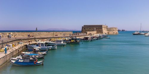
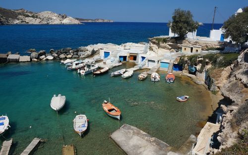
Despite being the third-largest Dodecanese island, poised halfway between Rhodes and Crete, long, narrow KÁRPATHOS has always been a wild and underpopulated backwater. The island’s usually cloud-capped mountainous spine, which rises to over 1200m, divides it into two very distinct sections – the low-lying south, with its pretty bays and long beaches, and the exceptionally rugged north, where deeply traditional villages nest atop towering cliffs. If you prefer to stay in a sizeable town, then Pigádhia on the east coast, Kárpathos’s capital and largest port, is a good choice, with a wide range of hotels as well as a good beach, but several smaller resorts and isolated coves also hold lovely beachfront accommodation.

Touring Kárpathos’s magnificent, windswept coastline is consistently superb, with its verdant meadows, high peaks, isolated promontories and secluded beaches, lapped by crystalline waters. The interior, however, isn’t always as alluring: the central and northern forests have been scorched by repeated fires, while agriculture plays a minor role. The Karpathians are too well off to bother much with farming; emigration to North America and the resulting remittances have made this one of Greece’s wealthiest islands.

Although the Minoans and Mycenaeans established trading posts on what they called Krapathos, the island’s four Classical cities figure little in ancient history. Kárpathos was held by the Genoese and Venetians after the Byzantine collapse and so has no castle of the Knights of St John, nor any surviving medieval fortresses of note.

The north

Northern Kárpathos still feels very much a world apart. Despite repeated promises, the road north from Spóa has not been fully paved, and remains a hair-raising prospect for all but the hardiest mountain drivers. Most visitors therefore still arrive by boat at the little port of Dhiafáni, and then take a bus up to the traditional hilltop village of Ólymbos.

Hiking in northern Kárpathos

Northern Kárpathos is renowned for excellent hiking. While the most popular walk of all simply follows the jeep track down from Ólymbos to the superb west-coast beach at Fýsses, a sharp drop below the village, most local trails head more gently north or east, on waymarked paths.

Ólymbos to Dhiafáni

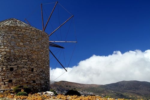
An easy ninety-minute walk leads back down to Dhiafáni, starting just below the two working windmills. The way is well marked, with water twenty minutes along, and eventually drops to a ravine amid extensive forest. The final half-hour, unfortunately, follows a bulldozed riverbed.

Ólymbos to Vrykoúnda

Heading north from Ólymbos, it takes around 1hr 30min to reach sparsely inhabited Avlóna, set on a high upland devoted to grain. From there, less than an hour more of descending first moderately, then steeply, along an ancient walled-in path that takes off from the valley-floor track, will bring you to the ruins and beach at Vrykoúnda. Once you’ve seen the Hellenistic/Roman masonry courses and rock-cut tombs here, and the remote cave-shrine of John the Baptist on the promontory (focus of a major Aug 28–29 festival), there’s good swimming in the pebble coves to one side.

Avlóna to Trístomo

Starting just above Avlóna, a magnificent cobbled way leads in 2hr 30min, via the abandoned agricultural hamlets of Ahordhéa and Kílios, to Trístomo, a Byzantine anchorage in the far northeast of Kárpathos. The views en route, and the path itself, are the thing; Trístomo itself is dreary, with not even a beach.

Trístomo to Vanánda

If you’ve already hiked to Trístomo, and would prefer not to retrace your steps to Avlóna, you can hook up, via a shortish link trail east from Trístomo, with a spectacular coastal path back to Vanánda (3hr 30min). Once clear of abandoned agricultural valleys and over a pine-tufted pass, it’s often a corniche route through the trees, with distant glimpses of Dhiafáni and no real challenge except at the steep rock-stairs known as Xylóskala.
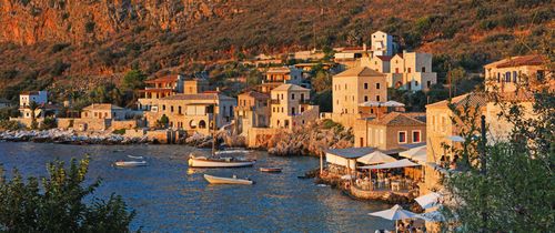
Kastellórizo

Although KASTELLÓRIZO’s official name of Meyísti means “Biggest”, it’s actually among the very smallest Dodecanese islands; it’s just the biggest of a local archipelago of islets. It’s also extremely remote, located more than 100km east of Rhodes and barely more than a nautical mile off mainland Asia. At night its lights are outnumbered by those of the Turkish town of Kaş opposite, with which Kastellórizo has excellent relations.

The island’s population has dwindled from around ten thousand a century ago to perhaps three hundred now. Having been an Ottoman possession since 1552, it was occupied by the French from 1915 until 1921, and then by the Italians. When Italy capitulated to the Allies in 1943, 1500 Commonwealth commandos occupied Kastellórizo. Most departed that November, after the Germans captured the other Dodecanese, which left the island vulnerable to looters, both Greek and British. By the time a fuel fire in 1944 triggered the explosion of an adjacent arsenal, demolishing half the houses on Kastellórizo, most islanders had already left. Those who remain are supported by remittances from more than 30,000 emigrants, as well as subsidies from the Greek government to prevent the island reverting to Turkey.

Yet Kastellórizo has a future of sorts, thanks partly to repatriating “Kassies” returning each summer to renovate their crumbling ancestral houses as second homes. Visitors tend either to love Kastellórizo and stay a week, or crave escape after a day; detractors dismiss it as a human zoo maintained by the Greek government to placate nationalists, while devotees celebrate an atmospheric, little-commercialized outpost of Hellenism.

Léros

As the island of LÉROS is indented with deep, sheltered bays, lined with little settlements, it doesn’t have an obvious “capital”. Ferries arrive at both Lakkí on the west coast and Ayía Marína on the east, but neither is recommended as a place to stay. Instead visitors congregate in the resorts of Pandélli and Álinda, and in more refined Plátanos up on the hillside. While Léros can be very attractive, however, it doesn’t hold spectacular beaches, so tourism remains relatively low-key.

The island still bears traces of the Battle of Léros of November 1943, when German paratroops displaced a Commonwealth division that had occupied Léros following the Italian capitulation. Bomb nose-cones and shell casings turn up as gaily painted garden ornaments, or do duty as gateposts. After the war, the local economy relied on prisons and sanatoria in former Italian military buildings. During the civil war and the later junta, leftists were confined to a notorious detention centre at Parthéni, while hospitals warehoused intractable psychiatric cases and mentally handicapped children. In 1989, a major scandal exposed conditions in the asylums; most wards were eventually closed.

Pátmos

Arguably the most beautiful, certainly the best known of the smaller Dodecanese, PÁTMOS has a distinctive, immediately palpable atmosphere. In a cave here, St John the Divine (known in Greek as O Theológos, “The Theologian”, and author of one of the four Gospels) set down the Book of Revelation, the final book of the New Testament. The huge fortified monastery that honours him remains the island’s dominant feature; its monks owned all of Pátmos until the eighteenth century, and their influence remains strong.

For those visitors not motivated by religion, Pátmos’s greatest strength is its beaches. With so many attractive strands, you can usually escape the crowds even in high season, though you may need a vehicle to do so. Day-trippers exceed overnighters, thanks in part to the island’s lack of an airport, and Pátmos feels a different place once the last excursion boat has left after sunset. Among those staying, no single nationality predominates, lending Pátmos a cosmopolitan feel almost unique in the Dodecanese. The steady clientele can be very posh indeed, with assorted royal and ex-royal families among repeat visitors.

Skála

Home to most of Pátmos’s 3200 official residents, SKÁLA seems initially to contradict any solemn image of the island; the commercial district with its gift boutiques is incongruously sophisticated for such a small town. During peak season, the quay and inland lanes throng with trippers, and visitors still tend to be arriving after dark, including from the huge, humming cruisers that weigh anchor around midnight. Skála becomes a ghost town in winter (which here means by early October), when most shops and restaurants close.

Given time, Skála reveals more enticing corners in the residential fringes to its east and west, where vernacular mansions hem in pedestrian lanes creeping up the hillsides. At the summit of the westerly rise, Kastélli, masonry courses from an ancient acropolis enclose a more recent chapel. An easy ten-minute walk southwest across the flat isthmus, starting from the central market street, brings you to pebbly Hokhlakás Bay on the island’s west coast. More of a quiet seafront suburb than a beach, it enjoys wonderful sunset views.

Saint John on Pátmos

Pátmos has been intimately associated with Christianity since John the Evangelist – later John the Divine – was exiled here from Ephesus by emperor Domitian in about 95 AD. John is said to have written his Gospel on Pátmos, but his sojourn is better remembered for the otherworldly voice that he heard coming from a cleft in the ceiling of his hillside grotto, which bid him to set down its words in writing. By the time John was allowed to return home, that disturbing finale to the New Testament, the Book of Revelation (aka the Apocalypse), had been disseminated as a pastoral letter to the Seven Churches of Asia Minor.

Revelation followed the standard Judeo-Christian tradition of apocalyptic books, with titanic battles in heaven and on earth, supernatural visions, plus lurid descriptions of the fates awaiting the saved and the damned following the Last Judgement. Hugely open to subjective interpretation, Revelation was being wielded as a rhetorical and theological weapon within a century of appearing. Its vivid imagery lent itself to depiction in frescoes adorning the refectories of Byzantine monasteries and the narthexes of Orthodox churches, conveying a salutary message to illiterate medieval parishioners.

John also combated paganism on Pátmos, in the person of an evil wizard, Kynops, who challenged him to a duel of miracles. As the magician’s stock trick involved retrieving effigies of the deceased from the seabed, John responded by petrifying Kynops while he was under water. A buoy just off Theológos beach in Skála today marks the relevant submerged rock.

Forever after in the Orthodox world, heights amid desolate and especially volcanic topography have become associated with John. Pátmos, with its eerie landscape of igneous outcrops, is an excellent example, as is Níssyros, where one of the saint’s monasteries overlooks the volcano’s caldera.

Sými

For sheer breathtaking beauty, the Greek islands can offer nothing to beat arriving at SÝMI. While the island as a whole is largely barren, its one significant population centre, Sými Town, is gorgeous, a magnificent steep-walled bay lined with Italian-era mansions.

With its shortage of fresh water and relative lack of sandy beaches, Sými has never developed a major tourist industry. Sými Town however holds a wide range of small hotels, as well as abundant delightful rental properties, while day-trippers from Rhodes – and yachties lured by the wonderful harbour – mean it can support some very good restaurants too. In the height – and searing heat – of summer it can get uncomfortably crowded, with a large influx of Italian visitors as well as mainland Greeks, but in spring and autumn it’s wonderful, and even in winter a substantial expat community keeps many businesses open.

Visitors who venture beyond the inhabited areas find an attractive island that has retained some forest of junipers, valonea oaks and even a few pines – ideal walking country in the cooler months. Dozens of tiny, privately owned monasteries dot the landscape; though generally locked except on their patron saint’s day, freshwater cisterns are usually accessible. Near the southern tip of the island, the much larger monastery of Panormítis is an important pilgrimage destination.

Little more than a century ago, Sými Town was home to more people than Rhodes Town, thanks to the wealth generated by its twin ancient skills of shipbuilding and sponge-diving. Many of the mansions built during that age of prosperity have long since tumbled into decay – a process hastened in September 1944, when an ammunition blast set off by the retreating Germans levelled hundreds of houses up in Horió. While restoration is gradually bringing them back to life, the scattered ruins lend the island an appealing sense of time-forgotten mystery.

Sými Town

SÝMI, the capital and only town, is arrayed around a superb natural harbour in an east-facing inlet on the island’s north shore. Inter-island ferries arrive right in the heart of town, while excursion boats jostle for room in summer with mighty Mediterranean cruisers. Immediately behind the straight-line quaysides that enclose the main segment of the port, scattered with sponge stalls and souvenir stores targeted at day-trippers, the lowest row of Italian-era mansions clings to the foot of the hillsides. Each is painted in the officially ordained palette of ochres, terracotta, cream or the occasional pastel blue, and topped by a neat triangular pediment and roof of ochre tiles. The hills are steep enough that the houses seem to stand one above the other, to create a gloriously harmonious ensemble.

The lower level of the town, known as Yialós, extends northwards to incorporate the smaller curving Haráni Bay. Traditionally this was the island’s shipbuilding area, and you’ll still see large wooden boats hauled out of the water. Yialós also stretches some way inland from the head of the harbour, beyond the main town square, which is used for classical and popular Greek performances during the summer-long Sými Festival.

On top of the high hill on the south side of the port, the old village of Horió stands aloof from the tourist bustle below. It’s hard to say quite where Yialós ends and Horió begins, however; the massive Kalí Stráta stair-path, which climbs up from the harbour, is lined with grand mansions, even if some are no more than owl-haunted shells. Another similar stairway, the Katarráktes, climbs the west side of the hill, from further back in Yialós, but it’s more exposed, and used largely by locals.

Discover more places in Greece

Planning your own trip? Prepare for your trip

Use Rough Guides' trusted partners for great rates

Rough Guides Editors

written by
Rough Guides Editors

updated 19.05.2021

Ready to travel and discover
Greece?

Get support from our local experts for
stress-free planning & worry-free travels

Plan my trip ⤍