Gulf Coast
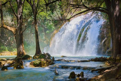
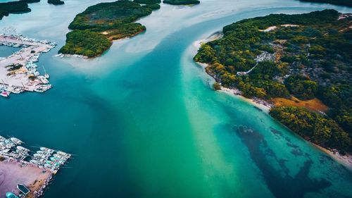
A wide, fast road (Hwy-261) connects Mérida with the Gulf Coast to the north, passing the ancient Maya complex of Dzibilchaltún before reaching the port of Progreso, a popular summer escape for meridanos. West of Mérida, the small village of Celestún offers a very different coastal experience, surrounded by a vast nature reserve. Many visitors head for the beach only after taking a boat tour through a long inlet that shelters a huge flamingo colony, an unforgettable highlight on any trip to Mexico.
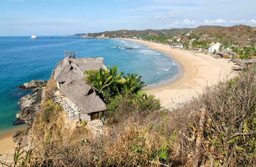
Celestún
Were it not for its amazing flamingo-filled lagoon, Celestún, 93km west of Mérida, would be little more than a one-boat fishing village. It’s literally the end of the road, dead-straight for most of the drive through the forest, until you emerge and cross a bridge to the end of a sandbar on the northwest coast of the peninsula. The town has grown a tiny bit in the twenty-first century (with an ATM and a petrol station, finally), but still has a castaway feel; it’s busy only on occasional Sundays and during Mexican holidays.
The beach is wide, and the sea is cloudy yet clean – but it’s the birds in the 600-square-kilometre Ría Celestún Biosphere Reserve here that are the real draw. A typical boat tour takes in the flamingos, most numerous from November to May, when blue-winged teal and shovellers also migrate. Dedicated birders can hire a skilled guide, or, if you're looking for something more active, there is the option to bike and canoe through the mangroves.
South and east of Mérida
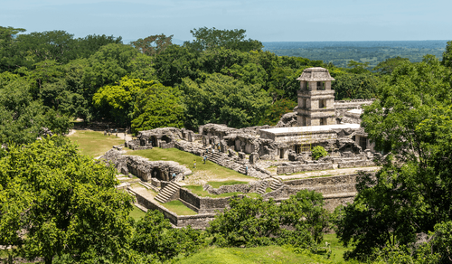
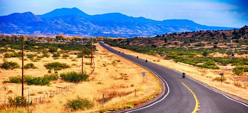
South of Mérida are two scenic routes, steeped in Maya and colonial history: the Ruta Puuc, and the Ruta de los Conventos. Both are best experienced in a car, though you can get to a couple of major attractions by bus. East of the city, by car or bus, lies the pueblo mágico (“magic village” – an official Mexican government designation) of Izamal, which is exceptionally scenic and rich in tradition. Taken as a whole, this area represents the essence of Maya rural life, the heart of the Yucatán, in dozens of villages linked by narrow roads through dense forest. Life is slower here, often conducted by bicycle – stay alert while driving.
Ruta Puuc
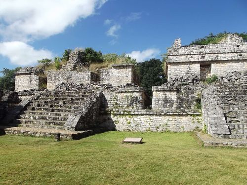
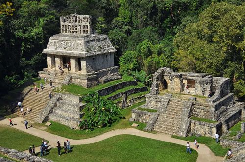
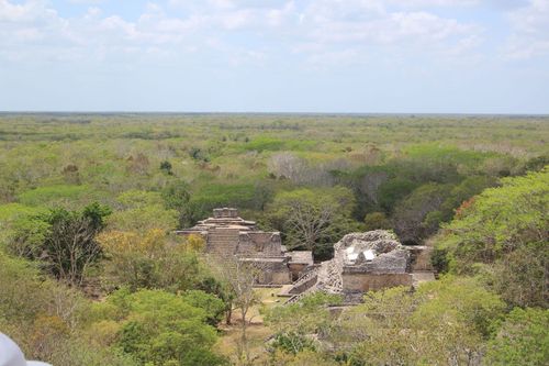
About 80km south of Mérida in the Puuc hills lies a group of important and well-restored archeological sites, linked along a road commonly called the Ruta Puuc. The chief attraction is Uxmal, second only to Chichén Itzá in tourist appeal as well as in its size and historical significance. From Uxmal, Hwy-261 continues on to the lesser site of Kabáh; shortly after that, bearing east on a smaller side road, you pass Sayil and Labná. From Labná you can continue to the farming town of Oxkutzcab, on the road between Muna and Felipe Carrillo Puerto, and head back to Mérida via Ticul and Muna.
The distinctive Puuc sites clearly evolved from themes in the Río Bec and Chenes regions: you’ll see the same gaping monster mouths and facades decorated in mosaic-like Xs and checkerboards. In both cases, though, the techniques reflect a new strategy of mass production – the mask-covered front of the Codz Poop at Kabáh, for instance, is dotted with hundreds of consistently round carved eyes. A new core-and-veneer style of construction, rather than stone blocks stacked with mortar, yielded sounder buildings with a smoother appearance.
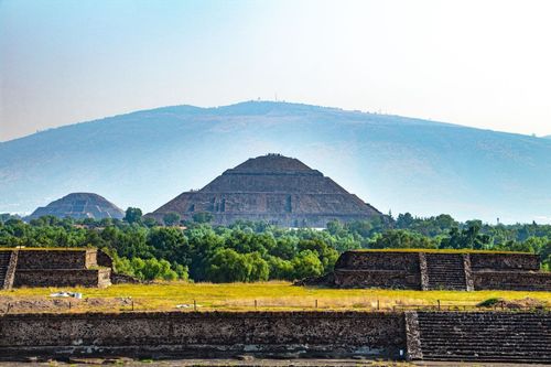
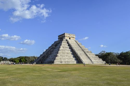
Uxmal
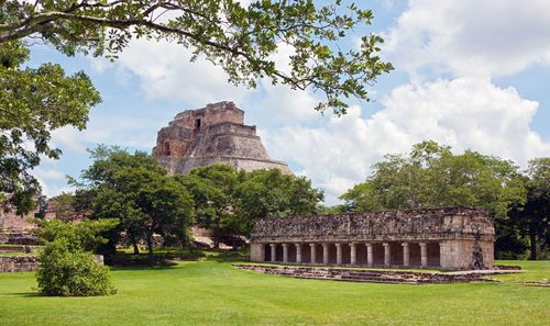
Meaning “thrice-built”, the UNESCO World Heritage Site of Uxmal (pronounced OOSH-mal) represents the finest achievement of the Puuc-region Maya culture before it fell into its ultimate decline near 1000 AD. Its spectacular buildings are encrusted all over with elaborate, and sometimes grisly, decoration. Uxmal is potentially more rewarding than a visit to Chichén Itzá, as the crowds can be a bit lighter, the decorative detail is fascinating, and you can still climb one of the pyramids. If you arrive close to opening time (the drive from Mérida takes about an hour), you can see the major buildings in a couple of hours and leave before the buses start rolling in. There’s a pay car park at the entrance to the site, where the visitor centre includes a small museum, bookshop with guides to the site, crafts store, snack bar and ATM.
The main restored buildings are set out on a roughly north–south axis in a large cleared site; the alignment of individual buildings often has astrological significance. As in all Maya sites in the Yucatán, the face of Chac, the rain god, is everywhere. Chac must have been more crucial in this region than almost anywhere, for Uxmal and the other Puuc sites have no cenotes or other natural sources of water, relying instead on chultunob, jug-shaped underground cisterns, to collect and store rainwater (most have been filled in, to prevent mosquitoes breeding, but Kabáh has an extant one).
Brief history
Little is known of the city’s history, but the chief monuments, which marked its peaks of power and population, were erected around 900 AD. Sometime after that, the city began to decline, and by 1200 Uxmal and the other Puuc sites, together with Chichén Itzá, were all but abandoned. Political infighting, ecological problems and loss of trade with Tula, near Mexico City, may have played a part. Later, the Xiu dynasty settled at Uxmal, making it one of the central pillars of the League of Mayapán, but a 1441 rebellion put an end to centralized Maya authority.
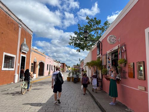
Izamal
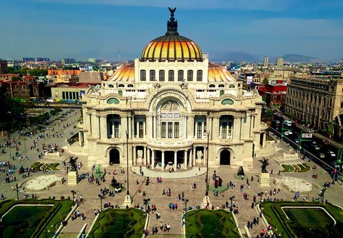
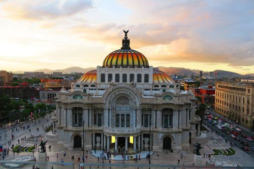
The excellent regional crafts centre of IZAMAL is easy enough to visit from Mérida on a day trip, but don’t leave before sunset, when the place takes on a perfect golden glow, thanks to the striking ochre-yellow that covers all of the buildings – a memorable touch on 10-day Mexico trips. If you prefer the country to the city, Izamal can also be a good alternative to Mérida as a base for sightseeing. In this case, though, it’s nice to have a car, as Izamal is served only by second-class buses.
You can take a craft tour of the town, using a free map, available from most hotels and businesses, which identifies the workshops of wood-carvers, papier-mâché artists and other artisans around Izamal – they’re all well marked and easily reached by bike, available from the craft museum. Be sure to visit Don Esteban, on Calle 26 at Calle 45, whose jewellery made from henequen spines is striking and modern, and whose effusive character is memorable. Agustín Colli, on Calle 19 between calles 24 and 26, makes double-weave hammocks that are positively luxurious.
For a broader selection of craftwork, visit Hecho a Mano on the south side of the convent plaza. This particularly good craft and folk-art shop is stocked with everything from Mexican wrestling masks to Huichol yarn paintings from Nayarit, as well as excellent photography by the owner.
Ruta de los Conventos
The “Convent Route” – Hwy-18 from Oxcutzcab to Mérida – is a natural extension of the Ruta Puuc, or an easy day outing from Mérida on its own. Every town along the route has an immense fortress church, but the historic highlights are Maní and the late Maya site of Mayapán. The churches date mainly from the seventeenth century or even earlier, as the Spanish were trying to establish their control. They were built so huge partly to impress, as a sign of the domination of Christianity over traditional gods, and partly as fortresses and places of refuge in times of trouble.
Maní
This small town was founded by the Xiu after they abandoned Uxmal, and it was the largest city encountered by the Spanish in the Yucatán, though almost no trace now survives. Avoiding a major confrontation, Maní’s ruler, Ah Kukum Xiu, converted to Christianity and became an ally of the Spanish. In 1548 one of the earliest and largest Franciscan monasteries in the Yucatán was founded here. This still stands, surrounded now by Maya huts, and just about the only evidence of Maní’s past glories are the ancient stones used in its construction and in walls around the town. In front of the church, in 1562, Bishop Diego de Landa held his infamous auto-da-fé, in which he burned the city’s records (because they “contained nothing in which there was not to be seen the superstitions and lies of the devil”), destroying virtually all original Maya literature.
Mayapán
The ruins of the most powerful city in the Yucatán from the thirteenth to the fifteenth centuries sit right beside the road. It was a huge population centre by the standards of the day, with some fifteen thousand people living on a site covering five square kilometres, in which traces of more than four thousand buildings have been found.
What can be seen today is less than grand – the buildings were crude and small by Maya standards, at best poor copies of what had gone before, and only a few have been restored (a visit doesn’t take long). The Mayapán society was initially dismissed as decadent and failing, but a case can be made for the fact that it was merely a changing one. As the priests no longer dominated here, what grew instead was a more genuinely urban society: highly militaristic, no doubt, but also far more centralized and more reliant on trade than previous Maya culture.
Brief history
According to Maya chronicles, Mayapán, Chichén Itzá and Uxmal formed the League of Mayapán, which exercised control over the entire peninsula from around 987 to 1185. It broke up when Mayapán’s Cocom dynasty attacked the already declining Chichén Itzá and took control of the peninsula. The archeological evidence, however, suggests Mayapán was not founded until 1263, after the fall of Chichén Itzá.
Either way, hegemony was maintained until 1441, when Ah Xupan, a Xiu leader from Uxmal, overthrew the Cocom and destroyed their city. But this led to factionalism, which aided the Spanish Conquest considerably.
Acancéh
A mix of Maya, modern and colonial architecture, the town of Acancéh (pronounced “ah-kan-KAY”) encapsulates Yucatecan history. At the central plaza, beside the sixteenth-century church is a large Maya pyramid, plus two smaller ones, all surrounded by everyday life. At the top of the large pyramid are four huge stucco masks, some of the finest of their kind.
The ancient Maya Palacio de los Estucos is about four blocks away, behind the market (get directions from the booth at the main pyramid). The stucco decoration on the long, low building is far from complete, but there are plenty of easily identifiable figures, animals and glyphs.
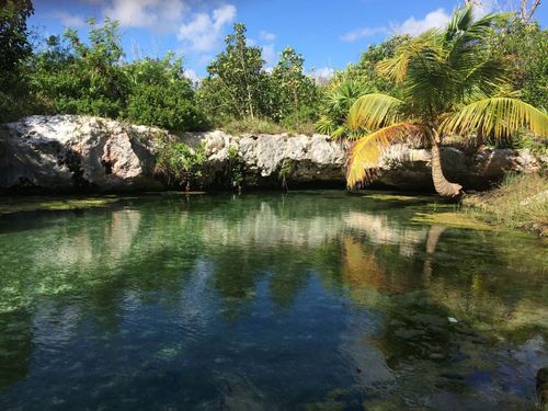
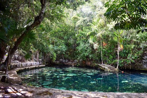
Los Tres Cenotes
The trip to three cavernous cenotes is less a detour off the convent route than a separate day outing, as it typically takes at least six hours, including the drive from the main highway to the village of Chunkanán, followed by a 45-minute ride on a truk (or carrito), a rickety, horse-drawn carriage down old narrow-gauge rail lines. But the reward is great scenery, refreshing swims and a taste of bygone hacienda history. You’ll want to bring swimming gear, towels and perhaps a picnic, as locals do on weekends.
The process of hiring a truk is slightly complicated by a business rivalry. Coming from Cuzamá, east of Acancéh, you first reach a large parking area off the right side of the road, signed as Los Tres Cenotes. This is an upstart organization, run by people from Cuzamá and greatly resented by the people of Chunkanán – another 2km south on a narrow road – who have no other income in their village. If you press on less than 1km down the road, you will find the original operation, in front of a multi-storey palapa restaurant. If you’re in a taxi or triciclo from Cuzamá, you’ll get steered to the first, Cuzamá-run truk stop; if you want to go to Chunkanán without raising a fuss, you can always say you’re headed for the restaurant.