Brief history
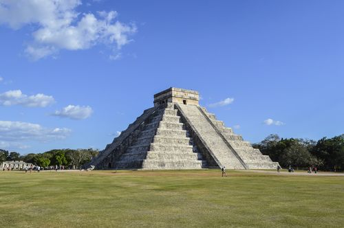
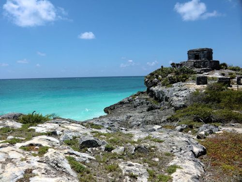
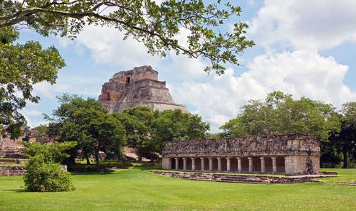
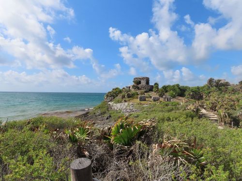
The Yucatán Peninsula is the longest continuously settled part of Mexico, with evidence of Maya inhabitants as early as 2500 BC. The Maya were at their cultural peak during the Classic period (300–900 AD), during which time they used solar, lunar and astral cycles to develop their complex and highly accurate calendar; they also had an elaborate mathematical and hieroglyphic system. Five hundred years before the Renaissance, moreover, the Maya had developed a sophisticated perspective in art. In the early ninth century AD, southern lowland cities (Tikal, in Guatemala, and Calakmul, among others) were abandoned, and northern cities such as Chichén Itzá grew. These in turn collapsed around 1200 AD, to be succeeded by Mayapán and a confederacy of other cities that probably included Tulum and Cozumel.
By the time the Spanish arrived, the Maya had splintered into tribalism – although still with cities and long-distance sea trade that awed the conquistadors. The Yucatán Peninsula proved the hardest area of the country to pacify, with the Maya resisting slavery and debt peonage through constant armed rebellion. The latter half of the nineteenth century saw the Caste Wars, when the Maya briefly gained control of the entire peninsula. The guerrilla fighters were eventually pushed back into the wilds of southern Quintana Roo, and held out until the early twentieth century, ending their struggle with conciliation from the Mexican government. It was one of the most successful fights against colonialism in the New World.
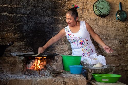
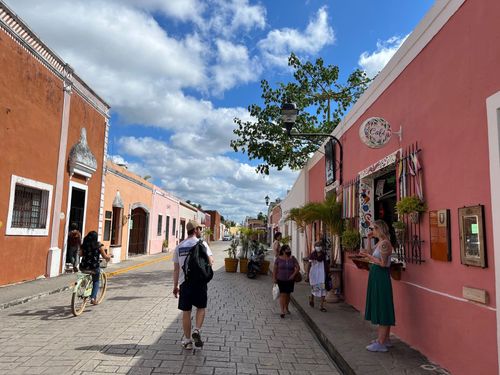
Today, the Maya continue to live throughout the Yucatán, often maintaining traditions and ways of life that have endured for centuries. Their culture and language remain a powerful source of pride, giving the region a distinct identity that enriches any Mayan heritage trip.
On February 1, 2015, the state of Quintana Roo, which includes Cancún, changed time zones, swapping Central Standard Time for Eastern Standard Time. The aim was to boost tourism by creating longer, lighter evenings.
Fiestas in the Yucatán
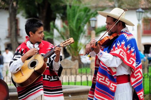
A highlight of village festivals in the area are the massive bullrings, elaborate hand-built structures made entirely of saplings. Expect plenty of fireworks and jaranas, one of the traditional Maya dances. Carnaval, the week before Lent, is colourfully celebrated in Mérida and on Cozumel and Isla Mujeres. For events in smaller villages, ask at the Yucatán state tourism office in Mérida, which maintains a full list, or check the weekly events bulletin at yucatanliving.com, which often mentions nearby fiestas.
- Fiesta de los Tres Reyes (Jan 1–6). In the cattle town of Tizimín (Yucatán); expect steak.
- Día de la Candelaria (Feb 2). Candlemas: candlelight processions at Tecoh and Kantunil (Yucatán). The week prior is a fiesta in Valladolid (Yucatán).
- Equinox (March 21). Huge gathering for the serpent shadow at Chichén Itzá.
- Semana Santa (Holy Week, beginning Palm Sunday, variable March–April). Passion plays in Mérida, Acanceh and Maní (Yucatán).
- Fiestas de Santa Cruz (end of April). Two-week fair in Cozumel’s El Cedral (Quintana Roo), ending on or near May 3.
- Fiesta de la Cruz Parlante (May 12–18). Chancah Veracruz (Quintana Roo), near Felipe Carrillo Puerto, celebrates the Talking Cross of the Caste Wars.
- Feria del Jipi (May 20). In Becal (Campeche), celebration of the Panama hat.
- Torneo de Pesca (last weekend in May). Fishing tournament and party in Puerto Morelos.
- Día de la Chispa (June 4). In Valladolid (Yucatán), re-enactment of the battle that sparked the 1910 Revolution.
- Fiesta de San Pedro y San Pablo (June 26–30). On Cozumel and in Panaba (Yucatán).
- Fiesta de Nuestra Señora del Carmen (July 15–30). Ciudad del Carmen (Campeche) and Motul (Yucatán).
- Chac ceremony (dates variable). In Edzná (Yucatán), to encourage the spring rains.
- Feria (Aug 10–16). Town celebration in Oxcutzcab (Yucatán).
- Feria de San Román (Sept 14–30). Campeche’s city festival.
- Gremios (mid-Sept to mid-Oct). Pilgrimages and processions to Mérida’s main church.
- Equinox (Sept 21). Another serpent spectacle at Chichén Itzá.
- Día de San Miguel (Sept 29). Cozumel’s main town festival.
- El Cristo de Sitilpech (Oct 18–28). The miraculous Black Christ is paraded from Sitilpech (Yucatán) to neighbouring Izamal, where there’s ten days of celebration.
- Feria del Estado de Yucatán (first three weeks of Nov). At fairgrounds south of Mérida.
- Feria de Motul (Nov 4–11). Festival in Motul (Yucatán) with bullfights.
- Día de la Inmaculada Concepcíon (Dec 8). Widely celebrated, especially in Izamal, where crowds gather to sing the entire night before.
- Día de la Virgen de Guadalupe (Dec 12). Celebrated everywhere; roads are filled in the days prior with church groups running relays.
- Christmas Fiesta (Dec 25–Jan 6). In Temax (Yucatán), featuring the procession of Las Pastorelas, in which images of the Holy Family are carried from house to house.
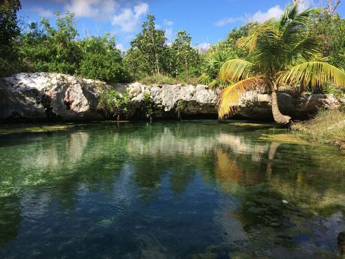
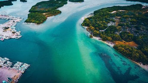
Chicxulub and cenotes
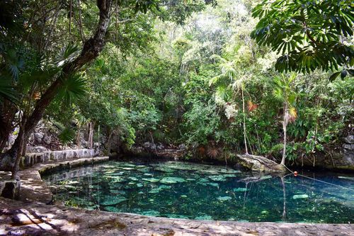
Some 65 million years ago, the Chicxulub asteroid struck the Yucatán Peninsula near the town that now bears its name. The impact is believed to have contributed to the extinction of the dinosaurs and caused large sections of the region’s limestone bedrock to collapse, creating thousands of cenotes, or natural sinkholes.
The vast network of cenotes, most of them filled with fresh water, became essential to the Maya civilization that flourished across the peninsula long before the Spanish arrived in the 1500s. In a landscape with few rivers or lakes, these submerged chambers provided reliable drinking water, and Maya towns, villages and ceremonial centers often grew around them. Cenotes were also revered as portals to the underworld, known as Xibalba, “the place of fear.” At the Sacred Cenote of Chichén Itzá, offerings such as statues, pottery, incense, textiles, jade, gold and even human sacrifices were cast into the water to honor the gods. Those rare individuals who survived such rituals were believed to have spoken with the gods and gained prophetic abilities.
Today, cenotes remain among the most unforgettable places to swim, snorkel or dive on any Yucatan trip. Some have been developed into adventure parks, while others remain tranquil and untouched. Two of the most striking examples are Cenote X’Kekén and Cenote Samula, located just outside the city of Valladolid.
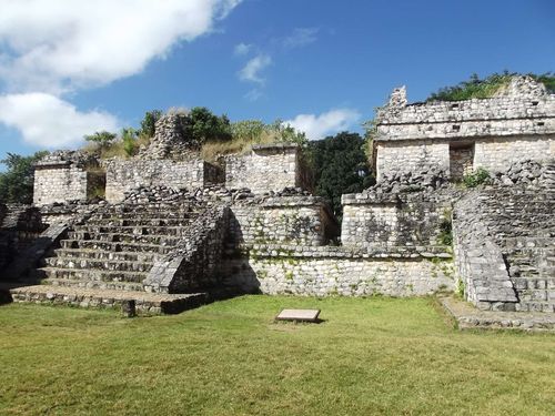
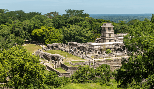
Río Bec Sites
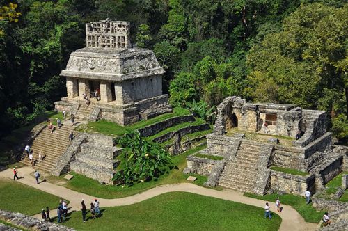
West of Chetumal, along the border with Guatemala, lie the little-visited but dramatic Río Bec sites, many tucked in dense jungle that harbours diverse birds and beasts, especially in the Calakmul Biosphere Reserve, around the ruins of the same name. The area was once heavily populated by lowland Maya, and linked with the site of Tikal in Guatemala. The largest ruins here, with their long, low buildings, dramatic towers (really elongated, stylized pyramids) and intricate carvings, are easily as impressive as Chichén Itzá, heightened by the jungle setting. The area is accessible either from Campeche or from Chetumal, and you’ll need to have a car or hire a taxi to see many of these sites – but this means you’ll see few other tourists.
The largest town in the area is Francisco Escárcega (usually just called Escárcega), far to the west in Campeche state. It’s a major bus hub, but somewhat dusty and unwelcoming, so most visitors to the sites use the much smaller village of Xpujil, on the border of Campeche and Quintana Roo, as a base for visiting the area. It’s a one-street town straddling Hwy-186, with basic hotels and restaurants, as well as taxi drivers prepared to shuttle visitors around. If you’re in your own car, note that there’s a gas station just east of town.
Calakmul
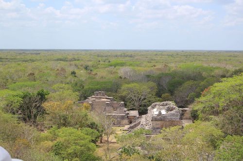
The ruined Maya city of Calakmul is one of the best places for contemplating the culture’s architectural legacy, and its remote jungle setting makes it especially well suited to 20-day Mexico trips. The complex is only partially restored and a long drive south of Hwy-186, but its location in the heart of the jungle and its sheer size are awe-inspiring. Probably the biggest archeological area in Mesoamerica, Calakmul has nearly seven thousand buildings in the central area alone and more steles and pyramids than any other site; the great pyramid here is the largest Maya construction in existence, with a base covering almost five acres.
The view of the rainforest from the top is stunning, and on a clear day you can even glimpse the tip of the Danta pyramid at El Mirador in Guatemala. Arrive early (the gate to the biosphere on Hwy-186 opens at 7am) to look for wildlife such as wild turkeys, peccaries, toucans and jaguars. Even if you don’t spot anything, you’ll likely hear booming howler monkeys and raucous frogs. Plan to spend about four hours exploring the site – longer if you’re a Maya-phile. Bring snacks and water, as there’s no vending at the ruins.
Brief history
During the Classic period, the city had a population of about two hundred thousand and was the regional capital. A sacbé (Maya road) running between Calakmul and El Mirador (another leads on to Tikal) confirms that these cities were in regular communication. Calakmul reached its zenith between 500 and 850 AD but, along with most other cities in the area, it was abandoned by about 900 AD. Excavations begun in the 1980s have so far uncovered only a fraction of the buildings, the rest being earthen mounds. Some of Calakmul’s treasures are on display in the archeological museum at Campeche, including two hauntingly beautiful jade masks. Another mask was found in a tomb in the main pyramid in 1998.
If you're planning a trip to Mexico, don't miss our Mexico itineraries and information on how to get there.