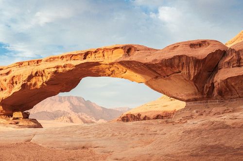
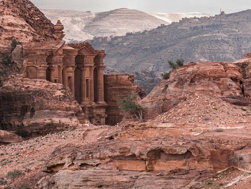
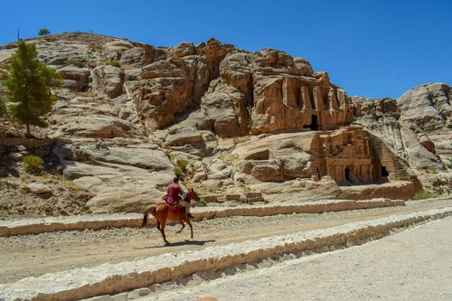
Ajloun
Northern Jordan’s verdant hills are cut through by countless lush valleys. Even in the height of summer, when the hills are baked brown and dry, you’d miss a good deal of the kingdom’s beauty if you neglected the chance for a trip into the countryside. Thick forests of pine, oak and pistachio covered these slopes until the early 1900s, when large areas were cleared to provide timber for the Hejaz Railway, both for track-building and for fuel. Enough survived, though, around the highland market town of Ajloun – within half an hour’s drive of Jerash – to give plenty of walking and picnicking possibilities in what are some of the most southerly natural pine forests in the world. Use the town – or, better, the rural tourism projects around the Ajloun Forest Reserve nearby – as a base to get way off the beaten track for a day or three, walking silent hillside tracks and exploring the magnificent Crusader-period castle perched among the olive groves.
Ajloun itself (pronounced “adge-loon”), 25km west of Jerash via a beautiful road that lopes over the hills among stands of pine and olive trees, has been a centre of population for a thousand years or more. Marking the centre of the town, 150m along the market street from the bus station, is a mosque that probably dates from the early fourteenth century. The square base of its minaret, as well as the simple prayer hall and carved Quranic inscriptions set into the walls, are original; ask the guardian if he will show you around inside.
A two-day trek from Ajloun to Pella
Outside the rainy (and occasionally snowy) winter months, the gentle terrain of north Jordan allows walkers to make their own explorations – preferably in the springtime, when the flowers are at their best. There are no marked trails, so you’re free to wander at will over the verdant hills.
A fine two-day trek leads 36km from the fortress of Ajloun down to the ruins of Pella. Bring water, since places to replenish supplies are widely spaced. From the castle walls at Ajloun you can see the line of the route: west along the ridge, then down right into the thickly forested valley and up west to a saddle between rounded hills, on the far side of which is concealed the Wadi al-Yabis (also known as Wadi Rayyan). The walk down this long and varied valley is particularly beautiful, first passing through natural forests to reach a knoll on its right side, with Ottoman ruins; this makes for an idyllic campsite, with a view to the setting sun behind the Palestinian hills. The second day covers about 20km, with a pleasant morning walk down through olive groves. The path crosses and recrosses the stream, until a larger stream enters from the right after a couple of hours. Cross the confluence and take a track north through well-tended orchards where birds dart between pomegranate blossoms in spring. The trail rises steeply to the hilltop village of Kufr Abil, from where various options down 6km of country lanes take you almost to the Jordan Valley, emerging above the village of Tabaqat Fahl at the ruins of Pella.
But don’t rely on our brief outline: this and other walks in the area are described in detail in Jordan: Walks, Treks, Caves, Climbs, Canyons by Tony Howard.
The Balqa hills
The gentle hills which roll westward from Amman down to the Jordan Valley through the historic Balqa region, of which the graceful old town of Salt is the capital, are laced with lush valleys and dotted with quiet, pleasant towns such as Wadi Seer and Fuheis.
Near Wadi Seer is one of the few examples of Hellenistic architecture surviving in Jordan, the impressive white palace of Qasr al-Abd, set in open countryside near an ancient cave system known as Iraq al-Amir.
All these places are easily accessible by bus from Amman, and could together form an unusual half or full day trip by car on a classic Jordan tour.
Fuheis
Set among rolling hills near Salt – and just 15km northwest of Amman – Fuheis (pronounced “fhayce”) is a prosperous small town, 95 percent Christian, with a scattering of nineteenth-century churches. Its easy-going atmosphere – and, in summer, Jordan’s best peaches – make it a pleasant stop-off if you’re driving; it’s not really worth the effort by bus.
The upper half of town, known as al-Allali (with a large calligraphic sculpture in the central Shakr roundabout), is newer and less attractive; carry on down the steep hill to the older part, known as al-Balad. Between the two lies Jordan’s biggest cement factory, which employs more than seventy percent of the town but which has, for years, inflicted clouds of cement dust and soaring rates of asthma on local people. It remains both a blessing and a curse.
Al-Balad, centred on a roundabout with a statue of St George killing the dragon, comprises a district of quiet lanes and hundred-year-old stone cottages alongside the deep Wadi Rahwa. It makes for an interesting short wander, and the lanes come into their own in the golden light of late afternoon. One of Jordan’s top Arabic restaurants adds to the attraction.
During August Fuheis hosts a small-town carnival, while you may also find music and cultural events staged in the week or two before Christmas.
Salt
For many centuries, Salt was the only settlement of any size in Transjordan. A regional capital under the Ottomans, the town – whose name derives from the ancient Greek saltos, meaning “thick forest” – came into its own in the late nineteenth century, when merchants from Nablus arrived to expand their trading base east of the river. Into what was then a peasant village of shacks boxed between precipitous hills, the merchants brought sophisticated architects and masons to work with the honey-coloured local limestone; buildings were put up in the ornate Nabulsi style to serve both as grand residences and as merchandise centres. With open trade to and from Palestine, Salt’s boom continued into the 1920s; the new Emirate of Transjordan was formally proclaimed in 1921 in the town’s main square, but by then the railway from Damascus had reached nearby Amman and Emir Abdullah chose the better-connected town to be his capital. As quickly as Salt had flourished, it went into decline: superseded by Amman, it was cut off by war in 1948 from its traditional trade outlet to the Mediterranean at Haifa, then again in 1967 from its Palestinian twin, Nablus.
As a consequence, Salt has seen none of the headlong modernization that has afflicted the capital: much of its Ottoman architecture has survived, as has a small town’s atmosphere, perfect for aimless exploration.
Standing under one of the huge eucalyptus trees that line the lower end of Maydan Street, you are surrounded by three towering hills: to your right are the bare rocky slopes of as-Salalem, to the left rises the tree-adorned peak of al-Jada’a, and straight ahead is al-Qal’a, named for the Mamluke fortress on its summit which was demolished in 1840 and finally swept away recently for a white-domed mosque.
Historic Old Salt Museum (Beit Abu Jaber)
Stroll first up Dayr Street and through the commerce-heavy, crowded central streets to the graceful arched facade of the Abu Jaber House, one of the city’s most beautiful houses, built over twenty years from 1886 using local sandstone, Belgian stained glass, Italian marble and hand-painted Jerusalem tiles. Newly restored, it is now the home of the Historic Old Salt Museum, with good displays on local history and trade, as well as fine views from the top-floor frescoed salon over the rooftops and a lovely café. Pick up a town map from the front desk showing a heritage trail around the city centre, linking more than a dozen architectural points of interest in a looping walk.
Jabal Al Qal’a
Across Al-Ain square, facing the Abu Jaber House, tiny Khadir Street has several flights of steps leading steeply up the hill. Partway up you’ll see the colonnaded honey-stone English Hospital, its gates still bearing an “EH” monogram; the building is now the Middle East’s first vocational training centre for people with disabilities. The view from Jabal Al Qal’a’s summit, bathed in sunshine, out over the town to the rolling Balqa hills beyond, is worth the hard climb.
Souk Hammam
From Al-Ain square, dive into narrow Hammam Street (the eponymous hammam was razed in the 1930s for lack of customers). This lane, known as Souk Hammam, is lined with buildings which date from Salt’s golden age, including a wonderful old mosque. The street hosts Jordan’s oldest – and, some say, best – souk, an ordinary little market of food and household goods that nonetheless is full of atmosphere, wreathed in the aroma of spices and lifted by the gorgeous honeystone Ottoman architecture.
Salt Archeological Museum
At the end of Souk Hammam, turn right to reach the arched and pillared facade (on the left) of the Salt Archeological Museum, housing a fascinating modern collection that includes a working model of a Mamluke sugar mill and an impression of a Neolithic dolmen landscape. The Ottoman-era building is equally interesting, known as Beit Touqan, once the stately residence of the Touqan family (King Hussein’s third wife, Queen Alia, was a Touqan). A few café tables in the enchanting upper courtyard entice you to linger.
Far North Jordan
The land hard up against the Syrian border in the far north of Jordan is hilly farming country, especially beautiful in springtime when a riot of colour covers the fields between groves of olives and figs. The ancient trees around the picturesque village of Umm Qais, perched on the very edge of the Transjordanian plateau, are famed for producing some of the choicest olives in the region, although the village is best known for the atmospheric ruins of Gadara – where Jesus performed one of his most famous miracles – and for spectacular views out over the Sea of Galilee. Below coils the dramatic gorge of the River Yarmouk, which flows west to meet the River Jordan just south of the Sea of Galilee, and which now marks the border between Jordan and the Israeli-occupied Golan Heights (Jawlan in Arabic). Travel along the gorge is restricted. On 7-day Jordan trips, the far north has enough depth to reward more than a passing look: nestled among palm trees and banana plantations below the heights is Himmeh, graced with a laid-back air that belies the Israeli watchtowers within shouting distance. Further east, tucked away in the peaceful Wadi Qwaylbeh north of Irbid, lie the part-excavated ruins of Abila, another of the Decapolis cities, featuring a hillside rock-cut cemetery decorated with Byzantine frescoes.
The Yarmouk Gorge road
Himmeh is as far east along the Yarmouk as you’re allowed to venture, but with your own transport you can head west alongside a portion of the deep and dramatic Yarmouk Gorge (all buses go back up the hill to Umm Qais). The views on this tense frontier road are spectacular (even better looking east than they are looking west), gazing down into the Yarmouk, across to the Sea of Galilee and up to the Golan Heights. Drive slowly and remember you are under constant surveillance here from both the Jordanian army and the Israeli army; although you might be able to snatch a photo or two of the beautiful scenery, or of the wrecked bridge, bombed in the 1967 war and still hanging over the gorge, you may find the soldiers objecting. There are checkpoints every few hundred metres, for which you should always stop and show your passport. After 6km of this you come to a junction where the only option is to turn left, and this road delivers you after another 7.5km to the town of Shuneh ash-Shamaliyyeh (North Shuneh), at the head of the Jordan Valley, a pleasant enough little market town. It’s a short drive south towards Pella.
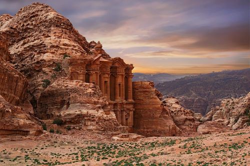
Top image: Ajloun castle, Jordan © Shutterstock