Himachal Pradesh Travel Guide

Tailor-made Travel
Accommodation
A COUPLE
expand_more
expand_more

Ruffled by the lower ridges of the Shivalik Range in the far south, cut through by the Pir Panjal and Dhauladhar ranges in the northwest, and dominated by the great Himalayas in the north and east, Himachal Pradesh (HP) is India’s most popular and easily accessible hill state. Sandwiched between the Punjab and Tibet, its lowland orchards, subtropical forests and maize fields peter out in the higher reaches where pines cling to the steep slopes of mountains whose inhospitable peaks soar in rocky crags and forbidding ice fields to heights of more than 6000m.

Places to visit in Himachal Pradesh

Together with deep gorges cut by rivers crashing down from the Himalayas, these mountains form natural boundaries between the state’s separate districts. Each has its own architecture, from rock-cut shrines and shikhara temples to colonial mansions and Buddhist monasteries. Roads struggle against the vagaries of the climate to connect the larger settlements, which are way outnumbered by remote villages, many of which are home to seminomadic Gaddi and Gujjar shepherds.

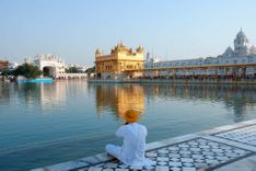
An obvious way to approach the state is to head north from Delhi to the state capital, Shimla, beyond the lush and temperate valleys of Sirmaur. The former summer location of the British government, Shimla is a curious, appealing mix of grand homes, churches and chaotic bazaars, with breathtaking views. The main road northeast from Shimla tackles a pass just north of Narkanda, then follows the River Sutlej east towards Sarahan, with its spectacular wooden temple, before entering the eastern district of Kinnaur, much of which is accessible only to those holding Inner Line permits. Kinnaur becomes more austere and barren as it stretches east to the Tibetan plateau, its beauty enhanced by delicate timber houses, temples and fluttering prayer flags.

Another road from Shimla climbs slowly northwest to Mandi, a major staging post for the state. To the north is Himachal’s most popular tourist spot, the Kullu Valley, an undulating mass of terraced fields, orchards and forests overlooked by snowy peaks. Its epicentre is the continuously expanding tourist town of Manali – long a favourite hangout of Western hippies – set in idyllic mountain scenery and offering trekking, whitewater rafting and relaxing hot springs in nearby Vashisht. The sacred site of Manikaran in the Parvati Valley also has hot sulphur-free springs.

Beyond the Rohtang Pass in the far north of Kullu district, the high-altitude desert valleys of Lahaul and Spiti stretch beneath massive snow-capped peaks and remote settlements with Tibetan gompas dotting the landscape. Permits are needed for travel through to Kinnaur, but Ki, Kaza and Tabo have unrestricted access, as does the road through Lahaul to Leh in Ladakh.

Visitors to the densely populated Kangra Valley west of Manali invariably make a beeline for Dharamsala, or more properly McLeod Ganj, whose large community of Tibetan exiles includes the Dalai Lama himself. Trekking paths lead north from here across the treacherous passes of the Dhauladhar mountains into the Chamba Valley.

Finding guides and porters for treks is rarely difficult. The season runs from July to late November in the west, and to late October in the north and east. In winter, all but the far south of the state lies beneath a thick blanket of snow. The region north of Manali is accessible only from late June to early October when the roads are clear. Even in summer, when the days are hot and the sun strong, northern Himachal can be beset with chilly nights.

Restricted areas and Inner Line permits

Foreigners travelling between Sumdo in Spiti and just east of Spillo in Kinnaur – where the road passes within a few kilometres of Western Tibet – require Inner Line permits, valid for travel through the border districts. Officially you are required to travel in a group of four or more, but in practice that is never enforced – though in most places you officially have to apply as part of a group.

Inner Line permits are valid for fourteen days and available from Shimla, Manali, Kullu, Rampur, Kaza and Rekong Peo. If travelling independently, you’re best off applying at Kaza where you can do the legwork yourself and obtain a permit in an hour or two at no charge. In the other five locations officials normally insist that you can only apply as a group of four through a travel agent, although these agents are very creative in manufacturing the requisite numbers. Wherever you apply, you will need to provide two photographs and photocopies of your passport and visa.

When travelling through restricted areas, you should never take photographs of military installations or sensitive sites such as bridges. Stick to the main route and you should have no problems with officialdom.

Brief history of Himachal Pradesh

The earliest known inhabitants of the area now known as Himachal Pradesh were the Dasas, who entered the hills from the Gangetic plain between the third and second millennium BC. By 2000 BC the Dasas had been joined by the Aryans, and a number of tribal republics, known as janapadas, began to emerge in geographically separate regions, where they fostered separate cultural traditions. The terrain made it impossible for one ruler to hold sway over the whole region, though by 550 AD Hindu Rajput families had gained supremacy over the northwestern districts of Bharmour and Chamba, just two of the many princely states created between the sixth and sixteenth centuries. Of these, the most powerful was Kangra, where the Katoch Rajputs held off various attacks before finally falling to the Mughals in the sixteenth century.

During the medieval era, Lahaul and Spiti remained aloof, governed not by Rajputs, but by the Jos of Tibetan origin, who introduced Tibetan customs and architecture. After a period of submission to Ladakh, Lahaul and Spiti came under the rajas of Kullu, a central princely state that reached its apogee in the seventeenth century. Further south, the region around Shimla and Sirmaur was divided into more than thirty independently governed thakurais. In the late seventeenth century, the newly empowered Sikh community, based at Paonta Sahib (Sirmaur), added to the threat already posed by the Mughals. By the eighteenth century, under Maharaja Ranjit Singh, the Sikhs had gained strongholds in much of western Himachal, and considerable power in both Kullu and Spiti.

Battling against Sikh expansion, Amar Singh Tapur, the leader of the Gurkha army, consolidated Nepalese dominion in the southern Shimla hill states. The thakurai chiefs turned to the British for help, and forced the last of the Gurkhas back into Nepal in 1815. Predictably, the British assumed power over the south, thus tempting the Sikhs to battle in the Anglo-Sikh War. With the signing of a treaty in 1846 the British annexed most of the south and west of the state, and in 1864 pronounced Shimla the summer government headquarters.

After Independence, the regions bordering present-day Punjab were integrated and named Himachal Pradesh (“Himalayan Provinces”). In 1956 HP was recognized as a Union Territory and ten years later the modern state was formed, with Shimla as its capital. Despite being a political unity, Himachal Pradesh is culturally very diverse. With more than ninety percent of the population living outside the main towns, and many areas remaining totally isolated during the long winter months, Himachal’s separate districts maintain distinct customs, architecture, dress and agricultural methods. Though Hinduism dominates, there are substantial numbers of Sikhs, Muslims and Christians, and Lahaul, Spiti and Kinnaur have been home to Tibetan Buddhists since the tenth century. This may explain why the state has traditionally been a stronghold for the more inclusive Congress Party, although recent years have seen the BJP make some gains.

Best time to visit Himachal Pradesh

Being a mountainous state, the best time to visit Himachal Pradesh is between late March and mid-November, as it is freezing cold and snowy for much of the winter and few facilities remain open in the more remote parts of the state such as Spiti. The main high season from April to June, though blessed with clear skies, is also when the touristic parts of the state are at their most crowded and expensive, thus not ideal. The monsoon can make it extremely cloudy and wet, especially in places like Shimla and Dharamsala, for much of July and August. So the best time to visit overall is at the end of the monsoon in September and October, when the skies are mostly clear again, the days still warm and the nights not too chilly.

Festivals in Himachal Pradesh

  • Losar (late Jan to late Feb)

    Tibetan New Year, marked with dancing and music in areas with large Buddhist populations, principally Dharamsala/McLeod Ganj and Spiti.

  • Suhi Mata (early April)

    Four-day local festival celebrating the legend of Rani Sunena in Chamba.

  • Baisakhi (usually April 13)

    Fairs are held throughout the state and people take dips in holy waters. Women are especially prominent with colourful dress.

  • Minjar (early Aug)

    A week-long riot of singing and dancing in Chamba to celebrate the growth of maize.

  • Flaich Ukhayang (Sept, date varies)

    Colourful festival of flowers throughout Kinnaur, marked by a procession of the village deity and goat sacrifice.

  • Dussehra (late Sept to late Oct)

    Important throughout India, in Himachal this ten-day festival is particularly spectacular in Kullu.

Kinnaur

Before 1992, the remote backwater of Kinnaur, a rugged buffer zone between the Shimla foothills and the wild western extremity of Chinese-occupied Tibet, was strictly off-limits to tourists. Although visitors are now allowed to travel through the “Inner Line”, and on to Spiti, Lahaul and the Kullu Valley, permits are still required. Other areas of Kinnaur, notably the Baspa Valley and the sacred Kinner-Kailash massif visible from the mountain village of Kalpa, are completely open, and offer some fine trekking.

Straddling the mighty River Sutlej, which rises on the southern slopes of Mount Kailash, Kinnaur has for centuries been a major trans-Himalayan corridor. Merchants travelling between China and the Punjabi plains passed through on the Hindustan–Tibet caravan route, stretches of which are still used by villagers and trekkers. The bulk of the traffic that lumbers east towards the frontier, however, uses the newer NH-22, which veers north into Spiti just short of the ascent to Shipki La pass, on the Chinese border, which remains closed.

Kalpa (Chini)

Kalpa can be reached by the twisting 9km road from Rekong Peo or on foot along various steep tracks. Its narrow atmospheric lanes, crammed with rickety wooden shops, and dramatic location, high above the right bank of the Sutlej, make it by far the most attractive base in the immediate vicinity. The ancient Tibetan gompa here was founded by Rinchen Zangpo, and there is also a small Shiva temple. The village and its growing number of hotels are quite spread out up the hill, which is festooned with apple orchards, and along the roads that radiate from the centre. Facing the village, the magnificent Kinner-Kailash massif sweeps 4500m up from the valley floor. The mountain in the middle, Jorkaden (6473m), is the highest, followed by the sacred summit of Kinner-Kailash (6050m) to the north, and the needle point of Raldang (5499m) in the south.

Trekking in Kinnaur

Unfrequented mountain trails crisscross Kinnaur, offering treks ranging from gentle hikes to challenging climbs over high-altitude passes. The routes along the Sutlej Valley, punctuated with government resthouses and villages, are feasible without the aid of ponies, but away from the main road you need to be completely self-sufficient. Porters can usually be hired in Rampur, Rekong Peo and the Baspa Valley except in early autumn (Sept/Oct), when they’re busy with the apple harvest.

The Kinner-Kailash circuit

The five- to seven-day parikrama (circumambulation) of the majestic Kinner-Kailash massif, a sacred pilgrimage trail, makes a spectacular trek for which you won’t need an Inner Line permit. The circuit starts at the village of Morang, on the left bank of the Sutlej, served by buses from Tapri or Rekong Peo. A track, passable by jeep, runs southeast from here to Thangi, the trailhead, and continues through Rahtak, over the Charang La pass (5266m) to Chitkul in the Baspa Valley. The trail then follows the river down to the beautiful village of Sangla, from where a couple of worthwhile day-hikes can be made – to Kamru fort behind the village, or the steep ascent to the Shivaling La pass, from where there are superb views of Raldang (5499m), the southernmost peak on the Kinner-Kailash massif. The final stage passes through the lower Baspa Valley, via Shang and Brua to Karcham, which overlooks the NH-22 highway. The best time for the Kinner-Kailash parikrama is between July and October; August is the most popular month with local pilgrims.

Kafnu to Kaza, via the Pin Valley

This challenging route across the Great Himalayan range, via the Kalang Setal glacier and the Shakarof La pass, is a dramatic approach to Spiti and the Pin Valley, and no restrictions apply. The trail, which is very steep, snow-covered, and hard to follow in places, should definitely not be attempted without ponies, porters, adequate gear and a reliable guide. It starts in earnest at Kafnu village, now connected to Wangtu on the main road by a paved surface, continuing via Mulling, Phustirang (3750m), and over the Bhaba Pass (4865m), a gruelling slog through snowfields, before dropping down into the beautiful and isolated Pin Valley. You can then trek onwards or get a vehicle to Kaza. More of this route may become paved as the delayed Wangtu–Mudh road project painfully progresses.

Chitkul to Har-ki-Dun

This ten-day trek to Garhwal passes along the edge of the Inner Line and is subject to restrictions. Starting from Chitkul and crossing the River Baspa to Doaria, the route then climbs up a side valley to follow a lateral moraine up to the Zupika Gad and then a steep ascent – the final section of which is up a crevassed glacier – to the Borsu Pass (5300m). The other side of the pass is down a steep snow- and boulder-field requiring some scrambling; you arrive a few days later in the beautiful valley of Har-ki-Dun in Garhwal. A guide is essential.

The old Hindustan–Tibet road from Kalpa to the Rupa Valley

Another route to consider is the relatively easy five-day trek starting at Kalpa and following the old Hindustan–Tibet road through the remote hamlets of upper Kinnaur (permits needed), past Shi Asu to the Rupa Valley. The views along the route are superb and the villagers are extremely hospitable. The road, now crumbling in places, is also ideal for mountain biking.

Northwest Himachal

From Shimla the main road winds west and north to the riverside market town of Mandi, an important crossroads linking the Kullu Valley and the hills to the northwest. The rolling foothills on this side of the state are warmer and more accessible than Himachal’s eastern reaches, though less dramatic and considerably lower. The area sees little tourism outside Dharamsala, the British hill station turned Tibetan settlement, home to the Dalai Lama. Dharamsala is an excellent base for treks over the soaring Dhauladhar Range to the Chamba Valley, which harbours uniquely styled Hindu temples in Brahmour and Chamba. South of Chamba, the fading hill station of Dalhousie still has a certain ex-Raj charm, and is popular with Indian tourists who arrive in droves during the hot season.

While most visitors make the six-hour journey to Dharamsala in one go, those with more time can detour to sacred Rewalsar, just outside Mandi, or stop in the Kangra Valley to pick up the narrow-gauge train that trundles through patchwork fields and light forest to Kangra, just an hour away from Dharamsala and jumping-off point for a couple of little-visited places of interest.

Rewalsar

If you’ve any interest in Buddhism it’s worth taking a detour to Rewalsar (Tso Pema in Tibetan), 24km southeast of Mandi, where three Tibetan monasteries (Nyingma, Drikung Kagyu and Drukpa Kagyu) mark an important place of pilgrimage. There are also Sikh and Hindu temples here, all of which draw a steady stream of pilgrims and tourists. The devout complete a chora around the small sacred lake and along narrow lanes full of shrines and stalls selling Tibetan curios, before lounging beneath the prayer flags on the lake’s grassy fringes.

It’s believed that Padmasambhava left many footprints and handprints in rocks and caves up in the hills around the lake, and steep paths lead up from the lake to caves that are used today as isolated meditation retreats. Of the three monasteries around the lake, Tso-Pema Ogyen Heruka Gompa is the most venerated and atmospheric; check out the tree planted in 1957 by the Dalai Lama, who visited India that year – two years before his exile from Tibet – to celebrate the 2500th anniversary of the Buddha’s birth. Towering dramatically over the lake and visually dominating the Rewalsar setting is the large but much newer Drukpa Kagyu Zigar Gompa.

The Kangra Valley Railway

India has five of the twenty or so vintage “toy trains” or narrow-gauge mountain railways in the world – three in the Himalayas and two of these in Himachal Pradesh. Most famous is the Kalka–Shimla line, but the little-known 163km Kangra Valley Railway is also a magnificent engineering feat. Unlike the Kalka line, with its 103 tunnels and tortuous switchbacks, engineers of this route preferred bridges – 950 in all, many of which are still considered masterpieces – that give passengers uninterrupted views all the way from Pathankot to Joginder Nagar. Although it’s slower than the equivalent road journey, the scenery along the way is far more impressive, particularly the stretch between Kangra and Mangwal.

Dharamsala and McLeod Ganj

Home to the Dalai Lama and Tibetan government in exile, and starting point for some exhilarating treks into the high Himalayas, Dharamsala, or more correctly, its upper town McLeod Ganj, is one of Himachal’s most irresistible destinations. Spread across wooded ridges beneath the stark rock faces of the Dhauladhar Range, the town is divided into two distinct and separate sections, separated by 10km of perilously twisting road and almost 1000m in altitude. Originally a British hill station, McLeod Ganj has been transformed by the influx of Tibetan refugees fleeing Chinese oppression in their homeland. Tibetan influence here is subsequently very strong, with temples, schools, monasteries, nunneries, meditation centres and the most extensive library of Tibetan history and religion. As well as playing host to hordes of foreign and domestic tourists, McLeod Ganj is a place of pilgrimage that attracts Buddhists and interested parties from all over the world, including Hollywood celebrities such as Richard Gere and Uma Thurman. Many people visit India specifically to come here, and its relaxed and friendly atmosphere can make it difficult to leave.

Despite heavy snows and low temperatures between December and March, McLeod Ganj receives visitors throughout the year. Summer brings torrential rains – this being the second wettest place in India – that return in bursts for much of the year. Daytime temperatures can be high, but you’ll need warm clothes for the chilly nights.

Trekking from Dharamsala

Dharamsala is one of the most popular starting points for treks over the rocky ridges of the Dhauladhar Range, which rise steeply from the Kangra Valley to 4600m. Trails pass through forests of deodar, pine, oak and rhododendron, cross streams and rivers and wind along vertiginous cliff tracks passing the occasional lake waterfall and glacier. Unless you are very experienced, you’ll need a guide, as the routes are steep and memorial stones testify to those who didn’t make it. The Mountaineering Institute on the road to Dharamkot can help arrange guides and porters, and stocks maps. Despite the availability of rough huts and caves, it’s best to take a tent. The best season to trek here is from September to November, when the worst of the monsoon is over and before it gets too cold. Winter climbing should only be attempted by mountaineers experienced in using crampons and ice axes.

Dharamsala to Chamba over Indrahar Pass

The most frequented route from Dharamsala to the Chamba Valley, over the Indrahar Pass (4350m), is arduous in places, but most trekkers manage it in around five days. The first section, from Dharamkot, winds through thick forest and steep rocky terrain for 9km to a grassy plateau at Triund. From here the path climbs to Laqa Got, and then on a seriously steep section up to the knife-edged Indrahar Pass where, weather permitting, you’ll enjoy breathtaking views south to the plains and north to the snowy Pir Panjal peaks and Greater Himalayas. The descent is difficult in places and will take you via the Gaddi villages of Kuarsi and Channauta to the main road, from where you can pick up transport to Bharmour and Chamba by road.

Other routes from Dharamsala to Chamba

Several other routes cross the Dhauladhar Range, including the Toral Pass (4575m) which starts from Tang Narwana (1150m), 10km from Dharamsala. The most difficult route north is the five- or six-day trek across Bhimghasutri Pass (4580m), covering near-vertical rocky ascents, sharp cliffs and dangerous gorges. A much easier four- or five-day trek from Dharamsala crosses Bleni Pass (3710m) in the milder ranges to the northwest, weaving through alpine pastures and woods and crossing a few streams, before terminating at Dunali, on the Chamba road.

Khajjiar

Heading east towards Chamba, the road descends through deodar forests to the meadow of Khajjiar where the small twelfth-century temple of Khajjinag looks down over a vast rolling green with a small lake cupped in the centre. Khajjiar is a popular day-trip from Dalhousie for Indian tourists who come to take pony rides. It is also possible to make a stop at Kalatop Wildlife Sanctuary, 10km before Khajjiar, a thickly forested area that is home to barking deer, Himalayan bear and rich birdlife. The road beyond Khajjiar dips across denuded and terraced hillsides down towards Chamba.

Chamba

Shielded on all sides by high mountains, Chamba was ruled for an entire millennium by kings descended from Raja Sahil Verma, who founded it in 920 AD and named it after his daughter Champavati. Unlike Himachal states further south, it was never formally under Mughal rule and its distinct Hindu culture remained intact until the first roads were built to Dalhousie in 1870. When the state of Himachal Pradesh was formed in 1948, Chamba became the capital. Today, few foreign visitors make it out here, passing through before or after trekking, or stopping off to see the unique temples.

The chaugan, a large green used for sports, evening strolls and festive celebrations, marks the centre of town, overlooked by the imposing old Rang Mahal palace, now a government building.

Chamba festivals

Chamba’s annual four-day Suhi Mata Festival, in early April, commemorates Rani Sunena, the wife of the tenth-century Raja Sahil Verma. A curious legend relates that when water from a nearby stream failed to flow through a channel supposed to divert it to the town, local brahmins advised Raja Verma that either his son or his wife would have to sacrifice themselves. The queen obliged; she was buried alive at the head of the channel, and the water flowed freely. Only women and children participate in the festival, dancing on the chaugan before processing with an image of Champavati (Rani Sunena’s daughter who gave her name to the town) and banners of the clan’s solar emblem to the Suhi Mata temple in the hills behind the town.

Minjar, a week of singing and dancing at the start of August to celebrate the growth of maize, is also peculiar to Chamba. Its climax comes on the last day, when a rowdy procession of locals, Gaddis and Gujjars, dressed in traditional costumes, leaves the palace and snakes down to the riverbank, where bunches of maize are thrown into the water. Before Independence, locals followed a custom whereby a male buffalo was pushed into the river; its drowning was an auspicious sign but if the beast managed to swim to the opposite bank bad fortune was expected for the coming year.

Brahmour

Brahmour is a delightful small town, made up of slate-roofed houses, apple trees and small maize fields, draped across a verdant ridge above the river and shadowed on all sides by high snowy peaks. This gem of a place is well worth the effort to travel the extra distance from Chamba and you are likely to be rewarded by being the only foreigner in town. From the bus stand, the main street winds up through the bazaar area to the picturesque main square, which is dominated by the magnificent Chaurasi temple complex.

The temples, whose curved shikharas dominate the large, neatly paved central square, are more dramatic and better preserved than their rivals at Chamba. The sanctuaries are unlocked only for puja in the mornings and evenings, permitting a glimpse of bold bronze images of Shiva, Narsingh, Ganesh and Parvati, unchanged since their installation in the seventh and eighth centuries when Bharmour was capital of the surrounding mountainous region. A life-sized bronze Nandi bull, draped in a colourful cloth, stands under a shelter in front of the main Shiva temple, while a giant 25m deodar tree towers over the temple from behind.

Several rewarding trekking routes lead north from Bharmour over the Pir Panjal Range.

Treks around Chamba and Bharmour

The most popular treks from Chamba lead south over the Dhauladhar via the Minkiani or Indrahar pass to Dharamsala. Equipment can be rented and porters and guides hired in Chamba and Brahmour. Mani Mahesh Travels in Chamba organizes and equips treks.

Treks in the Pangi Valley to Lahaul

Few trekkers make it to the spectacular, all but inaccessible Pangi Valley, between the soaring Greater Himalayan Range in the north and the Outer Himalayan Range in the south. Several peaks within it have never been climbed, and onward paths lead to Kashmir, Lahaul and Zanskar. The trek to Lahaul takes nine or ten days from Traila (90km north of Chamba) via Satraundhi (3500m) over the Sach Pass to Killar, Sach Khas, and finishing in Purthi from where you can take a bus via Tindi to Udaipur. Buses run from here to Keylong, capital of Lahaul, for connections northwards to Leh or south over the Rohtang Pass and down to Manali.

Treks from Bahmour

Trekking routes lead north from Bahmour (2130m) over the Pir Panjal Range across passes that are covered with snow for most of the year. The challenging six- to seven-day trek over Kalichho Pass (4990m), “the Abode of Kali”, ends in the village of Triloknath, whose ancient temple to three-faced Shiva is sacred to both Hindus and Buddhists. Buses run from here to Udaipur, and on to Keylong and Manali.

Another demanding five- to six-day route crosses the Kugti Pass (5040m). From Hadsar, an hour by bus from Bahmour, the path follows the River Budhil for 12km to Kugti, then up to Kuddi Got, a vast flower-filled meadow (4000m). The next stage, over the pass, requires crampons and ice axes for an incredibly taxing six-hour climb. Having enjoyed views of the towering peaks of Lahaul and Zanskar from the summit, you plummet once again to the head of a glacier at Khardu, continuing down to Raape, 7km from Shansha, which is linked to Udaipur and Keylong by road.

Finally, a delightful three-day trek to the sacred lake of Manimahesh (4183m) starts from and returns to Hadsar. The awesome Manimahesh Kailash massif, with its permanent glaciers and ice fields, overlooks the lake.

Masrur

Thirty-five kilometres southwest of Kangra, the tiny village of Masrur is the only place in the Himalayas with rock-cut Hindu temples similar to, though nowhere near as impressive or well-preserved as those at Ellora in Maharashtra. The fifteen temples, devoted to Ram, Lakshman and Sita, were hewn from natural rock in the ninth and tenth centuries.

Jawalamukhi

A simple whitewashed temple in the otherwise nondescript town of Jawalamukhi, 35km south of Kangra, protects one of north India’s most important Hindu shrines. The sanctuary, crowned with a squat golden spire, contains a natural blue gas flame emitted from the earth, revered as a manifestation of the goddess of fire, Jawalamukhi.

The Kullu Valley

The majestic Kullu Valley is cradled by the Pir Panjal to the north, the Parvati Range to the east, and the Barabhangal Range to the west. This is Himachal at its most idyllic, with roaring rivers, pretty mountain villages, orchards and terraced fields, thick pine forests and snow-flecked ridges. The valley extends 80km north from the mouth of the perilously steep and narrow Larji Gorge, near Mandi, to the foot of the Rohtang Pass – gateway to Lahaul and Ladakh.

Most tourists make a beeline for Manali after a gruelling bus ride from Leh or Delhi. With its vast choice of hotels and restaurants, there is something here for everyone. Still an evergreen hippie hangout, it’s India’s number-one honeymoon spot, and is also popular with outdoors enthusiasts taking advantage of the fine trekking. Few travellers actually stay in Kullu town and the only real attraction is the annual Dussehra festival in October. Flights from Delhi to Bhuntur, just south of Kullu, offer a welcome but weather-dependent alternative to the long overnight bus journeys. To the north, Naggar’s castle, ancient temples and relaxed guesthouses make a pleasant change from the claustrophobic concrete of modern Manali, as do Manikaran’s sacred hot springs, up the spectacular Parvati Valley.

Kullu

Kullu, the valley’s capital since the mid-seventeenth century, became district headquarters after Independence. Despite being the region’s main market and transport hub it has been eclipsed as a tourist centre by Manali, 40km north. Kullu is noisy, polluted and worlds away from the tranquil villages that peer down from the surrounding hillsides, even though a bypass now diverts some of the traffic from the centre. Kullu makes a handy transport hub if you’re travelling onwards to the Parvati Valley, and there are several temples dotted around town, some of which provide fine valley views. In October, when the entire population of the valley comes to town to celebrate Dussehra, the city takes on a life of its own. The town is also the centre for the manufacture of the valley’s famous shawls, handwoven on looms from lamb’s wool, angora or pashmina and increasing in price accordingly.

The Parvati Valley

Hemmed in by giant-pinnacled mountain peaks, the Parvati Valley, which twists west from the glaciers and snowfields on the Spiti border to meet the Beas at Bhuntur, is the Kullu Valley’s longest tributary. It’s a picturesque place, with quiet hamlets perching precariously on its sides amid lush terraces and old pine forests. Though the landscape around Jari has been scarred by the ugly Malana hydro project, there is strong local pressure to at least camouflage the site. Visitors to the valley are an incongruous mix – a combination of Western hippies (especially Israelis) and van-loads of Sikh pilgrims bound for the gurudwara at Manikaran, 32km northeast of the Beas–Parvati confluence.

Reaching the scenic Himalayan Valley is not as difficult as it may initially seem. To reach Parvati, you will need to take the bus in the direction of Manali. Stop at Bhunter, which is 10km away from Kullu - from here you can get local connecting buses eventually reaching Kasol, 30km away from Bhunter.

The best time to visit the Pavarti Valley

The best time to visit the Parvati Valley is during March - June during the dry season. The temperature is good throughout the year averaging at 30 degrees Celsius although the monsoon season brings lots of rain, so it is best to avoid this time if you plan to spend time with nature outdoors.

Activities in The Parvati Valley

The Parvati Valley is predominately a quiet and quaint, peaceful place, however, if you wish to get active then have no worries - there is plenty for you to do. Kullu is a haven for water rafters with roaring waves that make the thrill exciting and provide an adrenaline rush to the usually slow pace of life in the Himalayan Mountain Ranges.

To make the most of the Parvati's stunning scenery, you'll have to hike. The best treks often start from the villages of Kasol and Barsaini.

Festivals in the Pavarti Valley

The Parvati Valley has become a retreat for hippies and backpackers during the last few years, along with these new visitors come the psychedelic festivals. Young Indians and Israeli travellers seeking a trance-party flock here for the music and vibes. Often festivals pop up with very little or no advertising, but those in who favour the lifestyle always seem to know about them and come to the valley for weeks at a time. Police often monitor the roads to the festivals.

Hiking in the Parvati Valley

Two popular trails thread their way up the Parvati Valley: one heads north from the fascinating hill village of Malana, over the Chandrakhani Pass to Naggar; the other follows the River Parvati east to another sacred hot spring and sadhu hang-out, Khirganga. The trail continues from Khirganga to Mantalai with its Shiva shrine and over the awesome 5400m Pin-Parvati pass into Spiti. This serious snowfield is riddled with crevasses and takes several hours to cross.

A guide is absolutely essential. Over the last two decades the Parvati Valley has seen the mysterious disappearance of at least twenty travellers. Most of the vanished have never been found, including the Israeli who went missing in the most recently publicized case in July 2009. Several theories have been put forward to explain these disappearances, from drug-related accidents on the treacherous mountain trails, to attacks by bears or wolves or foul play by the numerous cannabis cultivators in the region; some even claim that the disappeared may have joined secret cults deep in the mountains. Most likely, however, they were victims of bandit attacks, motivated solely by money, with the wild waters of the River Parvati conveniently placed for disposing of bodies. Individual travellers should take heed and only use recognized guides on treks across the mountains.

Manikaran Sahib

Crouched at the foot of a gloomy ravine, sits the ancient religious site, Manikaran. Sacred to Hindus as well as Sikhs, the gurudwara is famous for its hot sulphur springs that bubble out of its stony riverbanks. Locals believe the waters bring healing powers from the Beas-Parvati confluence, 32km away in the northeast.

Mini-Israel

Kosul, a village within the Parvati Valley is dubbed 'mini-Israel' by local Indians for its vast number of Israeli migrants. Many have been living in the village for years and run restaurants and cafes that are popular with the local people who embrace the authentic Israeli cuisine. Hiking trails that pass Kosul are known to be part of the 'hummus trail' - for obvious reasons.

Naggar

Stacked up the lush, terraced lower slopes of the valley as they sweep towards the tree line from the left bank of the Beas, Naggar is the most scenic and accessible of the hill villages between Kullu and Manali, roughly 20km from each. Clustered around an old castle, this was the regional capital before the local rajas decamped to Kullu in the mid-1800s. A century or so later, European settlers began to move in. Seduced by the village’s ancient temples, peaceful setting and unhurried pace, visitors often find themselves lingering in Naggar – a far less hippified village than those further north – longer than they intended. Numerous tracks wind up the mountain to more remote settlements, providing a choice of enjoyable hikes.

Naggar is a very pleasant place, often sadly overlooked by travellers making a beeline for Manali. The relaxed atmosphere, refreshing elevation, stunning views and a variety of interesting sites combine to make it an excellent spot to while away a few days.

Manali

Himachal’s main tourist resort, Manali, stands at the head of the Kullu Valley, 108km north of Mandi. Despite lying at the heart of the region’s highest mountain range, it remains easily accessible by road from the plains; after one hour on a plane and a short hop by road, or sixteen hours on a bus from Delhi, you could be staring from your hotel veranda across apple orchards and thick pine forests to the snowfields of Solang Nala, which shine a tantalizing stone’s throw away to the north. Manali has become increasingly popular with domestic tourists (more than five million annually), and now greets an eclectic mix of honeymooners, holiday-makers, hippies, trekkers and traders.

The Manali that lured travellers in the 1970s has certainly changed, although the majestic mountain scenery, thermal springs and quality charas can still be enjoyed. Old Manali retains some of its atmosphere, and the village of Vashisht across the valley, with its increasing number of guesthouses and cafés, has become a popular place to chill out. For those preferring to venture into the mountains, Manali makes an ideal trekking base for short hikes and serious expeditions, and countless agencies can help put a package together for you. The relaxing hotels in Manali’s cleaner, greener outskirts, and dozens of sociable cafés and restaurants ranged around a well-stocked bazaar, provide a welcome relief from the rigours of the mountain trails. As well as treks around Manali you can also explore the Kullu Valley.

Adventure sports and tours around Manali

Considering the fierce whitewater that thrashes down the Kullu Valley during the spring melt, Manali’s rafting scene is surprisingly low-key. Raft trips down the River Beas are offered between the end of May and early July, when water levels are highest, beginning at Piridi (above Bhuntur) around 15km downstream at Jhiri. The price should include food, lifejackets, helmets and return travel; check exactly what you’re paying for, as some unscrupulous operators expect you to make your own way back after the trip.

Skiing in the Solang Valley is popular from January to April – but the slope isn’t much bigger than a cricket pitch and there is no proper ski centre. A new ski centre in conjunction with the Finnish government is still in the pipeline for the Rohtang Pass. The valley is also a popular spot for paragliding. Rock climbing, zorbing and especially canyoning are also gaining in popularity. For a less strenuous burst of expensive adrenaline and stunning views, helicopter rides of between five and thirty minutes can be arranged.

One of the best ways to explore Kullu is by mountain biking, which is possible from mid-June to mid-October. Popular routes include the descent from Rohtang, the forest trail to the Bijli Mahadev Temple and the back road to Naggar.

Numerous agents offer jeep safaris and other guided tours to remote areas such as Lahaul, Spiti and Ladakh – prices vary wildly, as does what is included, so always shop around. Most of these operations also run treks on the most popular local routes and further afield.

Adventure sports and tours agencies

  • Himalayan AdventurersRup Negi and his experienced team offer the full range of activities from trekking, mountain biking and skiing to jeep and motorbike tours. There’s even birdwatching.
  • Himalayan JourneysThe principal agent for thrilling helicopter rides above the mountains.
  • Magic MountainOwner Raju Sharma specializes in mountain biking and leads tours himself. He can also arrange trekking, skiing and jeep safaris.
  • Tiger Eye AdventureVery efficient Dutch-run agency, which runs reliable trekking, bicycle, motorbike and jeep tours.

Treks around Manali and the Kullu Valley

The Kullu Valley’s spectacular alpine scenery makes it perfect for trekking. Trails are long and steep, but more than repay the effort with superb views, varied flora and the chance to visit remote hill stations. Within striking distance of several major trailheads, Manali is the most popular place to begin and end treks. While package deals (around ₹2500/person for three days with a group of four) offered by the town’s many agencies can save time and energy, it is relatively easy to organize your own trip with maps and advice from the tourist office and the Mountaineering Institute at the bottom end of town. Porters and horsemen can be sought out in the square behind the main street. Always take a reliable guide, especially on less-frequented routes, as you cannot rely solely on maps. Some trekkers have reported difficulties when descending from the Bara Bangal Pass, as maps don’t do the terrain justice.

The optimum trekking season is right after the monsoons (mid-Sept to late Oct), when skies are clear and pass-crossings easier. From June to August, you run the risk of sudden, potentially fatal snow, or view-obscuring cloud and rain. There are several good trekking agencies in Manali.

Manali to Beas Kund

The relatively easy trek to Beas Kund, a glacial lake at the head of Solang nala, is the region’s most popular short hike. Encircled by 5000m-plus peaks, the well-used campground beside the lake, accessible in two days from Manali, makes a good base for side-trips up to the surrounding ridges and passes.

From Palchan, a village thirty minutes north of Manali by bus, follow the jeep track up the valley to Solang, site of a small ski station, resthouse and the Mountaineering Institute’s log huts. The next two hours take you through pine forests and grassy meadows to the campground at Dhundi (2743m). A more strenuous walk of five to six hours the next day leads to Beas Kund. The hike up to the Tentu La Pass (4996m) and back from here can be done in a day, as can the descent to Manali via Solang.

Manali to Lahaul, via the Hampta Pass

The three-day trek from the Kullu Valley over the Hampta Pass to Lahaul, the old caravan route to Spiti, is a classic. Rising to 4330m, it is high by Kullu standards; do not undertake it without allowing good time to acclimatize. Day one, from the trailhead at Jagatsukh or Hampta (both villages near Manali) to the campground above Sethen, is an easy hike (4–5hr) up the verdant, forested sides of the valley. Day two (5hr) brings you to Chikha, a high Gaddi pasture below the pass; stay put for a day or so if you’re feeling the effects of altitude. The ascent (700m) on day three to the Hampta Pass (4330m) is gruelling, but the views from the top – of Indrasan and Deo Tibba to the south, and the moonscape of Lahaul to the north – are sublime recompense. It takes six to seven hours of relentless rock-hopping and stream-crossing to reach Chhatru, on the floor of the Chandra Valley. From here, you can turn east towards Koksar and the Rohtang Pass, or west past the world’s largest glacier, Bara Shigri, to Batal, the trailhead for the Chandratal–Baralacha trek.

Naggar to Malana via the Chandrakhani Pass and onwards

The trek to Jari in the Parvati Valley from Naggar, 21km south of Manali, is quintessential Kullu Valley trekking, with superb scenery and fascinating villages. The round trip can be completed in three days, but you may be tempted to linger in Malana and explore the surrounding countryside. A guide is essential for several reasons: the first stage of the trek involves crossing a maze of grazing trails; Malana is culturally sensitive and requires some familiarity with local customs; and a number of people have disappeared in the Parvati Valley in recent years under suspicious circumstances. The descent to the Parvati Valley is too steep for pack ponies, but porters are available in Naggar through the guesthouses.

The trail leads through the village of Rumsu and then winds through wonderful old-growth forests to a pasture just above the tree line, which makes ideal camping ground. From here, a climb of 4km takes you to the Chandrakhani Pass (3660m), with fine views west over the top of the Kullu Valley to the peaks surrounding Solang nala and north to the Ghalpo mountains of Lahaul. Some prefer to reach the base of the pass on the first day and then camp below the final ascent.

The inhabitants of Malana, a steep 7km descent from the pass, are known for their frostiness and staunch traditions. Plans by regional developers to extend a paved road here are vehemently opposed by the insular locals. Although notions of caste pollution are not as strictly adhered to as they once were, you should observe a few basic “rules” in Malana: approach the village quietly and respectfully; stick to paths at all times; keep away from the temple; and above all, don’t touch anybody or anything, especially children or houses. If you do commit a cultural blunder, you’ll be expected to make amends: usually in the form of a ₹1500 payment for a sacrificial offering of a young sheep or goat to the village deity, Jamlu, one of the most powerful Kullu Valley gods. His temple, open to high-caste Hindus only, is decorated with lively folk carvings, among them images of soldiers – the villagers claim to be the area’s sole remaining descendants of Alexander the Great’s army.

The final stage of the trek takes you down the sheer limestone sides of Malana nala to the floor of the Parvati Valley – a precipitous 12km drop that is partially covered by a switchback road. From the hamlet of Rashol, you have a choice of three onward routes: either head east up the right bank of the river to Manikaran; follow the trail southwest to the sacred Bijli Mahadev Mandir; or climb the remaining 3km up to the road at Jari, from where regular buses leave for Bhuntur, Kullu and Manali.

Vashisht

Famous for its sweeping valley views and sulphurous hot-water springs, the ever-expanding village of Vashisht, 3km northeast of Manali, is an amorphous jumble of traditional timber houses and modern concrete cubes, divided by paved courtyards and narrow muddy lanes. It is the epicentre of the local budget travellers’ scene, with a good choice of guesthouses and cafés and more of an alternative feel than Old Manali has these days. The tranquil and traditional atmosphere is only interrupted by the occasional rave that takes place in the woods, or if the weather is poor, in one or two obliging hotels.

The only place for a hot soak is in the bathing pools of Vashisht’s ancient temple, which is far more atmospheric anyway. Divided into separate sections for men and women, they attract a decidedly mixed crowd of Hindu pilgrims, Western hippies, semi-naked sadhus and groups of local kids.

Dussehra in the Valley of the Gods

In the Kullu region, often dubbed the “Valley of the Gods”, the village deity reigns supreme. No one knows how many devtas and devis inhabit the hills south of the Rohtang Pass, but nearly every hamlet has one. The part each one plays in village life depends on his or her particular powers; some heal, others protect the “parish” borders from evil spirits, summon the rains, or ensure the success of the harvest. Nearly all, however, communicate with their devotees by means of oracles. When called upon to perform, the village shaman, or gaur – drawn from the lower castes – strips to the waist and enters a trance in which the devta uses his voice to speak to the congregation. The deity, carried out of the temple on a ceremonial palanquin, or rath, rocks back and forth on the shoulders of its bearers as the gaur speaks. His words are always heeded, and his decisions final; the devta-oracle decides the propitious dates for marriages, and for sowing crops, and arbitrates disputes.

Dussehra

The single most important outing for any village deity is Dussehra, which takes place in the town of Kullu every October after the monsoons. Although the week-long festival ostensibly celebrates Rama’s victory over the demon-king of Lanka, Ravana, it is also an opportunity for the devtas to reaffirm their position in the grand pecking order that prevails among them – a rigid hierarchy in which the Kullu raja’s own tutelary deity Rama, alias Raghunathji, is king.

On the tenth day of the new, or “white” moon in October, between 150 and 200 devtas make their way to Kullu to pay homage to Raghunathji. As befits a region that holds its elderly women in high esteem, the procession proper cannot begin until Hadimba, the grandmother of the royal family’s chief god, arrives from the Dunghri temple in Manali. Like her underlings, she is borne on an elaborately carved wooden rath swathed in glittering silk and garlands, and surmounted by a richly embroidered parasol, or chhatri. Raghunathji leads the great procession in his six-wheeled rath. Hauled from the Rupi Palace by two hundred honoured devotees, the palanquin lurches to a halt in the middle of Kullu’s maidan, to be circumambulated by the raja, his family, and retinue of priests. Thereafter, the festival’s more secular aspect comes to the fore. Folk dancers perform for the vast crowds, and the maidan is taken over by market stalls, snake charmers, astrologers, sadhus and tawdry circus acts. The revelries finally draw to a close six days later on the full moon, when the customary blood sacrifices of a young buffalo, a goat, a cock, a fish and a crab are made to the god.

Kullu’s Dussehra, now a major tourist attraction, has become increasingly staged and commercialized. Book accommodation well in advance, and be prepared for a crush if you want to get anywhere near the devtas.

Lahaul and Spiti

Few places on earth can mark so dramatic a change in landscape as the Rohtang Pass. To one side, the lush green head of the Kullu Valley; to the other, an awesome vista of bare, chocolate-coloured mountains, hanging glaciers and snowfields that shine in the dazzlingly crisp light, with just flecks of flora deep in the valley to soften the stark image. The district of Lahaul and Spiti, Himachal’s largest, is named after its two subdivisions, which are, in spite of their numerous geographical and cultural similarities, distinct and separate regions.

Although parts of the old trade routes to Ladakh and Tibet are now sealed with tarmac, most of this remote and spectacular region is still only accessible on foot.

Lahaul

Lahaul, sometimes referred to as the Chandra-Bhaga Valley, is the region that divides the Great Himalayas and Pir Panjal ranges. Its principal river, the Chandra, rises deep in the barren wastes below the Baralacha Pass, and flows south, then west towards its confluence with the River Bhaga near Tandi. Here, the two rivers become the Chenab, and crash north out of Himachal to Kishtwar in Kashmir. Being closer to what rains the monsoon brings across the Rohtang Pass from the south, Lahaul’s climate is less arid than in Ladakh and Zanskar to the north and as a consequence, the key highway passes of Rohtang La and Baralacha La are more prone to early snow than the higher examples further north. So it is that between late October and late March, heavy snows close the passes and seal off the region. The Rohtang Pass is usually closed on Tuesdays for maintenance and often gets blocked by landslides following heavy rain. Despite such difficulties, Lahaulis, a mixture of Buddhists and Hindus, enjoy one of the highest per capita incomes in the Subcontinent. Using glacial water channelled through ancient irrigation ducts, Lahauli farmers manage to coax a bumper crop of seed potatoes from their painstakingly fashioned terraces. The region is also the sole supplier of hops to India’s breweries, and harvests prodigious quantities of wild herbs, used to make perfume and medicine. Much of the profit generated by these cash crops is spent on lavish jewellery, especially seed-pearl necklaces and coral-and turquoise-inlaid silver plaques, worn by the women over ankle-length burgundy or fawn woollen dresses. Lahaul’s traditional costume and Buddhism are a legacy of the Tibetan influence that has permeated the region from the east.

Spiti

From its headwaters below the Kunzum La pass, the River Spiti runs 130km southeast to within the flick of a yak’s tail of the border with Tibet, where it meets the Sutlej. The valley itself, surrounded by huge peaks with an average altitude of 4500m, is one of the highest and most remote inhabited places on earth – a desolate, barren tract scattered with tiny mud-and-timber hamlets and lonely lamaseries. Until 1992, Spiti in its entirety lay off-limits to foreign tourists. Now, only its far southeastern corner falls within the Inner Line – which leaves upper Spiti, including the district headquarters Kaza, freely accessible from the northwest via Lahaul. If you are really keen to complete the loop through the restricted area to or from Kinnaur, you will need a permit. The last main stop before reaching the restricted zone is the famed Tabo gompa, which harbours some of the oldest and most exquisite Buddhist art in the world.

Trekking in Lahaul and Spiti

Lahul and Spiti's trails, though well frequented in high season, are long, hard and high, so you must be self-sufficient and have a guide. Pack-horses and provisions are most readily available in Manali, or in Keylong and Darcha (Lahaul) and Kaza (Spiti) if you can afford to wait a few days. A good rope for river crossings will be useful, particularly in summer when the water levels are at their highest.

The best time to trek is July to early September, when brilliant blue skies make this an ideal alternative to the monsoon-prone Kullu Valley. By late September, the risk of snowfall deters many visitors from the longer expeditions. Whenever you leave, allow enough time to acclimatize to the altitude before attempting any big passes: AMS (Acute Mountain Sickness) claims victims here every season.

Lahaul: Darcha to Padum via the Shingo La Pass

The most popular trek is from Darcha over the Shingo La pass (5000m) to Padum in Zanskar. The trail passes through Kargyak, the highest village in Zanskar, and follows the Kargyak Valley down to its confluence with the Tsarap at Purne. There is a small café, shop, and camping ground here and it’s a good base for the side trip to Phuktal gompa, one of the most spectacular sights in Zanskar. During the high season (July & Aug), a string of chai stall/tent camps spring up at intervals along the well-worn trail through the Tsarap Valley to Padum, meaning that you can manage without a guide or ponies from here on. Do not bank on finding food and shelter here at the start or end of the season.

Lahaul: Batal to Baralacha Pass

Lahaul’s other popular trekking route follows the River Chandra north to its source at the Baralacha Pass (4920m) and makes a good extension to the Hampta Pass hike. Alternatively, catch a Kaza bus from Manali to the trailhead at Batal (3960m) below the Kunzum La (4551m). The beautiful milky-blue Chandratal (“Moon”) Lake is a relentless ascent of 7hr from Batal, with stunning views south across the world’s longest glacier, Bara Shigri, and the forbidding north face of the White Sail massif (6451m). The next campground is at Tokping Yongma torrent. Tokpo Yongma, several hours further up, is the second of the two big side-torrents and is much easier to ford early in the morning; from here it is a steady climb up to the Baralacha Pass. You can then continue to Zanskar via the Phirtse La, or pick up transport (prearranged if possible) down to Keylong and Manali or onwards to Leh.

Spiti: Kaza via the Pin Valley to Manikaran or Wangtu

One of the best treks in Spiti is up the Pin Valley. The track alongside the River Pin, which passes a string of traditional settlements and monasteries, is now motorable as far as Mudh, around 40km south of Kaza. Over the next few years it is expected to be paved right through to Wangtu, but for now it forks beyond Mudh into two walking paths: the northern path over the Pin–Parvati Pass (5400m) to Manikaran in the Parvati Valley, and the southern one to Wangtu in Kinnaur via the Bhaba Pass (4865m). The last section to Wangtu itself has also fallen to the roadbuilders, so you might decide just to hitch a ride.

The Manali–Leh Highway

Since it opened to foreign tourists in 1989, the famous Manali–Leh Highway has replaced the old Srinagar–Kargil route as the most popular approach to Ladakh. In summer, a stream of vehicles set off from the Kullu Valley to travel along the second-highest road in the world, which reaches a dizzying altitude of 5328m at Tanglang La. Its surface varies wildly from fairly smooth asphalt through potholes of differing depths to dirt tracks sliced by glacial streams, traversing a starkly beautiful lunar wilderness. Depending on road conditions and type of vehicle, the 485km journey can take anything from seventeen to thirty hours’ actual driving. Bus drivers invariably stop for a short and chilly night in one of the spartan tent camps along the route. These, however, are few and far between after September 15, when the highway officially closes; in practice, all this means is that the Indian government won’t airlift you out if you get trapped in snow. Yet some companies run regardless of this until the passes become blocked by snowfall in late October. Note also that if it’s a heavy monsoon the unpaved parts of the road can get extremely muddy in July and August especially and that landslides can cut off sections of road and cause severe delays.

The Rough Guide to India and related travel guides

Find even more inspiration for India here

Planning on your own? Prepare for your trip

Use Rough Guides' trusted partners for great rates

author photo
written by Andy Turner
updated 4/26/2021
Share
fb tw mail_outline
attach_file
Ready to travel and discover India?
Get support from our local experts for
stress-free planning & worry-free travels