Puerto Viejo de Talamanca and around
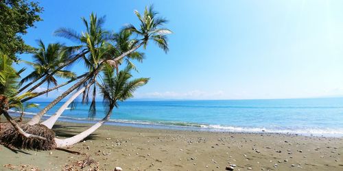
The twelve-kilometre coastal stretch between the languorous village of Puerto Viejo de Talamanca, 18km southeast of Cahuita, and Manzanillo is among the loveliest in Costa Rica. Though not great for swimming, its beaches – Playa Chiquita, Playa Cocles, Punta Uva and Manzanillo – are some of the most picturesque on the Caribbean coast. Puerto Viejo itself is one of the most popular backpacker towns in Central America, with plenty of accommodation, plus a lively social scene, and the entire place sells out at weekends, so prepare accordingly.
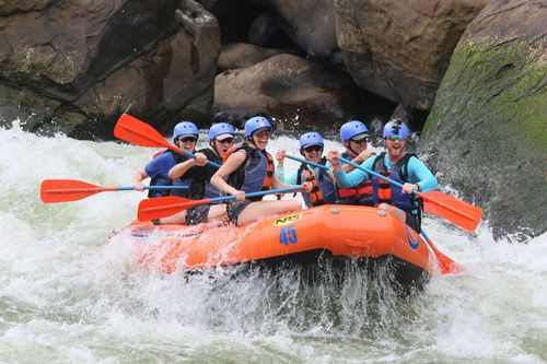
It’s surfing, however, that really pulls in the crowds; the stretch south of Stanford’s restaurant at the southern end of Puerto Viejo offers some of the most challenging waves in the country and certainly the best on the Caribbean coast. Puerto Viejo’s famous twenty-foot wave “La Salsa Brava” crashes ashore between December and March and from June to July; September and October, when La Salsa Brava disappears, are the quietest months of the year. Then there’s the South Caribbean Music and Arts Festival held every year for the four weekends leading up to Easter, and featuring Costa Rican musicians playing a variety of music including ska, jazz, reggae, calypso and more.
South to Manzanillo
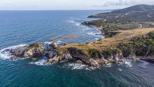
The fifteen-kilometre stretch of coast south of Puerto Viejo features some of the most appealing beaches on the entire Caribbean coast. All the trappings of a pristine tropical paradise are here, with palm trees leaning over calm sands, purples, mauves, oranges and reds fading into the sea at sunset and a milky twilight mist wafting in from the Talamancas. The first two hamlets heading south from Puerto Viejo, are Playa Cocles (2km south) and Playa Chiquita (4km south) which, owing to the amount of recent development, now more or less blend into one another. Patrolled by lifeguards, Playa Cocles offers perhaps the best surfing in the entire region and is also home to the jungle bookstore Echo Books, with excellent coffee and chocolates, and an impressive selection of reading matter. Playa Chiquita has a couple of interesting attractions nearby, plus a good selection of bars and cafés.
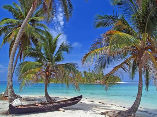
Punta Uva, 5km beyond Playa Chiquita, has a pristine white-sand beach set in a protected cove making it particularly good for swimming. Manzanillo, another 2km further on, almost at the end of the coastal road, has a large shelf of coral reef just offshore that teems with marine life and offers some of the best snorkelling in Costa Rica. The village itself is small and charming, with laidback locals and a couple of great places to eat and hang out.
The Reserva Indígena KéköLdi and ATEC
About two hundred Bribrí and Cabécar peoples live in the Reserva Indígena KéköLdi, which begins just south of Puerto Viejo and extends inland into the Talamanca Mountains. The reserve was established in 1976 to protect the indigenous culture and ecological resources of the area, but the communities and land remain under constant threat from logging, squatters, tourism and banana plantations. The worst problems arise from lax government checks on construction in the area which, inhabitants claim, have led to several hotels being built illegally on their land. The main obstacle between the indigenous peoples and their neighbours has been, historically, their irreconcilable views of land. The Bribrí and Cabécar see the forest as an interrelated system of cohabitants all created by and belonging to Sibö, their god of creation, while the typical campesino view is that of a pioneer – the forest is an obstacle to cultivation, to be tamed, conquered and effectively destroyed.
The best way to visit the reserve is on one of the tours organized by the Asociación Talamanqueña de Ecoturismo y Conservación, or ATEC, a grassroots organization set up by members of the local community – Afro-Caribbeans, Bribrí indigenous peoples and Spanish-descended inhabitants. If you’re spending even just a couple of days in the Talamanca region, an ATEC-sponsored trip is a must; to reserve a tour, go to their Puerto Viejo office on the main road at least one day in advance. The organization’s main goal is to give local people a chance to demonstrate their pride in and knowledge of their home territory, and to teach them how to make a living from tourism without selling their land or entering into more exploitative business arrangements. In this spirit, ATEC has trained about fifteen local people as guides, who get about ninety percent of the individual tour price. Whereas many of the hotel-organized excursions use cars, ATEC promotes horseback and hiking tours. They also visit places on a rotating roster, so that local hamlets don’t deteriorate from foreigners traipsing through daily.
The tour does not take you, as you might expect, to villages where indigenous peoples live in “primitive” conditions. The Bribrí speak Spanish (as well as Bribrí) and wear Western clothes. But underneath this layer of assimilation lie the vital remains of their culture and traditional way of life. Although the area has seen some strife between the reserve dwellers, their neighbours and foreign hotel developments, these altercations remain largely on the level of policy. As a visitor, you won’t see any overt ill-feeling between the groups. Treks usually last about four hours, traversing dense rainforest and the Talamanca Mountains. They start near the road to Puerto Viejo – where Bribrí crafts, including woven baskets and coconut shell carvings, are on sale – and pass cleared areas, cocoa plantings and small homesteads, and then into secondary, and finally primary, cover. In this ancient forest the guide may take you along the same trails that have been used for centuries by Bribrís on trips from their mountain homes down to the sea, pointing out the traditional medicinal plants that cure everything from malaria to skin irritations. A tour may also involve discussions about the permanent reforestation programme or a visit to the iguana breeding farm established by the local community. However, they conveniently neglect to mention one of the reasons they breed the iguanas is to eat them – especially when the females are pregnant – a major reason they are on the verge of extinction.
Bribrí and the Panamanian border
From Puerto Viejo, the paved road (Hwy-36) continues inland to Bribrí, about 10km southwest, arching over the Talamancan foothills to reveal the green valleys stretching ahead to Panamá. This is banana country, with little to see even in Bribrí itself, which is largely devoted to administering the affairs of indigenous reserves in the Talamanca Mountains. There are several indigenous reserves near Bribrí. You can’t visit them without special permission both from the communities themselves and from the government, but if you’re interested, anthropologist Fernando Cortés (t 2766-6800) leads small groups through the Talamanca Mountains on officially sanctioned visits to Cabécar communities. Trips (lasting around a week) begin near Cartago, from where you walk into the Talamanca region, and cost about $100 per person.
From Bribrí, a dusty gravel road winds for 34km through solid banana fincas to Sixaola. Locals cross the border here to do their shopping in Panamá, where most things are less expensive. The majority of foreigners who cross into Panamá do so simply because their tourist visa for Costa Rica has expired and they have to leave the country for 72 hours, though the pristine Panamanian island of Bocas del Toro just over the border offers an inviting prospect even for those who don’t need an extension.
Reserva Biológica Hitoy-Cerere
Sixty kilometres, and a three-hour road-trip, south of Limón is one of Costa Rica’s least visited national reserves, the Reserva Biológica Hitoy-Cerere. Sandwiched between the Tanyí, Telier and Talamanca indigenous reservations, this very rugged, isolated terrain – ninety-one square kilometres of it – has no campsites or washrooms, though there is a ranger station at the entrance with a small dormitory where you can bed down for the night.
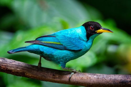
In the Bribrí language, hitoy means “woolly” (the rocks in its rivers are covered with algae, and everything else has grown a soft fuzz of moss); and cerere means “clear waters”, of which there are many. One of the wettest reserves in all of Costa Rica, it receives a staggering 4m of rain per year in some areas, with no dry season at all. Its complicated biological profile reflects the changing altitudes within the park. The top canopy trees loom impressively tall – some as high as 50m – and epiphytes, bromeliads, orchids and lianas grow everywhere beneath the very dense cover. Wildlife is predictably abundant, but most of the species are nocturnal and rarely seen, although you might spot three-toed sloths, and perhaps even a brocket deer. You’ll probably hear howler monkeys, and may glimpse white-faced monkeys. Pacas and rare frogs abound, many of them shy and little-studied. More visible are the 115 species of birds, from large black vultures and hummingbirds to trogons and dazzling blue kingfishers.
Parque Nacional Tortuguero
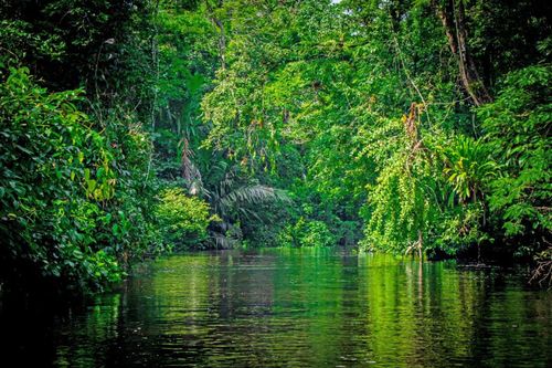
Despite its isolation – 254km from San José by road and water – Parque Nacional Tortuguero is among the most visited national parks in Costa Rica. Tortuguero means turtle-catcher in Spanish, and turtle-catchers have long flourished in this area, one of the most important nesting sites in the world for the green sea turtle, one of only eight species of marine turtle. Along with the hawksbill turtle, the green sea turtle lays its eggs here between July and October.
First established as a protective zone in the 1960s, Tortuguero officially became a national park in 1975. It encompasses 190 square kilometres of protected land, including not only the beach on which the turtles nest, but also the surrounding impenetrable tropical rainforest, coastal mangrove swamps and lagoons, and canals and waterways. Except during the comparatively dry months of February, March, September and October the park is fairly wet, receiving over 3500mm of rain a year. This soggy environment hosts a wide abundance of wildlife – fifty kinds of fish, numerous birds, including the endangered green parrot and the vulture, and about 160 mammals, some under the threat of extinction. Due to the waterborne nature of most transport and the impenetrability of the ground cover, it’s difficult to spot them, but howler, white-faced capuchin and spider monkeys lurk behind the undergrowth. The park is also home to the fishing bulldog bat, which fishes by sonar, and a variety of large rodents, including the window rat, whose internal organs you can see through its transparent skin. Jaguars used to thrive here, but are slowly being driven out by the encroaching banana plantations at the western end of the park; you may also spot the West Indian manatee, or sea cow, swimming underwater. It’s the turtles, however, that draw all the visitors. The sight of the gentle beasts tumbling ashore and shimmying their way up the beach to deposit their heavy load before limping back, spent, into the dark phosphorescent waves can’t fail to move.
As elsewhere in Costa Rica, logging, economic opportunism and fruit plantations have affected the parkland. Sometimes advertised by package tour brochures as a “Jungle Cruise” along “Central America’s Amazon”, the journey to Tortuguero is indeed Amazonian, taking you past tracts of deforestation and lands cleared for cattle – all outside the park’s official boundaries but, together with the banana plantations, disturbingly close to its western fringes.
Desove
Most people come to Tortuguero to see the desove, or egg-laying of the turtles. Few are disappointed, as the majority of tours during laying seasons (March–May & July–Oct) result in sightings of the surreal procession of the reptiles from the sea to make their egg-nests in the sand. While turtles have been known to lay in the daylight (the hatchlings wait under the cover of sand until nightfall to emerge), it is far more common for them to come ashore in the relative safety of night. Nesting can take place turtle-by-turtle – you can watch a single mother come ashore and scramble up the beach just south of the village or, more strikingly, in groups (arribadas) when dozens emerge from the sea at the same time to form a colony, marching up the sands to their chosen spot, safely above the high-tide mark. Each turtle digs a hole in which she lays eighty or more eggs; the collective whirring noise of sand being dug away is extraordinary. Having filled the hole with sand to cover the eggs, the turtles begin their course back to the sea, leaving the eggs to hatch and return to the waves under the cover of darkness. Incubation takes some weeks; when the hatchlings emerge they instinctively follow the light of the moon on the water, scuttling to safety in the ocean.
Tortuguero is one of the best spots in Costa Rica to observe marine turtles nesting, as three of the largest kinds of endangered sea turtles regularly nest here in large numbers. Along with the green (verde) turtle, named for the colour of soup made from its flesh, you might see the hawksbill (carey), with its distinctive hooked beak, and the ridged leatherback (baula), the largest turtle in the world, which weighs around 300kg – though some are as heavy as 500kg and reach 2.4m in length. The green turtles and hawksbills nest mainly from July to October (August is the peak month), while the leatherbacks may come ashore from March to May.
Turtling
For hundreds of years the fishermen of the Caribbean coast made their living culling the seemingly plentiful turtle population, selling shell and meat for large sums to middlemen in Puerto Limón. Initially, turtles were hunted for local consumption only, but during the first two decades of the 1900s, the fashion for turtle soup in Europe, especially England, led to large-scale exports.
Turtle-hunting was a particularly brutal practice. Spears were fashioned from long pieces of wood, taken from the apoo palm or the rawa, and fastened with a simple piece of cord to a sharp, barbed metal object. Standing in their canoes, fishermen hurled the spear, like a miniature harpoon, into the water, lodging the spear in the turtle’s flesh. Pulling their canoes closer, the fishermen would then reel in the cord attached to the spear, lift the beasts onto the canoes and take them ashore dead or alive. On land, the turtles might be beheaded with a machete or put in the holds of ships, where they could survive a journey of several weeks to Europe if they were given a little water.
Today, turtles are protected, their eggs and meat a delicacy. Locals around Tortuguero are officially permitted to take two turtles a week during nesting season for their own consumption – the unlucky green turtles are considered the most delicious. The recent sharp decline in the populations of hawksbill, green and leatherback turtles has been linked, at least in part, to poaching. This has prompted the national parks administration to adopt a firm policy discouraging the theft of turtle eggs within the park boundaries and to arm park rangers. Meanwhile, should you find a turtle on its back between July 10 and September 15, do not flip it over, as in most cases it is being tagged by researchers, who work on the northern 8km of the thirty-five-kilometre-long nesting beach.
It is not just the acquisitive hand of humans that endangers the turtles. On land, a cadre of predators, among them coati and raccoons, regularly ransack the nests in order to eat the unborn reptiles. Once the hatching has started – the darkness giving them a modicum of protection – the turtles really have their work cut out, running a gauntlet of vultures, barracudas, sharks and even other turtles (the giant leatherback has been known to eat other species’ offspring) on their way from the beach to the sea. Only about sixty percent – an optimistic estimate – of hatchlings reach adulthood, and the survival of marine turtles worldwide is under question.
Refugio Nacional de Vida Silvestre Barra del Colorado
Created to preserve the area’s abundant fauna, the Refugio Nacional de Vida Silvestre Barra del Colorado lies at the northern end of Costa Rica’s Caribbean coast, 99km northeast of San José near the border with Nicaragua. This ninety-square-kilometre, sparsely populated (by humans, at least) tract of land is crossed by the Río Colorado, which debouches into the Caribbean next to the village of Barra del Colorado. The grand Río San Juan marks the park’s northern boundary, which is also the border with Nicaragua. The river continues north of the border all the way to the Lago de Nicaragua and almost all traffic in this area is by water.
The small, quiet village of Barra del Colorado, the area’s only settlement of any size, is inhabited by a mixed population of Afro-Caribbeans, Miskitos, Costa Ricans and a significant number of Nicaraguans, many of whom spilt over the border during the Civil War. The village is divided into two halves: Barra Sur and the larger Barra Norte, which stand opposite each other across the mouth of the Río Colorado. Tropical hardwoods are still under siege from illegal logging around here – you may see giant tree trunks being towed along the river and into the Caribbean, from where they are taken down to Limón. There are no public services in town (no post office, police station, internet café or hospital) except for a couple of public phones outside the souvenir shop next to the airport and near the Los Almendros bar.
The Río San Juan and the Nicaraguan border
Heading to or from Barra via the Sarapiquí area in the Zona Norte entails a trip along the Río Sarapiquí to the mighty Río San Juan. Flowing from Lago de Nicaragua to the Caribbean, the San Juan marks most of Costa Rica’s border with Nicaragua, and the entire northern edge of the Refugio Nacional de Vida Silvestre Barra del Colorado. It’s theoretically in Nicaraguan territory, but Costa Ricans have the right to travel on the river – though this eastern stretch of the San Juan has been the source of a diplomatic dispute between the two countries since late 2010. There isn’t, however, an official entry point between the two countries so it’s technically illegal to cross into either country along this stretch.
One bizarre phenomenon local to this area is the migration of bull sharks from the saltwater Caribbean up the Río San Juan to the freshwater Lago de Nicaragua. They are unique in the world in making the transition, apparently without trauma, from being saltwater to freshwater sharks.
You’ll notice much evidence of logging in the area, especially at the point where the Sarapiquí flows into the Río San Juan – the lumber industry has long had carte blanche in this area, due to the non-enforcement of existing anti-logging laws. The Nicaraguan side of the Río San Juan, part of the country’s huge Reserva Indio Maíz, looks altogether wilder than its southern neighbour, with thick primary rainforest creeping right to the edge of the bank. Partly because of logging, and the residual destruction of its banks, the Río San Juan is silting up, and even shallow-bottomed lanchas get stuck in this once consistently deep river. It’s a far cry from the sixteenth and seventeenth centuries, when pirate ships used to sail all the way along the Río San Juan to Lago de Nicaragua, from where they could wreak havoc on the Spanish Crown’s ports and shipping.
Refugio Nacional de Vida Silvestre Gandoca-Manzanillo
Covering over fifty square kilometres of land and a similar area of sea, the little-visited but fascinating Refugio Nacional de Vida Silvestre Gandoca-Manzanillo sits in the southeast corner of the country, with its ranger station 200 metres south of Manzanillo village. The refuge, which includes the small hamlets of Gandoca and Manzanillo, borders Río Sixaola and the frontier with Panamá. It was established to protect some of Costa Rica’s last few coral reefs, of which Punta Uva is the most accessible and offers great snorkelling. There’s also a protected turtle-nesting beach south of the village of Manzanillo, along with tracts of mangrove forests and the last orey swamp in the country. More than 358 bird species have been identified, many of them rare – ten years ago there were sightings of the endangered harpy eagle, believed to be extinct in the rest of the country due to deforestation. Other species found in the refuge include the manatí, tapir and American crocodile, who hang out along the river estuary, though you’re unlikely to see them.
Four kilometres from Manzanillo down a rough track, Gandoca provides access to the estuary of the Río Gandoca, a bird-spotter’s delight with boat trips organized from the village. You can get here by walking from Manzanillo, or there’s access from the Sixaola Road – if you have a 4WD – via the banana fincas of Daytonia, Virginia and Finca 96.
The Punta Mona Center for Sustainable Living
If you are looking for an alternative to conventional tourism and even backpacking, and want to settle in a remote spot, Punta Mona is worth a visit. The Punta Mona Center for Sustainable Living is an 85-acre organic farm and retreat centre located inside the Gandoca-Manzanillo Wildlife Refuge near the Panamanian border. The only way to get there is to take a boat or hike three or four hours from Manzanillo, where the coastal road ends and the rainforest begins. The café and convenience store are the last opportunity to purchase provisions until your return. Ask for Bako, the man with the boat, and if he’s not around someone else will take you for about $20 per person.
If you are feeling adventurous, there is a trail that goes south along the beach, crosses a stream and on toward Punta Mona. Bear in mind this trail is usually very muddy and can be slow going. There are also paths leading off from there that go to distant indigenous villages. One wrong turn and you might find yourself dropping in on the natives, uninvited. If you take the boat, it’s a thirty-minute journey until you round the bend, and lay eyes on the white sands and ears on the howler monkeys who inspired Christopher Columbus to name the place “Monkey Point”.
The guerrilla gardeners who hold down the Punta Mona fort are completely dedicated to teaching environmental awareness, and they welcome everyone for visits of any length. Promoting a sustainable way of living through example, they grow their own food organically, recycle and manage all waste, use eco-technologies such as solar power, and create an amazing sense of community. You learn about the fruit and vegetable trees, gather the food, and participate in the cooking. Their architecturally impressive houses are built from fallen trees, they’ve constructed an incredible irrigation system, solar panels provide the electricity, and they’ve planted a variety of tropical fruits, nuts, spices and medicinals from around the world.
When you’re not doing your share to keep the place running, you can laze on a hammock, take Spanish lessons, snorkel, kayak, hike, look for dolphins or nesting turtles (in season), play dominoes with Paddy, an old fisherman – or even surf the internet care of a satellite broadband connection. There is something very cool about signing on to chat with friends in their cubicles back home while you are tucked away in a remote stretch of Latin American rainforest.