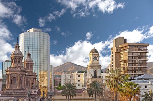
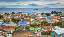
El Norte Chico Travel Guide

A land of rolling, sun-baked hills streaked with sudden river valleys that cut across the earth in a flash of green, the Norte Chico, or “Little North”, of Chile is what geographers call a “transitional zone”. Its semi-arid scrubland and sparse vegetation mark the transformation from the country’s fertile heartland to the barren deserts bordering Peru and Bolivia. Starting around the Río Aconcagua, just north of Santiago, it stretches all the way to Taltal, and the southernmost reaches of the Atacama, more than 800km further north.

Brief history of El Norte Chico

Mining has shaped the region’s growth, giving birth to towns, ports, railways and roads, and drawing large numbers of settlers to seek their fortune here. Gold was mined first by the Incas for ritual offerings, and then intensively, to exhaustion, by the Spaniards until the end of the eighteenth century. Next came the great silver bonanza of the nineteenth century, when a series of dramatic silver strikes – some of them accidental – set a frenzy of mining and prospecting in motion, propelling the region into its heyday. Further riches and glory came when the discovery of huge copper deposits turned it into the world’s largest copper producer from the 1840s to 1870s. Mining is still the most important industry here, its presence most visible up in the cordillera, where huge mining trucks hurtle around the mountain roads, enveloped in clouds of dust.

What to see in El Norte Chico

A series of rivers – notably the Choapa, the Limarí, the Elqui, the Huasco and the Copiapó – flow through the Norte Chico region from the Andes to the coast, allowing the surrounding land to be irrigated and cultivated. The result is spectacular: lush, vibrant green terraces laden with olives, apricots and vines snake between the brown, parched walls of the valleys, forming a sensational visual contrast. The most famous product of these valleys is pisco, the pale, aromatic brandy distilled from sun-dried grapes and treasured by Chileans as their national drink (a claim vigorously contested by the Peruvians, who consider it their own).

The largest population centre – and one of the country’s most fashionable seaside resorts – is La Serena, its pleasing, colonial-style architecture and lively atmosphere making it one of the few northern cities worth visiting for its own sake. It’s also an ideal base for exploring the beautiful Elqui Valley, immortalized in the verses of the Nobel laureate Gabriela Mistral, and home to luxuriant vines and idyllic riverside hamlets. Just down the coast from La Serena lies the Parque Nacional Fray Jorge, with a microclimate that supports a small, damp cloudforest. Another botanical wonder is the famous desierto florido or flowering desert. Occasionally, after heavy winter rains, the normally dry earth sprouts vast expanses of vibrantly coloured flowers. This rare, unpredictable phenomenon, centred on Vallenar, occurs on average once every four to eight years.

Skies that are guaranteed cloudless almost year-round and very little air pollution have made the region the obvious choice for some of the world’s major astronomical observatories. They range from the state-of-the-art facility at dazzling-white Tololo to the modest municipal installation at Mamalluca, near the picturesque village of Vicuña, where you don’t have to be an expert reserving months in advance to look through the telescope.

The Norte Chico also boasts a string of superb beaches, some totally deserted and many of them tantalizingly visible from the Panamericana as you enter the region, just north of Santiago. Bahía Inglesa is famous throughout Chile for its turquoise waters, though increasingly prolific algae is turning the bay greener.

Copiapó, the northernmost major city in the region, serves as a useful springboard for excursions into the nearby desert or, further afield, up into the high cordillera. Here the Parque Nacional Nevado de Tres Cruces, the Volcán Ojos del Salado and Laguna Verde present some of Chile’s most magnificent yet least-visited landscapes: snow-topped volcanoes, bleached-white salt flats and azure lakes. A couple of hours to the north, near the towering cliffs and empty beaches of Parque Nacional Pan de Azúcar, a small island is home to colonies of seals, countless pelicans and thousands of penguins.

Bear in mind that, whereas the Norte Grande, Chile’s northernmost region, can be visited year-round, the Norte Chico is at its best in the summer months (Oct–March) when the valleys are at their greenest, the coast is likelier to be free of fog and the ocean and sky are pure blue. On the downside, resorts like La Serena and Bahía Inglesa can be horribly overcrowded and overpriced in the high season, especially January.

Ovalle

Almost 380km north of Santiago – some 140km beyond Los Vilos – a lone sign points to the little-visited market town of Ovalle. The town’s main claim to fame is as the birthplace of one of the country’s outstanding contemporary writers, Luis Sepúlveda. It’s also a good base for exploring the dramatic Hurtado Valley or the deeply rural Limarí Valley, home to a few low-key attractions, including the Monumento Natural Pichasca, the Termas de Socos hot springs and the petroglyphs at the Valle del Encanto.

If you have your own car, you can take the scenic road northeast of Ovalle – an alternative route to Vicuña and the Elqui Valley – which winds slowly up into the mountains, passing ancient petrified wood stumps at Pichasca and the delightful oasis village of Hurtado. If you head west, you’ll find a concentration of rock carvings in the Valle del Encanto, a hot springs resort at the Termas de Socos and the impressive cloudforest reserve of Parque Nacional Fray Jorge.

Feria Modelo de Ovalle

About ten blocks east of Plaza de Armas, the town's central plaza, you’ll find a huge, ramshackle iron hangar that houses the colourful Feria Modelo de Ovalle, the largest fresh-produce market in the north of Chile and definitely worth a visit; you can pick up fantastic home-made cheeses (including some alarmingly pungent goat cheeses) as well as delicious dried figs and a range of fruit and vegetables.

Parque Nacional Fray Jorge

A UNESCO world biosphere reserve since 1977, Parque Nacional Fray Jorge sits on the Altos de Talinay, a range of steep coastal hills plunging into the Pacific some 80km west of Ovalle and 110km south of La Serena. It extends over 100 square kilometres, but its focal point, and what visitors come to see, is the small cloudforest perched on the highest part of the sierra, about 600m above sea level.

The extraordinary thing about this forest is how sharply it contrasts with its surroundings, indeed with everywhere else in the area. Its existence is the result of camanchaca, the thick coastal fog that rises from the ocean and condenses as it meets the land, supporting a cover of dense vegetation – fern, bracken and myrtle trees – normally found only in the south of Chile. Close to the parking area, a 1km path dotted with information panels guides you through a poorly labelled range of plants and trees, and leads to the forest proper, where a slippery, wooden boardwalk takes you through tall trees dripping with moisture. The whole trail takes less than half an hour to walk. Three kilometres beyond the Conaf control there’s a picnic area, but note that camping is no longer allowed anywhere in the park.

Andacollo

Enfolded by rolling, sun-bleached hills midway between Ovalle and La Serena, Andacollo is a tidy little town of small adobe houses grouped around a long main street. It lies along a side road which branches northeast from the Ruta 43, the most direct, scenic route between Ovalle and La Serena. Andacollo has been an important gold- and copper-mining centre ever since the Inca mined its hills in the sixteenth century, but is best known as the home of the Virgen de Andacollo, a small wooden carving that draws over one hundred thousand pilgrims to the town each year between December 23 and 26 for the Fiesta Grande de la Virgen, four days of music and riotous dancing performed by costumed groups from all over Chile. The town is also home to one of the country’s newest observatories, open to the public for evening stargazing.

Coquimbo

West of Ovalle, the Panamericana turns towards the ocean and skirts a string of small resorts that provide a calmer and more attractive beach setting than the built-up coast at La Serena. Spread over a rocky peninsula studded with colourful houses, the busy port of Coquimbo was established during colonial times to serve neighbouring La Serena and became Chile’s main copper exporter during the nineteenth century. Despite its impressive setting, the town has a slightly rough-edged, down-at-heel air, but is useful as an inexpensive base from which to enjoy La Serena’s beaches, or for taking public transport to the nearby resorts of Guanaqueros – a fishing village 37km south with a sweeping beach – and Tongoy, 13km further south. A couple of blocks north of Coquimbo’s main street, Avenida Costanera runs along the shore, past the large port, the terminal pesquero, and along to the lively fish market. This area makes for a pleasant stroll along the ocean, provided you don’t mind the strong whiff of fish.

Elqui Valley

Quiet, rural and extremely beautiful, the Elqui Valley unfolds east from La Serena and into the Andes. Irrigated by canals fed by the Puclara and La Laguna dams, the valley floor is given over entirely to cultivation – of papayas, custard apples (chirimoyas), oranges, avocados and, most famously, the vast expanses of grape vines grown to produce pisco. It’s the fluorescent green of these vines that makes the valley so stunning, forming a spectacular contrast with the charred, brown hills that rise on either side.

Some 60km east of La Serena, appealing little Vicuña is the main town and transport hub of the Elqui Valley. Moving east from here, the valley gets higher and narrower and is dotted with tiny villages like Montegrande and the odd pisco distillery. Pisco Elqui, 105km east of La Serena, is a very pretty village that makes a great place to unwind for a couple of days. If you really want to get away from it all, head for one of the rustic cabañas dotted along the banks of the Río Cochiguaz, which forks east of the main valley at Montegrande, or delve beyond Pisco Elqui into the farthest reaches of the Elqui Valley itself. Buses and a paved road will get you all the way to Horcón but not to the farthest village of all, Alcohuaz.

Vicuña

An hour by bus inland from La Serena, Vicuña is a neat and tidy agricultural town ringed by mountains and laid out around a large, luxuriantly landscaped square. It’s a pleasant, easy-going place with a few low-key attractions, a good choice of places to stay and eat, a couple of pisco distilleries just out of town and two visitor-friendly observatories on its doorstep. If you’re looking to stretch your legs, there are panoramic views of the town and entire Elqui Valley from the top of Cerro de la Virgen, north-east of the centre.

Life revolves firmly around the central Plaza de Armas, which has at its centre a huge stone replica of the death mask of Nobel Prize-winning poet Gabriela Mistral, the Elqui Valley’s most famous daughter. On the square’s northwest corner stands the Iglesia de la Inmaculada Concepción, topped by an impressive wooden tower built in 1909 – take a look inside at its vaulted polychrome ceiling, painted with delicate religious images and supported by immense wooden columns. Right next door, the eccentric Torre Bauer is a bright-red, mock-medieval tower prefabricated in Germany in 1905 and brought to Vicuña on the instructions of the town’s German-born mayor, Adolfo Bauer; the adobe building supporting it houses the Municipalidad.

Gabriela Mistral

Possibly even more than its pisco, the Elqui Valley’s greatest source of pride is Gabriela Mistral, born in Vicuña in 1889 and, in 1945, the first Latin American to be awarded the Nobel Prize for Literature. A schoolmistress, a confirmed spinster and a deeply religious woman, Mistral’s poetry reveals an aching sensitivity and passion, and her much romanticized life was punctuated with tragedy and grief.

Pisco

Pisco has been enjoyed by Chileans for more than four centuries, but it wasn’t until the 1930s that it was organized into an effective commercial industry, starting with the official creation of a pisco denominación de origen. Shortly afterwards, a large number of growers, who’d always been at the mercy of the private distilleries for the price they got for their grapes, joined together to form cooperatives to produce their own pisco. The largest were the tongue-twisting Sociedad Cooperativa Control Pisquero de Elqui y Vitivinículo de Norte Ltda (known as “Pisco Control”) and the Cooperativa Agrícola y Pisquera del Elqui Ltda (known as “Pisco Capel”), today the two most important producers in Chile, accounting for over ninety percent of all pisco to hit the shops.

Planta Capel distillery

Just out of Vicuña, across the bridge by the filling station, you’ll find the Planta Capel, the largest pisco distillery in the Elqui Valley. It has a small museum outlining the history of pisco and also offers slick guided tours in English and Spanish every half-hour, with tastings and the chance to buy bottles and souvenirs at the end.

Cerro Mamalluca observatory

Nine kilometres northeast of Vicuña, the Cerro Mamalluca observatory, built specifically for public use, is run by the Municipalidad de Vicuña and features a 30cm Smith-Cassegrain telescope donated by the Cerro Tololo team. The two-hour evening tours start with a high-tech audiovisual talk on the history of the universe, and end with the chance to look through the telescope. If you’re lucky, you might see a dazzling display of stars, planets, galaxies, nebulas and clusters, including Jupiter, Saturn’s rings, the Orion nebula, the Andromeda galaxy and Sirius. These tours are aimed at complete beginners, but serious astronomers can arrange in-depth, small-group sessions with at least a few weeks’ notice.

Vallenar

North of La Serena, the Panamericana turns inland and heads via a couple of winding passes (Cuesta Buenos Aires and Cuesta Pajonales) towards the busy but somewhat run-down little town of Vallenar, 190km up the road. The town, which acts as a service centre for local mining and agricultural industries, was founded in 1789 by Governor Ambrosio O’Higgins, who named the city after his native Ballinagh in Ireland. It makes a convenient base for an excursion east into the fertile upper Huasco Valley, laced with green vines and small pisco plants, or northwest towards the coast and, in the spring, the wild flowers of the Parque Nacional Llanos de Challe.

The self-appointed “capital del desierto florido” (and vigorously promoted as such by the tourist authorities), Vallenar is indeed the best base for forays into the flowering desert, if you’re here at the right time. The Museo del Huasco at Ramírez 1001 has some moderately diverting displays on indigenous cultures and photos of the nearby flowering desert.

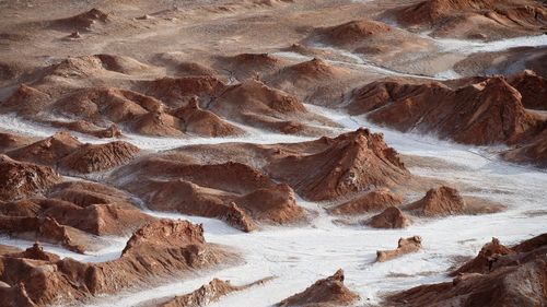
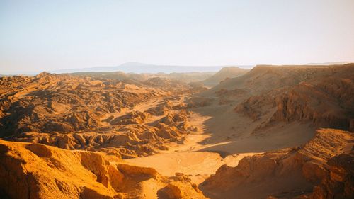
The Flowering Desert

For most of the year, as you travel up the Panamericana between Vallenar and Copiapó you’ll cross a seemingly endless, semi-desert plain, stretching for nearly 100km, sparsely covered with low shrubs and copao cacti. But take the same journey in spring, and in place of the parched, brown earth, you’ll find green grass dotted with beautiful flowers. If you’re really lucky and you know where to go after a particularly wet winter, you’ll happen upon fluorescent carpets of multicoloured flowers, stretching into the horizon.

This extraordinarily dramatic transformation is known as the desierto florido, or “flowering desert”; it occurs when unusually heavy rainfall (normally very light in this region) causes dormant bulbs and seeds, hidden beneath the earth, to sprout into sudden bloom, mostly from early September to late October.

There’s no predicting the desierto florido, which is relatively rare – the frequency and intensity varies enormously, but the general phenomenon seems to occur every four to five years, although this has been more frequent in recent years. The best guide in Vallenar, and a veritable gold-mine of information about the dozens of flower varieties, is Roberto Alegría (desiertoflorido2010@hotmail.cl).

Copiapó

Overlooked by arid, rippling mountains, the prosperous city of Copiapó sits in the flat basin of the Río Copiapó, some 60km from the coast and 145km north of Vallenar. To the east is the most northerly of Chile’s “transverse valleys” and beyond it the transformation from semi-desert to serious desert is complete, and the bare, barren Atacama stretches a staggering 1000km north towards the Peruvian border. Just to the north of the city, Arabian-style dunes await exploration. There isn’t a great deal to do here, however, and Copiapó’s main use to travellers is as a springboard for excursions into the surrounding region.

Brief history of Copiapó

When Diego de Almagro made his long trek south from Cuzco in 1536, following the Inca Royal Road down the spine of the Andes, it was into this valley that he descended, recuperating from the gruelling journey at the tambo, or resting place, where Copiapó now stands. The valley had been occupied and cultivated by the Diaguita people starting around 1000 AD and was then inhabited, beginning around 1470, by the Inca, who mined gold and copper here. Although Spanish encomenderos occupied the valley from the beginning of the conquest, it wasn’t until 1744 that the city of Copiapó was founded, initially as “San Francisco de la Selva”. A series of random silver strikes in the nineteenth century, most notably at Chañarcillo, threw the region into a frenzied boom.

Following a period of decline at the beginning of the twentieth century, Copiapó is once more at the centre of a rich mining industry, revolving around copper, iron and gold. The city shot to international notoriety in October 2010, when 33 workers from the nearby San José mine were rescued after 69 days trapped underground.

The rescue of Los 33

On August 5, 2010, a boulder collapsed inside the San José copper and gold mine, 32km north-east of Copiapó, trapping 33 workers some 700m below the desert. That may well have been the end of the story – the miners consigned to statistics in Chile’s notoriously dangerous mining industry – but for a fortuitous combination of determined families, a captivated media and a president in dire need of a ratings boost. In the aftermath of the accident, relatives of the trapped miners set up camp outside the pithead and refused to budge, urging the company to continue their search effort.

Limelight in the darkness

The families kept up the pressure via the national media, compelling the then new right-wing president Sebastián Piñera – perceived to be out of touch with the working class and reeling from a ratings blow following his handling of February’s earthquake and tsunami – to get involved. On day 17 of the search operation, just as hope was fading, rescue workers struck media gold – a handwritten note attached to their drillhead which read: “We are fine in the shelter – the 33.” The miners’ relatives were euphoric, the president triumphant and the international media dispatched to “Camp Hope” to cover the miracle (and soap opera) unfolding in the Chilean desert.

Food, medicine, pornography and video cameras were sent down a narrow communications shaft to the desperate men. What happened next was beamed around the world: one miner proposed a church marriage to his partner; a two-timer was exposed when his wife and mistress turned up at Camp Hope to lend support; a musical miner kept his colleagues entertained with Elvis impersonations; and another lay in the hot, dark tunnel while above ground his wife give birth to his daughter, named, appropriately, “Esperanza” (hope).

Saved

Just after midnight on October 13, 69 days after the miners were buried alive (the longest underground entrapment in history), state-of-the-art rescue capsules hauled the first of “Los 33” to freedom, to an estimated global TV audience of 1.5 billion people. In the aftermath of the rescue, the miners enjoyed a flurry of media attention and were flown around the world and paraded as heroes. Most, however, chose to remain tight-lipped about what really went on in that subterranean hell, and as well as struggling with post-traumatic stress, the majority now live quiet, unassuming lives in Copiapó.

Around Copiapó

The region around Copiapó features some of the most striking and varied landscapes in Chile. To the east, the Río Copiapó Valley offers the extraordinary spectacle of emerald-green vines growing in desert-dry hills, while high up in the Andes, you’ll ascend a world of salt flats, volcanoes and lakes, encompassed by the Parque Nacional Nevado de Tres Cruces, the Volcán Ojos del Salado and the blue-green Laguna Verde. To the west, Bahía Inglesa, near the port of Caldera, could be a little chunk of the Mediterranean, with its pristine sands and odd-shaped rocks rising out of the sea. Further south, reached only in a 4WD, the coast is lined with wild, deserted beaches lapped by turquoise waters.

Parque Nacional Nevado de Tres Cruces

East of Copiapó, the Andes divide into two separate ranges – the Cordillera de Domeyko and the Cordillera de Claudio Gay – joined by a high basin, or plateau, that stretches all the way north to Bolivia. The waters trapped in this basin form vast salt flats and lakes towered over by enormous, snowcapped volcanoes, and wild vicuña and guanaco roam the sparsely vegetated hills. This is a truly awe-inspiring landscape, conveying an acute sense of wilderness and space. It’s easier to fully appreciate it here than around San Pedro de Atacama, for instance, thanks to the general absence of tourists. The number of visitors has started to increase, however, following the creation in 1994 of the Parque Nacional Nevado de Tres Cruces, which takes in a dazzling white salt flat, the Salar de Maricunga; two beautiful lakes, the Laguna Santa Rosa and Laguna del Negro Francisco; and the 6753m volcano Tres Cruces.

The bumpy road up to Parque Nacional Nevado de Tres Cruces takes you through a brief stretch of desert before twisting up narrow canyons flanked by mineral-stained rocks. As you climb higher, the colours of the scoured, bare mountains become increasingly vibrant, ranging from oranges and golds to greens and violets. Some 165km from Copiapó, at an altitude of around 3700m, the road (following the signs to Mina Marta) reaches the first sector of the park, skirting the pale-blue Laguna Santa Rosa, home to dozens of pink flamingos.

Immediately adjacent, the gleaming white Salar de Maricunga is Chile’s most southerly salt flat, covering an area of over 80 square kilometres. A two- to three-hour drive south from here, past Mina Marta, the park’s second sector is based around the large, deep-blue Laguna del Negro Francisco, some 4200m above sea level and home to abundant birdlife, including wild ducks and flamingos. Towering over the lake, the 6080-metre Volcán Copiapó was the site of an Inca sacrificial altar.

Laguna Verde

Close to but not part of Parque Nacional Nevado de Tres Cruces, by the border with Argentina, the stunning, blue-green Laguna Verde lies at the foot of the highest active volcano in the world, the 6893m Volcán Ojos del Salado. The first, sudden sight of Laguna Verde is stupendous. The intense colour of its waters – green or turquoise, depending on the time of day – almost leaps out at you from the muted browns and ochres of the surrounding landscape. The lake lies at an altitude of 4500m, about 250km from Copiapó on the international road to Argentina (follow the signs to Paso San Francisco or Tinogasta). At the western end of the lake, a small shack contains a fabulous hot-spring bath, where you can soak and take blissful refuge from the biting wind outdoors. The best place to camp is just outside the bath, where a stone wall offers some protection from the wind, and hot streams provide useful washing-up water. At the lake’s eastern end there’s a carabineros checkpoint, where you should make yourself known if you plan to camp.

Volcán Ojos del Salado

Laguna Verde is surrounded by huge volcanoes: Mulas Muertas, Incahuasi and the monumental Ojos del Salado. At 6893m, this is the highest peak in Chile and the highest active volcano in the world; its last two eruptions were in 1937 and 1956. A popular climb (Oct–March), it takes up to twelve days and is not technically difficult, apart from the last 50m that border the crater. The base of the volcano is a 12km walk from the abandoned carabineros checkpoint on the main road, and there are two refugios on the way up, one at 5100m (four beds, with latrines) and another at 5750m (twelve beds with kitchen and lounge). Temperatures are low at all times of year, so take plenty of warm gear.

Bahía Inglesa and around

The beaches of Bahía Inglesa are probably the most photographed in Chile, adorning wall calendars up and down the country. More than their white, powdery sands – which, after all, you can find the length of Chile’s coast – it’s the exquisite clarity of the turquoise sea and the curious rock formations that rise out of it which set these beaches apart.

Northern beaches

Several beaches are strung along the bay to the north of Caldera, separated by rocky outcrops: the long Playa Machas is the southernmost beach, followed by Playa La Piscina, then by Playa El Chuncho and finally Playa Blanca. Surprisingly, this resort area has not been swamped by the kind of ugly, large-scale construction that mars Viña del Mar and La Serena, and Bahía Inglesa remains a fairly compact collection of cabañas and a few hotels. While the place gets hideously crowded in the height of summer, at most other times it’s peaceful and relaxing.

Southern beaches

South of Bahía Inglesa, beyond the little fishing village of Puerto Viejo that marks the end of the paved road, the coast is studded with a string of superb beaches lapped with crystal-clear water and backed by immense sand dunes. The scenery is particularly striking around Bahía Salada, a deserted bay indented with tiny coves some 130km south of Bahía Inglesa. You might be able to find a tour operator that arranges excursions to these beaches, but if you really want to appreciate the solitude and wilderness of this stretch of coast, you’re better off renting a jeep and doing it yourself.

Parque Nacional Pan de Azúcar

Home to two dozen varieties of cactus, guanacos and foxes, and countless birds, Parque Nacional Pan de Azúcar is a 40km strip of desert containing the most stunning coastal scenery in the north of Chile. Steep hills and cliffs rise abruptly from the shore, which is lined with a series of pristine white-sand beaches. Though bare and stark, these hills make an unforgettable sight as they catch the late afternoon sun, when the whole coastline is bathed in rich shades of gold, pink and yellow. The only inhabited part of the park is Caleta Pan de Azúcar, 30km north of Chañaral, where you’ll find a cluster of twenty or so fishermen’s shacks as well as the Conaf information centre and a campsite.

Top image © Shuttertock

Discover more places in Chile

Planning your own trip? Prepare for your trip

Use Rough Guides' trusted partners for great rates

Rough Guides Editors

written by
Rough Guides Editors

updated 26.04.2021

Ready to travel and discover
Chile?

Get support from our local experts for
stress-free planning & worry-free travels

Plan my trip ⤍