The Armenian ruins
Centuries of Armenian rule have bequeathed eastern Turkey a series of superb ruins that pepper the modern-day border; most are made from a peach-colored stone known as duf. Many visitors find this area even more scenic than the one that holds the Georgian ruins, with lofty, rolling fields rather than crinkle-cut valleys.
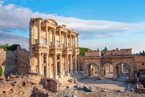
You’re almost certain to pass through Kars, the main city and transport hub, especially if you’re heading to Ani, justifiably the best-known complex and certainly up there with the best ruins in all Turkey. Once the Armenian capital, it now possesses an isolated, decaying grandeur carrying subtle echoes of former glories.
For 8-day Turkey trips that reach the far east, this route offers a powerful mix of borderland scenery, medieval architecture, and remote historic sites. Also in the area are the complexes of Karmir Vank and Horomos, though the latter is currently closed to tourists. Farther afield, the churches at both Khtskonk and Mren are accessible from the small town of Digor.
Ani
Once the capital of Bagratid Armenia, ANI is today a melancholy, almost vacant triangular plateau, divided from Armenia by the stunning Arpa Çayı (Ahuryan River) gorge and all but separated from the rest of Turkey by two deep tributaries.
While the site now consists of little more than an expanse of rubble, from it rise some of the finest examples of ecclesiastical and military architecture of its time. The Armenians were master stoneworkers, and the fortifications that defend the northern, exposed side of the plateau, and the handful of churches that lie behind, are exquisite compositions in a blend of ruddy sandstone and darker volcanic rock. Recent mining of the same materials has resulted in a few unsightly scars on the Armenian side of the border – which is surely the result of spite, given their positioning. However, the gently undulating landscape remains every bit as evocative as the ruins: it’s inconceivable to venture east of Erzurum or Artvin without fitting Ani into your plans.
Be sure you’re prepared for a trip to Ani. Midsummer is usually very hot, so you’re advised to bring a hat, sun cream and water to tour the site, as well as snacks. Note also that the site itself nudges up against the highly sensitive Armenian border, and whole areas remain out of bounds. The jandarma, who patrol the site continuously, will let you know which areas to avoid.
Ani’s vast tenth-century walls, studded with towers, are visible from afar, as you approach past villages teeming with sheep, buffalo, horses, donkeys and geese. Aslan Kapısı, site of the ticket office and named for a sculpted Selçuk lion on the wall just inside, is sole survivor of the four original gates. Once beyond the inner wall you’re confronted by the forlorn, weed-tufted plateau, dotted with only the sturdiest bits of masonry that have outlasted the ages.
Signposted paths, many of them remnants of Ani’s former streets, lead to or past all of the principal remains.
Brief history
Ani first came to prominence after the local installment of the Armenian Gamsarkan clan during the fifth century. Situated astride a major east–west caravan route, the city prospered, receiving fresh impetus when Ashot III, fifth in the line of the Bagratid kings of Armenia, transferred his capital here from Kars in 961. For three generations the kingdom and its capital enjoyed a golden age. Beautified and strengthened militarily, with a population exceeding one hundred thousand, Ani rivalled Baghdad and Constantinople themselves.
By the middle of the eleventh century, however, wars of succession took their toll. The Byzantine Empire annexed the city in 1045, but in the process dissolved an effective bulwark against the approaching Selçuks, who took Ani with little resistance in 1064. After the collapse of the Selçuks, the Armenians returned in less than a century. The Pahlavuni and Zakhariad clans ruled over a reduced but still semi-independent Armenia for two more centuries, continuing to endow Ani with churches and monasteries.
The Mongol raids of the thirteenth century, a devastating earthquake in 1319 and realigned trade routes proved mortal blows to both Ani and its hinterland; thereafter the city was gradually abandoned, and forgotten until noticed by European travellers of the nineteenth century.
The Armenian issue
The Turkish–Armenian border has been closed since 1993, when politicians in Ankara chose to side with their Turkic brethren in Azerbaijan over the conflict in Nagorno-Karabakh, a majority-Armenian area that lies in Azeri territory, and now forms a de facto independent state. Complicating matters were decades of ill feeling surrounding the fate of the Ottoman Empire’s ethnic Armenians in the years following World War I: a hugely contentious issue on both sides of the border. The events are viewed by Armenia – and most international historians – as the world’s first orchestrated genocide, a term that the Turkish government has repeatedly refused to accept.
Turkish Prime Minister Recep Erdoğan’s 2009 visit to Baku came during a political thaw, and at one stage the border seemed likely to reopen, but relations have since frosted over once again. The Kars–Yerevan rail line may one day reopen, but for now the fastest overland route from Turkey to Armenia is through Georgia, via the border crossing near Posof.
Cibiltepe ski resort
Surrounded by conifers, 55km west of Kars, Sarıkamış is the coldest town in Turkey. Thick seasonal snow supports the very good Cibiltepe ski resort, 3km back east towards the main highway. Facilities comprise just two chairlifts from 2150m up to 2700m, serving two advanced runs, two intermediate ones and one novice piste threading the trees.
Equipment rental is cheap at around TL35 per day – this, as well as the arrangement of lift passes and instruction, is cheapest at the lift offices rather than the resort’s few hotels.
Kars
Hidden in a natural basin on the banks of the Kars Çayı, KARS is an oddly attractive town, unusual in Turkey thanks to a few incongruous terraces of Russian belle époque buildings. Although a couple of hundred metres lower than Erzurum, the climate is even more severe; winters are fierce, while when it rains, which it often does, the outskirts become a treacherous swamp. Most visitors have made the long trek out here for the sole purpose of visiting the former Armenian capital of Ani, but a few sights are certainly worth dallying for, and the city makes a pleasant place in which to break up a tour of the northeast with a few days’ rest. It has also found fame as the setting for the novel Snow, by Nobel Prize winner Orhan Pamuk.
Kars was once one of Turkey’s ugliest cities, but things are improving. The central streets are clean, and have been repaved with cobbles or bricks, though watch out for some near-invisible steps on the pavements. The best area to stroll around, Ordu Caddesi, is lined with some fantastic Russian architecture, while the winding road to the citadel above town is dotted with appealing pre-Ottoman structures.
Brief history
Kars was originally founded by the Armenians, who knew it as Kari. It became the capital of their Bagratid dynasty early in the tenth century, when the citadel that still dominates the town was substantially improved. Later that century, the main seat of Armenian rule was transferred to nearby Ani, and Kars lost importance. The Selçuks took it along with almost everything else in the area during the mid-eleventh century, but devastating Mongol raids made a mockery of the new overlords’ plans. In 1205 the Georgians, profiting from the waning of both Selçuk and Byzantine power, seized the town and held it for three centuries until displaced by the Ottomans.
The Russians tried repeatedly during the nineteenth century to capture what they saw as the key to Anatolia. Sieges in 1828 and 1855 – the latter during the Crimean War, when a British and Turkish garrison was starved out of the citadel after five months – were successful, but on both occasions Kars reverted to the Ottomans by terms of peace treaties. Not so in 1878, when, after a bloody eight-month war between the two powers, the city was finally awarded to the Tsar. It only returned to Turkish rule following the Treaty of Kars in 1920. In the immediate aftermath of World War II the Soviet Union made unsuccessful attempts to overturn the treaty and reclaim the city.
Hunting the belle époque in Kars
Kars’ period under Russian rule, between 1878 and 1920, explains both the unusual grid layout of the city centre, and its incongruous belle époque buildings. Most of these structures were made from basalt and sport elaborate street facades and iron roofs; rainwater is often channelled onto the ground with decorative (often animal-shaped) spouts.
The best place in which to hunt for these architectural treasures is the stretch of Ordu Caddesi north of Faikbey Caddesi, which is studded with several superb examples. Approaching from the north, the first building you’ll come across is the old Governor’s Mansion, a large, lemon-coloured structure built in 1883; this is where the Treaty of Kars was signed in 1921. Just southeast, the squat Chamber of Industry and Commerce sports decorative motifs on its front walls. Further south again is the peach-coloured Revenue Office, a large structure with false columns and some wonderfully elaborate balconies – you certainly wouldn’t want to take tea on any of these, they all look set to drop off any second.