Diyarbakır
Superbly positioned on a bluff above a great loop in the Tigris, the old city of DİYARBAKIR shelters behind massive medieval walls of black basalt, enclosing a maze of cobbled streets and alleys. Many of its finest mosques and churches have been restored, and renovation work is in progress on many more. There’s plenty of decent accommodation right in the heart of the walled city, plus enough cafés and restaurants to keep the average visitor more than happy.
Diyarbakır struggled to cope with an influx of Kurdish refugees fleeing the state–PKK war in the 1990s, many of whom now occupy old houses in the very heart of the walled city. As a result, this is now the most proudly and most overtly Kurdish city in Turkey.
Be aware, however, that Diyarbakır still has a definite “edge”. Violent street demonstrations break out from time to time, while other potential hazards include bag-snatchers, pickpockets and the odd stone-throwing youngster. Indeed an old Arab saying runs “Black the walls, black the dogs, and black the hearts in black Diyarbakır”. That said, avoid the backstreets around and after dusk, and you’ll have no problem – the vast majority of the population are justly proud of their fascinating city, and very welcoming to visitors.
Brief history
Diyarbakır dates back at least five thousand years, to the Hurrian period. Later subject to successive periods of Urartian, Assyrian and Persian hegemony, it fell to Alexander the Great and his successors, the Seleucids, in the late fourth century BC.
The Romans, who knew Diyarbakır as Amida, appeared on the scene in 115 AD. Over the next few centuries they and their successors, the Byzantines, struggled violently over the town with the Sassanid Persians. It was the Romans who built the first substantial walls around the city in 297 AD, though those visible today are the result of Byzantine and Arab rebuilds. The threatening basalt bulwarks gave the place its popular ancient name – Amid the Black – which is still used in the Kurdish language. The modern name comes from the Arabs: in 638 the Bakr tribe of Arabs arrived and renamed the city Diyar Bakr, or “Place of the Bakr”. With the decline of Arab influence, Diyarbakır became a Selçuk, then an Artukid, and finally an Ottoman stronghold.
The city’s position on the banks of the fertile Tigris encouraged fruit growing, particularly watermelons which are still cultivated here. In the old days they are said to have weighed 100kg, and had to be transported by camel and sliced with a sword.
Gaziantep
Rapidly expanding Gaziantep is one of southeastern Turkey’s most prosperous cities, with a long-standing reputation for textile production, agriculture, and, above all, pistachios.
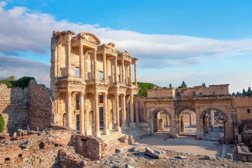
Tourism is also an important part of the city’s appeal. Many of Gaziantep’s handsome pale-stone historic buildings, especially its hans and mosques, have been restored and made accessible to visitors, with helpful explanatory displays in English. The Zeugma Mosaic Museum, whose collection rivals the best in the world, is simply stunning; it alone would make a trip here worthwhile.
For 7-day Turkey trips that venture into the southeast, Gaziantep offers a compelling mix of history, architecture, food culture, and world-class archaeology.
Gaziantep has been successively occupied by the Hittites, Assyrians, Persians, Hellenistic Greeks, Romans, Selçuks, Crusaders, Byzantines and Arabs. Locals still call it “Antep”, a corruption of the Arab ayn teb (“good spring”); the prefix “Gazi” (“warrior for Islam”) was added to honour the Turkish Nationalist forces who withstood a ten-month siege by the French in 1920. For centuries Gaziantep held a mixed Muslim and Christian Armenian population. The Armenians were expelled during the vicissitudes of World War 1, but their attractive old quarter remains on a hill above the prominent Atatürk statue in front of the Adliye (court) building. The traditional Muslim bazaar quarter, centred on the castle, lies a short walk northeast of the Atatürk statue.
Zeugma Mosaic Museum
The superb new Zeugma Mosaic Museum, slightly inconveniently located on the ring road north of the city centre, exhibits a superb collection of mosaics rescued from the once-luxurious Hellenistic/Roman border city of Zeugma, now virtually submerged by the Birecik dam on the Euphrates.
On the ground floor, where visitors enter, arrows direct you along the best route around an incredible array of mosaic floor panels, taken from the houses of wealthy citizens at Zeugma. Particularly impressive are the re-creations of Roman peristyle villas, complete with their original mosaic flooring and wall frescoes. The mosaics themselves, most of which portray scenes from Classical Greek mythology, including Perseus and Andromeda, Eros and Psyche, and Pasiphae and Daedelus, are well labelled in English.
Below ground level, a section is devoted to the bathhouse of a gymnasium complex, including mosaics, water pipes, toilets and the under-floor heating system – and a magnificent bronze statue of the god of war, Mars. The first floor holds yet more wonderful mosaics, including a superb scene of Zeus kidnapping Europa. The mosaic panel that has become a symbol of today’s city, the enigmatic face of a young female known as the “Gypsy Girl”, gets a darkened room all to itself.
The free, 15-minute video on the history of Zeugma that’s shown at regular intervals, to the left of the entry turnstiles, is well worth catching.
Harran
The beehive-style houses of HARRAN (Altınbaşak), 45km southeast of Urfa, are an established tourist attraction. The village has grown up within the crumbling remnants of the old, 4km circumference walls of a settlement once much more important than Urfa. Harran has strong biblical links, too: according to Genesis 11:31 and 12:4, the patriarch Abraham dwelt here before moving onto Canaan.
These days, Arabs and a few Kurds live amid the ruins of old Harran, surviving by farming the newly irrigated fields and smuggling goods across the Syrian border, 10km south. The stone-built, mud-covered beehive-shaped buildings owe their distinctive shape to the fact that no wood is used as support. Virtually all are now used for storage or animal – not human – habitation.
Harran’s enigmatic ruins exude tragic grandeur, dwarfing the beehive dwellings of the ethnically Arab villagers. Near the jandarma, an artificial tumulus marks the site of the original settlement. Excavations currently under way here, by a team from Ankara University, have revealed the remains of an Umayyad palace. North of the mound, and most impressive of the ruins, is the Ulu Cami, the first mosque ever built on what is now Turkish soil. Its substantial square minaret, originally built in the eighth century, was mistaken for a cathedral belfry by T. E. Lawrence when he passed through in 1909. The layout of the mosque, much rebuilt under the Ayyubid dynasty in the twelfth century, can be made out clearly, though only fragments of its structure survive relatively intact.
The eleventh-century citadel, in the southeast corner of the old walled city, is possibly built on the site of the ancient temple of the moon god Sin. Three of its four polygonal towers have survived reasonably well, but take care scrambling around as there are several holes in the upper part of the structure.
Brief history
Harran is thought to have been continuously inhabited for at least six thousand years. It became a prosperous trading town under the Assyrians, who turned it into a centre for the worship of Sin, god of the moon; there was a large temple here, later also used by the Sabians. Planet worshippers, they stand accused in some accounts of holding lurid orgies and carrying out human sacrifice, and with the arrival of the Arabs were given the choice of conversion to Islam or death. In 53 BC the Roman general Crassus was defeated here, crucified and had molten gold poured into his mouth by the Parthians. Despite this, the Romans later converted Harran into an important centre of learning, a role it continued to play under the Byzantines, then the Arabs, first under the Umayyad dynasty, then the Ayyubid. However, the arrival of the Mongols during the thirteenth century meant devastation.
Hasankeyf
The spectacular ruined settlement of HASANKEYF, an hour’s dolmuş ride north of Midyat, is one of Turkey’s most evocative historic sites. Poised on the very lip of a sheer cliff, carved from the mountainside by the swift-flowing waters of the Tigris, stands a remarkable series of remains of Selçuk, Arabic and Kurdish origin. Below the ruins, the Tigris is spanned by the arches of a vintage 1950s concrete bridge, itself overlooking the mighty piers of its medieval precursor. It’s a photographer’s dream, especially at sunset and sunrise, while a meal at one of the many simple fish restaurants lining the bank beneath the cliff is unforgettable.
While many of the four-thousand-plus caves in the surrounding hills were inhabited in prehistoric times, the original settlement was founded by the Romans as an eastern bastion of the empire, and later became the Byzantine bishopric of Cephe. In 640 AD, the conquering Arabs changed the town’s name to Hisn Kayfa. During the twelfth century the Artukid Turcoman tribe decided to make Hasankeyf their capital, which it remained until the Mongols arrived in 1260. Hasankeyf then served as the stronghold of the Ayyubids, a clan of Kurdish chieftains supplanted by the Ottomans early in the fifteenth century.
The modern town of Hasankeyf is strung out either side of the road leading to the concrete bridge across the river. To reach the site, head to the southern end of the modern bridge, then turn left. The 1km road is lined by rows of souvenir stalls, selling everything from tasteful, locally woven goat-hair blankets to garish wall-hangings. Its initial section, fronting the river, holds simple restaurants – some with platforms out in the water at the foot of the cliff.
The first sight of note is the El Rizk Camii, built under the Ayyubids in 1409 AD, which has a beautiful minaret decorated with kufic inscriptions and tear-drop patterns, and is topped by a stork’s nest. It also holds useful toilets.
The ticket booth, beyond the mosque, marks the start of the ascent to the cliff-top ruins. Climbing the time-polished stone pathway is demanding in the heat of the day. The path cuts back from the cliff edge and weaves up to the Ulu Camii, an evocatively ruined, partially restored Ayyubid mosque, built in 1305, which holds a long, narrow prayer hall, finely carved mihrab and truncated minaret. Scattered all around are the remains of abandoned houses, exposed cisterns (take care), and Muslim cemeteries and mausoleums. Below it, the twelfth-century building conjectured to be the palace of the Artukid kings is perched right on the cliff edge above the Tigris. At the time of writing, it was under excavation and off-limits.
Head back down the cobbled steps to the cliff top, now guarded by a rail, next to the so-called Kücük Sarayı or ‘‘Small Palace”, which is off-limits for safety reasons. The grill to the left guards the entrance to the stepped tunnel, which once gave secret access to the river below but has now been deemed unsafe. Look right to see the four massive pillars of the old Artukid bridge, once the largest in Anatolia. Its central span is thought to have been constructed from wood.
From the cliff top, you can also see the conspicuous fifteenth-century Zeyn El-Abdin Türbesi, a beautiful, onion-domed cylindrical building clad in glazed turquoise tiles and red brick, across the river to the left (northwest). To explore, head back down to the modern bridge, cross it and walk west for ten or fifteen minutes either along the main road or the river banks. Constructed in 1475, it was made for Zeynel Bey, the son of an Akkoyunlu sultan, Uzun (Tall) Hasan. Recent excavations around the tomb have revealed an extensive complex of buildings including a couple of medreses (theological schools).