Aragonese cuisine
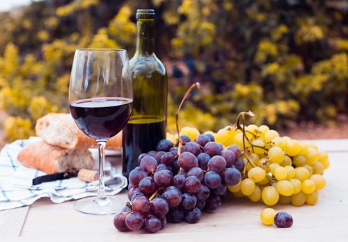
Aragonese cuisine in many ways reflects the region: rugged, hearty, traditional. In a word: meat. Popular dishes include roast lamb (ternasco, derived from the word tierno, or tender); plump coils of pork sausages, such as longaniza; and, of course, ham, particularly from Teruel, whose dry but cold winds create an ideal climate for curing. The region is also known for its stews, such as chilindrón, which gets its name from the heavy pot in which it’s cooked. Multiple varieties exist – the traditional version is a fragrant mix of bell peppers, chicken and cured ham. Migas (“breadcrumbs”), based on day-old bread cooked with garlic, peppers and other ingredients, is a popular dish throughout central Spain; the Aragón recipe calls for sausage and grapes. As for fish, fresh river trout from the Pyrenees often appears on menus, while sweets include the region’s famous frutas de Aragón: candied fruits covered in chocolate. Aragón also has several wine-growing regions, including Somontano, Campo de Borja, Cariñena and Calatayud.
Benasque and around
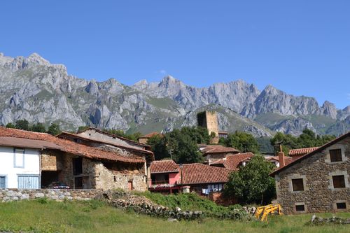
East of Bielsa lies the small town of Benasque, spectacularly set in the spacious green Ésera valley and ringed by rocky mountains. Much of the surrounding area is protected as the Parque Natural Posets-Maladeta, and numerous trails snake through the valleys and up the mountains. A lively crossroads, the town of Benasque itself is hardly untouched – it’s often crammed with adventure-seeking tourists in high season – but this also means that it has plenty of outdoor sports services and tours, mountaineer-friendly accommodation and decently priced restaurants where you can refuel over robust meals.
Benasque is especially popular with avid climbers and trekkers who wish to ascend the Pyrenees’ highest peaks, Aneto (3404m) and Posets (3371m). To do this you’ll need all the proper equipment: crampons, ice-axe, rope and a helmet to guard against falling rocks. If you’re less experienced, your best bet is to go on a trek with one of the many operators in town. Either way, the tourist office is well equipped with maps and can update you on weather and trail conditions. As for snow sports, there’s a popular ski hub in the area at Cerler.
Hikes around Benasque
Benasque falls more or less in the middle of the trans-Pyrenean GR11 trail, making the town a popular resting spot for hikers, whether for one or more nights. One of the best ways of exploring the surrounding wilderness is to use the many refuges dotted around Benasque as your base.
One of the more popular treks is northwest of Benasque, along the Estós valley to the Refugio de Estós, a three-hour trek. You can then continue over the Puerto de Gistaín to the Refugio de Viadós, which takes another 5 hours. Viadós is a base for treks up Posets, but again, this is a serious undertaking, and you’ll need all the proper equipment to do this climb.
An alternative to this route (though best if you’re in tip-top shape, because it can be challenging) is northwest up the Eriste valley, 4km southwest of Benasque, and then over the Collado de Eriste before descending to Viadós. Along this route, you can stop at the Refugio Ángel Órus.
North of Benasque lies the lush Upper Esera valley and massive Maladeta massif. A small hub is La Besurta, about 16km northeast of Benasque (and linked by buses in summer), which has parking and a small hut/bar with food and supplies (summer only) and is a gateway to hikes in the area. A good base is Hotel-Spa Hospital de Benasque, about 3km before you reach La Besurta. In the summer, buses connect Benasque to La Besurta (€11 round trip) and also to Valle de Vallibierna and the Refugio Pescadores, 11km northwest of Benasque.
Parque Nacional de Ordesa y Monte Perdido
The best of Aragón’s natural wonders all seem to converge with climactic glory in the Parque Nacional de Ordesa y Monte Perdido. Presiding over the park’s greenery is the Monte Perdido (Lost Mountain) range, the largest limestone chain in Western Europe. Verdant valleys blanketed in beech, fir and pine cut through the terrain, and clear blue streams and gushing waterfalls keep the fields fertile. After the snow melts, honeysuckle, primroses and irises bloom in rocky crevices and on sun-speckled slopes. As for wildlife, the park is teeming with it: Egyptian vultures and golden eagles soar overhead; Pyrenean chamois scamper up hillsides; and trout dart through ice-cold streams.
Many of the deep valleys were created by massive glaciers, at the heads of which are cirques: basins shaped roughly like an amphitheatre with steep walls of rock. Elsewhere, tiny alpine villages, with stone houses crowned with sandstone-tile roofs and conical chimneys, dot the mountainsides and make for pleasant stops along the many routes that meander through the park. The park is divided roughly into three main sections: Ordesa (to the west), Añisclo (to the south) and Escuaín (to the east). The chief town of Torla, 3km south of the park’s southwest border, is one of the more popular gateways, from where trails lead into the park.
Hikes in the park
The park offers a wide range of hikes, from half-day ambles to multi-day treks, all of which take you past natural wonders, including crashing waterfalls, gaping canyons and bright-green valleys. You can access the park on foot from Torla on the well-marked GR15 path from town, which eventually links up with the GR11, a right fork of which goes to Pradera de Ordesa, entrance to the Cañón de Ordesa and the starting point for most of the popular hikes further into the park. The whole trek from Torla to Pradera takes about two hours.
Circo de Soaso
The Circo de Soaso trek is one of the park’s main crowd-pleasers – and for good reason. It offers a lovely overview of the park’s natural highlights – gorgeous greenery, tumbling waterfalls – but is not too challenging, and it can be completed in a day. From Pradera de Ordesa the route leads through forest, followed by a steep climb up the Senda de los Cazadores (Hunters’ Path), which then flattens out as the Faja de Pelay path to the beautiful Cola de Caballo (Horsetail Waterfall). The journey takes about three to four hours (around 6–7hr roundtrip).
Circo de Cotatuero
This trek also has a lovely waterfall as a reward, and takes you along the northern crest of the impressive Valle de Ordesa. The full round-trip hike takes about 5 to 6 hours. Park officials warn that the hike should only be done in the summer or early autumn; in the winter and spring, there is the risk of avalanches. From Pradera de Ordesa, the hike starts steeply and eventually leads to a lookout point below the thundering Cascada de Cotatuero (for an onward route from the Cascada, see Brecha de Rolando). To return from the Cascada, head downhill and then continue on the Cotatuero circo back to the Pradera de Ordesa.
Refugio Góriz and Monte Perdido
From Pradera de Ordesa, trek along the GR11 to Circo de Soaso (about 3hr) and then up to the Refugio Góriz (2169m), the traditional jumping-off point to climb Monte Perdido (3355m). The trek up Monte Perdido (about 5hr) requires intermediate mountaineering skills, crampons and other professional equipment.
Brecha de Rolando and Refuge des Sarradets
If you have a head for heights, try this memorable onward route from the Cascada de Cotatuero: from the waterfalls, on the Cotatuero cirque, you can climb, via a series of iron pegs in a wall, the Clavijas de Cotatuero. Note that you don’t need any special climbing equipment but you should be fit and have the aforementioned affinity for heights. Once you’ve done the climb, it’s about a two- to three-hour trek to the Brecha de Rolando, a large natural gap in the Cirque de Gavarnie on the French border. From the Brecha, it’s then a steep climb (about 500m) to the Refuge des Sarradets (2587m;), across the border in France.
Parc National des Pyrénées and Gavarnie village
The northern section of the park is adjacent to France’s Parc National des Pyrénées, which in total runs for about 100km along the Spain–France border. The French side offers more of the same wild Pyrenean landscape, and a popular trek with hikers is to cross northwest into the French park and on to the pretty village of Gavarnie. Many will do this hike over the course of a couple of days. From Torla, hike along the GR15.2 to Puente de los Navarros and then continue on the GR11 to San Nicolás de Bujaruelo (roughly 7km from Torla), which is marked by a medieval bridge. Here you’ll find the Refugio Valle de Bujaruelo. From the San Nicolás bridge, you can trek over mountains and into France and Garvarnie – about a six- to eight-hour hike.
Jaca
The busy industrial town of Jaca is one of the main crossroads and transport hubs of northern Aragón, and first impressions are not great. Venture into the city centre, however, and you’ll find a bevy of sights that powerfully evoke the town’s long history, including a magnificent cathedral. Extending south of the cathedral is Jaca’s casco antiguo (old town), which includes atmospheric little plazas and streets, and the fifteenth-century Torre de Reloj.
Jaca was founded by the Romans and then conquered by the Moors in the early eighth century. Later in the century, it was won back by the Christians in a victory that’s celebrated annually on the first Friday in May. In an interesting twist, the Moorish armies were driven back thanks to an immense – and brave – effort by the town’s women, and the festival includes a parade that pays homage to these brave Jaca ladies. In the eleventh century, Jaca became the first capital of the Aragón kingdom, though by the end of the century the power had shifted to Huesca.
Jaca makes for a good jumping-off point for outdoor adventure in the Pyrenees, including skiing at Astún and Candanchu, just 30km away. During the Festival Folklórico de los Pirineos (wjaca.es/festival), held in early August every odd-numbered year, people stream in from all over the Pyrenees to show off their cultural traditions with religious dances, performances and food. Also in August, over a two-week period, is the annual Festival Internacional en el Camino de Santiago (wfestivalcaminosantiago.com), featuring religious and classical music concerts at different venues, including the famous cathedral, as well as a medieval market in the city centre.
Hit the slopes in Aragón
Skiing in the Aragon Pyrenees matches that of Catalunya and, increasingly, of France. Overall, the ski resorts are well maintained and cater to all levels, from downhill daredevils to wobbly first-timers. Note that, as in the Catalan Pyrenees, some of the best discounts are via pre-trip package deals offered by hotels, agencies or the resorts themselves. But even if you don’t book a package ahead of time, you can often find on-site deals once you’ve arrived, offered by the turismos as well as the hotels and the resorts.
In the west are Candanchú (wcandanchu.com), with a well-known ski school, and Astún (wastun.com), which lies just 4km away, and has a wide range of pistes, including plenty for beginners. The main hub for accommodation and the like is Jaca. Partly funded by the Aragón government, the Aramón group (waramon.com) now manages a group of formerly independently run ski resorts. Of these, Formigal is one of the larger, with 93 runs and 21 lifts, and caters to all levels. Panticosa is smaller but also less crowded, as daily numbers are limited to 3500 people per day. In the Pyrenees’ easternmost section, sleek Cerler attracts seasoned skiers, with several ski centres totalling about 52km, altitudes up to 2630m, 61 runs and 18 lifts. Cerler also offers equipment rental and ski and snowboard schools. Benasque is a popular hub for Cerler, with a decent array of accommodation.
San Juan de la Peña
The Monasterio de San Juan de la Peña, set amid protected natural parkland 21km south of Jaca, is one of the most stunning sacred buildings in Aragón, if not in Spain. Tucked protectively under the overhang of a massive boulder, it’s built right into a rocky mountain: from certain angles, it’s hard to tell where man-made structure ends and nature begins. Dating from the ninth century, the monastery is named after a hermit who lived in solitude atop the towering cliff (peña). The monastery features a Romanesque church with twelfth-century murals and the Gothic San Victorián chapel, but the real standout is the elegant twelfth-century cloister, shaded by the bulging rock face that looms over it. The cloister has ornate capitals, some fully ringed by saints and apostles, depicting different scenes from the Bible.
In 1675, a fire in the monastery forced the monks to leave and build a newer one, which sits further up the hill. The Monasterio Nuevo (same hours as old monastery) features a helpful visitors’ centre and two interpretation centres, which chronicle the history of the monastery and the eventful lives of the Aragón’s kings and queens.
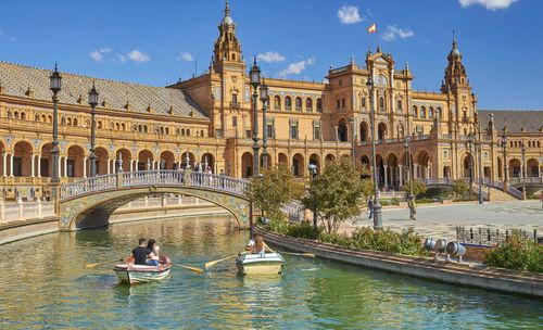
Zaragoza, Teruel and Southern Aragón
The city of Zaragoza houses nearly half of Aragón’s 1.5 million population, and most of its industry. It’s a big but enjoyable place, with a lively zone of bars and restaurants tucked in among remarkable monuments, and it’s a handy transport nexus, too, for both Aragón and beyond. Its province includes the Mudéjar towns of Tarazona, Calatayud and Daroca, and, along the border with Navarra, the old Cinco Villas, a series of lovely mountain villages, of which the most interesting is Sos del Rey Católico. Wine enthusiasts can also follow the Ruta de los Vinos, south from Zaragoza through Cariñena to Daroca.
Teruel province is a lot more remote, and even the capital doesn’t see too many passing visitors. It is unjustly neglected, considering its superb Mudéjar monuments, and if you have transport of your own, there are some wonderful rural routes to explore: especially west, through Albarracín to Cuenca, or south to Valencia. The valleys and villages of the Sierra de Gúdar and El Maestrazgo, which borders Valencia province, are the most remote of the lot: a region largely untouched by tourism, and where transport of your own is a big help.
Book tickets and tours for Zaragoza
Tarazona and around
The Aragonese plains are dotted with reminders of the Moorish occupation, and nowhere more so than at TARAZONA, a wonderfully atmospheric old town loaded with Mudéjar architecture. If you’re en route to Soria or Burgos, it’s an ideal place to break the journey. Don’t miss out, either, on the tranquil Cistercian monastery of Veruela, 15km southeast.
Tarazona’s most absorbing sights lie in the old upper town, incorporating the Judería and Morería (Jewish and Moorish quarters, respectively), which stands on a hill overlooking the river, with medieval houses and mansions lining the callejas and pasadizos – the lanes and alleyways.
If you’re around for the fiesta on August 27, watch out for “El Cipotegato”, a luckless character dressed in jester-like red, green and yellow stripy pyjamas who runs through the streets while everyone pelts him with tomatoes. He kicks off the town’s annual week-long festivities, during which there are street parties, live music and bullfights.
Calatayud
Like Tarazona, Calatayud is a town of Moorish foundation with some stunning Mudéjar towers. It’s worth climbing up to the old upper town where, amid a maze of alleys, stand the church of San Andrés (generally closed; enquire at turismo) and Colegiata de Santa María (closed for renovations) both of which have ornate Mudéjar towers. Santa María, the collegiate church, also has a beautifully decorative Plateresque doorway, while towards the river, at c/Valentín Gómez 3, San Juan el Real (daily 10am–1pm & 4–8pm; free) features paintings attributed to the young Goya. The ruins of a Moorish castle (open access; free) survive on high ground at the opposite end of town from the train station. The views from here are lovely, and you can walk around the evocative ruins and parts of the city wall.
Sierra de Gúdar
The mountains of the Sierra de Gúdar and nearby El Maestrazgo, to the east and northeast of Teruel, are an area of great variety and striking, often wild, beauty, with severe peaks, deep gorges and lush meadows. One hundred years ago, this now impoverished region had four times the number of inhabitants it does today. Defeated in their attempts to make a living from agriculture, many left to seek their fortunes in the cities, leaving behind the crumbling remains of once grand, honey-hued farmhouses that dot the landscape and stone-walled terraces etched into the steep-sided hills.
A landscape of sharp, rocky crags, Sierra de Gúdar is easy to access by following the N234 southeast from Teruel and then heading northeast into the mountains along the A232. This will bring you to the lovely medieval villages of Mora de Rubielos, 42km from Teruel, and its even lovelier twin, Rubielos de Mora. Head north from here for Linares de Mora and Mosqueruela, also charming and remote mountain villages.
Albarracín
ALBARRACÍN, 37km west of Teruel, is one of the more accessible targets in rural southern Aragón – and also one of the most picturesque towns in the province, poised above the Río Guadalaviar and retaining, virtually intact, its medieval streets and tall, balconied houses. There’s a historical curiosity here, too, in that from 1165 to 1333, the town formed the centre of a small independent state, the kingdom of the Azagras.
Despite its growing appeal as a tourist destination, Albarracín’s dark, enclosed lanes and ancient buildings adorned with splendid coats of arms still make for an intriguing wander – reminders of past eras. Approaching from Teruel, you may imagine that you’re about to come upon a large town, for the medieval walls swoop back over the hillside – protecting, with the loop of the river, a far greater area than the extent of the town, past or present.
Teruel
The provincial capital of TERUEL offers an appealing glimpse into this rugged and sparsely populated wedge of Aragón. Because it’s often overlooked, the region came up with the playful slogan “Teruel existe” (“Teruel exists”). If you’re looking for remote, you’re in the right region, with its back-of-beyond villages and medieval sights that haven’t been prettified. The land, too, is high and harsh, with the coldest winters in the country.
Teruel the town is a likeable and impressively monumental place, with some of the finest Mudéjar work in Spain. Like Zaragoza, it was an important Moorish city and retained significant Muslim and Jewish communities after its Reconquest by Alfonso II in 1171. As you approach town, the Mudéjar towers, built by Moorish craftsmen over three centuries, are immediately apparent, and – like the fabulous Mudéjar ceiling in the cathedral – should not be missed.
The centro histórico, on a hill above the Río Turia, has Plaza del Torico at its heart, and is enclosed by a few remains of fortified walls, with a viaduct linking it to the modern quarter to the south. Leading off to the north is a sixteenth-century aqueduct, Los Arcos, a slender and elegant piece of monumental engineering.
Southern Maestrazgo
Unfolding northeast of Teruel, the Maestrazgo is dry, windswept, rugged terrain dominated (and named after) the Maestrazgo mountain range. In keeping with the rest of the region, the Maestrazgo is sparsely populated and often seems stuck in time, particularly if you wander the quiet, cobbled streets of its ancient mountain villages. Approaching the region from Teruel, you pass nearby Cedrillas with its conspicuous, ridge-top castle ruin. From here the road starts climbing into the hills, scaling high mountain passes and affording tantalizing views of the valleys. The first village of any size is Cantavieja, which makes a useful base for exploring – or walking in – the region, while to the southeast lies the fairly well-preserved La Iglesuela del Cid.
The Cinco Villas
North of Zaragoza, the Cinco Villas stretch for some 90km along the border with Navarra and comprise Tauste, Ejea de los Caballeros, Sádaba, Uncastillo and Sos del Rey Católico, all set in delightful, scarcely visited countryside. The title of Cinco Villas is owed to Felipe V, who awarded it for their services in the War of the Spanish Succession (1701–14). For those en route to the Pyrenees (the road past Sos continues to Roncal in Navarra) or to Pamplona, the Cinco Villas make a pleasant stopoff. Sos, the most interesting of the five, attracts the majority of visitors.
If you're planning a trip to Spain, don't miss our Spain itineraries and information on how to get there.