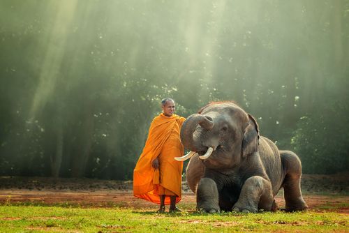
Xieng Khuang and the Plain of Jars
Xieng Khuang province lies at the crossroads of important trade routes leading north to China, south to Thailand and east to Vietnam, and has been coveted throughout the centuries by rival Southeast Asian empires. Xieng Khuang, hemmed in by a ring of dramatic mountains, including the country’s tallest peak, Phu Bia, is best known for the treeless flatlands and crater-ridden landscape of the Plain of Jars. A plateau of grassy meadows and low rolling hills situated at the centre of the province, the Plain takes its name from the clusters of chest-high funerary urns found there. For people with a very deep interest in archeology and Southeast Asian history the jars are worth the journey to Xieng Khuang, but for some tourists they are something of an anticlimax. However, their other-worldliness, against the flat barren landscape of the area, retains a certain mystique, and by choosing your guide wisely it’s possible to get a lot more out of a visit here.
As the flattest area in northern Laos, the Plain of Jars is also a natural gathering point for armies – a fact not lost on military commanders of the early kingdoms of Lane Xang, Vietnam and Siam and later the Soviet Union, France and America, the Viet Minh, the Pathet Lao and the Lao Royalists. Fought over dearly in the Second Indochina War, the region was bombed extensively between 1964 and 1973, transforming the Plain into a wasteland, which leaves a lasting impression on those who fly over it into Phonsavan.
With much of the literature of the province’s historical Phuan kingdom destroyed and many of the customs lost, Hmong culture and festivals have come to play an important role in Xieng Khuang life. Boun Phao Hmong, or the Festival of the Hmong, celebrated throughout the province in November, draws overseas Hmong back each year for an event featuring water buffalo and bull-fights. In December, Hmong New Year, a time for young Hmong to find a husband or wife, is celebrated, as is the lowland Lao festival of Boun Haw Khao, a two-day holiday in which food is offered to the dead. It has a distinctly Xieng Khuang flavour, however, with the addition of horse races, horses being especially prized by villagers who work Xieng Khuang’s far-flung fields.
Some history
Even the legends surrounding the jars reveal how thoroughly life in Xieng Khuang has been overshadowed by war, with local lore telling of how the jars were created to hold rice wine by an army of giants to celebrate a military victory. Although the identity of the civilization that built the jars remains a mystery, local folk tales telling of the arrival of the Phuan people, the lowland Lao group that still dominates the ethnic make-up of the area today, date back as far as the seventh century, when the divine Tai–Lao first ancestor Khoun Borom sent his seventh and youngest son, Chet Chuong, to rule over the Tai peoples of Xieng Khuang. Although the time frame for this version of events may be a bit premature, Xieng Khuang was nonetheless one of the earlier areas settled by Tai peoples in Laos, and by the fourteenth century, an independent Phuan principality, known as Xieng Khuang and centred on modern-day Muang Khoun, had already begun to flourish here.
While the Kingdom of Xieng Khuang had the wealth to build exquisite pagodas, it never amassed the might necessary to become a regional power. Sandwiched between the great empires lying to its east and west, Phuan kings maintained a semblance of independence over the years by offering tribute to Vietnam and Lane Xang and eventually Siam. Whatever price the royal house paid, however, it was not enough to keep Xieng Khuang from being repeatedly annexed, overrun and forcibly depopulated, beginning with the invading armies of the Vietnamese on their way back from sacking Luang Prabang in the late 1470s through to the Second Indochina War, when nearly every village in the province was obliterated.
In 1869, warrior horsemen from southern China raced across the plain, slaughtering villagers or carrying them off into captivity. These Black Flag bandits pillaged the riches of the kingdom and plundered the contents of the jars. Those that fled didn’t get far: Lao and Thai soldiers on their way to Xieng Khuang to quell the invasion rounded up the refugees and frogmarched them through the jungle to the Chao Phraya River Valley in Siam, where they became slaves to Thai lords. The tortuous march lasted over a month, with many dying along the way, lost to sickness and starvation. In two generations, Siamese armies and Chinese bandits reduced the population by three-quarters through death and forced migration. The Phuan state never recovered.
Xieng Khuang enjoyed better protection from its neighbours with the arrival of the French, who considered the province’s temperate climate – which can be downright cold by any measure for several months of the year – suitable for European settlement and plantation agriculture. The primary cash crop, however, was opium, a trade the French quickly moved to control. Muang Khoun was chosen as the French provincial capital and the devastated former royal seat of the defunct kingdom was transformed into an architectural gem of French Indochinese villas and shophouses, which might have rivalled the charm of Luang Prabang and Savannakhet had Xieng Khuang not returned to its familiar role as battleground a few decades later.
One hundred years after the carnage of the Chinese bandits, American planes wreaked destruction that was equally indiscriminate, levelling towns and forcing villagers to take to the forest, as the two sides in the Second Indochina War waged a bitter battle for control of the Plain of Jars, which represented a back door to northern Vietnam. Throughout much of the 1960s, Xieng Khuang was the site of a seesaw war, with the Royalist side led by Hmong General Vang Pao gaining the upper hand in the rainy season and the communist side launching offensives in the dry months.
Today, villages have been rebuilt and fields replanted. Many of the valley-dwelling, wet-rice farmers, as well as a majority of the townsfolk in Phonsavan, are descendants of the Phuan kingdom. In addition to the Lao, the Phuan are joined by a third lowland group, the Black Tai, and also the Khmu – a Lao Theung group who ruled the lowlands until they were forced into the hills with the arrival of the Tai groups over a thousand years ago – and a significant population of Hmong, who arrived in Laos from China in the nineteenth century and now make up roughly a third of the provincial population.
The Plain of Jars
Many visitors mistake the Jar sites for the PLAIN OF JARS and vice versa. The latter is a broad rolling plain covering an area roughly 15km across at the centre of the Xieng Khuang Plateau, which sits high above the Mekong and the Vientiane Plain. The ancient Jar sites scattered around the perimeter of the plain led the French to name the region the Plain de Jars – the PDJ to the American pilots who flew over it. Topographically, the plain is something like the hole in a doughnut with concentric rings of increasingly high mountain peaks around it. Although the jars are the main tourist attraction of Xieng Khuang Province, there’s much more to see here. The Plain itself offers beautiful scenery, which most visitors, obsessed with seeing the jars, completely overlook. Away from the main highway there are countless backroads to explore as well as friendly Phuan and Hmong villages, where it may feel like you’re the first foreigner the children have seen.
The presence of the jars attests to the fact that Xieng Khuang, with its access to key regional trade routes, its wide, flat spaces and temperate climate, has been considered prime real estate in mainland Southeast Asia for centuries, but the story of the plain as a transit route for ancient man has yet to be told. As a natural corridor between the coasts of southern China and the vast plains of Korat beyond the Mekong, the Plain of Jars has certainly seen the passage of many tribes and races, perhaps even groups of Homo erectus, who ranged from northern China to Java between one million and 250,000 years ago.
The Jar sites
The Jar sites are among the most important prehistoric archeological sites in Southeast Asia. Clusters of stone jars thought to be 2000 years old, along with seemingly older stone pillars, are scattered across the Plain and also in other parts of Xieng Khuang and Hua Phan province. The largest urns measure 2m in height and weigh as much as ten tonnes. Little is known about the Iron Age megalithic civilization that created these artefacts; war and revolution kept archeologists from working on the sites for decades. By the time French archeologist Madeleine Colani began excavating at the Jar sites in the 1930s, most of the urns had been looted, although she did find bronze and iron tools as well as coloured glass beads, bronze bracelets and cowrie shells. Colani theorized that the jars were funerary urns, originally holding cremated remains. More recent discoveries have revealed underground burial chambers, further supporting Colani’s theory.
Of the dozens of Jar sites, twelve are currently open to tourists, though the three main sites are those most commonly visited on tours. The closest one, known as Site 1, just 2km southwest of town, has over two hundred jars. Sites 2 and 3 are much more scenic and are located about 10km southwest of the market village of Lat Houang, which is 10km south of Phonsavan, on the road to Muang Khoun.
Safety in Xieng Khuang
Occasional attacks by mountain bandits or insurgents have given Xieng Khuang province an uncertain reputation. In particular, tourists have long been discouraged from travelling along Route 7 between Phou Khoun and Phonsavan due to attacks on vehicles by armed bandits – these days, the threat appears to be less, and with limited flights into Phonsavan it’s likely that you will travel this route in order to reach the area. In 2003, two foreign nationals were killed as a result of banditry on this stretch, but it’s important to remember that hundreds of tourists visit the area each month without incident. Of more immediate danger are the mines, bomblets and bombs littering the province. The main Jar sites have been cleared of Unexploded Ordnance (UXO), but it’s important to stick to the paths, and not to pick up or kick any object if you don’t know what it is.
Hua Phan province
Sparsely populated Hua Phan province is a sea of misty mountains, dotted with isolated bowl-like valleys. The country’s northeasternmost province, it’s also one of the most spectacularly beautiful provinces in all of Laos, with some of the north’s highest mountains, a large number of diverse ethnic groups, extensive forest cover and one of Laos’s largest NBCAs. There are also enough caves, waterfalls and limestone karst scenery to give Vang Vieng hoteliers sleepless nights: you only need to drive the road in from Nam Neun to realize what amazing tourist potential Hua Phan has. The problem of course is infrastructure – though roads are now greatly improved, there are still very few of them, and unless they’re travelling through to or from Vietnam, very few travellers make the effort to see the area.
The difficult terrain and the province’s proximity to Vietnam made Hua Phan the perfect headquarters for the Pathet Lao, who operated out of the caves that honeycomb the karst formations in Vieng Xai for the better part of their Thirty Year Struggle. Along with Phongsali, Hua Phan was set aside as a regroupment area for the communist forces under the Geneva Agreements of 1954. While the province formed the backbone of the Pathet Lao’s liberated zone, not all of Hua Phan was under communist control: for years, the 1786m mountain peak of Phou Pha Thi was crowned by a “blind bombing” device to guide air raids on Hanoi.
The real muscle behind the Pathet Lao during the war, Vietnam, retains much political and economic control over Hua Phan, and a steady flow of Vietnamese goods, electricity, merchants and construction workers arrives in the Lao province via three border points – one of which is open to foreign travellers. Travelling beyond Sam Neua town is a more attractive option than it used to be now that the Na Meo border crossing gives overland access to Thanh Hoa province in Vietnam. Regular buses from Sam Neua travel up to the border, though you’ll need to already have a Vietnamese visa in order to make the crossing.
Hua Phan is predominantly populated by various Tai groups – Red, Black, Neua and White – and, in the towns, migrants from Vietnam and China. With more than twenty ethnic groups in the mix, it’s perhaps not surprising that even residents from neighbouring Xieng Khuang complain about the difficulty of understanding Hua Phan dialect. During the centuries before French rule, the area was part of a Black Tai principality, known as the Sipsong Chao Tai, which spanned the present-day Lao–Vietnamese border. The principality fell under the sway of the lowland Lao kingdoms of Luang Prabang, Xieng Khuang and Vientiane and under the control of the greater powers that in turn controlled them – Siam and Vietnam. Stone pillars (known as Suan Hin), located several kilometres off Route 6 near Houa Muang, suggest that the area was a hub of some forgotten culture long before Tai–Lao and Vietnamese rulers squabbled over this region.
Vieng Xai
Arriving in VIENG XAI (“City of Victory”), you wouldn’t know the Pathet Lao and their communist allies in Vietnam had won the Second Indochina War. Sprawled across a valley surrounded by the cave-riddled karst formations used by the Pathet Lao as their wartime headquarters, Vieng Xai was cobbled together by comrades from Russia, North Korea and Vietnam as well as labourers from Hua Phan’s notorious re-education camps. In 1973, at the end of the war, there were plans to make Vieng Xai the heart of the newly socialist nation, but in the end Laos’s socialist friends could not be convinced to foot the bill to turn a backwater into a gleaming new capital, and so the Pathet Lao leadership decamped to Vientiane. With time, Vieng Xai couldn’t even compete with nearby Sam Neua as a provincial hub. People moved out and many buildings fell into a state of crumbling decay. These days, the town has a slow, dusty charm, complemented by its stunning backdrop of limestone karsts.
Very few travellers stay in Vieng Xai, most preferring to do the caves as a day-trip from Sam Neua, which has much better food and accommodation. However, for those who can afford the time, the scenic countryside and ambience around Vieng Xai reward further exploration, evoking Guilin in China. In fact, if you want to know what Vang Vieng was like before it was overrun with trippy backpackers, Vieng Xai is the place for you.
Re-education camps
The first group of prisoners to be transported to re-education camps – the Pathet Lao’s means of neutralizing its wartime enemies – arrived by invitation in full military dress months before the communist takeover in December 1975. After receiving letters signed by Prince Souvannaphouma, seventy high-ranking Royal Lao Army officers and provincial governors came to what they thought would be an important meeting and were whisked off to the Plain of Jars, where they were fêted with a banquet and a movie. Any hope of a uniquely Lao solution to the Second Indochina War ended there, as these officials were shortly thereafter flown off to Hua Phan, where they were stripped of their rank and separated into small work parties. In the following months, thousands of civil servants and army officers voluntarily entered the re-education centres in Hua Phan, Attapeu and Phongsali after being assured the “seminars” would last only a few weeks. With their opponents safely out of the way in the most remote corners of the country, or having opted already to flee to Thailand, the Pathet Lao moved ahead with the final stage of their bloodless takeover virtually unopposed.
Joined later by thousands more who arrived somewhat less willingly, the internees were turned loose in the fenceless camps, which were heavily guarded and hemmed in by the extreme geographical features of the Lao wilderness, and left to forage for food and build their own shelters out of bamboo. Each morning, a bell was rung at 5am and the prisoners were assigned a job for the day – cutting wood in the jungles, building roads, working in the fields. In the evenings, self-criticism and political indoctrination sessions were held. Although there was no physical torture, mindless rules were established in order to control the captives, who were never allowed to settle into one place. The cumulative effect of the “re-education”, according to a former Royal Lao Army officer, who spent thirteen years in a Hua Phan camp, was a sort of “brainwashing”. Life in the camps was hard – the officer is certain that he only made it because of a Green Beret survival course he attended in the United States – and many ran off or died of malaria.
Drug addicts, prostitutes and other “anti-social” elements were also rounded up and shuttled off to Ang Nam Ngum near Vang Vieng, where an estimated three thousand people were placed on “Boy Island” and “Girl Island”. In 1977, the royal family too was arrested and banished to Camp 01 at Sop Hao, in Hua Phan, where the king and crown prince reportedly died of starvation two weeks apart in May 1978. The queen is said to have died in 1981, and, like her husband and son before her, was buried in an unmarked grave outside the camp. The only government acknowledgement of their deaths came a decade later, when Party Secretary General Kaysone mentioned in an aside during a visit to Paris that the king had died of old age.
There are no official figures for the number of people who were interned in the camps, but estimates based on reports by former inmates and their families suggest that at the height of the camps, in 1978–79, the number of internees may have been as high as fifty thousand. Whatever willingness supporters of the Royalist regime had to work with the new government quickly evaporated when it became clear that those interned in the camps weren’t coming home anytime soon. Confronted with the prospect of being sent off for re-education, more than three hundred thousand people, nearly a tenth of Laos’s population, fled the country.
The first group of prisoners, low-ranking members of the former regime, was released in 1980, and despite finally being deemed fit to live in socialist Laos, many took the first chance they got to cross the Mekong. As the 1980s wore on, more and more prisoners were gradually released under pressure from Western nations and Amnesty, which reported that in 1985 seven thousand people remained in the camps, a number which had dwindled to 33 by March 1991. The camps may now be empty, but the current number of political prisoners in Laos is not known, and Amnesty International has described Laos as “a country which has a zero-tolerance policy towards dissent in any form”.