Uttarakhand Travel Guide
Book your individual trip, stress-free with local travel experts
Northeast of Delhi, bordering Nepal and Tibet, the mountains of the Garhwal and Kumaon regions rise from the fertile sub-Himalayan plains. Together they form the state of Uttarakhand, which (as Uttaranchal) was shorn free from lowland Uttar Pradesh in 2000 after years of agitation. The region has its own distinct languages and cultures, and successive deep river valleys shelter fascinating micro-civilizations, where Hinduism and Buddhism meet animism. The snow peaks here rank among the most beautiful mountains of the inner Himalayas, forming an almost continuous chain that culminates in Nanda Devi, the highest mountain in India at 7816m.
Garhwal is the more visited region, busy with pilgrims who flock to its holy spots. At Haridwar, the Ganges thunders out from the foothills on its long journey to the sea. The nearby ashram town of Rishikesh is familiar from one of the classic East-meets-West images of the 1960s; it was where the Beatles came to stay with the Maharishi. From here pilgrims set off for the high temples of Char Dham – Badrinath, Kedarnath, Yamunotri and Gangotri, the source of the Ganges. Earthier pursuits are on offer at Mussoorie, a British hill station and now a popular Indian resort. The less-visited Kumaon region remains largely unspoilt, and boasts pleasant small towns with panoramic mountain views, among them Kausani, Ranikhet, and the tiny hamlet of Kasar Devi, as well as the Victorian hill station of Nainital, where a lakeside promenade throngs with visitors escaping the heat of the plains. Further down, the forests at Corbett Tiger Reserve offer the chance to go tiger-spotting atop an elephant. Both districts abound in classic treks, many leading through bugyals – summer pastures, where rivers are born and paths meet.
The first known inhabitants of Garhwal and Kumaon were the Kuninda in the second century BC. A Himalayan tribal people practising an early form of Shaivism, they traded salt with Tibet and shared connections with contemporaneous Indo-Greek civilization. As evidenced by a second-century Ashokan edict at Kalsi in western Garhwal, Buddhism made some inroads in the region, but Garhwal and Kumaon remained Brahmanical. The Kuninda eventually succumbed to the Guptas around the fourth century AD, who, despite controlling much of the north Indian plains, failed to make a lasting impact here. Between the seventh and fourteenth centuries, the Shaivite Katyuri dominated lands around the modern-day Baijnath valley in Kumaon, where their stone temples still stand. As Brahmanical culture flourished, Jageshwar emerged as a major pilgrimage centre. In following centuries, Kumaon prospered further under the Chandras, who took learning and art to new levels, while Garhwal fell under the Panwar rajas. In 1803, the westward expansion of the Nepali Gurkhas engulfed both regions, but their brief rule ended with the Sugauli Treaty of 1816, resulting in annexation of both regions by the British.
Following Independence, Garhwal and Kumaon became part of Uttar Pradesh, but failure by the administration in Lucknow to develop the region led to increasingly violent calls for a separate state. The sympathetic high-caste BJP took up the separatist cause after coming to power in 1998, leading to the creation of a new state, originally called Uttaranchal, in 2000, and later reverting to its historical name, Uttarakhand, meaning “northern country”, in 2007. The process of creating the new state was somewhat acrimonious, and deep cultural differences continue to characterize Garhwal and Kumaon.
On the environmental front, deforestation in the hills has led to a rapid loss of arable land, while global warming continues to shrink glaciers at an alarming rate. In June 2013, unprecedented rainfall caused devastating floods and landslides across north India, claiming thousands of lives and hitting Uttarakhand hardest of all. The tragedy, compounded by unscientific development – haphazard road-building, unregulated hotel construction on fragile river banks and the establishment of more than seventy hydroelectric projects in the state’s watersheds – was regarded by environmentalists as a disaster waiting to happen.
Uttarakhand is good to visit all year round except the peak winter and monsoon periods, especially in the upper tracts. During monsoons (July/August), heavy rains bring landslides, causing long transport delays, while snowfall in winter may lead to roadblocks. Summertime is pleasant, especially in the hills, though hill stations like Mussoorie and Nainital can get crowded in May/June.
Annual festival organized by Parmarth Niketan Ashram in Rishikesh, with yoga classes, mantras, kirtans, plus lifestyle and healing programmes alongside cultural events.
In the hill tracts of Kumaon, Holi is a musical affair and takes various forms. At Baithki Holi, celebrations kick off in temple premises with traditional folk songs sung to a classical accompaniment. There’s more singing at Khari Holi, celebrated mainly in rural areas. Mahila Holi is a women-only gathering.
The unique stone-pelting festival is celebrated at the Varahi Devi temple at Devidhura, just south of Nainital. Amid folk songs and dances, two groups (khams) throw stones at each other while protecting themselves with large wooden shields. The priest stops the ritual when it is ascertained that enough blood has been shed (equivalent to one man) to appease the goddess.
A day devoted to worshipping the sacred Ganges, with devotees marking the occasion with a dip in the river and aarti. Hand-made Dussehra posters adorn the doors of temples and homes in Rishikesh, Haridwar and other towns along the river.
Dedicated to Uttarakhand’s patron goddess, with an annual jaat (procession) and melas held in towns and villages with Nanda Devi shrines across Garhwal and Kumaon, including Almora, Nainital and Ranikhet.
Capital of Uttarakhand, Dehradun, 255km north of Delhi, is pleasantly located at just below 700m, as the Himalayan foothills begin their dramatic rise, so it never gets too hot in summer, and snows rarely appear in winter. It stands at the centre of the 120km-long Doon Valley, hemmed in by the Yamuna to the west and the Ganges at Rishikesh to the east.
A popular retirement spot renowned for its elite institutions, the town dates its origins to 1676, when Guru Ram Rai, eldest son of the seventh Sikh Guru Har Rai ji, set up a dera (camp) in this tract of the dun or doon (valley). It was later occupied by Mughals and Gurkhas, but it’s British influence that is most apparent. More recently, driven by its status as state capital, increasing local and government investment has led to a commercial and IT boom in the city, with much of the surrounding agricultural land swallowed up for development – Dehradun’s legendary high-quality basmati rice is fast becoming a rarity. The accompanying noise and traffic problems are most intense around the markets near the tall Victorian clock tower, and along Gandhi and Rajpur roads.
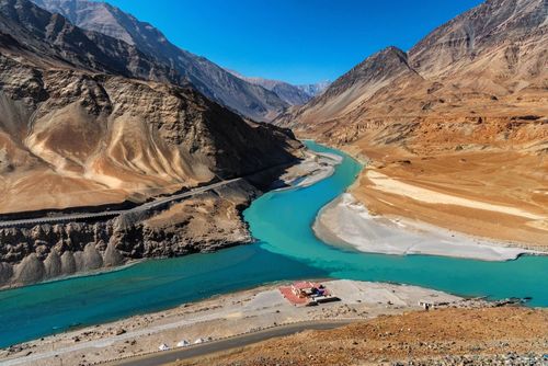
As the sacred land that holds the sources of the mighty Ganges and Yamuna rivers, Garhwal has been the heartland of Hindu identity since the ninth century when, in the wake of the decline of Buddhism in northern India, the reformer Adi Shankara incorporated many of the mountains’ ancient shrines into the fold of Hinduism. He founded the four main yatra (pilgrimage) temples, deep within the Himalayas, known as the Char Dham – Badrinath, Kedarnath, Gangotri and Yamunotri. 
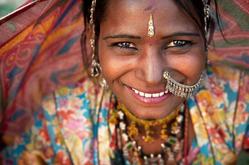
Each year, between May and November, once the snows have melted, streams of pilgrims penetrate high into the mountains, passing by way of Haridwar and Rishikesh, the land of yogis and ashrams.
For more than a millennium, the yatris (pilgrims) came on foot. However, the annual event has been transformed in the last few years; roads blasted by the military through the mountains during the war against China in the early 1960s are now the lifelines for a new form of motorized yatra. Eastern Garhwal in particular is getting rich, and the fabric of hill society is changing rapidly – visitors hoping to experience the old Garhwal should spend at least part of their time well away from the principal yatra routes. 
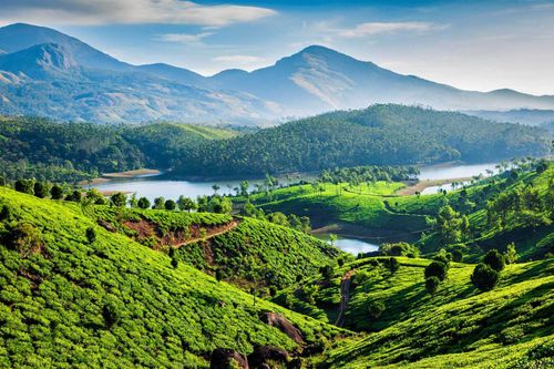
In addition to their spiritual significance, the hills have become a hub for adventure sports, offering all levels of trekking, whitewater rafting, paragliding, skiing and climbing.
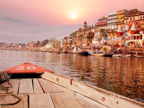
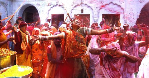
Spreading for 15km along a high serrated ridge, Mussoorie is the closest hill station to Delhi, just 278km north of the capital and 34km north of Dehradun, from where it is visible on a clear day. At an altitude of 2000m, it gives travellers from the plains their first glimpse of the snow-covered Himalayan peaks of western Garhwal, as well as dramatic views of the Doon valley below.
A favoured retreat since the 1820s, Mussoorie is a highly popular weekend retreat for middle-class Indians up from the plains, with many of its Raj-era homes converted into heritage hotels. Most foreign visitors come to Mussoorie to study Hindi at the excellent Landour Language School, but the town also makes a handy base for treks into western Garhwal. Dominated by the long Bandarpunch Massif (6316m), with Swargarohini (6252m) in the west and the Gangotri group in the east, Mussoorie’s mountain panorama forms a pleasant backdrop to the busy holiday town.
Mussoorie centres on the 2km pedestrian-only Mall, bookended by the town’s two most lively hubs: Library Bazaar (also called Gandhi Chowk) to the west and Kulri Bazaar (or Picture Palace) to the east.
The most popular of Mussoorie’s viewpoints, Gun Hill (2024m) rises like a volcano over central Mussoorie, offering superb Himalayan views when the weather is right. It can be ascended by a footpath forking up from the Mall, or by a 400m cable-car ride starting from the Ropeway station about halfway down the Mall.
Rounding the northern base of Gun Hill is the pleasant 4km promenade of Camel’s Back Road, a scenic northerly arch connecting Library and Kulri bazaars. Along the way are several worthy viewpoints, as well as the distinctive Camel’s Rock and an old British cemetery – the resting place of British adventurer “Pahari” Wilson (closed to visitors).
The 6km hike from Library Bazaar via Hathipaon hill to the former home and laboratory of Sir George Everest is rewarded with fantastic views of both the Himalayas and the Doon Valley. The whitewashed, abandoned house – The Park – was bought by the famous Welsh surveyor in 1833, and much of the work of the Great Trigonometric Survey of India, demarcating the boundaries of British India and measuring the height of the world’s greatest peaks, took place here.
The 300-acre Childer’s Lodge estate was established in the 1860s on the slopes of Lal Tibba (Red Hill), 5km east of the Mall above Landour. As the vicinity’s highest vantage point, it affords some of the best panoramic views of the Garhwal Himalayan range.
At Haridwar – the Gates (dwar) of God (Hari) – 214km northeast of Delhi, the River Ganges emerges from its final rapids past the Shivalik Hills to begin its long slow journey across northern India to the Bay of Bengal. Stretching for roughly 3km along a narrow strip of land between the craggy wooded hills to the west and the river to the east, Haridwar is revered by Hindus, for whom the Har-ki-Pauri ghat (literally the “Footstep of God”) marks the exact spot where the river leaves the mountains. As a road and rail junction, Haridwar links the Gangetic plains with the mountains of Uttarakhand and their holy pilgrimage (yatra) network. Along with Nasik, Ujjain and Allahabad, it is one of the four holy tirthas or “crossings” that host the massive Kumbh Mela festival. Every twelve years (next due in 2022), millions of pilgrims come to bathe at a preordained moment in the turbulent waters of the channelled river around Har-ki-Pairi.
The modern, eight-storey, 55m Bharat Mata temple, dedicated to “Mother India”, was inaugurated in 1983 by Indira Gandhi. Each of its various floors – connected by lifts – is dedicated to a celestial or political theme, and populated by lifelike images of heroes, heroines and Hindu deities.
Rajaji National Park, part of the same forest belt as Corbett Tiger Reserve, 180km east, spans around 830 square kilometres of the Himalayan foothills immediately east and west of Haridwar. Of the park’s eight entry points, the most useful are the main gates at Chilla, 9km east of Haridwar, and the gates at Kunnao, close to Rishikesh. Set beside the Ganges barrage and its massive electricity pylons, Chilla makes a relatively quiet base for explorations of the park. Meanwhile, Chilla Beach – occasionally used by large river turtles – lies within walking distance through the woods, 1km north along the Ganges.
Although largely surrounded by development and dotted with settlements of the Van Gujjars, a nomadic tribe whose summer homes have traditionally fallen within the park, for the time being Rajaji remains pristine and its wildlife resilient. Less developed than Corbett, it contains a similar range of fauna, most notably elephants, but also leopard and at least fourteen tigers at last count.
The largest town in the interior of Garhwal, picturesque Uttarkashi makes a convenient stopover to break up the road from Rishikesh (148km south) to Gangotri (100km northeast). Pilgrims often stop at the ancient Kashi Vishwanath temple in the heart of town, and discerning travellers are beginning to linger longer to hike the unspoiled trails of Garhwal’s interior or to gear up for longer treks such as to Dodi Tal.
Occupying the flat and fertile valley floor of the Bhagirathi, Uttarkashi is no stranger to natural disasters; the town was hit by severe floods in 1978, an earthquake in 1991, a massive landslide in 2003, and further floods in 2013. Efforts have since been made to secure the hillside against landslides, but the bridge to Gangotri had to be rebuilt after the 2013 floods.
One of Garhwal’s classic hikes, the Dodi Tal trek links the Gangotri and Yamunotri regions without straying into high glacial terrain. It’s relatively short and easy, but local villagers are keen to offer their services as porters or guides, taking hikers off the beaten track to visit the villages. Carry as much of your own food as possible and bring a tent.
From Uttarkashi, catch a morning bus (45min) or jeep heading to Sangam Chatti (1350m), from where it’s a 7km climb through fields and woodland to Agoda (2286m), where you can set up camp or head to the Tourist Bungalow at the far end of the village. On the second day, follow the trail from Agoda as it climbs west of the Asi Ganga and zigzags steadily upwards through lush pine and spruce forests, with a smattering of chai shops en route. After 14km and a final undulation, you will reach the lake of Dodi Tal (3024m), set against a backdrop of thickly forested hills and said to be the spot where Lord Ganesha was both born and beheaded. Near the basic forest bungalow in the clearing are chai shops and areas for camping.
On the third day you’ll make the 4km hike to Dharwa Top, following the well-marked path along (and often across) the stream that feeds Dodi Tal, which can get steep and entail scrambling, until you emerge above the tree line. A further 2km along, the trail heads left to a small pass, then zigzags up scree to Dharwa Top (4130m), the highest point of the trek, offering superb panoramas of the Srikanta Range. A leftward path beyond the top leads to camping and water, but if you’ve still got sufficient energy and daylight, you can continue along the main route, which takes about four more hours and 13km to rejoin the tree line at Sima, where there’s basic hut accommodation.
The following day’s beautiful 12km trail from Sima kicks off with a steep 1.5km scramble alongside a stream before easing past forest and bugyal (alpine meadow). A well-defined rocky path drops steadily through two villages and zigzags down to the Hanuman Ganga, finally emerging at Hanuman Chatti, from where buses and jeeps connect with Barkot, Uttarkashi, Mussoorie and other points in Garhwal. The Dodi Tal trek can easily be tied in with hikes in the Har-ki-Dun and Yamunotri areas.
Cradled in a deep cleft in the lap of Bandarpunch, and thus denied mountain vistas, the temple of Yamunotri (3291m), 223km northeast of Rishikesh, marks the source of the Yamuna, India’s second holiest river after the Ganges. The least dramatic but most beautiful of the four dhams (temples) of Garhwal, it’s also the least spoiled and commercial. Access (mid-April to early Nov; exact dates vary annually) has become easier following road improvements; from the roadhead at Janki Chatti it’s a mere 5km along a trail that follows the turbulent ice-blue river as it runs below rocky crags, with snowy peaks in the distance. The walk can also be combined with the Dodi Tal trek linking nearby Hanuman Chatti to Uttarkashi.
Built around three piping-hot sulphur springs by the river, Yamunotri’s temple is new and architecturally uninteresting; it has to be completely rebuilt every few years due to the impact of heavy winter snows and monsoon rains. Its main shrine – actually part of the top spring, worshipped as the source of the river – holds a small silver image of the goddess Yamuna, bedecked with garlands. The daughter of Surya, the sun, and Sangya, consciousness, Yamuna is the twin sister of Yama, the lord of death; all who bathe in her waters are spared a painful end, while food cooked in the water is considered to be prasad (divine offering). Most pilgrims bathe in the hot spring (free), which has separate pools for men and women.
Set amid tall deodar and pine forests at the head of the Bhagirathi gorge, 248km north of Rishikesh at 3140m, Gangotri is the most remote of Garhwal’s Char Dham and the last place to stock up on supplies before heading up to the high altitudes. The jeep drive from Uttarkashi is breathtaking – in more ways than one – as it winds high above the Bhagirathi and crosses one the world’s highest bridges, over the gorge near Lanka. Although the wide Alaknanda, which flows past Badrinath, may have a better technical claim to be the main channel of the Ganges, Gangotri is for Hindus the spiritual source of the great river, while its physical source is the ice cave of Gaumukh on the Gangotri Glacier, 14km further up the valley. From here, the River Bhagirathi begins its tempestuous descent through a series of mighty gorges, carving great channels and cauldrons in the rock and foaming in whitewater pools.
A flight of steps beside the Gangotri temple begins the 20km trek to Gaumukh Glacier, one of the most beautiful and accessible glaciers in the inner Himalayas.
Leaving Gangotri, the trail rises gently above the north bank of the river, offering increasingly spectacular mountain vistas. Just 2km along at Kankhu is the forest checkpoint, where permits are inspected. About 7km further is the oasis of Chirbasa, where the skyline becomes dominated by magnificent buttresses and glass-like walls, culminating in the sharp pinnacles of Bhagirathi 3 (6454m) and Bhagirathi 1 (6856m). The path then climbs above the tree line, passing across a steep rocky area prone to landslides. Just around the bend, beyond a stream crossing, 5km from Chirbasa, is the cold grey hamlet of Bhojbasa, cowering in the shadows of the surrounding peaks. Most visitors spend a night here before the final push to the glacier.
From Bhojbasa, it’s a further 4km up the giant boulder-strewn path to reach Gaumukh (“the cow’s mouth”), bringing into view the beautiful Shivling Peak (6543m), the “Indian Matterhorn”, and providing a closer look at the Bhagirathi peaks and the huge expanse of the Gangotri Glacier – 23km long, up to 4km wide and sweeping like a gigantic highway through the heart of the mountains. At the source, the river emerges with great force from a cavern in the glacier. The steadily retreating ice is in a constant state of flux, so the huge greyish-blue snout of the glacier continually changes appearance as chunks of ice tumble into the gushing water. Visitors are advised to keep 500m back from the glacier’s mouth: many pilgrims have been crushed to death by falling ice while attempting to collect holy water. It’s well worth braving the cold to reach Gaumukh for sunrise, though it’s also rewarding in the afternoon, when the source is lit by the sun. From the glacier, most hikers return to Gangotri via Bhojbasa, while others may continue beyond the glacier to the meadow of Tapovan (6km) or further afield to the lake at Vasuki Tal.
It’s hard to imagine a more dramatic setting for a temple than Kedarnath (3583m), 223km northeast of Rishikesh, which sits close to the source of the Mandakini overlooked by tumbling glaciers and giant buttresses of ice, snow and rock. The third of the sacred Char Dham sites, Kedarnath is among the most important shrines in the Himalayas and as one of India’s twelve jyotirlinga – lingams of light – attracts hordes of Hindu pilgrims (yatri) in the summer months. The area makes a refreshing change from the rocky and desolate valleys of west Garhwal, with lush hanging gorges, terraced hillsides and abundant apple orchards. Reachable via a new 15km trail from Gaurikund, Kedarnath is also a good base for short treks to the beautiful lake of Vasuki Tal.
In June 2013, however, Kedarnath was the epicentre of one of the worst Himalayan disasters in India. At the peak of the tourist season, continuous rain for five days and a cloudburst above the peak of Kedar Dome ruptured the Chorabari Glacier, 4km north, causing the Mandakini River to flood its banks. The ensuing flashflood wreaked havoc at Kedarnath and downstream as far as Rishikesh, with debris washing away hotels and other buildings, many illegally built on fragile riverbanks. According to official figures, over 5700 people died, though the actual toll of this “Himalayan tsunami” is much higher. With large chunks of the trail disappearing off the mountainside and the midway point at Rambara completely devastated, new trekking routes and a new tented camp for pilgrims were created, as Kedarnath slowly hobbles back to normality.
With the original six-hour trail to Kedarnath from Gaurikund via Rambara and Garur Chatti washed away in the 2013 floods, a new 15km route from Gaurikund has been developed by the Indian army and members of the Nehru Institute of Mountaineering (NIM). The new trail heads up via Jangal Chatti (4km away), Chhoti Linchuli and Badi Linchuli, crossing the Mandakini River before reaching the south face of Kedarnath peak (6940m) at the end of the valley. An alternative, more circuitous route starts from Sonprayag, 5km short of Gaurikund, heading up via Gomkara, Dev Vishnu and Dhumgajgiri.
Beginning near the main bridge just before town, a paved pathway crosses the Mandakini to the left of the valley and ends 4km north at the Chorabari Glacier (1–2hr) At its edge lies Chorabari Tal, a lake also known as Gandhi Sarovar as some of the Mahatma’s ashes were scattered here. The source of the Mandakini lies around 800m before the lake, emerging from a hole in the moraine on extremely suspect ground. An alternative route to the lake begins from the small bridge just behind the temple, across which the main track may be reached after a scramble up the rough boulder-strewn moraine.
Another walk is to the ancient shrine of Bhairava, visible from Kedarnath’s main temple and just under 1km to the east of town. It is connected by another well-marked path running diagonally along the hillside, and surrounded with fluttering prayer flags. A cliff known as Bhairava Jhamp rises nearby, said to be where fanatical pilgrims used to leap to their deaths in hopes of instant liberation – until the British banned the practice in the nineteenth century.
A longer, more difficult path (consider hiring a guide in Kedarnath) leads from near the GMVN Tourist Bungalow to Vakuki Tal (4135m), 9km away (4–5hr). Set in a desolate high mountain valley surrounded by the snow-clad Chaukhamba peaks, the little lake is crystal clear.
The scattered administrative town of Joshimath clings to the side of a deep valley 250km northeast of Rishikesh, with tantalizing glimpses of the snow-capped peaks high above and the prospect, far below, of the road disappearing into a sunless canyon at Vishnu Prayag, the confluence with the Dhauli Ganga. Few of the pilgrims who pass through en route to Badrinath linger, but Joshimath has close links with Adi Shankara, the ninth-century reformer who attained enlightenment here beneath a mulberry tree before going on to establish Jyotiramath, one of the four centres of Hinduism (dhams) at the four cardinal points. The town itself consists of a long drawn-out Upper Bazaar, and, around 1km from the main market, a Lower Bazaar that holds the colourful Narsingh, Navadurga, Vasudev and Gauri Shankar temples. A 4km cable car links the town to the slopes of Auli, one of India’s better ski resorts, attracting visitors throughout the year for its views of the High Himalayas.
Badrinath, “Lord of the Berries”, just 40km from the Tibetan border, is the most popular of Garhwal’s four main pilgrimage temples, and one of Hinduism’s holiest sites. Founded by Shankara in the ninth century, it lies near the source of the Alaknanda, the main tributary of the holy Ganges. Badrinath’s setting is dazzling, deep in a valley beneath the sharp, snowy pyramid of Nilkantha (6596m), but the town itself, sprawled to the south and east beyond the temple, is largely grubby and unattractive.
Immediately south of the temple, on the west bank of the Alaknanda, is the old village of Badrinath, its traditional stone buildings and small market seeming like relics from a bygone age.
Starting from the mountain hamlet of Govind Ghat (1800m), 28km south of Badrinath, an important pilgrim trail winds 14km up a steep stone path to the overgrown village of Gangharia (3048m), also known as Ghovind Dham. This one-street town is a stopover point for hundreds of Sikh pilgrims en route to Hemkund, as well as for a small trickle of visitors to the Valley of Flowers. Overnight stays are prohibited at both sites.
From Ghangaria, it is a further 6km trek along a steep path to reach the snow-melt lake of Hemkund (4329m). In the Sikh holy book, the Guru Granth Sahib, Govind Singh recalled meditating at a lake surrounded by seven high mountains; only in the twentieth century was Hemkund discovered to be that lake. A large gurudwara and a small shrine to Lakshmana, the brother of Rama, now stand alongside.
An alternative trail forks left from just above Ghangaria, climbing 5km to the mountain bugyals of the Bhyundar Valley – the Valley of Flowers. Starting at an altitude of 3352m, the valley was discovered in 1931 by the visionary mountaineer Frank Smythe, who named it for its multitude of rare and beautiful flora. The meadows are at their best during the monsoon, from mid-July until mid-August. Due to the no-camping rule, it is unfortunately impossible to explore the 10km valley in its entirety in the space of a day’s hike from Ghangaria.
The small, peanut-shaped crater lake of Nainital, set in a mountain hollow at an altitude of 1938m, 277km north of Delhi, gives its name to the largest town in Kumaon. Discovered for Europeans in 1841 by Mr Barron, a wealthy sugar merchant, Nainital swiftly became a popular escape from the summer heat of the lowlands, and remains one of India’s top hill stations. Throughout the year, and especially between March and July, hordes of tourists and honeymooners pack the Mall, a 1.5km promenade of restaurants, hotels and souvenir shops that links Mallital (head of the lake), the older, colonial part of Nainital at the north end, with Tallital (foot of the lake).
Nainital’s position within striking range of the inner Himalayas – the peaks are visible from vantage points above town – makes it a good base for exploring Kumaon. When the town’s commercialism gets a bit much, it’s always possible to escape into the beautiful surrounding country, to lakes such as Sat Tal (23km away), where the foothills begin their sudden drop towards the plains to the south, or to the forested ridges around Kilbury (12km) and the old Shiva temple at Mukteshwar (51km), both of which offer stunning Himalayan vistas.
Based at Ramnagar 63km southwest of Nainital, Corbett Tiger Reserve is one of India’s premier wildlife reserves. Established in 1936 by Jim Corbett (among others) as the Hailey National Park, India’s first, and later renamed in his honour, it is one of Himalayan India’s last expanses of wilderness. Almost the entire 1288-square-kilometre park, spread over the foothills of Kumaon, is sheltered by a buffer zone of mixed deciduous and giant sal forests, which provide impenetrable cover for wildlife. The core area of 520 square kilometres at its heart remains out of bounds, and safaris on foot are only permissible in the fringe forests.
Corbett is famous for its big cats, in particular, the tiger – it was the first designated Project Tiger Reserve in 1973 – but its 215 or so tigers are elusive, and sightings are far from guaranteed. Nonetheless, the project has proven more successful in Uttarakhand (both in Corbett and the nearby Rajaji National Park) than in any of its other 48 reserves. While the very survival of the tiger in India remains in serious jeopardy, Corbett does seem to be prioritizing the needs of tigers over those of other wildlife and of tourists. Incidents of poaching, however, are not unheard of, though of late it’s Corbett’s leopards that have faced the most serious threat.
The reservoir within the park also shelters populations of gharial, a long-snouted, fish-eating crocodile, and maggar, a large marsh mugger crocodile, as well as other reptiles. Jackal are common, and wild boar often run through the camps in the evenings. The grasslands around Dhikala are home to deer species such as the spotted chital, hog and barking deer and the larger sambar, while rhesus and common langur, the two main classes of Indian monkey, are both abundant, and happy to provide in-camp entertainment. Corbett also has spectacular birdlife, with nearly five hundred resident and migratory species, including around fifty species of raptors or birds of prey, among them the crested serpent eagle and the Himalayan grey-headed fishing eagle. Late spring (April–June) is the best time to see wildlife, when low water levels force animals into the open. The park is divided into six “eco-tourism zones” open for day-visits, of which by far the best for sighting big game is picturesque Dhikala, deep into the park near the reservoir and where visitors can stay overnight. Bijrani, Sonanandi, Jhirna, Durgadevi and Dhela are the other five zones, the last opened to tourism only in 2014.
Hunter of man-eating tigers, photographer, conservationist and author, Jim Corbett was born in Nainital of English and Irish parentage. A childhood spent around the Corbett winter home just outside Kaladhungi (29km southeast of Ramnagar) instilled in young Jim a love for close communion with nature and an instinctive understanding of jungle ways.
Known locally as “Carpet Sahib”, a mispronunciation of his name, Jim Corbett was called upon time and time again to rid the hills of Kumaon of man-eating tigers and leopards. Normally shy of human contact, such animals become man-eaters when infirmity brought upon by old age or wounds renders them unable to hunt their usual prey. Many of those killed by Corbett were found to have suppurating wounds caused by porcupine quills embedded deep in their paws.
One of Corbett’s most memorable exploits was the killing of the Champawat tiger, which was responsible for a documented 436 human deaths, and was bold enough to steal its victims from the midst of human habitation. By the mid-1930s, though, Corbett had become dismayed with the increasing number of hunters in the Himalayas and the resultant decline in wildlife, and diverted his energies into conservation, swapping his gun for a movie camera and spending months capturing tigers on film. His adventures are described in books such as My India, Jungle Lore and Man-Eaters of Kumaon; Martin Booth’s Carpet Sahib is an excellent biography of a remarkable man. Unhappy in post-Independence India, Jim Corbett retired to East Africa, where he continued his conservation efforts until his death at the age of eighty.
For a further glimpse into Corbett’s life, head to his family’s former winter retreat near Kaladhungi, which has been turned into the Jim Corbett Museum.
The small and deliberately undeveloped hill station of Ranikhet (1824m), 50km west of Almora, is essentially an army cantonment, home to the Kumaon Rifles. New construction is confined to the Sadar Bazaar area, while the rest of the town above it, climbing towards the crest of the hill, retains its peacefully pleasant atmosphere in the shade of tall pine woods. Forest trails abound, including a shortcut from the bazaar to the Mall (something of a misnomer, as it’s a quiet road with few buildings apart from officers’ messes), which starts just above the town and continues south for 3km along the wooded crest of the ridge.
Spread out over a hilltop overlooking terraced fields, 67km north of Nainital, Almora (1646m) is Kumaon’s official and cultural capital. Founded by the Chand dynasty in 1560, and occupied successively by the Gurkhas and the British, it remains a major market town, and has attracted an eclectic assortment of visitors over the years, including Swami Vivekananda, Timothy Leary and the Tibetologist author of The Way of the White Clouds, Lama Angarika Govinda. While many foreign visitors prefer the nearby traveller colony of Kasar Devi, around 8km north, Almora makes a practical base for regional excursions.
Spread among the cedar and rhododendron forest below the unassuming hilltop temple of Kasar Devi (of Swami Vivekanda fame), 8km north of Almora, is the pleasant hamlet of Kasar Devi. Nicknamed “hippieland” by some of the locals, it plays host to a thriving long-term travellers’ scene.
Spread out east to west along a narrow pine-covered ridge 52km northwest of Almora, the village of Kausani has become a popular resort thanks to its spectacular Himalayan panorama. It’s a simple day-trip from Almora, though as the peaks – Nanda Choti, Trisul, Nanda Devi and Panchchuli – are at their best at dawn and dusk, it’s well worth an overnight stay. Up the hill from the town centre are several ashrams, including one that once housed Mahatma Gandhi, who walked here in 1929, thirty years before the road came through.
There are numerous possibilities for short day-hikes in the woods and terraced valleys around Kausani, among them the scenic hike to the Kausani Tea Estate (4km north), and the pleasant trail down the valley to the temples of Baijnath (10km). Further afield is the important pilgrimage site of Bageshwar and the trailhead for the Pindari Glacier, a few hours away in Song.
One of the most accessible glaciers in the Kumaon region, the Pindari Glacier stretches more than 3km in length and almost 500m in width. Passing through pristine high mountain country and a host of tiny Himalayan villages, the trail follows the Pindar River to its source, offering views along the way of the region’s giants, among them Nanda Kot (6861m), Panwali Dwar (6663m) and Maiktoli (6803m).
Beginning and ending in Song (1600m), the trail covers about 90km roundtrip and takes six days to complete, crossing over the Dhakuri Pass (2680m) and beyond the final settlement of Khati to reach Zero Point at the edge of the Pindari Glacier (3660m).
The whole route can be done teahouse style, as basic government lodges dot the trail. Camping equipment and sleeping bags are highly recommended. Near the glacier itself, you can stay with Swami Dharmanand or Babaji, whose NGO, Himalayan Villages Education And Development Program, pays the salaries of teachers at local schools threatened with closure. Guides and porters are easily arranged in Song, connected to Bageshwar by jeeps (1hr 30min) and buses (2hr). The Pindari Glacier has also caught the attention of mountain-bikers: two-wheel tours are run by Mountain Bike Kerala in April and October.
Top image: Chakratirth Valley of the Flower on a cloudy evening , en route satopanth Swargarohini trek, Uttarakhand, India © uttam panwar/Shutterstock