Discover more places in Greece
Planning your own trip? Prepare for your trip
Use Rough Guides' trusted partners for great rates
written by
Rough Guides Editors
The cultural riches and natural beauty of the Peloponnese can hardly be overstated. This southern peninsula – technically an island since the cutting of the Corinth Canal – seems to have the best of almost everything Greek. Ancient sites include the Homeric palaces of Agamemnon at Mycenae and of Nestor at Pýlos, the best preserved of all Greek theatres at Epidaurus, and the lush sanctuary of Olympia, host to the Olympic Games for a millennium. The medieval remains are scarcely less rich, with the fabulous Venetian, Frankish and Turkish castles of Náfplio, Methóni and ancient Corinth; the strange battle towers and frescoed churches of the Máni; and the extraordinarily well-preserved Byzantine enclaves of Mystra and Monemvasiá.
Beyond this incredible profusion and density of cultural monuments, the Peloponnese is also a superb place to relax and wander. Its beaches, especially along the west coast, are among the finest and least developed in the country, and the landscape inland is superb – dominated by forested mountains cut by some of the most captivating valleys and gorges to be imagined. Not for nothing did its heartland province of Arcadia become synonymous with the very concept of a Classical rural idyll.
The Peloponnese reveals its true character most clearly when you venture off the beaten track: to the old Arcadian hill towns like Karítena, Stemnítsa and Dhimitsána; the Máni tower villages such as Kítta or Váthia; at Voïdhokiliá and Elafónissos beaches in the south; or a trip through the Vouraikós Gorge, possibly on the old rack-and-pinion railway.
The region will amply repay any amount of time you spend. The Argolid, the area richest in ancient history, is just a couple of hours from Athens, and if pushed you could complete a circuit of the main sights here – Corinth, Mycenae and Epidaurus – in a couple of days, making your base by the sea in Náfplio. Given a week, you could add in the two large sites of Mystra and Olympia at a more leisurely pace. To get to grips with all this, however, plus the southern peninsulas of the Máni and Messinía, and the hill towns of Arcadia, you’ll need at least a couple of weeks.
If you were planning a combination of Peloponnese-plus-islands, then the Argo-Saronic or Ionian islands are most convenient. Of the Ionian islands, isolated Kýthira is covered in this section since closest access is from the southern Peloponnese ports.
Anciently known as the Moreas, from the resemblance of its outline to the leaf of a mulberry tree (mouriá), the Peloponnese was home to some of the most powerful rulers in ancient Greece. During the Mycenaean period (around 2000–1100 BC), the peninsula hosted the semi-legendary kingdoms of Agamemnon at Mycenae, Nestor at Pýlos and Menelaus at Sparta. In the Dorian and Classical eras, the region’s principal city-state was Sparta, which, with its allies, brought down Athens in the ruinous Peloponnesian War. Under Roman rule, Corinth was the capital of the southern Greek province.
From the decline of the Roman Empire to the Ottoman conquest, the Peloponnese pursued a more complex, individual course from the rest of Greece. A succession of occupations and conquests, with attendant outposts and castles, left an extraordinary legacy of medieval remains. It retained a nominally Roman civilization well after colonial rule had dissipated, with Corinth at the fore until it was destroyed by two major earthquakes in the fourth and sixth centuries.
The Byzantines established their courts, castles and towns from the ninth century onward; their control, however, was only partial. The Venetians dominated the coast, founding trading ports at Monemvasiá, Pýlos and Koróni, which endured, for the most part, into the fifteenth century. The Franks, fresh from the sacking of Constantinople in the Fourth Crusade, arrived in 1204 and swiftly conquered large tracts of the peninsula, dividing it into feudal baronies under a prince of the Moreas.
Towards the mid-thirteenth century, there was a remarkable Byzantine renaissance, which spread from the court at Mystra to reassert control over the peninsula. A last flicker of “Greek” rule, it was eventually extinguished by the Turkish conquest between 1458 and 1460, and was to lie dormant, save for sporadic rebellions in the perennially intransigent Máni, until the nineteenth-century Greek War of Independence.
The nineteenth and twentieth centuries
The Peloponnese played a major part in the revolt against the Turks, with local heroes Theodhoros Kolokotronis and Petros Mavromihalis becoming important military leaders. At Pýlos, the international but accidental naval battle at Navarino Bay in 1827 decided the war, and the first Greek parliament was convened at Náfplio. After independence, however, power swiftly drained away from the Peloponnese to Athens, where it was to stay. The peninsula became disaffected, highlighted by the assassination of Kapodhistrías, the first Greek president, by Maniots in Náfplio.
Throughout the nineteenth and early twentieth centuries, the region developed important ports at Pátra, Kórinthos and Kalamáta, but its interior reverted to backwater status, starting a population decline that has continued up to the present. It was little disturbed until World War II, during which the area saw some of the worst German atrocities; there was much brave resistance in the mountains, but also some of the most shameful collaboration. The subsequent civil war left many of the towns polarized and physically in ruins; in its wake there was substantial emigration from both towns and countryside, to North America and Australia in particular. Earthquakes still cause considerable disruption, as at Kórinthos in 1981, Kalamáta in 1986, and Éyio in 1995.
Today, the southern Peloponnese has a reputation for being one of the most traditional and politically conservative regions of Greece. The people are held in rather poor regard by other Greeks, though to outsiders they seem unfailingly hospitable.
The region that you enter to the south and southeast of Corinth was known as the Argolid (Argolídha in modern Greek), after the city of Árgos, which held sway here in Classical times. The greatest concentration of ancient sites in Greece is found in this compact peninsula, its western boundary delineated by the main road south from Kórinthos. Within less than an hour’s drive of each other are Agamemnon’s fortress at Mycenae, the great theatre of Epidaurus, and lesser sites at Tiryns and Árgos.
In peak season you may want to see the sites early or late in the day to realize their magic. When ruin-hopping palls, there are the resort-town pleasures of elegant Náfplio, and a handful of beach resorts.
Tucked into a fold of the hills just east of the road from Kórinthos to Árgos, Agamemnon’s citadel at MYCENAE (Mykínes) fits the legend better than any other place in Greece. It was uncovered in 1874 by the German archeologist Heinrich Schliemann (who also excavated the site of Troy), impelled by his single-minded belief that there was a factual basis to Homer’s epics. Schliemann’s finds of brilliantly crafted gold and sophisticated tomb architecture bore out the accuracy of Homer’s epithets of “well-built Mycenae, rich in gold”. And with the accompaniment of the sound of bells drifting down from goats grazing on the hillsides, a stroll around the ramparts is still evocative of earlier times.
The Mycenae-Árgos region is one of the longest occupied in Greece, with evidence of Neolithic settlements from around 3000 BC. But it is to the period from around 1550 to 1200 BC that the citadel of Mycenae and its associated drama belong. This period is known as Mycenaean, a term that covers not just the Mycenae region but a whole Bronze Age civilization that flourished in southern Greece at the time, referred to in Homer’s epics.
The archeological remains of Mycenae fit remarkably easily with the tales (see Mycenaean murders), at least if it is taken as a poetic rendering of dynastic struggles, or, as most scholars now believe it to be, a merging of stories from various periods. The buildings unearthed by Schliemann show signs of occupation from around 1950 BC, as well as two periods of intense disruption, around 1200 BC and again in 1100 BC – at which stage the town, though still prosperous, was abandoned.
No coherent explanation has been put forward for these events, but it seems that war among the rival kingdoms was a major factor in the Mycenaean decline. These struggles appear to have escalated as the civilization developed in the thirteenth century BC: excavations at Troy revealed the sacking of that city, quite possibly by forces led by a king from Mycenae, in 1240 BC. The Mycenae citadel seems to have been replanned, and heavily fortified, during this period.
The Citadel of Mycenae is entered through the famous Lion Gate, whose huge sloping gateposts bolster walls dubbed “Cyclopean” by later Greeks, in bewildered attribution to the only beings deemed capable of their construction. Above them a graceful carved relief stands out in confident assertion: Mycenae at its height led a confederation of Argolid towns (Tiryns, Árgos, Assine, Hermione – present-day Ermióni), dominated the Peloponnese and exerted influence throughout the Aegean. The motif of a pillar supported by two muscular lions was probably the symbol of the Mycenaean royal house, for a seal found on the site bears a similar device.
Inside the walls to the right is Grave Circle A, the royal cemetery excavated by Schliemann, who believed it contained the bodies of Agamemnon and his followers, murdered on their triumphant return from Troy. Opening one of the graves, he found a tightly fitting and magnificent gold mask that had somehow preserved the flesh of a Mycenaean noble; “I have gazed upon the face of Agamemnon,” he exclaimed in an excited cable to the king of Greece. For a time it seemed that this provided irrefutable evidence of the truth of Homer’s tale. In fact, the burials date from about three centuries before the Trojan War, though given Homer’s possible combining of several earlier sagas, there’s no reason why they should not have been connected with a Mycenaean king Agamemnon. They were certainly royal graves, for the finds (now in the National Archeological Museum in Athens) are among the richest that archeology has yet unearthed.
Schliemann took the extensive South House, beyond the grave circle, to be the Palace of Agamemnon. However, a building much grander and more likely to be the Royal Palace was later discovered near the summit of the acropolis. Rebuilt in the thirteenth century BC, this is an impressively elaborate and evocative building complex; although the ruins are only at ground level, the different rooms are easily discernible. Like all Mycenaean palaces, it is centred around a great court: on the south side, a staircase would have led via an anteroom to the big rectangular throne room; on the east, a double porch gave access to the megaron, the grand reception hall with its traditional circular hearth. The small rooms to the north are believed to have been royal apartments, and in one of them the remains of a red stuccoed bath have led to its fanciful identification as the scene of Agamemnon’s murder.
A salutary reminder of the nature of life in Mycenaean times is the secret cistern at the eastern end of the ramparts, created around 1225 BC. Whether it was designed to enable the citadel’s occupants to withstand siege from outsiders, rival Mycenaeans or even an increasingly alienated peasantry is not known. Steps lead down to a deep underground spring; it’s still possible to descend the whole way, though you’ll need to have a torch and be sure-footed, since there’s a drop to the water at the final turn of the twisting passageways. Nearby is the House of Columns, a large and stately building with the base of a stairway that once led to an upper storey.
Only the ruling Mycenaean elite could live within the citadel itself. Hence the main part of town lay outside the walls and, in fact, extensive remains of merchants’ houses have been uncovered near to the road. Their contents included inscribed tablets (in Linear B, an early form of Greek) which detailed the spices used to scent oils, suggesting that the early Mycenaeans may have dabbled in the perfume trade. The discovery of the tablets has also shown that, here at least, writing was not limited to government scribes working in the royal palaces, as had previously been thought, and that around the citadel there may have been a commercial city of some size and wealth.
Alongside the merchants’ houses are the remains of Grave Circle B, from around 1650 BC and possibly of an earlier, rival dynasty to those kings buried in Grave Circle A, and two tholos (circular chamber-type) tombs, identified by Schliemann as the tombs of “Aegisthus” and “Klytemnestra”. The former, closer to the Lion Gate, dates from around 1500 BC and has now collapsed, so is roped off; the latter dates from some two centuries later – thus corresponding with the Trojan timescale – and can still be entered.
Four hundred metres down the road from the Citadel site is another, far more startling, tholos, known as the Treasury of Atreus or – the currently preferred official name – “Tomb of Agamemnon”. This was certainly a royal burial vault at a late stage in Mycenae’s history, contemporary with the “Tomb of Klytemnestra”, so the attribution to Agamemnon is as good as any – if the king were indeed the historic leader of the Trojan expedition. Whoever it belonged to, this beehive-like structure, built without the use of mortar, is an impressive monument to Mycenaean building skills. Entering the tomb along a majestic 15m corridor, you arrive at the chamber doorway, above which is a great lintel formed by two immense slabs of stone – one of which, a staggering 9m long, is estimated to weigh 118 tonnes.
According to legend, the city of Mycenae was founded by Perseus, the slayer of Medusa the Gorgon, before it fell into the bloodied hands of the House of Atreus. Atreus, in an act of vengeance for his wife’s seduction by his brother Thyestes, murdered Thyestes’ sons, and fed them to their father. Not surprisingly, this incurred the wrath of the gods: Thyestes’ daughter, Pelopia, subsequently bore her father a son, Aegisthus, who later murdered Atreus and restored Thyestes to the throne.
The next generation saw the gods’ curse fall upon Atreus’ son Agamemnon. On his return to Mycenae after commanding the Greek forces in the Trojan War – a role in which he had earlier consented to the sacrifice of his own daughter, Iphigeneia – he was killed in his bath by his wife Klytemnestra and her lover, Aegisthus, who had also killed his father. The tragic cycle was completed by Agamemnon’s son, Orestes, who, egged on by his sister Elektra, took revenge by murdering his mother, Klytemnestra, and was pursued by the Furies until Athena finally lifted the curse on the dynasty.
The isolated southeasternmost “finger” of the Peloponnese is known as Vátika. It comprises a dramatic and underpopulated landscape of harsh mountains and poor, dry, rocky soil. The highlight here is the extraordinarily preserved Byzantine enclave of Monemvasiá – an essential visit for any tour of the southern Peloponnese. The rest of this slim peninsula is little visited by tourists, except for the area around Neápoli, the most southerly town in mainland Greece, which offers access to the islet of Elafónissos, just offshore, and to the larger island of Kýthira, lying on the way to Crete.
MONEMVASIÁ, standing impregnable on a great island-like irruption of rock, was the medieval seaport and commercial centre of the Byzantine Peloponnese. Its modern mainland service town is called Yéfira, from which a 1km causeway takes visitors out to the medieval site. Divided into the inhabited lower town and the ruined upper town, it’s a fascinating mix of atmospheric heritage, careful restoration and sympathetic redevelopment.
Fortified on all approaches, it was invariably the last outpost of the Peloponnese to fall to invaders, and was only ever taken through siege. Even today, it differs deeply in character from the nearby mainland.
Founded by the Byzantines in the sixth century, Monemvasiá soon became an important port. It later served as the chief commercial port of the Despotate of Mystra and was for all practical purposes the Greek Byzantine capital, with a population of almost 60,000. Like Mystra, Monemvasiá had something of a golden age in the thirteenth century, when it was populated by a number of noble Byzantine families and reaped considerable wealth from estates inland, wine production (the Mediera-like Malvasia) and from their own roving corsairs who preyed on shipping heading for the East.
When the rest of the Moreas fell to the Turks in 1460, Monemvasiá was able to seal itself off, placing itself first under the control of the papacy, later under the Venetians. Only in 1540 did the Turks gain control, the Venetians having abandoned their garrison after the defeat of their navy at Préveza.
Monemvasiá was again thrust to the fore during the War of Independence, when, in July 1821, after a terrible siege and wholesale massacre of the Turkish inhabitants, it became the first of the major Turkish fortresses to fall. After the war, there was no longer any need for such strongholds and, with shipping moving to the Corinth Canal, the town drifted into a village existence, its buildings allowed to fall into ruin. By the time of World War II only eighty families remained. Today just a handful of people are in permanent residence, but much restoration work has been done to the houses, walls and many of the churches.
From mainland Yéfira nothing can be seen of the medieval town itself, which is built purely on the seaward face of the rock. Nor is anything revealed as you cross the causeway to the Kástro, as locals call it; but the 1km-long entrance road, used for parking, finally deadends at castellated walls. Once through the fortified entrance gate, narrow and tactically z-shaped, everything looms into view: in the lower town, clustered houses with tiled roofs and walled gardens, narrow stone streets, and distinctively Byzantine churches. High above, the extensive castle walls protect the upper town on the summit.
The lower town once numbered forty churches and over eight hundred homes, an incredible mass of building, which explains the confusing labyrinth of alleys. A single main street – up and slightly to the left from the gateway – is lined with cafés, tavernas and souvenir shops.
At the end of this street is the lower town’s main square, a beautiful public space, with a cannon and a well in its centre, and the setting for the great, vaulted cathedral, built by the Byzantine emperor Andronikos II Komnenos when he made Monemvasiá a see in 1293. The largest medieval church in southern Greece, it is dedicated to Christ in Chains, Elkómenos Khristós. Across the square is the domed church of Áyios Pétros, originally a sixteenth-century mosque, which was reconverted by the Turks back into a mosque in the eighteenth century and now houses a small museum of local finds (officially Tues–Sun 8.30am–3pm in winter, till 8pm in summer; free). Unusually for Ottoman Greece, the Christian cathedral was allowed to function during the occupation, and did so beside this mosque.
Access by water is as limited as by land. In peaceful times, the town was supplied from the tiny external harbour, Kourkoúla, below the road as you approach the entrance gateway. While in town, down towards the sea, the Portello is a small gate in the sea wall; you can swim off the rocks here.
The climb to the upper town is highly worthwhile – not least for the solitude, since most day-trippers stay down below – and it is less strenuous than it initially looks (20–30min depending on fitness). To get the most from the vast site, it’s a good idea to bring some food and drink (from Yéfira, since Monemvasiá has no proper supermarket), so you can explore at leisure. There are sheer drops from the rockface, and unfenced cisterns, so descend before dusk.
The fortifications, like those of the lower town, are substantially intact, with even the entrance gate retaining its iron slats. Within, the site is a ruin, unrestored and deserted though many structures are still recognizable, and there are information boards. The only building that is relatively complete, even though its outbuildings have long since crumbled to foundations, is the beautiful thirteenth-century Ayía Sofía (usually locked), a short distance up from the gateway. It was founded on the northern rim of the rock as a monastery by Andronikos II.
Beyond the church extend acres of ruins; in medieval times the population here was much greater than that of the lower town. Among the remains are the stumpy bases of Byzantine houses and public buildings, and, perhaps most striking, vast cisterns to ensure a water supply in time of siege. Its weak point was its food supply, which had to be entirely imported from the mainland. In the last siege, by Mavromihalis’s Maniot army in the War of Independence, the Turks were reduced to eating rats and, so the propagandists claimed, Greek children.
YÉFIRA is little more than a straggle of hotels, rooms and restaurants serving the rock’s tourist trade, with a pebble beach; though for a beach day-trip, it’s best to head 3–4km north along the coast to Porí beach, or via a separate road to the very clean, northern, Kastráki end of the beach, by the Cyclopean walls of ancient Epidavros Limira. Snorkellers can see further marble remains from the site, now underwater, as well as the wreckage of a sunken German warship.
Part of the mainland until 375 AD, when an earthquake separated it, ELAFÓNISSOS is just 19 square kilometres and gets very busy in the short summer season, when its 700-odd resident population is vastly outnumbered by visitors, mainly Greek. The island’s eponymous town is largely modern, but has plenty of rooms, mostly in the narrow backstreets, plus some good fish tavernas.
One of the island’s two surfaced roads leads 5km southeast to Símos, one of the best beaches in this part of Greece, a large double bay with fine pale sand heaped into dunes and views to Kýthira; a kaïki (boat) leaves from the town to Símos every morning in summer. To the southwest of town is the small, scattered settlement of Káto Nisí, and Panayítsa beach, quieter than Símos but almost as beautiful, with views to the Máni peninsula. There is a petrol station on the Panayítsa road.
Isolated at the foot of the Peloponnese, the island of KÝTHIRA traditionally belongs to the Ionian islands, and shares their history of Venetian and, later, British rule; under the former it was known as Cerigo. For the most part, similarities end there. The island architecture of whitewashed houses and flat roofs looks more like that of the Cyclades. The landscape is different, too: wild scrub- and gorse-covered hills, or moorland sliced by deep valleys and ravines. Though badly affected by emigration (see Kangaroo Island) tourism has brought some prosperity but most summer visitors are Greeks. For the few foreigners who reach Kýthira, it remains something of a refuge, with its undeveloped beaches a principal attraction. Some accommodation does not open until June and closes early in September.
Kýthira was never a rich island, but, along with Monemvasiá, it did once have a military and economic significance – which it likewise lost with Greek independence and the opening of the Corinth Canal. Since then, emigration (almost entirely to Australia, which islanders refer to as “Big Kýthira”) has reduced the permanent population significantly. In summer many Greek Australians return to here to visit family (Greeks call it “Kangaroo Island”), which is why the English spoken on the island usually has a distinct Down Under lilt.
The southernmost peninsula of Greece, the MÁNI, stretches from Yíthio in the east to Kardhamýli in the west and terminates at Cape Ténaro. It is a wild landscape, an arid Mediterranean counterpart to Cornwall or the Scottish Highlands, with a wildly idiosyncratic culture and history to match. Perhaps because of this independent spirit, the sense of hospitality is, like nearby Crete, as strong as anywhere in Greece.
The peninsula’s spine, negotiated by road at just a few points, is the vast grey mass of Mount Taïyetos and its southern extension, Sangiás. The Mésa Máni – the part of the peninsula south of a line drawn between Ítylo and Vathý bay – is classic Máni territory, its jagged coast relieved only by the occasional cove, and its land a mass of rocks. Attractions include the coastal villages, like Yeroliménas on the west coast, or Kótronas on the east, as well as the remarkable caves at Pýrgos Dhiroú, but the pleasure is mainly in exploring the region’s distinctive tower-houses and churches, and the solitude.
The Éxo Máni – the somewhat more verdant coast up from Areópoli to Kalamáta, mostly in Messinía province – sees the emphasis shift to walking and beaches. Stoúpa and Kardhamýli are both attractive resorts, developed but far from spoilt. The road itself is an experience, threading up into the foothills of Taïyetos before looping back down to the sea.
The mountains offer the key to Maniot history. Formidable natural barriers, they provided a refuge from, and bastion of resistance to, every occupying force of the last two millennia. Christianity did not take root in the interior until the ninth century (some five hundred years after the establishment of Byzantium) and the region was ruled by intense and violent internal tribalism, seen at its most extreme in the elaborate tradition of blood feuds.
The Turks, wisely, opted to control the Máni by granting a level of local autonomy, investing power in one or other clan whose leader they designated “bey” of the region. This system worked well until the nineteenth-century appointment of Petrobey Mavromihalis. With a power base at Liméni he united the clans in revolution in March 1821, and his Maniot army was to prove vital to the success of the War of Independence. Mavromihalis swiftly fell out with the first president of the nation, Kapodhistrías, and, with other members of the clan, was imprisoned by him at Náfplio – an act leading to the president’s assassination at the hands of Petrobey’s brothers. The monarchy fared little better until one of the king’s German officers was sent to the Máni to enlist soldiers in a special Maniot militia.
In the twentieth century, ignored by the powerful central government in Athens, this backwater area slipped into decline, with drastic and persistent depopulation of the villages. In places like Váthia and Kítta, which once held populations in the hundreds, the numbers are now down to single figures. Recently, there has been an influx of money, partly due to increased tourism, partly to membership in the EU. The result has been considerable refurbishment, with many postwar concrete houses acquiring “traditional” stone facings.
The giant Výros Gorge plunges down from the summit ridge of Taïyetos to meet the sea just north of Kardhamýli. Tracks penetrate the gorge from various directions and are well worth a day or two’s exploration. From Kardhamýli, the kalderími from the citadel continues to the church and village of Ayía Sofía, and then proceeds on a mixture of tracks and lanes either across the plateau up to the hamlet of Exohóri, or down into the gorge, where monasteries nestle deep at the base of dramatic cliffs. An hour or so inland along the canyon, more cobbled ways lead up to either Tséria on the north bank (there’s a taverna, but no accommodation) or back towards Exohóri on the south flank, about 10km from Kardhamýli. Linking any or all of these points is a reasonable day’s hiking at most; forays further upstream require full hiking gear and detailed topographical maps. One bus a day runs to Exohóri from Kardhamýli (25min), or you can take a taxi, for about €10.
Blood feuds were the result of an intricate feudal society that seems to have developed across the Máni in the fourteenth century. After the arrival of refugee Byzantine families the various clans developed strongholds in the tightly clustered villages. From these local forts, often marble-roofed towers, the clans conducted vendettas according to strict rules. The object was to destroy the tower and kill the male members of the opposing clan. The favoured method of attack was to smash the prestigious tower roofs; the forts consequently rose to four and five storeys.
Feuds would customarily be signalled by the ringing of church bells, and from this moment the adversaries would confine themselves to their towers, firing at each other with all available weaponry. The battles could last for years, even decades, with women (who were safe from attack) shuttling in food, ammunition and supplies. Truces were declared at harvest times; then, with business completed, the battle would recommence. The feuds lasted until either one side was annihilated or through ritual surrender whereby a whole clan would file out to kiss the hands of enemy parents who had lost children in the feud; the victors would then dictate strict terms by which the vanquished could remain in the village.
The province of Messinía stretches from the western flank of the Taïyetos ridge across the plain of Kalamáta to include the hilly southwesternmost “finger” of the Peloponnese. Green, fertile and luxuriant for the most part, it is ringed with a series of well-preserved castles overlooking some of the area’s most expansive beaches. The towns of Koróni, Methóni and Finikoúnda and their beaches draw the crowds, but the pale curve of fine sand at the bay of Voïdhokiliá, near Pýlos, sandwiched between sea, rock and lagoon, is one of the most beautiful beaches in Greece. Messinía’s notable archeological sites, such as ancient Messene west of Kalamáta and Nestor’s Palace north of Pýlos, rarely see visitors in the quantity of the Argolid sites.
METHÓNI is geared more conspicuously to tourism than Koróni and gets very crowded in season. The huge Venetian fortress here is as imposing as they come – massively bastioned, washed on three sides by the sea, and cut off from the land by a great moat. The modern town, stretching inland for 1km northward, is full of charming back alleys and it meets the sea at a small, pleasant beach just on the east side of the gargantuan citadel.
The fortress
Once used to garrison knights on their way to the Crusades, Methóni’s vast fortress is entered across the moat along a stone bridge. Inside are very extensive remains: a Venetian cathedral (the Venetians’ Lion of St Mark emblem is ubiquitous), a Turkish bath, the foundations of dozens of houses, a strange pyramid-roofed stone structure, and some awesome, but mostly cordoned-off, underground passages. Walk around the walls, and a sea gate at the southern end leads out across a causeway to explore the Boúrtzi, a small fortified island that served as a prison and place of execution. The octagonal tower was built by the Turks in the sixteenth century to replace an earlier Venetian fortification.
Capital of the large northern province of Ahaïa, Pátra is a major port and transport hub though offers little else to visitors. To the south are high mountains while along the narrow, densely populated coastal strip are a few decent beaches, the best at Kalogriá. From the drab town of Dhiakoftó on the Gulf of Kórinthos, you can opt for an outing on one of Greece’s first railway lines, which follows the dramatic Vouraikós Gorge, up to Kalávryta.
PÁTRA (Patras) is the largest city in the Peloponnese and, after Pireás and Igoumenítsa, a major port of Greece; from here you can catch ferries to Italy as well as to certain Ionian islands. The city is also a hub of the Greek-mainland transport network.
Unless you arrive late in the day from Italy, you won’t need, or want, to spend more than a few hours here. There are no beaches and no truly essential sights. Traffic noise goes on well into the night and starts earlier than you’d want to get up. Add to that the gangs of unemployed men, who hang around the port, and it’s preferable to move on quickly. That said, if you find yourself here for some time, there are a few reasonable attractions: the Kástro, the new archeological museum, and the massive church of Áyios Andhréas. Swimming near Pátra isn’t advisable – the sea is polluted for some kilometres to the southwest. Locals head to the beaches around Río (7km northeast; bus #6) or to Kalogriá.
The Kástro, a mainly Frankish-Byzantine and partly restored citadel fifteen minutes’ walk up from the water, is not particularly exciting, but it is up away from the city bustle, surrounded by a small park and with woodland beyond. Nearby, at Boukaoúri 29, is the hammam (Turkish baths,26102 74267; €5), still good for a steam after six hundred years.
Located about 3km from the centre, at the north end of the city, the new, crisply contemporary archeological museum is now second only in size to the new Acropolis Museum in Athens. Themed exhibits include a vast quantity of everyday objects from Ahaïa dating from the Mycenaean to the Roman eras, most of which have been in storage for the past thirty years. Though it houses one of Greece’s biggest Roman mosaic collections, there’s no single item of great import, and the whole approach can be a little too didactic for most.
This huge neo-Byzantine confection lies at the southwest end of the waterfront on the spot where St Andrew is said to have been martyred in 69 AD, and where an ancient temple to Demeter once stood. The saint’s relics are housed within, including his skull.
The 22km rack-and-pinion railway from Dhiakoftó to Kalávryta is a crazy feat of Italian engineering, rising at gradients of up to one in seven as it cuts inland through the Vouraïkós gorge. The journey can be hot, crowded and uncomfortable, but the route is a toy-train fantasy of tunnels, bridges and precipitous overhangs and well worth experiencing.
The railway was built between 1889 and 1896 to bring minerals from the mountains to the sea. Its 1896 steam locomotives were replaced some years ago – one (O Moutzouris) remains by the line at Dhiakoftó stationwith other relics, and another at Kalávryta – but the track itself retains all the charm of its period. The tunnels, for example, have delicately carved window openings, and the narrow bridges zigzagging across the Vouraïkós seem engineered for sheer virtuosity.
It takes around 45 minutes to get from Dhiakoftó to Zakhloroú (listed on timetables as Méga Spiléo), and about another twenty minutes from there to Kalávryta. In peak season the ride is very popular (there are just three to six trains a day, depending on the season), so plan to buy tickets in advance of your preferred departure (return €19; one way €9.50). Despite the short distance covered, trains on this line can be subject to the same lengthy delays (or cancellations) as their grown-up counterparts on the main lines.
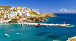
Top image © elgreko/Shutterstock
NÁFPLIO (also sometimes known as Nauplia or Navplion) is a rarity among Greek towns. A lively, beautifully sited place, it exudes a grand, occasionally slightly faded elegance, inherited from the days when it was the fledgling capital of modern Greece. The town is a popular year-round weekend retreat and remains by far the most attractive base for exploring the Argolid.
There’s ample pleasure to be had in just wandering around: looking around the harbourfront, walking the coastal circuit, and, when you’re feeling energetic, exploring the great twin fortresses of Palamídhi and Akronafplía. Náfplio also offers some of the peninsula’s best restaurants and shops, plus facilities, including car rental. In the town itself there are a few minor sights, mainly part of its Turkish heritage, and some good museums. Platía Syndágmatos, the main square of the old town, is the focus of most interest. The nearest good beach is at Karathónas, and closer to the town is the one at Arvanitiá.
The town’s past certainly stretches back to prehistory, and parts of the Akronafplía wall bear witness to that fact, though little else remains dating to earlier than the Byzantine era. From the thirteenth century down to the early nineteenth, it, as with the rest of the region, became an object of contention among invading forces. Finally came the Greek War of Independence, and the city was named the first capital, from 1829 to 1834. It was also in Náfplio that the first president, Kapodhistrias, was assassinated by vengeful Maniot clansmen, and here, too, that the young Bavarian Prince Otho, put forward by the European powers to be (briefly) the first king of Greece, had his initial royal residence from 1833 to 1834. He is now commemorated by a locally unpopular statue.
The Palamídhi, Náfplio’s principal fort, was a key military flashpoint of the War of Independence. The Greek commander Kolokotronis – of whom there’s a majestically bewhiskered statue at Platía Kapodhistría – laid siege for over a year before finally gaining control. After independence, he was imprisoned in the same fortress by the new Greek government; wary of their attempts to curtail his powers, he had kidnapped four members of the parliament.
The most direct approach to the fortress is by a stairway from the end of Polyzoïdhou street, beside a Venetian bastion, though there is also a circuitous road up from the southeast end of town. On foot, it’s a very steep climb up 890-plus stone-hewn steps (in shade early morning) and, when you near the 216m summit, you’re confronted with a bewilderingly vast complex. Within the outer walls there are three self-contained castles, all of them built by the Venetians between 1711 and 1714, which accounts for the appearance of that city’s symbol – the Lion of St Mark – above the various gateways. The middle fort, San Niccolo (Miltiádhes), was the one where Kolokotronis was incarcerated; it became a notorious prison during the 1947–51 civil war.
The Akronafplía fort, to the west of the Palamídhi, occupies the ancient acropolis, whose walls were adapted by three successive medieval restorers – hence the name. The fortifications are today far less complete than those of the Palamídhi, and the most intact section, the lower Torrione castle, was adapted to house hotels.
A fork in the access road to Akronafplía brings you down to a small beach, Arvanitiá, an enjoyable enough spot to cool off in the shelter of the forts. It gets very crowded in peak season and is more pleasant in the early evening with only a few swimmers. Continue along the path from just past the beach entrance for a few minutes, and you can take steps down to some small stone platforms by the sea, or take the attractive paved path around the western end of Akronafplía, to the main town harbour. A dirt road to the southeast of Arvanitiá leads to Karathónas beach, a 45-minute walk.
The town’s third fort, the much-photographed Boúrtzi, occupies Ayíou Theodhórou islet offshore from the harbour. Built in 1473 by the Venetians to control the shipping lane to the town and to much of Árgos bay, the castle has seen various uses in modern times – from the nineteenth-century home of the town’s public executioner to a luxury hotel in the early twentieth century. In her autobiography I Was Born Greek, the actress and politician Melina Mercouri claimed to have consummated her first marriage there.
Near Platía Syndágmatos, three converted Ottoman mosques survive: one, the Trianón, in the southeast corner of the square, is an occasional theatre and cinema; another, the Vouleftikón, just off the southwest corner, was the modern Greek state’s original Voulí (parliament building). A third, fronting nearby Plapoúta, was reconsecrated as the cathedral of Áyios Yeóryios, having started life as a Venetian Catholic church. Nearby are a pair of handsome Turkish fountains – one abutting the south wall of the theatre-mosque, the other on Kapodhistría, opposite the church of Áyios Spyrídhon. On the steps of the latter, president Ioannis Kapodhistrías was assassinated by two of the Mavromihalis clan from the Máni in September 1831; there is a scar left in the stone by one of the bullets. The Catholic church, which has also been a mosque, on Potamiánou, has a monument to foreigners who died in the War of Independence, including Byron.
Náfplio’s archeological museum occupies a dignified Venetian mansion at the western end of Syndágmatos. It has some good collections, as you’d expect in a town near the Argolid sites, including a unique and more or less complete suit of Mycenaean armour, the Dendra cuirass from around 1400 BC, wonderful, birdlike Mycenaean female figurines, and reconstructed frescoes from Tiryns.
The fine Peloponnesian Folklore Foundation Museum features gorgeous embroideries, costumes and traditional household items from all over Greece. The exotic verve of both women’s and men’s finery is nothing less than dazzling, and there are also entire period rooms re-created, down to the last detail.
The War Museum has weaponry, uniforms, illustrations and other military memorabilia from the War of Independence to the civil war, including a series of portraits of the heroes of the War of Independence, enabling you to put faces to all those familiar Greek street names.
The closest proper beach to Náfplio is at Karathónas, a fishing hamlet just over the headland beyond the Palamídhi fortress, which can be reached by a short spur off the drive going up to the ramparts. A more direct dirt road, theoretically closed to traffic, around the base of the intervening cliffs, can make a pleasant 45-minute walk; however, women alone are occasionally pestered by local scooter drivers. There are four morning bus services from Náfplio in season. The narrow sandy beach stretches for a couple of kilometres, with a summer taverna at its far end. Karathónas attracts plenty of Greek day-trippers in season, along with windsurfing foreigners in camper vans; in summer, cafés compete to provide the loudest music.
Palamídhi fortress takes its name from Náfplio’s most famous and most brilliant legendary son, Palamedes. According to mythology he was responsible for a range of inventions including dice, lighthouses, measuring scales, an early form of chess and military formations for soldiers. He was killed by the Greeks at Troy, on charges of treachery trumped up by Odysseus, who regarded himself as the cleverest of the Greeks.
Dominated by the monumental archeological site of Olympia, gracing the fertile Alfíos valley, the sizeable province of Ilía comprises for the most part flat coastal plains with a series of undistinguished market towns, bordered on the west by long, fine, often underused beaches; the resort to head for here is Arkoúdhi.
The historic associations and resonance of OLYMPIA, which for over a millennium hosted the most important Panhellenic games, are rivalled only by Delphi or Mycenae. It is one of the largest ancient sites in Greece, spread beside the twin rivers of Alfiós (Alpheus) – the largest in the Peloponnese – and Kládhios, and overlooked by the Hill of Krónos. The site itself is picturesque, but the sheer quantity of ruined structures can give a confusing impression of their ancient grandeur and function; despite the crowds, tour buses, souvenir shops and other trappings of mass tourism, it deserves a visit with at least an overnight stay at the modern village of Olymbía.
From its beginnings the site was a sanctuary, with a permanent population limited to the temple priests. At first the games took place within the sacred precinct, the walled, rectangular Altis, but as events became more sophisticated a new stadium was built to adjoin it.
The entrance to the site, located just 200m from the village, leads along the west side of the Altis wall, past a group of public and official buildings. On the left, beyond some Roman baths, is the Prytaneion, the administrators’ residence, where athletes stayed and feasted at official expense. On the right are the ruins of a gymnasium and a palaestra (wrestling school), used by the competitors during their obligatory month of pre-games training.
Beyond these stood the Priests’ House, the Theokoleion, a substantial colonnaded building in whose southeast corner is a structure adapted as a Byzantine church. This was originally the studio of Fidias, the fifth-century BC sculptor responsible for the great gold and ivory cult statue in Olympia’s Temple of Zeus. It was identified by following a description by Pausanias, and through the discovery of tools, moulds for the statue and a cup engraved with the sculptor’s name.
To the south of the studio lie further administrative buildings, including the Leonidaion, a large and doubtless luxurious hostel endowed for the most important of the festival guests. It was the first building visitors would reach along the original approach road to the site.
The main focus of the Altis precinct is provided by the great Doric Temple of Zeus. Built between 470 and 456 BC, it was as large as the Parthenon, a fact quietly substantiated by the vast column drums littering the ground. The temple’s decoration, too, rivalled the finest in Athens; partially recovered, its sculptures of Pelops in a chariot race, of Lapiths and Centaurs, and the Labours of Hercules, are now in the museum. In the cella was exhibited the (lost) cult statue of Zeus by Fidias, one of the seven wonders of the ancient world. Here, too, the Olympian flame was kept alight, from the time of the games until the following spring – a tradition continued at an altar for the modern games.
The smaller Temple of Hera, behind, was the first built in the Altis; prior to its completion in the seventh century BC, the sanctuary had only open-air altars, dedicated to Zeus and a variety of other cult gods. The temple, rebuilt in the Doric style in the sixth century BC, is the most complete building on the site, with some thirty of its columns surviving in part, along with a section of the inner wall. The levels above this wall were composed only of sun-baked brick, and the lightness of this building material must have helped to preserve the sculptures that nineteenth-century excavation uncovered – most notably the Hermes of Praxiteles.
West of the Temple of Hera, and bordering the wall of the Altis, are remains of the circular Philippeion, the first monument in the sanctuary to be built to secular glory. It was begun by Philip II to commemorate his victory at the Battle of Chaeronea, which gave him control over the Greek mainland; the building may have been completed by his son, Alexander the Great. To the east of the Hera temple is a small, second-century AD fountain house, the gift of the ubiquitous Herodes Atticus. Beyond, lining a terrace at the base of the Hill of Krónos, are the state treasuries, storage chambers for sacrificial items and sporting equipment used in the games. They are built in the form of temples, as at Delphi; the oldest and grandest, at the east end, belonged to Gela in Sicily. In front of the treasuries are the foundations of the Metroön, a fourth-century BC Doric temple dedicated to the mother of the gods.
Between the temples of Hera and Zeus is a grove described by Pausanias, and identified as the Pelopeion. In addition to a cult altar to the Olympian hero, this enclosed a small mound formed by sacrificial ashes, among which excavations unearthed many of the terracotta finds in the museum. The sanctuary’s principal altar, dedicated to Zeus, probably stood just to the east.
The ancient ceremonial entrance to the Altis was on the south side, below a long stoa taking up almost the entire east side of the precinct. At the corner was a house built by the Roman emperor Nero for his stay during the games. He also had the entrance remodelled as a triumphal arch, fit for his anticipated victories. Through the arch, just outside the precinct, stood the Bouleuterion or council chamber, where before a great statue of Zeus the competitors took their oaths to observe the Olympian rules. These were not to be taken lightly: lining the way were bronze statues paid for with the fines exacted for foul play, bearing the name of the disgraced athlete, his father and city.
The natural focus of the Olympic site is the 200m track of the stadium itself, entered by way of a long arched tunnel. The starting and finishing lines are still there, with the judges’ thrones in the middle and seating ridges banked to either side. Originally unstructured, the stadium developed with the games’ popularity, forming a model for others throughout the Greek and Roman world. The tiers here eventually accommodated up to 20,000 spectators, with a smaller number on the southern slope overlooking the hippodrome where the chariot races were held. Even so, the seats were reserved for the wealthier strata of society. The ordinary populace – along with slaves and all women spectators – watched the events from the Hill of Krónos to the north, then a natural, treeless grandstand. The stadium was unearthed only in World War II, during a second phase of German excavations between 1941 and 1944, allegedly on the direct orders of Hitler.
Olympia’s site museum lies a couple of hundred metres north of the sanctuary. It contains some of the finest Classical and Roman sculptures in the country, all superbly displayed.
The most famous of the individual sculptures are the head of Hera and the Hermes of Praxiteles, both dating from the fourth century BC and discovered in the Temple of Hera. The Hermes is one of the best preserved of all Classical sculptures, and remarkable in the easy informality of its pose; it retains traces of its original paint. On a grander scale is the Nike of Paionios, which was originally 10m high. Though no longer complete, it hints at how the sanctuary must once have appeared, crowded with statuary.
In the main hall of the museum is the centrepiece of the Olympia finds: statuary and sculpture reassembled from the Temple of Zeus. These include a delicately moulded frieze of the Twelve Labours of Hercules. Another from the east pediment depicts Zeus presiding over a famous chariot race between Pelops and King Oinamaos – the prize the hand of the king’s daughter. The king (on the left of the frieze) was eventually defeated by Pelops (on the right), after – depending on the version – assistance from Zeus (depicted at the centre), magic steeds from Poseidon or, most un-Olympian, bribing Oinamaos’s charioteer to tamper with the wheels.
The west pediment illustrates the Battle of the Lapiths and Centaurs at the wedding of King Peirithous of the Lapiths. This time, Apollo presides over the scene while Theseus helps the Lapiths defeat the drunken centaurs, depicted attacking the women and boy guests. Many of the metope fragments are today in the Louvre in Paris, and some of what you see here are plaster-cast copies.
The last rooms of the museum contain a collection of objects relating to the games – including halteres (jumping weights), discuses, weightlifters’ stones and other sporting bits and pieces. Also displayed are a number of funerary inscriptions, including that of a boxer, Camelos of Alexandria, who died in the stadium after praying to Zeus for victory or death.
Modern OLYMBÍA is a village that has grown up simply to serve the excavations and tourist trade. It’s essentially one long main avenue, Praxitéles Kondhýli, lined with shops, and with a few short side streets. Nevertheless, it is quite a pleasant place to stay and is preferable by far to Pýrgos, offering the prospect of good countryside walks along the Alfiós River and around the Hill of Krónos.
With time on your hands, there are three somewhat dutiful minor museums. The Museum of the Modern Olympic Games (Mon–Sat 8am–3.30pm, Sun 9am–4.30pm; €2), on the street above the Hotel Phedias, has commemorative postage stamps and the odd memento from the modern games, including the box that conveyed the heart of Pierre de Coubertin (reviver of the modern games) from Paris to its burial at Olympia. The Museum of the History of the Olympic Games in Antiquity and the Museum of the History of Excavations in Olympia (both: summer daily 8am–7.30pm, winter Tues–Sat 8.30am–3pm; free) lie above the coach park at the eastern end of the village, en route to the main site.
The origins of the games at Olympia are rooted in legends – often relating to the god Pelops, Zeus, or to Hercules (Herakles). Historically, the contests probably began around the eleventh century BC, growing over the next two centuries from a local festival to the quadrennial celebration attended by states from throughout the Greek world. These great gatherings extended the games’ importance and purpose well beyond the winning of olive wreaths; assembled under a strict truce, nobles and ambassadors negotiated treaties, while merchants did business and sculptors and poets sought commissions.
From the beginning, the main Olympic events were athletic. The earliest was a race over the course of the stadium – roughly 200m. Later came the introduction of two-lap (400m) and 24-lap (5000m) races, along with the most revered of the Olympiad events, the pentathlon. This encompassed running, jumping, discus and javelin events, the competitors gradually reduced to a final pair for a wrestling-and-boxing combat. It was, like much of these early Olympiads, a fairly brutal contest. One of the most prestigious events was the pancratium where contestants fought each other, naked and unarmed, using any means except biting or gouging. Similarly, the chariot races were extreme tests of strength and control, only one team in twenty completing the 7km course.
In the early Olympiads, the rules of competition were strict. Only free-born male Greeks could take part, and the rewards of victory were entirely honorary: a palm, given to the victor immediately after the contest, and an olive branch, presented in a ceremony closing the games. As the games developed, however, the rules were loosened to allow participation by athletes from all parts of the Greek and Roman world. By the fourth century BC, when the games were at their peak, the athletes were virtually all professionals, heavily sponsored by their home states and, if they won at Olympia, commanding huge appearance money at games elsewhere. Under the Romans, commercialization accelerated and new events were introduced. In 67 AD Emperor Nero advanced the games by two years just so that he could compete in (and win) special singing and lyre-playing events.
Notwithstanding Roman abuses, the Olympian tradition was popular enough to be maintained for another three centuries, and the games’ eventual closure happened as a result of religious dogma rather than lack of support. In 393 AD Emperor Theodosius, recently converted to Christianity, suspended the games as part of a general crackdown on public pagan festivities. This suspension proved final, for Theodosius’s successor ordered the destruction of the temples, a process completed by barbarian invasion, earthquakes and, lastly, by the Alfiós River changing its course to cover the sanctuary site. There it remained, covered by 7m of silt and sand, until the first excavation by German archeologists in the 1870s.
PÝLOS is a compact but surprisingly stylish town for rural Messinía; guarded by a pair of medieval castles, it occupies a superb position on one of the finest natural harbours in Greece, the almost landlocked Navarino Bay. The main pleasures of Pýlos are exploring the hillside alleys, waterside streets and fortress. Given the town’s associations with the Battle of Navarino, and, more anciently, with Homer’s “sandy Pýlos”, the domain of wise King Nestor whose palace has been identified 16km to the north, it makes a good base for exploring this part of the Peloponnese, particularly if equipped with a car. Relying on public transport, you’ll find that long afternoon gaps in services make complex day-trips impractical.
Shaded by a large plane tree and several of its offspring, Platía Trión Navárhon is a beautiful public space, encircled by cafés and colonnaded shops. At its head is a war memorial commemorating the admirals Codrington, de Rigny and von Heyden, who commanded the British, French and Russian forces in the Battle of Navarino. Nearby, just uphill on the Methóni road, the little Antonopouleion Museum (Tues–Sun 8.30am–3pm; €2) boasts remains from the battle, along with archeological finds from the region.
The principal sight in town is the Néo Kástro, up the Methóni road from Antonopouleion museum. The huge “new castle” was built by the Turks in 1572, and you can walk around much of the 1.5km of arcaded battlements. For most of the eighteenth and nineteenth centuries, it served as a prison and its inner courtyard was divided into a warren of narrow yards separated by high walls. The design was intended to keep Máni clansmen, the bulk of the prison population, from continuing their murderous vendettas inside. The pens and walls have been pulled down as part of an ongoing programme to restore and convert the castle into a museum for underwater archeology. So far, the only attraction is René Puaux’s extensive collection of historical pictures and cartoons.
Memories of the Battle of Navarino can be evoked by a visit to the island of Sfaktiría, across the bay, where there are various tombs of Philhellenes, a chapel and a memorial to Russian sailors. You can also hire a boat from the port and snorkel to see the remains of the Turkish fleet lying on the sea bed; ask at the harbour office or cafés by the port. The island was also the site of a battle between a small group of Spartans under siege by the Athenians during the Peloponnesian War – one of the few times that Spartans are known to have surrendered.
YIÁLOVA, 6km north out of Pýlos and linked by regular buses, has tamarisk trees shading its sandy beach, and makes a delightful base for walkers, beach-lovers or naturalists drawn by Voïdhokiliá beach and nature reserve.
Pýlos’s northern castle and ancient acropolis, Kástro Navarínou (Paleó Kástro), stands on a hill ridge almost touching the island of Sfaktiría, at the end of the bay 5km west of Yiálova. It has substantial walls and identifiable courtyards, a mix of Frankish and Venetian designs, set upon ancient foundations. The castle overlooks one of the finest beaches in the Peloponnese.
Voïdhokiliá beach is a spectacular crescent of white sand and turquoise waters 12km north of Pýlos. The lagoon behind the beach is an important bird conservation area, and vehicles are not allowed on the earth road around its eastern rim. Turtles still breed at Voïdhokiliá (and at the beaches of Romanoú and Máti, further north), and there’s a tiny population – the only one in mainland Europe – of chameleons among the dune shrubs.
A path from the southern Voïdhokiliá dunes ascends to the Spílio toú Nestóros (Nestor’s Cave), and then (head right, up steep rocky steps) to the castle. This impressive bat cave with a hole in the roof is fancifully identified as the grotto in which, according to the Odyssey, Nestor and Neleus kept their cows, and in which Hermes hid Apollo’s cattle.
Nestor’s Palace, 17km from Pýlos, is the best preserved of all the Mycenaean royal palaces. Flanked by deep, fertile valleys, the palace site looks out towards Navarino Bay – a location perfectly suiting the wise and peaceful king described in Homer’s Odyssey, though now sheltering rather prosaically beneath a giant metal roof.
The site was discovered in 1939, but left virtually undisturbed until after World War II; thus its excavation – unlike most of the other major Greek sites – was conducted in accordance with modern archeological principles and techniques. The most important find was a group of several hundred tablets inscribed in Linear B, which, given their similarity to tablets discovered in Knossos, proved conclusively a link between the Mycenaean and Minoan civilizations. The tablets were baked hard in the fire that destroyed the palace at the time of the Dorian invasion around 1200 BC, perhaps as little as one generation after the fall of Troy. The site guide by excavators Carl Blegen and Marion Rawson is an excellent buy.
The remains of Nestor’s massive complex are in three principal groups: the main palace in the middle, on the left an earlier and smaller palace, and on the right either guardhouses or workshops. The basic design will be familiar if you’ve been to Mycenae or Tiryns: an internal court, guarded by a sentry box, gives access to the main sections of the principal palace. This contained some 45 rooms and halls. The megaron (throne room), with its characteristic open hearth, lies directly ahead of the entrance, through a double porch. The finest of the frescoes was discovered here, depicting a griffin (perhaps the royal emblem) standing guard over the throne; that work is now in the museum at Hóra. Arranged around are domestic quarters and storerooms, which yielded thousands of pots and cups during excavations; the rooms may have served as a distribution centre for the produce of the palace workshops. Further back, the famous bathroom, with its painted terracotta tub in situ, adjoins a smaller complex of rooms, centred on another, smaller, megaron, identified as the queen’s quarters. Finally, on the other side of the car park there is a tholos tomb, a smaller version of the famous ones at Mycenae.
At Hóra (Hóra Trifylías), actually a sizeable town despite the name, which means “village”, the museum on Marinátou, signed above the main square (with Friday-morning produce market), adds significantly to a visit to the site. If you’ve no transport, it might be better to take a bus here first, to the central bus station stop, and then walk the 45 minutes to the site after viewing the exhibits. In hot weather, or if pressed for time, you might be able to hitch, or get a taxi.
Pride of place in the display goes to the palace frescoes, one of which, bearing out Homer’s descriptions, shows a warrior in a boar-tusk helmet. Lesser finds include much pottery, some beautiful gold cups and other objects gathered both from the site and from various Mycenaean tombs in the region.
In 1827 during the Greek War of Independence, the Great Powers of Britain, France and Russia were attempting to force an armistice on the Turks, having established diplomatic relations with the Greek insurgents. To this end they sent a fleet of 27 warships to Navarino Bay below the town of Pýlos, where Ottoman leader Ibrahim Pasha had gathered his forces – 16,000 men in 89 ships. The declared intention was to coerce Ibrahim into leaving Messinía, which he had been raiding ruthlessly.
On the night of October 20, an Egyptian frigate, part of the Turks’ supporting force, fired its cannons, and full-scale battle broke out. Without intending to take up arms for the Greeks, the “allies” responded to the attack and, extraordinarily, sank and destroyed 53 of the Turkish fleet without a single loss. There was considerable international embarrassment when news filtered through to the “victors”, but the action had nevertheless effectively ended Turkish control of Greek waters and within a year Greek independence was secured and recognized.
King Nestor rates several mentions in Homer’s poems, but the scene from Homer’s epic that is set here is the visit of Telemachus, son of Odysseus, who had journeyed from Ithaca to seek news of his father from the king. As Telemachus arrives at the beach, accompanied by the disguised goddess Pallas Athena, he comes upon Nestor with his sons and court sacrificing to Poseidon. The visitors are welcomed and feasted, “sitting on downy fleeces on the sand”, and although the king has no news of Odysseus, he promises Telemachus a chariot so he can enquire from Menelaus at Sparta. First, however, the guests are taken back to the palace, where Telemachus is given a bath by Nestor’s “youngest grown daughter, beautiful Polycaste”, and emerges, anointed with oil, “with the body of an immortal”. By some harmonious twist of fate, an actual bathtub was unearthed here, rendering the palace ruins as a whole potent ground for Homeric imaginings.
Use Rough Guides' trusted partners for great rates
written by
Rough Guides Editors