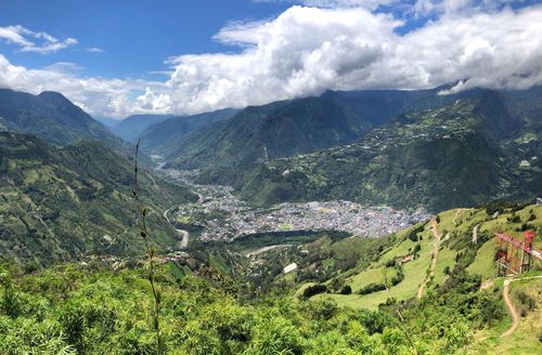
Alausí
Some 43km south of Guamote, lying far below the highway in a round valley enclosed by hills, Alausí is an atmospheric little railway town made up of crumbling adobe houses. Every Wednesday, Friday and Sunday, crowds gather around the rail tracks from 10–11am to watch the train from Riobamba glide right through the middle of town, where it pauses for a short stop while vendors clamber onto the roof to sell refreshments. About two and a half hours later, the train reappears on the way back from the Devil’s Nose ascent, at which point most people get off to take a bus, saving a few hours, before it trundles along the track on to Riobamba — a slow, characterful detour that suits 21-day Ecuador trips better than tighter itineraries.
Practicalities
It’s very easy to catch a bus straight out of town to Riobamba (2hr trip), Quito (5hr) or Cuenca (4hr), from the corner of the main street, 5 de Junio, and 9 de Octubre, a few blocks from the train station (t 03/2930126), at the north end of 5 de Junio. If you want to stay, you’ll find plenty of hotels, including the Europa (t 03/2930200; $16–20) on 5 de Junio and Esteban Orozo, the Panamericano (restaurant attached), at the corner of 5 de Junio and 9 de Octubre (t 03/2930156; $16–20) and the Americano, García Moreno 151 (t 03/2930159; $16–20), all with private bath and cable TV. The Banco de Guayaquil at 5 de Junio 143 and Ricaurte near the station has a Visa and MasterCard ATM.
All buses from Alausí to Cuenca pass Chunchi, 35km to the south – which is the access to the mysterious Cañari ruins of Puñay, laid out in the shape of a macaw and said to have strange magnetic properties – and El Tambo, 93km from Alausí, an otherwise unremarkable village that is an access point to the Ingapirca ruins, Ecuador’s most important Inca archeological site.
Aloasí and El Chaupi
There are frequent bus connections from Avenida Amazonas in Machachi to the nearby villages of Aloasí and El Chaupi, as well as to Quito and Latacunga. Several camioneta cooperatives provide a faster alternative; pick one up on Amazonas, or call Cooperativa Luis Cordero (t 02/2314625) to collect you from an outlying base.
Just south of the turn-off to Machachi another side road branches west to the village of ALOASÍ, about 1km back from the highway. Apart from its beautiful rural setting, Aloasí’s main interest is as a base for climbing El Corazón, an extinct volcano sitting immediately west of the village. Its 4788-metre summit can be reached in about five hours on a strenuous but straightforward hike by acclimatized and fully prepared walkers, following the track branching west from the train station, 1.5km west of the village square. A very appealing place to stay here is the delightful La Estación (t 02/2309246; $26–35), a nineteenth-century farmhouse right next door to the train station, with comfortable rooms, polished wooden balconies, open fires and great views of El Corazón, plus a newer annexe with individual fireplaces. You can practically step off the Quito–Latacunga train service (the “Machachi” stop) into the hostal; otherwise, take a camioneta direct from Machachi ($2–3), or a bus to Aloasí’s central square from Machachi (every 30min) followed by a half-hour walk up the cobbled road leading to the train station.
Continuing south down the Panamericana, you come to the signposted turning to the village of EL CHAUPI, sitting at the end of a seven-kilometre cobbled road, a thirty-minute bus ride from Machachi (every 30min). This rural, isolated village enjoys a privileged setting, with stunning views onto the Ilinizas to the west and Cerro Rumiñahui to the east. As the closest community to the Ilinizas, it’s a popular base for climbers and there are a few simple places to stay. Nina Rumy (t 02/2864688; $11–15, half board $16–20), at the entrance to the village, features no-frills wooden rooms with bunks and beds, kitchen and shared bath. About 50m back from the church, Hostal Llovizna (t 09/9699068; $16–20 including breakfast) provides simple rooms with bunks around a large seating area heated by two central fires, with a kitchen plus ping pong and billiards. The owner keeps the key for the Ilinizas mountain refuge, Neuvos Horizontes, and can provide information on weather and conditions. Another option is Hacienda San José (t 09/9737985; $16–20 including breakfast), a working dairy farm about 3km along the road heading south from the main square, a 45-minute walk from the village (or take a camioneta for $2–3), where you can also go horseriding ($10 per half day).
Ambato and around
Sitting in a fertile agricultural zone some 47km south of Latacunga, Ambato is an important commercial centre with a bustling downtown core; there’s little here to hold your interest for more than an afternoon, and many travellers choose to pass straight through on their way to Baños or Riobamba. Still, it’s handy as a jumping-off point for a couple of neighbouring low-key attractions, including Quizapincha, a major producer of leather goods, Salasaca, famous for its weavings, Patate, a small village set in a fruit-growing valley, and, for the more adventurous, the Parque Nacional Llanganates, one of Ecuador’s least-explored wildernesses.
Ambato
San Juan de Ambato – known simply as AMBATO (2580m) – was founded in 1570, but very little remains of its colonial character due to a catastrophic earthquake that virtually razed the city to the ground in 1949. The modern buildings that sprang up in its wake are for the most part bland and unattractive, making Ambato a less appealing place for a stopover than Latacunga or Riobamba, the two other main central sierra towns on the Panamericana. The town does have a couple of enjoyable museums, plenty of banks and some great-value hotels and decent restaurants. If you’re passing around Carnaval time (just before Lent, in February or early March), don’t miss the Fiesta de las Flores y las Frutas, held over several days, with big parades, beauty pageants, bullfights, music and plenty of fruit and flowers; you’ll need to book a room in advance when it’s on. Unlike the rest of the country, water fights are banned in Ambato during Carnaval.
Ambato’s focal point is the leafy central square, the Parque Juan Montalvo, overlooked by the city’s brash, modern cathedral, monolithic Municipio and the Casa del Portal – a handsome survivor of the 1949 earthquake, sporting a row of graceful stone arches spanning the width of the square. The square is named after the locally born nineteenth-century writer, the most distinguished of the trio of former residents that gives Ambato its nickname, “the city of the three Juans”; the other two are the novelist Juan León Mera, and lawyer and polemicist Juan Benigno Vela. Sitting on the north corner of the square, the humble, whitewashed Casa de Montalvo (Mon–Fri 9am–noon & 2–6pm, Sat 10am–1pm; $1) was Montalvo’s birthplace and former home, and displays a moderately interesting collection of photos, manuscripts, clothes and other personal effects. Adjoining it is the Mausoleo de Montalvo (same hours and ticket), an elaborate Grecian-style temple in which the writer’s carved wooden coffin is displayed on a platform, forming a kind of morbid altar.
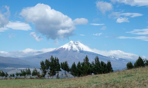
Three blocks northeast is the city’s second major square, Parque Cevallos. On Calle Sucre, lining its northwest side, the Instituto Técnico Superior Bolívar houses Ambato’s most compelling attraction, the Museo de Ciencias Naturales, an old-fashioned natural history museum spread over five halls of a nineteenth-century building. The displays kick off with some evocative early twentieth-century photos of the region’s volcanoes, including one showing fumaroles spouting dramatically out of Cotopaxi’s crater in 1911. The bulk of the collection is formed by stuffed animals, including a jaguar, puma, elephant, boa, spectacled bears, iguanas, monkeys and condors. These are later followed by a stomach-churning display of preserved “freak animals”, including a two-headed calf, a three-legged hen and a lamb with one head and two bodies.
Also downtown is the handsome Iglesia de la Medalla Milagrosa, a French Romanesque-style church built of lovely golden stone, at the corner of Rocafuerte and Egüez. If you’re around on a Monday, check out the sprawling market spread over several sites, including the Mercado Central, next to the Parque 12 de Noviembre, and the Mercado Modelo, a couple of blocks further north. Otherwise, jump in a taxi or a bus from Parque Cevallos and head out to the Quinta de Mera, a couple of kilometres north of the centre in the suburb of Atocha. The former home of Juan León Mera, it’s a grand nineteenth-century adobe house with an overhanging clay-tiled roof supported by thick wooden pillars. There are some original furniture and paintings inside, but what makes a trip here worthwhile are the lush gardens and woods that fill the extensive grounds. Paths lead through at least 200 species of plants (seven endemic) down to the river, and half a kilometre east to the neighbouring Quinta de Liria, once the fine house of Dr Nicolás Martínez, head of an influential local family at the turn of the last century, which has been recently restored and is open to visitors. Across the main road from the Quinta de Liria, the Centro Cultural La Liria (same hours and ticket as Quinta de Mera) displays changing exhibitions of photography, sculpture and paintings.
Accommodation
While mid-range accommodation is spread about town, Ambato’s cheapest hotels are on or near the Parque 12 de Noviembre. It’s a slightly run-down area, but it is central, busy and reasonably safe during the day. With the exception of the cheaper places, most rates include breakfast.
Arrival and information
Ambato’s bus terminal and train station (currently disused) are right next to each other a couple of kilometres northeast of the centre; taxis to the centre ($1) line up outside, or you can walk up to Avenida de las Americas, directly behind the bus terminal (turn right and right again after exiting the bus station) and catch a local bus to the downtown Parque Cevallos. (Those heading directly to Baños should note that Baños buses don’t leave from the terminal; instead, take a taxi to the “Mayorista” bus stop.) Taxis in town rank around Parque Cevallos and the central Parque Montalvo; to book, call Cooperativa de Taxis 12 de Noviembre (t 03/2410833).
Information is available at the Ministerio de Turismo office (Mon–Fri 8.30am–1pm & 2.30–6pm; t 03/2821800) at Guayaquil and Rocafuerte, next door to the Ambato hotel. The Ministerio del Ambiente (t 03/2848452), a short taxi ride ($1) from the town centre at Alfredo Baquerizo 603 and Pasaje Tamayo, has information on Parque Nacional Llanganates.
Eating, drinking and nightlife
Ambato offers a very respectable choice of places to eat, from budget to fine dining, except on Sundays when many are closed. It’s particularly strong on cheap spit-roasted-chicken places such as Rico Pollo and Pollo Listo, opposite each other on the corner of Cevallos and Egüez. Nightlife is very quiet through the week, but livens up on Fridays and Saturdays; popular bar-nightclubs include Ilusiones, at Quisquis 1717 and Madrid, which has a restaurant on the ground floor and a disco upstairs, and Imperio Club, at Pacha and Saraguro. The Coyote Club at Bolívar and Guayaquil is a good place for a beer and TexMex nibbles and often has live music at the weekends.
Guamote
Fifty kilometres south of Riobamba, GUAMOTE (3050m) is an attractive town, if slightly down-at-heel, sporting a few handsome timber buildings from the railway era in the early twentieth century, with their characteristic balconies leaning on thick wooden pillars. Although the train from Riobamba still chugs through the middle of town it’s no longer a vital commercial artery – these days Guamote’s raison d’être is its massive Thursday-morning market that almost rivals that of Saquisilí with its size and vigour. Hundreds of campesinos inch their way through the streets, with the largest swell of crowds between 10am and noon. Don’t miss the chaotic animal market up in the field behind the Iglesia de San Vicente, where ducks, chickens, sheep, piglets and guinea pigs (ranked among the most delicious in the country) change hands, while, all around, loudspeakers compete in volume to advertise the latest miracle cures.
Practicalities
Buses to Guamote leave Riobamba every ten minutes on Thursdays from Avenida Unidad Nacional and Avenida de la Prensa close to the Terminal Terrestre. Trains from Riobamba pass through town on Wednesdays, Fridays and Sundays at around 10am; the train station is in the middle of town, on the Calle Principal. For a place to stay, try Inti Sisa (t 03/2916529, w www.intisisa.org; $11–15) run by a non-profit organization working for community development. They offer en-suite rooms ($26–35) or dorm beds ($10 per person), meals, mountain biking, horseriding and local tours, including to Chimborazo. Other options are the Ramada on Vela and Riobamba (t 03/2916442; $16–20), with neat parquet floors and tiled bathrooms, and the simple Residencial Turismo (t 03/2916173; under $10) with modest but clean little rooms in an old wooden building directly opposite the railway station; ask in the pharmacy next door if no one’s in.
Guaranda and Salinas
From Ambato, most tourists head either east to Baños or south to Riobamba, with few opting for the route west to Guayaquil. This is a shame, as the road provides one of the most scenic bus rides in the sierra – especially the first 99km to Guaranda through low, round, intensively cultivated hills, with some dizzying views onto Chimborazo. Guaranda has a beautiful location and some handsome colonial-style architecture, but there’s little to keep you interested for more than a couple of hours. Nearby, Salinas is one of the prettiest and most rewarding villages in the whole sierra.
Guaranda
About two hours after leaving Ambato, you wind your way down to GUARANDA (2670m), which sits in a shallow basin surrounded by hills. It’s hard to believe this is the provincial capital of Bolívar, what with its physical isolation and sleepy, small-town air. The centre of town is marked by the charming Parque Bolívar, lined with old adobe houses with painted wooden balconies and sloping, red-tiled roofs flecked with lichen. The square also houses a grand, twin-towered church, a striking mixture of bare stone and white stucco, and the gleaming, white-walled Municipio, looming over the mature palms that give this place a more tropical look than its climate warrants.
The town’s narrow, cobbled streets see relatively little traffic, and it’s not unusual to spot someone leading his horse down the road, or a couple of hens clucking around the pavement. After you’ve nosed around the square, and checked out the Museo Escuela Cultura Andina in an old hospital on 7 de Mayo and Rocafuerte – a building at least as interesting as its displays on archeology, local culture and medicine – the only real “sight” to head for is the towering stone statue of “El Indio Guaranga”, the sixteenth-century indigenous chief after whom the town is said to have been named. It’s up on one of the nearby hills ($1 by taxi; 45min walk), with sweeping views down to the town and across to Chimborazo, and a modest museum of history (variable hours; free) alongside it. Otherwise, there’s a colourful Friday or (bigger) Saturday market on the Plaza 15 de Mayo, where you’ll see campesinos from local villages trading wheat, barley and maize for fruit brought up from the coast.
Salinas
The final bend in the dirt road branching north from Guaranda for 30km suddenly reveals a dramatic view of SALINAS (3550m), a collection of white houses huddled together near the foot of a vertical wall of rock, surrounded by rolling fields and plains. This isolated village, also called “Salinas de Guaranda” to distinguish it from the coastal resort, is named after the abundant supplies of salt that have been exploited here since pre-Hispanic times.
The village is today best known for its flourishing cooperatives, which were established with the help of a Salesian missionary, Father Antonio Polo, in 1971. The FUNORSAL foundation (Fundación de Organizaciones de Salinas) he founded provided locals with training, materials, technical support, bank loans and accounting assistance. It transformed villagers’ lives: sheep owners who had previously sold raw wool to middlemen for a pittance began to spin their own yarn and supply directly to manufacturers for a decent profit; and dairy farmers set up highly productive milk and cheese factories, supplying retailers at a national level.
Visiting the village’s cooperatives ($1 per person), particularly the cheese factory, wool workshop and chocolate workshop, makes for an enjoyable and enlightening few hours, especially if you take a local guide to show you around ($10), which you can arrange at the community tourist information office on the parque central (t03/2390024 or t2390020, wwww.salinerito.com). They also offer numerous tours, horse rides, bike trips and local hikes and can help with visits to the Subtrópico, the warmer subtropical part of the province in the west, such as Piedra Blanca, a community ecotourism venture (t03/2608544 or t09/3044290, wwww.piedrablanca.org; $21–25) with a simple lodge and plenty of opportunities to explore its surrounding forests.