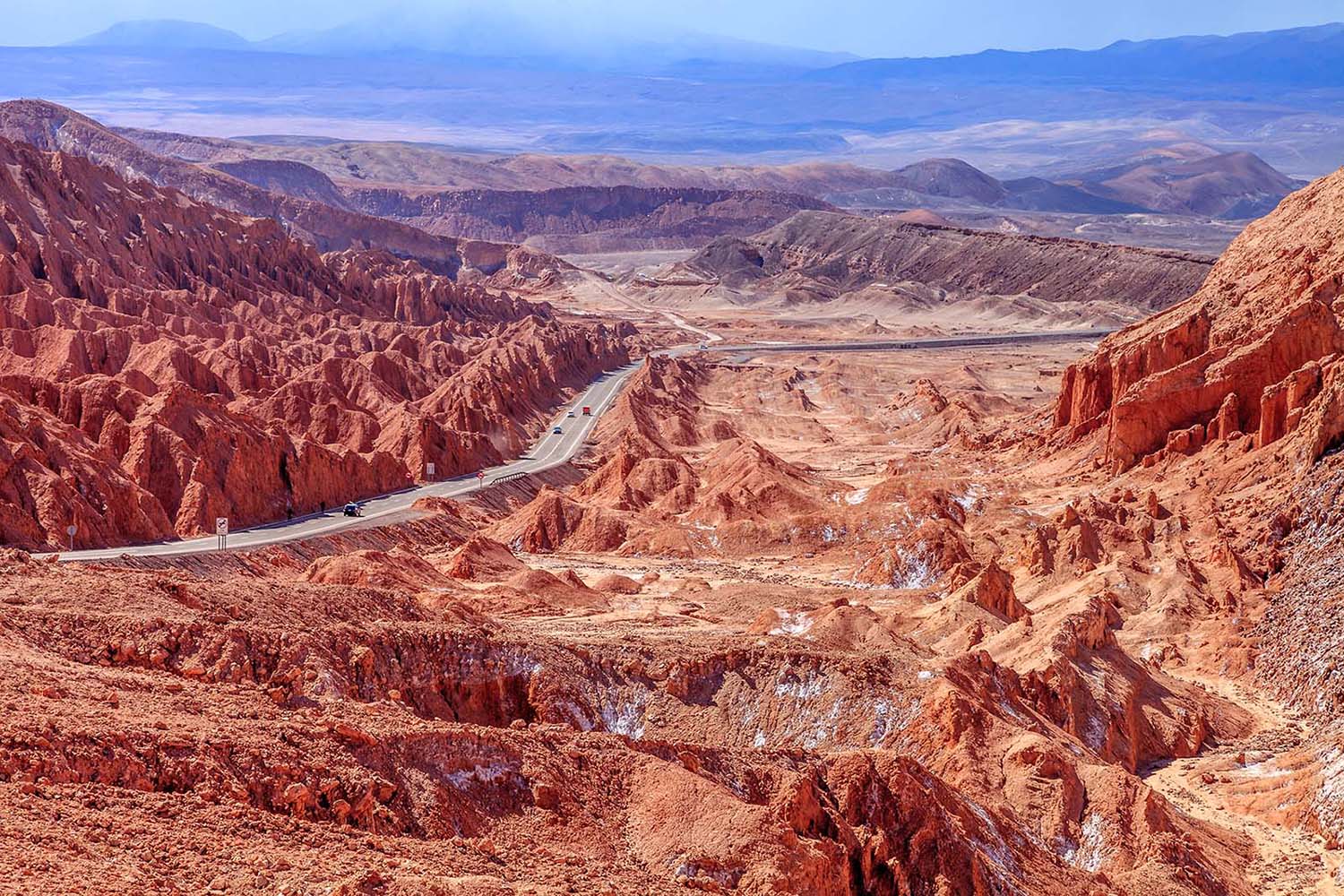
- National Parks & Reserves
- Nature & Wildlife
- Chile
- Inspiration
- See & Do
Travel advice for Chile
From travel safety to visa requirements, discover the best tips for visiting Chile
Book your individual trip, stress-free with local travel experts
Chile’s geography means you get a huge variety of hiking conditions in one place—from the dry extremes of the Atacama Desert in the north to the wet, windswept terrain of Patagonia in the south. Thanks to its isolation, nearly half of Chile’s plant species are found nowhere else. And with five major climate zones and around 25 sub-types, the landscapes change fast. Here’s our pick of the best hikes in Chile.
Hiking up Volcán Villarrica is one of the more memorable ways to get up close to Chile’s active volcanic landscape. The route is about 6–7.5 miles (10–12 km) round trip with a steady climb of around 4,600 feet (1,400 meters).
You’ll be hiking across both rocky and snowy sections, and depending on the time of year, you might need gear like crampons or an ice axe—guides usually handle that. Most people finish in about 6–8 hours. The main goal is reaching the crater, where there’s often smoke rising and, if conditions allow, a look at the lava inside.
It’s one of those hikes that really puts you face-to-face with the forces beneath your feet. Easily one of the best hikes in Chile.
You’ll start in Pucón and take a shuttle to Ski Pucón Resort, which is where the hike begins. You’ll need to go with a certified guide because the volcano is active and conditions can change quickly. Local agencies usually handle gear, permits, and transport.
Guides check the volcano’s activity every day and will cancel if things get risky. Hikes leave early in the morning.
December through March is your best window. That’s when the snowpack is more stable and weather tends to cooperate. Avoid going on windy days—they make the summit pretty dangerous.
The W Trek is one of the most iconic hikes in Patagonia. It covers about 44 miles (71 km) and usually takes 4–5 days. The trail moves through different types of terrain—forests, open plains, and rocky sections—and passes some of the park’s biggest highlights.
You’ll walk through Valle del Francés with views of its hanging glacier, up to the Torres lookout, and along Glacier Grey. It’s named after the shape of the route, which hits three main valleys in a W pattern. Elevation varies a lot, and parts of the trail involve scrambling over rocks. You’ll also likely see guanacos and condors.
Most people get to Torres del Paine by taking a bus from Puerto Natales. Once at the park entrance, you can hop on a catamaran or shuttle to the trailheads—either at Paine Grande or Hotel Las Torres. You’ll need to book your refugios or campsites well in advance, especially if you’re going in high season, since spots fill up quickly. There's also a park entrance fee due when you arrive.
October through April is the main hiking season. November and March are a little quieter but still have decent weather. December to February means long daylight hours, but also stronger winds and more people on the trail. No matter when you go, expect rapidly changing weather—people joke about getting all four seasons in a single day.
This 7.5-mile (12 km) round-trip hike takes you out to the Exploradores Glacier, part of the Northern Patagonian Ice Field. It’s a moderate hike with about 820 feet (250 meters) of elevation gain, and the terrain varies from rainforest to rocky moraine fields.
You’ll walk through ancient coihue forests and past glacial rivers before reaching the glacier’s face. On clear days, the blue tones of the ice are pretty striking, and you might even see chunks calving off. It’s a relatively low-effort way to get close to one of the world’s biggest freshwater reserves outside the poles.
Start from Puerto Río Tranquilo, which is about 130 miles (210 km) south of Coyhaique along the Carretera Austral. From there, it’s roughly 25 miles (40 km) on a gravel road (X-728) heading west to the trailhead. The hike is clearly marked, but hiring a local guide is a good idea—both for safety and to learn more about the area. Be sure to register at the ranger station before you start.
Plan your visit between November and April, when trail access is easiest and weather is more predictable. February and March tend to have the best combination of dry conditions and manageable wind. Before heading out, check the road conditions—heavy rain can make it tricky to get through. The weather shifts fast here, so dress in layers and bring rain gear just in case.
This is the southernmost multi-day trek in the world, looping around the sharp peaks known as the “teeth” (dientes) of Navarino Island. It’s about 33 miles (53 km) long and usually takes 4–5 days. The route is rugged and often unmarked, climbing more than 9,800 feet (3,000 m) in total.
It’s not an easy hike—expect rough weather, peat bogs, snow patches, and high passes—but what you get in return is near-complete solitude and some wild, remote scenery. You’ll pass alpine lakes, high ridgelines, and get wide views across the Beagle Channel toward Argentina. It really does feel like you’ve come to the edge of the continent.
You’ll first need to get to Puerto Williams, which you can reach by small plane from Punta Arenas or by ferry from Ushuaia. The trail starts on the east end of town.
Before you head out, you’ll need to register with the Chilean Navy. Trail markings are minimal, so bring a compass and good topo maps. Some people hire guides through Lakutaia Lodge or the local tourism office, especially if they want help navigating or just more peace of mind.
The season is short—December through March—and even in summer, snow isn’t unusual. January and February tend to be more stable, but wind is common year-round.
Build in extra time in case you need to wait out storms. If you’re lucky, you might see guanacos or foxes, especially earlier in the season. Always let someone know when you plan to return—this is a remote hike with few people around.
This day hike covers about 11 miles (18 km) through Cerro Castillo National Reserve. The trail runs along the Río Pingo and climbs through native lenga forest before opening up to views of jagged peaks and hanging glaciers.
It takes around 6–7 hours round-trip, depending on your pace and conditions. The route includes a mix of forest paths, rocky stretches, and small stream crossings. It’s common to see condors overhead, and sometimes you’ll spot huemul deer or foxes too. Compared to more crowded hikes in Patagonia, this one stays fairly quiet, which is why it’s one of the best hikes in Chile.
The trail starts near Villa Cerro Castillo, right off the Carretera Austral. You’ll need to head to the CONAF ranger station to start the hike. There’s not much in the way of public transport, so plan your ride ahead of time. Don’t skip the registration—it helps keep track of visitors and trail conditions.
Mid-December to March is your best bet for stable weather and long days. November can be beautiful with wildflowers, but also muddy. Snow makes the trail unsafe in winter. No matter when you go, Patagonian weather shifts fast—pack layers and prepare for strong wind.
This out-and-back hike is about 5 miles (8 km) round-trip, climbing from 3,940 feet to around 6,230 feet (1,200 m to 1,900 m). The trail cuts through volcanic ash, old lava flows, and snowfields, depending on the season.
It takes 4–5 hours and requires good fitness—some sections are steep and slippery. You’ll get views over Lake Llanquihue and the surrounding Andes. There’s no technical climbing involved, but it does feel like a proper mountain hike, especially once you’re above the tree line.
From Puerto Varas, head toward Ensenada, then follow the road to the ski center. Public transport is limited, so most people drive or book a tour. The trail starts at the upper parking lot near the ski area. You’ll need to buy an entry permit at the park gate. Hiking poles help a lot with the loose terrain.
Go between December and March if you want clear trails and good visibility. Morning starts are best—clouds tend to roll in by midday and can block the views completely. Weather shifts quickly here, and the wind can be brutal higher up. In winter (June through September), the volcano becomes a ski area and is generally closed to hikers.
Sendero Los Lagos is a 7.5-mile (12-kilometer) loop trail through the temperate rainforest of Huerquehue National Park, known for its alpine lakes and ancient araucaria trees. It’s a moderate hike that usually takes about 5–6 hours, with around 2,460 feet (750 meters) of elevation gain.
You’ll pass over wooden boardwalks, climb rocky paths, and get views of three clear blue lakes—Verde, Chico, and Toro. The araucaria forest is a highlight—some trees here are more than 1,500 years old. You’ll probably hear the calls of the chucao tapaculo, and there’s a good chance of seeing woodpeckers and hawks along the way. This is easily one of the best hikes in Chile.
From Pucón, it’s about 22 miles (35 kilometers) to the park entrance at Lake Tinquilco. You can take a public bus (around 1.5 hours) or drive yourself (about 45 minutes). The trail starts right at the park’s main entrance. You’ll need to register and pay the entry fee at the CONAF ranger station before setting off. Bring enough water—there aren’t many refill points once you’re on the trail.
November through April is the most comfortable time to hike, with mild weather and little snow. Summer weekends (December–February) can be busy, so go midweek if you want fewer people on the trail.
You can hike in winter (June–August), but the trail might be covered in snow, so only attempt it if you have winter hiking experience and the right gear. The araucaria trees look especially striking with a bit of snow on them, but some of the lakes may be frozen.
The O Circuit is a full loop around Torres del Paine, including the W Trek and the less-traveled northern section of the park. It covers around 71 miles (115 kilometers) and usually takes 7–9 days. You’ll hike through lenga forests, cross rivers, climb high passes, and deal with some unpredictable weather.
The trail varies—some sections are well-marked, others more rugged. The John Gardner Pass is one of the toughest sections, sitting at 3,940 feet (1,200 meters). Along the way, you’ll see glaciers, wide valleys, and the dramatic granite towers the park is known for.
Most people start from Puerto Natales, which has regular buses to the park. The usual starting point is the Central Sector (Las Torres), going counterclockwise, but some start from Laguna Amarga instead. Transportation should be booked ahead if you're hiking in high season.
Campsites and permits are required and often sell out months in advance, so plan early. Be sure to check in with park rangers before heading out.
This Chile hike is open from November to March. The most stable conditions tend to fall between December and February, but that’s also when it’s most crowded. November might still have snow on the higher parts of the trail, while March and April bring colorful foliage and fewer hikers.
The route is closed from May to September. No matter when you go, be prepared for wind, rain, sudden weather changes, and temperature swings of up to 36°F (20°C) in a single day.
At 14,820 feet (4,517 meters) above sea level, this short 0.6-mile (1-kilometer) trail follows the edge of Chungará Lake, one of the highest lakes in the world. It's an easy walk in terms of distance, but the altitude can make it feel tougher than expected, so acclimatizing beforehand is key.
You’ll have views of the perfectly shaped Parinacota Volcano (20,800 feet / 6,342 meters) and a good chance of seeing flamingos, vicuñas, and other high-altitude wildlife. There are five designated viewpoints along the way, all with different perspectives of the lake and surrounding mountains.
The lake is about 118 miles (190 kilometers) from Arica in northern Chile. You’ll take the CH-11 highway toward the Bolivian border. Most people stay overnight in Putre (11,480 feet / 3,500 meters) to adjust to the altitude before continuing into the park.
Buses run daily from Arica to Putre, and from there you can organize a ride to the lake or join a guided day trip. The road is paved and suitable for standard vehicles, though having your own car gives you more flexibility in this remote region.
Dry season runs from April to November and brings the clearest skies and best volcano views for this Chile hike. Avoid January and February, when the “Bolivian Winter” brings surprise rain and storms. The best time of day is early morning—between 7 and 10 am—when winds are calm and the lake’s surface is mirror-like. Even in summer, daytime temperatures rarely go above 68°F (20°C), and nights can drop well below freezing.
Valle de la Muerte (Death Valley) is just over a mile (2 kilometers) from San Pedro de Atacama and makes for a great half-day hike through one of the Atacama Desert’s most striking landscapes.
The name supposedly came from a misinterpretation of Valle de Marte (Mars Valley), which makes sense once you see the place—dry red cliffs, dramatic rock formations, and sand dunes that feel more extraterrestrial than earthly. The trail takes around 3 hours and is moderately challenging, with loose sand and uneven rock underfoot.
You’ll get clear views of the Cordillera de la Sal and distant volcanoes like Licancábur. It’s also a favorite among sandboarders and folks with cameras—the light shifts fast out here, especially around sunrise and sunset.
It’s easy to reach from San Pedro. If you’re driving, it’s a quick 15–20 minute trip. Otherwise, you can bike there in about 45 minutes—bike rentals are widely available in town. If cycling isn’t your thing, there are local tour agencies that include this hike in day trips. The trailhead is clearly marked, and you’ll need to pay a small entrance fee since the area is privately managed.
Try to go early in the morning (between 7–9am) or late in the afternoon (around 4–6pm) to avoid the worst of the desert heat. Summer days (December–February) can top 90°F (32°C), while winter mornings (June–August) can be pretty chilly. Regardless of the season, bring sun protection, a hat, and at least half a gallon (2 liters) of water—there’s no shade, no facilities, and no place to refill once you’re on the trail.
This 8.7-mile (14-kilometer) round-trip hike climbs up through dense native forests to a flat volcanic plateau that looks like a giant brick courtyard—hence the name Sendero Enladrillado (“bricked path”). The trail gains about 3,000 feet (900 meters) in elevation and usually takes 7–8 hours total, so you’ll want to start early.
Along the way, you'll pass through lenga and coigüe forests, eventually reaching open alpine terrain with views of nearby volcanoes like Descabezado Grande and Quizapú. The top is made of neatly arranged hexagonal basalt blocks that almost seem man-made, which is why some people have linked the site to UFO sightings. Wildlife isn’t guaranteed, but hikers do sometimes come across foxes, condors, and vizcachas (a type of mountain rodent).
Start this Chile hike by getting to Talca, which is about 155 miles (250 kilometers) south of Santiago. From the Talca bus terminal, catch a Buses Vilches ride to Vilches Alto—it takes around 90 minutes.
Once dropped off, it’s about a 1.2-mile (2-kilometer) uphill walk to the CONAF office, where you’ll register and pay a small entrance fee. The trail officially starts near the main camping area, a short walk beyond the admin station. If you’re driving, you can reach the park entrance by car, though a 4x4 is recommended for the final stretch.
Plan your hike for between November and April, with March and April being especially scenic thanks to the changing colors in the forest. Summer months (December–February) give you longer daylight, which helps since this isn’t a trail you want to rush.
Snow can stick around through late November in some years, so spring through early autumn tends to be the safest window.
This 33.5-mile (54-kilometer) loop takes about 4 days and gives you a remote slice of Patagonia without the crowds. The route cuts through the Aysén region and is known for its jagged peaks, hanging glaciers, and glacial lakes, all dominated by the Cerro Castillo massif.
Expect to hike through dense southern beech forests, cross alpine passes, and traverse valleys carved by ice. The trail includes two tough passes and several river crossings, so it’s best suited for experienced hikers with the right gear. You might see huemules (a native deer species), condors, or—if you're lucky and very quiet—even a puma.
Most people start the Chile hike at Las Horquetas, about 47 miles (75 kilometers) south of Coyhaique, right off the Carretera Austral (Route 7). From Coyhaique, take a bus toward Villa Cerro Castillo or Puerto Río Tranquilo and ask to be let off at Las Horquetas—it’s not a formal stop, so keep an eye out.
The trail ends in Villa Cerro Castillo, where you can catch another bus or hitch a ride back to Coyhaique. If you’re driving, you can park at the starting point and make arrangements for pickup at the end.
Late spring through early fall (November–April) is the safest window, with January and February typically bringing the most stable conditions. Snow may still linger on the passes in November or early December, and fall (March–April) means colder nights and more frequent rain.
Always leave some buffer days in case you need to wait out the weather, and be sure to check in with park rangers before starting the circuit.
The Cerro Castillo Circuit is a challenging multi-day trek in Chilean Patagonia that covers about 32 miles (51 kilometers). It’s one of the quieter alternatives to Torres del Paine, and you’ll pass through a wide range of landscapes—ancient Valdivian forest, alpine meadows, glacial lakes, and steep mountain passes. The big draw is the view of the jagged Castillo massif, especially as you cross the passes around it.
Plan for 3 to 4 days on the trail. It’s rated moderate to difficult, mostly due to the elevation changes and uneven terrain. You’ll want decent hiking experience and a good level of fitness. The trail is well-marked, with designated campsites along the way. You might see condors, huemul (an endangered deer native to the area), and even pumas, though sightings are rare.
To start the hike, head to the Las Horquetas trailhead, which is about 1.5 hours by bus from Coyhaique along Route 7. Buses leave regularly, or you can organize a transfer through a local company. There’s a ranger station at the entrance where you’ll need to check in and pay the park fee. The trail starts along an old logging road before reaching the official park boundary.
Bring solid hiking boots, trekking poles for the steep climbs and descents, and enough food and water for the full hike. The weather here is unpredictable, so pack for rain and sudden drops in temperature.
The main season runs from December through March, when temperatures are milder and trails are more likely to be snow-free. February usually brings the most stable weather, but conditions can still shift quickly—wind, rain, and even snow can roll in at any time.
Spring (October–November) can be a good time for wildflowers, though there may still be snow at higher elevations. Fall (April–May) brings beautiful colors but more rain.
The Rano Raraku Quarry Trail circles the volcano where most of Easter Island’s moai were carved. It’s a relatively easy loop that takes about 2 to 3 hours, but there’s a lot to take in.
Over 900 statues were carved here, and you’ll see everything from half-finished figures still embedded in the rock to full-bodied moai with carved backs and facial features. Some look like they’re buried up to the neck—hence the common "head-only" misconception.
This is also where you’ll find Tukuturi, the only kneeling moai on the island. The trail itself is simple to follow and includes views of the island’s coastline and Ahu Tongariki, where 15 moai have been re-erected in a row.
The quarry is on the southeastern side of the island, about 11 miles (18 kilometers) from Hanga Roa. Most people rent a car or hire a taxi, though you can also book a tour. The site is part of Rapa Nui National Park, and you'll need a valid park ticket to enter—note that the ticket only allows one visit to this site, even though it covers others multiple times over 10 days.
Once you arrive, check in at the entrance. The trail is well-marked with signs, but having a guide can be helpful if you want more cultural context.
Aim for shoulder seasons—April to June or October to November—if you want fewer people and milder weather. Mornings before 10:00 am tend to be cooler and good for walking, with softer light for photos.
Summer (December–March) brings warmer temperatures and more visitors, along with the occasional rain shower. Winter (June–August) is cooler and quieter, though generally dry. No matter when you go, bring water, sun protection, and good walking shoes, as the trail can be dusty and uneven.
The Cole-Cole Trek is a quieter coastal route on Chiloé Island that takes you through rainforest, across streams, and down to a remote beach that feels completely removed from daily life. The hike is just under 10 miles (15.8 kilometers) one way and is usually done as an overnight trip with camping at Cole-Cole Beach. It’s not a technically difficult trail, but it can be muddy in places and requires a bit of endurance.
You’ll walk through thick tepú forests (with twisted, cinnamon-colored trunks), past crystal-clear streams, and you might even spot native wildlife like Darwin’s fox or the elusive monito del monte. There’s a chance you’ll see wild horses roaming the beach, especially early or late in the day.
First, take the ferry to Chiloé Island and travel to Castro for this Chile hike. From there, it’s about a 2-hour bus ride to Cucao, the main access point to the park. You’ll need to check in and pay your entrance fee at the ranger station in Cucao. The trail begins near the park entrance and is easy to follow, though a bit muddy after rain.
Most hikers camp overnight at Cole-Cole Beach and return the next day, though it’s possible to do the full hike as a long day trip (around 7 hours of walking) if you start early.
December through March is the best window for hiking, with longer days and slightly more predictable weather. That said, Chiloé is known for its changeable conditions—sun, rain, and wind can all happen in the same day.
Spring (October–November) is good for flowers, and autumn (April–May) brings colorful foliage. But both seasons come with more rainfall. Winter (June–September) isn’t ideal, as heavy rains can make the trail nearly impassable.
About an hour southeast of Santiago, Maipo Canyon (Cajón del Maipo) is a reliable go-to for getting out into the Andes without needing a big trip. It’s the kind of place you can reach on a day trip but still feel like you’ve properly stepped into the mountains. The area follows the
Maipo River and branches off into all kinds of terrain—glacial valleys, rocky peaks, mineral springs, and even hot springs—depending on where you go.
One of the better-known hikes here is the El Morado Natural Monument trail. It’s about 5 miles (8 kilometers) each way and takes you past mineral springs, through glacier-fed valleys, and ends at a lagoon below the San Francisco Glacier.
If you’re interested in wildlife, the Mirador de Cóndores trail gives you a decent chance of seeing Andean condors riding the thermals above the canyon.
For something more intense, the Cerro Unión trail climbs high into the range and gives you sweeping views of the central Andes—definitely not a beginner route. If you’re just looking for something gentle or you're hiking with kids, the short interpretive paths near Cascada de las Ánimas are a nice option too.
From Santiago, you can take the Metro to Las Mercedes station and catch a local bus heading toward Cajón del Maipo. These usually run to
San José de Maipo, the main town in the area, and the ride takes about 1 hour. From there, you’ll need to hop on a second bus or grab a taxi to get closer to individual trailheads.
If you're heading to El Morado, keep going until you reach the village of Baños Morales, where the hike starts. There’s parking near most trailheads, and signage is decent. That said, if you want to see a few different parts of the canyon or move at your own pace, renting a car is a lot more convenient.
Best hiking conditions run from October to April, when most trails are clear of snow and the weather is more stable. December through March are the warmest months and a good window for tackling higher-elevation hikes like El Morado, which is usually closed in winter
written by
Dre Roelandt
updated 08.06.2025
Dre Roelandt is originally from the United States but lives and works in Berlin, Germany. Dre is a freelance writer and artist with a passion for travelling. They are an in-house Senior Content Editor at Rough Guides.
Use Rough Guides' trusted partners for great rates
From travel safety to visa requirements, discover the best tips for visiting Chile
Discover Chile's most captivating stories
Discover Chile – Your go-to guide for travel tips and inspiration.
Discover Chile – Your travel guide.