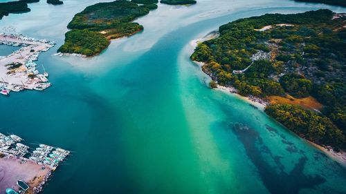
The State of Chiapas
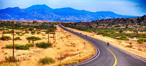
The state of Chiapas rises from the Pacific coastal plain to the peaks of two ranges, the Sierra Madre de Chiapas and Los Altos de Chiapas. The climate, like the land, varies enormously. The coastal areas can be hot and muggy, while in highland towns like San Cristóbal de las Casas, nights can call for a jumper, even in August.
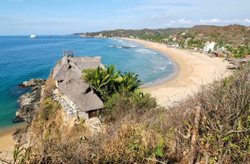
Chiapas has the greatest biological diversity in North America. Its forests are home to howler monkeys, red macaws and jaguars. Most visitors will likely see these animals only at the zoo in Tuxtla Gutiérrez, but you can venture into the heart of the huge Montes Azules Biosphere Reserve, a section of the largest remaining rainforest in North America. From Ocosingo you can make forays into its heart, Laguna Miramar, a truly isolated wilderness destination. There’s also cloud forest in the south of the state, protected in El Triunfo Biosphere Reserve. From the pretty colonial town of Comitán de Domínguez, the isolated Frontier Highway runs along the Guatemala border and past the beautiful lakes and hills of the Parque Nacional Lagos de Montebello.
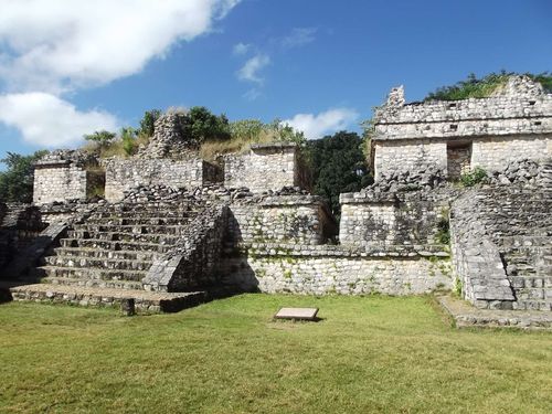
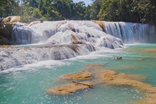
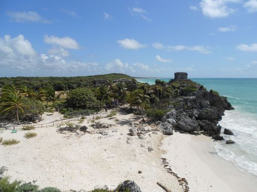
On the east side of the mountains, at the edge of the Yucatán plain, the Classic-period Maya city of Palenque is one of Mexico’s finest ancient sites. The limestone hills in this area are pierced by exquisite waterfalls. Palenque is the best starting point for a trip down the Usumacinta valley, to visit the remote ruins of Bonampak and Yaxchilán, where you can cross to Guatemala by boat. This remote eastern half of Chiapas is also the home of the Lacandón Maya, who retreated into the forest when the Spaniards arrived, and shunned all outside contact until some fifty years ago.
Fiestas in Chiapas and Tabasco
The states of Chiapas and Tabasco are extremely rich in festivals. Local tourist offices should have more information on what’s happening.
- New Year’s Day (Jan 1). San Andrés Chamula and San Juan Chamula, both near San Cristóbal, have civil ceremonies to install a new government for the year.
- Día de San Sebastián (Jan 20). In Chiapa de Corzo, a large fiesta with traditional dances (including the masked parachicos) lasts several days, with a re-enactment on Jan 21 of a naval battle on the Río Grijalva.
- Día de la Candelaria (Feb 2). Colourful celebrations at Ocosingo.
- Fiesta de San Caralampio (Feb 11–20). In Comitán, celebrated with a parade to San Caralampio church, where elaborate offerings are made and dances held in the plaza outside.
- Carnaval (the week before Lent; variable Feb & March). Celebrated in hundreds of villages throughout the area, but at its most frenzied in the big cities, especially Villahermosa.
- Anniversary of the foundation of Chiapa de Corzo (March 1). Town fair with kiddie rides, live music and more.
- Semana Santa (Holy Week). Widely observed. There are particularly big ceremonies in San Cristóbal de las Casas. Ciudad Hidalgo, at the border near Tapachula, has a major week-long market.
- Feria de San Cristóbal de las Casas (April 1–7). Festival in San Cristóbal de las Casas celebrating the town’s foundation.
- Feria de Villahermosa (second half of April). Villahermosa hosts its annual festival, with agricultural and industrial exhibits and the election of the queen of the flowers.
- Día de San Pedro (April 29). Celebrated in several villages around San Cristóbal, including Amatenango del Valle and Zinacantán.
- Día de la Santa Cruz (May 3). Celebrated in San Juan Chamula and in Teapa, between Villahermosa and San Cristóbal.
- Día de San Isidro (May 15). Peasant celebrations everywhere – famous and picturesque fiestas in Huistán, near San Cristóbal. There’s a four-day nautical marathon from Tenosique to Villahermosa, when craft from all over the country race down 600km of the Río Usumacinta.
- Día de San Antonio (June 13). Celebrated in Simojovel, near San Cristóbal, and Cárdenas (Tabasco), west of Villahermosa.
- Día de San Juan (June 24). The culmination of several days’ celebration in San Juan Chamula.
- Día de San Cristóbal (July 17). Celebrated enthusiastically in San Cristóbal de las Casas and in nearby villages such as Tenejapa and Amatenango del Valle.
- Día de Santiago (July 25). Provokes widespread celebrations, especially in San Cristóbal de las Casas.
- Fiesta de Santo Domingo de Guzmán (last week of July, first week of Aug). Comitán’s fair, with concerts, rodeos and more.
- Fiesta de San Lorenzo (Sun nearest Aug 10). Celebrated in Zinacantán, with much music and dancing.
- Día de Santa Rosa (Aug 30). Celebrated in San Juan Chamula, when the locals don traditional garb and play Tzotzil harps and instruments outside the church.
- Independence Day (Sept 14–16). In Chiapas, independence celebrations are preceded by those in honour of the state’s annexation to Mexico.
- Día de la Virgen del Rosario (first Sun in Oct). Celebrated in San Juan Chamula and Zinacantán with Tzotzil folk music and dances. There’s also a special craft market.
- Día de los Muertos (Day of the Dead; Nov 1–2) The most captivating celebration of the Day of the Dead in Chiapas takes place in Comitán, where the cemeteries overflow with flowers and ornate altars.
- Día de la Virgen de Guadalupe (Dec 12). An important day throughout Mexico. There are particularly good fiestas in Tuxtla Gutiérrez and San Cristóbal de las Casas.
- Feria and cheese expo (Dec 17–22). Held in Pijijiapan, on the coast highway to Tapachula.
San Cristóbal de las Casas and around
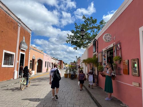
The unofficial capital of highland Chiapas, San Cristóbal de las Casas, or Jovel, as many locals call it, is a major stop on the travel circuit and a memorable highlight of any trip to Mexico. Despite its popularity, the city of tile-roofed houses gathered in a valley basin has retained its character. While the modern outskirts can feel unremarkable, the historic center has avoided unchecked development: pedestrianized streets encourage a relaxed social scene, with a cosmopolitan mix of small bars and restaurants that embrace a subtle leftist–revolutionary vibe. It’s also one of the best places to study at a Spanish-language school.
San Cristóbal is an ideal base for exploring highland Chiapas, one of the most scenic regions in the country and a memorable focus for 14-day Mexico trips. Dense forested mountains give way to dramatic gorges, jungle valleys filled with orchids, brilliantly colored birds, and noisy monkeys. The area’s relative isolation has allowed Indigenous communities to maintain traditions little influenced by Catholicism or modern commercialism. Clothing, crafts, and ceremonies remain deeply rooted, though visitors should remember that many locals, especially elders, prefer not to be photographed. Always ask permission and respect the answer. Villages west of the city are largely Tzotzil-speaking, while those to the east speak Tzeltal, each maintaining its own unique identity in costume, craftwork, and language.
Just 75km from Tuxtla, the fast toll highway rises through clouds into pine forests before reaching San Cristóbal at 2100m. Even in August, evenings can be chilly; come prepared.
Brief history
San Cristóbal was designed as a Spanish stronghold against an often hostile indigenous population – the attack here by Zapatista rebels in January 1994 was only the latest in a long series of uprisings. It took the Spaniards, led by conquistador Diego de Mazariegos, four years to pacify the area enough to establish a town here in 1528. The so-called Villareal de Chiapa de los Españoles was more widely known as Villaviciosa (Evil City) for the oppressive exploitation exercised by its colonists. In 1544, Bartolomé de las Casas was appointed bishop, and he promptly took an energetic stance in defence of the native population, playing a similar role to that of Bishop Vasco de Quiroga in Pátzcuaro. His name is still held in something close to reverence by the local population. Throughout the colonial era, San Cristóbal was the capital of Chiapas (at that time part of Guatemala), but lost this status in 1892 as a result of its continued reluctance to accept the union with Mexico.
Independent as the indigenous groups are, economic and social status in the mountains around the city lags far behind the rest of Mexico. This is in part due to the long duration of the encomienda system of forced labour, which remained in place here long after the end of Spanish colonialism. Many small villages still operate at the barest subsistence level. It’s worth noting that many indigenous communities and some local transport operators refuse to observe the time change in summer, preferring la hora vieja – the old time, or, as some savvy marketers have dubbed it, ‘Zapatista time’.
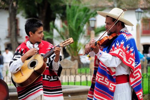
Kinta Jimultik in San Juan Chamula
During the annual Kinta Jimultik, the carnival (five days in Feb/March), representatives of all the villages in the area around San Cristóbal attend in traditional dress, marching in circles around Iglesia de San Juan Bautista and up to strategically placed crosses on the hillsides for the first four days. On the final day, which coincides with the last of the five ill-fated days of the Maya calendar, purification rites and fire-walking ceremonies take place in the plaza.
Visiting Chamula and Zinacantán
Almost everyone who stays in San Cristóbal visits the Tzotzil Maya villages of San Juan Chamula and San Lorenzo de Zinacantán. Both places have retained much of their unique cultural identity, including a religion that is a blend of traditional animist belief and Catholicism. The church at Chamula, in particular, is one of the most moving sights in Mexico.
It’s hard not to feel a sense of intrusion in these settings, where you may be a spectator at some intense religious ritual. Though an organized tour (very easy to arrange in San Cristóbal) can feel a little rushed and contrived, paradoxically it may make you feel like less of a gate-crasher – your presence in the church is made a bit more ‘official’, and the guides can explain some of the rituals. Tours depart at 9.30am, visit both villages and return to San Cristóbal around 2pm (there is little difference between companies).
If you do come on your own, you’ll feel less conspicuous in busy tourist times (Aug primarily), when there’s more of a Mexican tourist crowd, and a festive atmosphere. Inexpensive combis leave frequently for Chamula, Zinacantán and other villages from Edgar Robledo, just north of the market in San Cristóbal. There are no combis between Chamula and Zinacantán.
Visiting Chiapas: the legacy of the Zapatista rebellion
On January 1, 1994, the day that the North American Free Trade Agreement (NAFTA) came into effect, several thousand lightly armed rebels calling themselves Zapatistas (after early twentieth-century revolutionary Emiliano Zapata) occupied San Cristóbal de las Casas, the former state capital and Chiapas’ major tourist destination. The Zapatistas declared themselves staunchly anti-globalization, as well as opposed to local efforts by paramilitary groups to force indigenous people off the land. When the Mexican army recovered from its shock, it launched a violent counterattack, but international solidarity with the rebels soon forced the Mexican government to call a halt.
A ceasefire was agreed in 1995, and negotiations have continued over the years, as yet to conclude in a peace treaty. But eventually the issue of indigenous rights spread beyond the state’s borders, with large-scale disturbances in Oaxaca in 2006 making Chiapas seem relatively peaceful.
Twenty years on, the word “Chiapas” is still synonymous with violent revolution, but while the Zapatistas remain nominally “at war” with the Mexican government, the struggle is now largely ideological. The organization still runs its own municipalities, “caracoles”, on land seized from large landowners, and is largely left alone by the government. Tourists have always visited Chiapas with no problems other than delays due to army (and occasional Zapatista) checkpoints. The government is hostile to foreign Zapatista sympathizers, however, as their presence is considered an illegal influence on Mexican politics – so showing obvious Zapatista support in Chiapas can potentially lead to deportation.
Chiapa de Corzo and around
An elegant town of about seventy thousand, CHIAPA DE CORZO overlooks the Río Grijalva. As it’s barely twenty minutes east of Tuxtla, it makes a scenic alternative to the big city. It’s best known as the starting point for boat rides through the Cañón del Sumidero, and has quite a tourist scene during Mexican holiday times. The first Spanish city in Chiapas, it was officially founded in 1528, though it had already been an important centre in pre-Classic times. A stele found here bears the oldest Long Count date yet discovered, corresponding to December 7, 36 BC. The ruins that remain are on private land behind the Nestlé plant, at the far end of 21 de Octubre on the edge of town.
Cañon del Sumidero
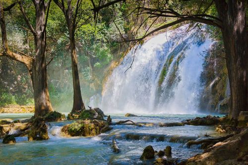
On the highway east from Chiapa de Corzo towards San Cristóbal, you catch occasional glimpses of the Río Grijalva and the lower reaches of one of Mexico’s deepest canyons, with walls up to 1000m high in some places. Its rock walls are sprinkled with patches of bright green vegetation and odd rock formations, and carved out with shallow caves. A drive along the rim passes miradores (lookout points) that are unnervingly close to the edge – the most dramatic is at Las Coyotas. A boat ride up the river from Chiapa de Corzo is just as awe-inspiring, snaking through the whole gorge up to the Chicoasén Dam, which forms a lake at the northern end. Along the way are several waterfalls, including the remarkable El Árbol de Navidad, where calcareous formations covered in algae resemble a Christmas tree. Crocodiles and spider monkeys can often be spotted, along with pelicans, egrets and cormorants.
The one drawback to the water-level view from the boat is the undeniable amount of rubbish in the water that collects along the stagnant edges of the canyons. It’s periodically rounded up and disposed of, but it’s particularly bad during the rainy season, when the water is highest. But this shouldn’t deter you from seeing the greatest geological wonder in Chiapas.
Chiapa de Corzo boat tours
In Chiapa de Corzo, several companies offer boat trips down the canyon, all for around the same price. The first office you reach is Turística de Grijalva (961 600 6402), on the west side of the plaza. Or you can head straight south down the street to the embarcadero, where other companies operate. During Mexican vacation times, boats fill with the requisite ten people almost immediately, and it doesn’t matter where you buy your ticket. In slower times, it’s best to show up early and go from company to company to see which boat is closest to full. Tours last a couple of hours.
Comitán de Domínguez
The fourth-largest city in Chiapas, Comitán is 88km from San Cristóbal, southeast along the Panamerican Highway through scintillating scenery. Strategically poised on a rocky hillside, the city is surrounded by rolling farms and wild countryside in which orchids bloom. Once past the scrappier outskirts, the city has an elegant colonial core and a small but absorbing market, as well as a mellow timetable, with many businesses still observing an afternoon siesta. Travellers often pause here before heading for the border with Guatemala or deeper into the wild at the Lagos de Montebello or the Lacandón forest.
Once a major Maya population centre (the ruins of Bonampak and Yaxchilán and even Palenque are not far, as the parrot flies), Comitán was originally known as Balún Canán (“Nine Stars”, or “Guardians”), but was renamed Comitán (“Place of Potters” in Náhuatl) when it came under Aztec control. At 1560m, it’s not as high as San Cristóbal but can still be more refreshing than the sweltering lowlands; make sure your hotel has blankets.
The Usumacinta valley and the Frontier Highway
The Carretera Fronteriza (Frontier Highway) heads south from Palenque into the Lacandón forest and the Río Usumacinta, passing the two great Maya sites of Bonampak and Yaxchilán. The remote highway, which was paved only in 2000, to help delineate the border with Guatemala, has a reputation as a dangerous place. Although tourist convoys are no longer required, it’s still not advisable to drive the road after dark: there is a risk of robbery, a lot of wildlife, and few people to help you if you break down, have an accident or encounter any trouble. Army checkpoints are common, so make sure you have your passport. If you don’t visit with a group, try to pick up an information sheet on the Lacandón community from Casa Na-Bolom in San Cristóbal.
Bonampak
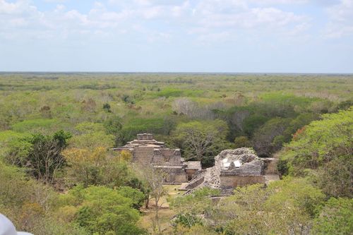
Relatively small compared with other ruined Maya cities, BONAMPAK is unique due to its fascinating murals, evocative memorials to a lost civilization. Bonampak’s actual buildings, most from the eighth century, are small and not the most spectacular, but the murals definitely make it worth the visit – there is very little like them elsewhere in the Maya world, and even in their decayed state, the colours are vivid and the imagery memorable.
Bonampak lies in the small biosphere reserve controlled by the Lacandón on the fringe of the much larger Montes Azules Biosphere Reserve. The site is quite isolated, and the only facilities are toilets and a couple of huts selling crisps and carved-wood souvenirs. The nearest settlement is the village of Lacanjá Chansayab, about 2.5km away – basic cabañas, rented by the Lacandón people, are available here.
Brief history
The outside world first heard of Bonampak, meaning “painted walls”, in 1946, when Charles Frey, an American who’d dodged the draft by heading to the Mexican forest during WWII, was shown the site (but apparently not the murals) by Lacandón, who still worshipped at the ancient temples. The first non-Maya to actually see these murals – astonishing examples of Classic Maya art – was the American photographer Giles Healey, who arrived shortly after Frey’s visit, sparking a long and bitter dispute over exactly who was responsible for their discovery.
La Gran Plaza
After crossing an airstrip, you are at the northwest corner of the central plaza, 110m long and bounded by low walls that mark the edges of a former palace. In the centre of the plaza Stele 1 shows a larger-than-life Chaan Muan II, the last king of Bonampak, dressed for battle – at 6m, it is one of the tallest steles in the Maya world. You’ll encounter other images of him throughout the site.
The Acrópolis
Ahead of the Gran Plaza, atop several steep flights of steps, lies the Acrópolis. On the lower steps, more well-preserved steles show Chaan Muan with his wife, Lady Rabbit, preparing himself for blood-letting and apparently about to sacrifice a prisoner. From the highest point of the acropolis there’s an impressive sense that you’re surrounded by primeval forest – the Selva Lacandona – with just a small cleared space in front of you.
Edificio de las Pinturas
The highlight is the modest-looking Edificio de las Pinturas, halfway up the steps of the acropolis. Inside, in three separate chambers and on the temple walls and roof, the Bonampak murals depict vivid scenes of haughty Maya lords, splendidly attired in jaguar-skin robes and quetzal-plume headdresses, and equally well-dressed ladies; and bound prisoners, one with his fingernails ripped out, spurting blood. Dating to around 790 AD, these paintings show the Bonampak elite at the height of their power: unknown to them, the collapse of the Classic Maya civilization was imminent. Some details were never finished, and Bonampak was abandoned shortly after the scenes were painted.
Though you can’t enter the rooms fully, the vantage point inside the doorway is more than adequate to absorb what’s inside. No more than three people are permitted to enter at any one time and queues are possible, but you shouldn’t have to wait long. Having said that, time and early cleaning attempts have clearly taken their toll on the murals, and apart from a few beautifully restored sections, it takes some concentration and imagination to work out what you’re looking at.
The murals
In Room 1, an infant wrapped in white cloth (the heir apparent?) is presented to assembled nobility under the supervision of the lord of Yaxchilán, while musicians play drums, pipes and trumpets in the background. Room 2 contains a vivid, even gruesome, exhibition of power over Bonampak’s enemies: tortured prisoners lie on temple steps, while above them lords in jaguar robes are indifferent to their agony. A severed head rolls down the stairs and Chaan Muan II grasps a prisoner (who appears to be pleading for mercy) by the hair – clearly about to deal him the same fate. Room 3 shows the price paid for victory: Chaan Muan’s wife, Lady Rabbit, prepares to prick her tongue to let blood fall onto a paper in a pot in front of her. The smoke from burning the blood-soaked paper will carry messages to ancestor-gods. Other gorgeously dressed figures, their senses probably heightened by hallucinogenic drugs, dance on the temple steps.
Yaxchilán
A larger and more dramatic site than Bonampak, Yaxchilán was an important Classic-period centre. From around 680 to 760 AD, the city’s most famous kings, Escudo Jaguar (Shield Jaguar) and his son Pájaro Jaguar IV (Bird Jaguar), led a campaign of conquest that extended Yaxchilán’s sphere of influence over the other Usumacinta centres and made possible alliances with Tikal and Palenque. The buildings occupy a natural terrace above the river, with others climbing steep hills behind – a superb natural setting.
Not so many people make the trip here, which involves a ride in a narrow lancha with a tin roof for shade, down the broad, fast-flowing river with Mexico on one bank, Guatemala on the other. At the site, it’s easy to be alone in the forest with nothing but moaning howler monkeys around you. Giant trees keep the place shady, but nonetheless the jungle heat can be palpable – bring plenty of water, as there are no services at the ruins.
Pequeña Acrópolis
From the site entrance, the main path leads straight ahead to the Gran Plaza, but if you have the energy for climbing, it’s more rewarding to explore the wilder parts of the site first. Follow the branching path to the right that leads up the hillside to the Pequeña Acrópolis, a set of thirteen buildings. A lintel on the most prominent ruin, known as Edificio 42, depicts Escudo Jaguar with one of his warriors.
Templos del Sur
Walk behind Edificio 42 to find another narrow trail down through the jungle, over several unrestored mounds, until you reach a fork: to the right, the path climbs steeply once again until it reaches, in about ten minutes, Edificios 39 to 41, also called the Templos del Sur, 90m above the river level – buildings that probably had some kind of astronomical significance. High above the main forest, this is also a good spot to look for canopy-dwelling birds like parrots, though the trees also obscure any view.
El Palacio
Retrace your steps back to the main path, and continue on until it emerges at the back of Edificio 33, the most famous building at the site, also known as El Palacio. It overlooks the main plaza from a high terrace. The lintels here are superbly preserved, and inside one of the portals is a headless statue of Pájaro Jaguar IV. In ancient times the building was a political court; more recently, it served as a religious site for the Lacandón Maya.
Gran Plaza
Descending 40m down the stairs in front of the Palacio brings you to the long Gran Plaza. Turn back to look up at the Palacio: with the sun shining through the building’s roofcomb and tree roots cascading down the stairs, this is what you imagine a pyramid lost in the jungle should look like, especially if you’ve been brought up on Tintin.
To your left, just above the level of the plaza, Edificio 23 has a few patches of coloured stucco around its doorframes – just one patch of many well-preserved paintings and relief carvings on the lintels of buildings surrounding the long green lawn. Some of the very best works were removed in the nineteenth century and are now in the British Museum in London, but the number and quality of the remaining panels are unequalled at any other Maya site in Mexico. Many of these depict rulers performing rituals.
This can also be seen on Stele 1, right in the middle of the plaza, near the base of the staircase. It depicts Pájaro Jaguar IV in a particularly eye-watering blood-letting ceremony, ritually perforating his penis. Stele 3, originally sited at Edificio 41, has survived several attempts to remove it from the site and now lies at the west side of the plaza, where it shows the transfer of power from Escudo Jaguar to Pájaro Jaguar IV.
El Laberinto
Heading back to the entrance, be sure to pass through El Laberinto (The Labyrinth) at the plaza’s northeast corner, the most complex building on the site, where you can walk down through dim passages out onto the main path.
The Lacandón
You may already have encountered the impressively wild-looking Lacandón Maya, dressed in simple white robes and selling exquisite (and apparently effective) bows and arrows at Palenque. Until recently, they were the most isolated of all the Mexican Indian groups. The ancestors of today’s Lacandón are believed to have migrated to Chiapas from the Petén region of Guatemala during the eighteenth century. Prior to that the Spanish had enslaved, killed or relocated the original inhabitants of the forest.
The Lacandón refer to themselves as “Hach Winik” (true people). Appearances notwithstanding, some Lacandón families are (or have been) quite wealthy, having sold timber rights in the jungle, though most of the timber money has now gone. This change has led to a division in their society, and most live in one of two main communities: Lacanjá Chansayab, near Bonampak, a village predominantly made up of evangelical Protestants, some of whom are keenly developing low-impact tourist facilities; and Nahá, where a small group still attempts to live a traditional life, and where it is possible to arrange stays in local homes. The best source of information on the Lacandón in Chiapas is Casa Na-Bolom in San Cristóbal de las Casas, where you can find a manuscript of Last Lords of Palenque, by Victor Perera and Robert Bruce. Hach Winik, by Didier Boremanse, is an excellent recent study of Lacandón life and history.
Parque Nacional Lagos de Montebello
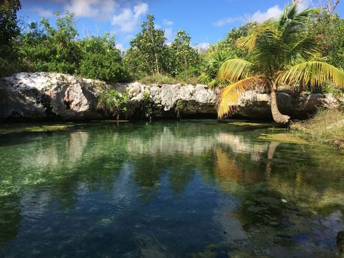
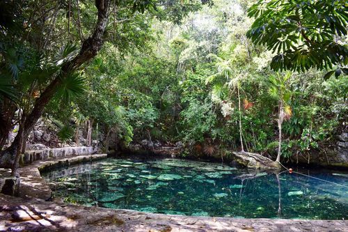
Fifty kilometres southeast of Comitán, along the border with Guatemala, the Parque Nacional Lagos de Montebello is beautiful wooded country studded with more than fifty lakes, sixteen of them very large, and many edged with small restaurants providing local food and basic cabañas. The combination of forest and water is reminiscent of Scotland or Maine, with many kilometres of hiking potential. For the less energetic, roadside viewpoints provide glimpses of various pools, lent different tints by natural mineral deposits and the angle of the sun. The lakes themselves are actually a series of cenotes (sinkholes) formed by the erosion of limestone over millions of years.
San Juan Chamula
Usually referred to as just Chamula, this is the closest indigenous village to San Cristóbal (10km), as well as the most frequently visited. It has a population of fifteen thousand or so, and more than ninety thousand in the surrounding municipality – despite the fact that thousands of residents have been cast out in recent decades for converting to Protestant faiths (these so-called expulsados create many of the crafts sold in San Cristóbal proper).
Chamula and the surrounding indigenous communities are essentially self-governing, and have their own schools, police force, and a small prison with two cells that are semi-open so as to expose the criminals to “public shame”. Over the centuries, the village has been far more resistant to change than neighbouring Zinacantán, putting up fierce resistance to the Spaniards from 1524 to 1528, then acting as the centre of a rebellion described as the second “Caste War” from 1867 to 1870, inspired by the uprising in the Yucatán.
On the north side of the plaza, the two hundred-year-old Iglesia de San Juan Bautista, painted a festive turquoise, is the epicentre of Tzotzil Maya religion in the area, and one of the most intensely sacred spots in all of Mexico. A visit can be a humbling and moving experience. The interior is glorious, the floor covered with pine needles and the light of a thousand candles casts an eerie glow. Lining the walls are statues of the saints adorned with offerings of clothes, food and mirrors (thought to aid communication with the laity), while above the altar, San Juan, patron saint of the village, takes pride of place. The customs practised inside the church incorporate aspects of Christian and Maya beliefs – each villager prays by clearing an area of pine needles and arranging a “message” in candles, and rituals frequently involve tearful chanting, singing, an array of fizzy drinks – locals believe expelling gas through burping helps to release evil spirits – and posh, a sugar-cane alcohol. Eggs, bones and live chickens – which are sacrificed in the church and later eaten or buried – are also used in these ceremonies. There are no priests, masses or marriages here, only baptisms, and the church is open 24 hours (though tourists are welcome only during daylight). It plays a central role in healing ceremonies.
In keeping with Chamula's very traditional atmosphere, photography is generally not appreciated, and it is explicitly banned inside the church.
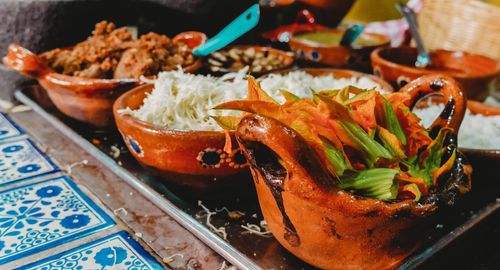
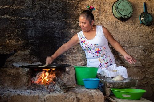
Chiapas on a plate
While the cuisine of Chiapas is not as famous as that of neighbouring Oaxaca, you can still eat very well while visiting the state. Dishes to look out for include pepita con tasajo (sliced beef marinated in chilli and herbs), tamales flavoured with local herbs like hoja santa and chipilín, pork in a pipian (pumpkin seed) sauce, and (in the coastal regions) dried shrimps in a tomato sauce. The city of San Cristóbal de las Casas is known for its Spanish-style cured hams and sausages, while the area around Ocosingo produces a good range of artisanal cheeses, and Chiapa de Corzo is famous for its suckling pig dishes. In terms of drinks, as well as excellent coffee from the state’s highland regions, there are some more unusual beverages to sample, such as tazcalate (a blend of toasted corn, chocolate and cinnamon) and pozol (a sugary corn and chocolate drink).
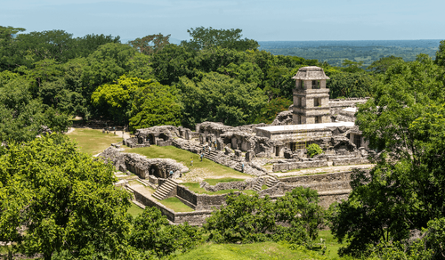
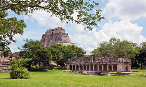
Palenque and around
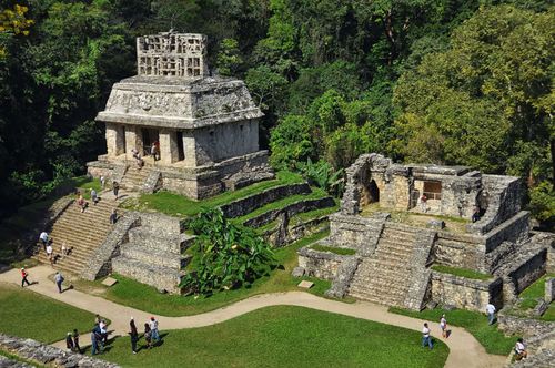
Set in thick jungle buzzing with insects, the ancient Maya ruins of Palenque are some of Mexico’s finest Maya sites: less crowded than Chichén Itzá, larger than Uxmal, and with the most spectacular setting. It is a relatively small site – you can see everything in a morning – but a fascinating one, strongly linked to the lost cities of Guatemala while displaying a distinctive style.
Nine kilometres east of the ruins, the rather helter-skelter town of Palenque functions as the base for exploring the ruins and the waterfalls in the nearby hills. With every facility a visitor might need, it’s lively enough, but it has no real intrinsic appeal. As there are a number of excellent camping sites, cabañas and hotels near the ruins, you may prefer not to stay in town at all.
The ruins are located in the Parque Nacional de Palenque, the border of which is just after El Panchán accommodation and restaurant site. The main road first passes a well-stocked artesanía shop, a café and the excellent site museum. You can enter at the gate across the road, hiking up to the main part of the site via the waterfalls trail, but most people will press on to the main site entrance, at the top of the hill another 2km up a winding road. Near this main entrance, there’s a small café and numerous souvenir stalls selling drinks, as well as toilets and some expensive lockers.
The ruins themselves bear a closer resemblance to the Maya sites of Guatemala than to those of the Yucatán, but ultimately the style here is unique – the towered palace and pyramid tomb are like nothing else, as is the abundance of reliefs and inscriptions. The setting, too, is remarkable. Surrounded by jungle-covered hills, Palenque is right at the edge of the great Yucatán plain – climb to the top of any of the structures and you look out over an endless stretch of low, pale-green flatland. If you arrive early enough in the day, the mist still clings to the treetops and the howler monkeys are roaring off in the greenery.
Rough Guides tip: Find tons of ideas for your Mexican adventure in our guide to the best vacation spots in Mexico.
Brief history
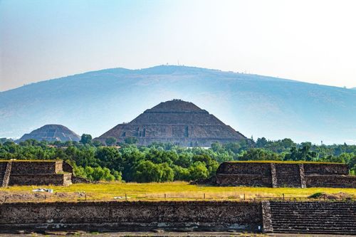
Founded around 100 BC as a farming village, it was four hundred years before Palenque began to flourish, during the Classic period (300–900 AD). Towards the end of this time the city ruled over a large part of modern-day Chiapas and Tabasco, but its peak, when the population is thought to have numbered some one hundred thousand, came during a relatively short period in the seventh century, under two rulers: Hanab Pakal (Jaguar Shield) and Chan Bahlum (Jaguar Serpent). Almost everything you can see (and that’s only a tiny, central part of the original city) dates from this era.