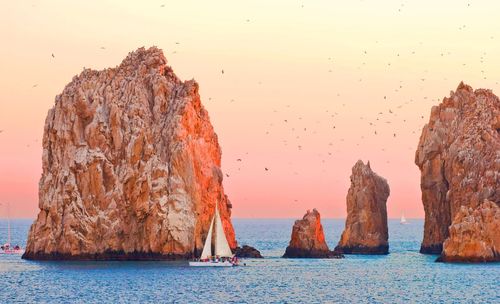
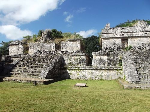
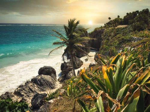
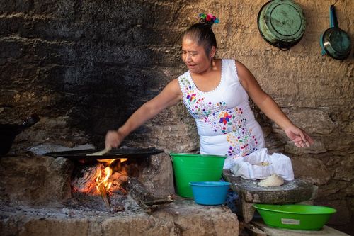
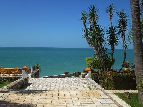
Baja California Travel Guide

Graced with tantalizing desert landscapes, lush oases and rich marine life, Baja California is one of the most compelling and popular destinations in Mexico. Its human history is no less enticing, with a legacy of remote cave paintings, crumbling Spanish missions, luxury beach resorts and fabulous seafood. Yet even today, Baja maintains a palpable air of isolation from the rest of Mexico. The peninsula lies over 1300km west of Mexico City, and the sheer distances involved in traversing its length – it’s over 1700km long – are not conducive to quick exploration.

One of the most magical sights in Baja is the annual grey whale migration from December to April; the best places to see the whales are the Laguna Ojo de Liebre, just off Guerrero Negro, or the lagoon near San Ignacio, where the town is an attraction in itself. The peninsula is also home to some of the most bewitching and thought-provoking cave art in the world – the Sierra de San Francisco, between Bahía de los Angeles and Loreto, was declared a World Heritage Site by UNESCO in 1993 because of its five hundred particularly vivid rock-art sites.

And all along the coast you’ll find turquoise waters and white-sand beaches; most towns in Baja California Sur offer fantastic opportunities for diving, fishing and kayaking, but Bahía Concepción, Loreto, La Paz and the remote settlements on the East Cape are the standouts among them. In complete contrast, right at the end of the peninsula, the booming resort of Los Cabos offers its own special blend of boutique hotels, beach activities, top-notch restaurants and wild nightlife.

You never know where your Baja California adventure will take you, so don't set off without securing great value travel insurance from our trusted partner Heymondo.

Bahía de los Ángeles

If you have your own transport, a worthy detour off Hwy-1 is BAHÍA DE LOS ÁNGELES (also known as L.A. Bay), a small community of fewer than one thousand on the Sea of Cortez. The town maintains an underdeveloped, frontier feeling, little changed from when Steinbeck sailed through in 1941, while the eponymous bay teems with sea life and is hemmed in by contorted mountains and lots of enticing beaches. Because of the difficulty getting supplies to the bay, lodging and food are more expensive than you’d expect, and there are no banks or ATMs, so make sure you have enough cash.

Ensenada

Perched on the edge of the Bahía de Todos Santos, 100km south of Tijuana, the attractive port of ENSENADA is far calmer, cheaper and smaller than its northern rival, making for an inviting pit-stop and jumping-off point for the wineries to the east. Like Tijuana, Ensenada is a relatively recent creation by Mexican standards, despite being officially “founded” (ie discovered by the Spanish) in 1542; nothing much happened until 1872, when gold was unearthed in nearby Real de Castillo. Ensenada was gradually developed as a port, the modern town effectively planned and developed by American investor George H. Sisson and the British-owned Mexican Land & Colonization Co in the 1880s. The town remained a backwater, however, with tourism and modern development only taking off in the 1950s. Note that US cruise excursions to Ensenada are booming, so be prepared for crowds on days that ships are in port (mainly during the summer months).

While you're here, don't miss the Mercado de Mariscos (aka Mercado Negro) at the northwest end of the Malecón, where you'll find numerous stalls selling the day’s catches. The diversity of what’s on display – from squirming eel and smoked fish to giant abalone – is impressive, and it’s a good place to try the town’s lauded fish tacos, which were supposedly invented in Ensenada and have been served at the market since it opened in 1958.

Valle de Guadalupe

The vineyards of the Valle de Guadalupe, just east of Ensenada, are not quite Napa Valley standard, but the region is clearly on the right track, as illustrated by growing international acclaim and the pioneering work of French-trained winemaker Hugo d’Acosta since the 1990s. Though you can show up at the major wineries without a reservation, it is best to call vineyards before visiting, especially if you’re coming in the warmer months (July–Sept). The villages of San Antonio de las Minas in the southwest and Francisco Zarco and El Porvenir in the northeast are the centres of the valley’s production.

Baja wines: five of the best

Once derided for watery grapes and poor vintage, Baja wines have gathered a loyal following since the late 1990s thanks to small-production, high-quality boutique wines. These are five of the best:

  • Vino de Piedra, Casa de Piedra Tones of black fruit lace this blend of Tempranillo and Cabernet Sauvignon.
  • Viñas de Camou, Château Camou Bordeaux-style blend of Cabernet Sauvignon, Cabernet Franc and Merlot.
  • Cabernet Sauvignon/Merlot, Monte Xanic Smooth, dark-red wine with a peppery aroma.
  • Special Reserve Chardonnay, Château Camou One of the best white wines in the valley.
  • Gabriel, Adobe Guadalupe Another exquisite red-wine blend (55 percent Merlot), produced by Hugo d’Acosta.

Guerrero Negro

Continuing south on the main highway, there’s little between El Rosario and the 28th parallel, where an enormous metal monument marks the border between the states of Baja California and Baja California Sur; you’ll have to set your watch forward an hour when you cross. GUERRERO NEGRO, just across the border, offers little in the way of respite from the heat and aridity that has gone before (winters, however, can find the town quite chilly). Flat and dust-blown, it was only established in the 1950s as a supply centre for Exportadora de Sal, the world’s largest salt manufacturer, and is surrounded by vast saltpans and drab storage warehouses. At most times of year you’ll want to do little more than grab a drink and carry straight on, especially if you don’t have a car – it’s a dispiriting place to navigate on foot. In January and February (and, peripherally, Dec & March–April), however, Guerrero Negro is home to one of Mexico’s most extraordinary natural phenomena, the congregation of scores of grey whales just off the coast.

La Paz

Everyone ends up in LA PAZ eventually, the state capital and largest city of Baja California Sur. The outskirts may be an ugly sprawl, but the old town centre near the languid malecón, modernized as it is, has managed to preserve something of its sleepy provincial atmosphere. During the last week in February, La Paz livens up with its boisterous carnival, a plethora of colourful parades and cultural events that transform the town, while eating here is a real pleasure at any time. There’s not much to see in the city itself, but the surrounding beaches are lots of fun, and a boat trip to the Isla Espíritu Santo, rich in marine life, should not be missed.

South to La Paz

South of Ensenada, most travellers follow Hwy-1 as it shifts from suburban sprawl to farmland and then into curvy, hilly passes that eventually drop into the Santo Tomás valley. From here it’s around 1375km to La Paz, a journey which can take twenty hours direct or preferably several days, taking in the entrancing landscapes and small towns along the way – you’ll see far fewer tourists on this stretch of the Transpeninsular Highway. The alternative (if you have your own transport) is to detour via Hwy-3 and Hwy-5 to San Felipe, then take the rugged route along the Sea of Cortez to rejoin Hwy-1 north of Guerrero Negro.

Bahía Concepción

There is good diving and fishing immediately around Mulegé, but the best beaches are between 10km and 50km south of town along the shore of Bahía Concepción, for once easily accessible from Hwy-1 – the drive down to Loreto along this stretch of road is truly spectacular. The bay ranges from 3km to 6.5km wide, is 48km long and is enclosed on three sides and dotted with islands. The blue-green waters, tranquil bays and white-sand beaches are spellbinding and relatively undeveloped – though you will at times find teams of RVs lining the waters – and it’s a good place to break your journey for a day or so before travelling south. As far as kayaking goes, there are few places better than Bahía Concepción.

Whale watching from Guerrero Negro

Whale-watching is the principal reason people visit Guerrero Negro, as hordes of friendly California grey whales (up to two thousand at a time), which spend most of their lives in the icy Bering Sea around Alaska, can be observed (at remarkably close quarters) from within the nearby Laguna Ojo de Liebre (aka Scammon’s Lagoon), thrity minutes south of town. It’s a magical experience – and many visitors actually get to touch the whales, which sometimes come right up to bobbing vessels after the engines are switched off.

Organized tours begin in Guerrero, but you can also drive to the lagoon and hire a cheaper panguero (boat) yourself. Take Hwy-1 south for 9km and look for the sign to the Parque Natural de la Ballena Gris. From here it’s 6km along a rough dirt road to a gate (which someone will open, but only during the whale-watching season Jan–March), and another 18km to the lagoon. You’ll probably be asked to pay the park entrance fee here.

San Ignacio

Leaving Guerrero Negro, Hwy-1 winds 142km inland for the hottest, driest stage of the journey, across the Desierto Vizcaíno. In the midst of this landscape, SAN IGNACIO’s appeal is immediate, even from a distance. Gone are the dust and concrete that define the peninsula, replaced by green palms and a cool breeze; despite being hammered by Hurricane Odile in 2014, it remains an oasis any desert traveller would hope for, and another excellent base for whale-watching and cave art tours. There are no banks in town and few places accept credit cards – it’s best to come with a supply of cash.

Tours and trips from San Ignacio

Whale watching

Although whales are most in evidence in January and February, whale-watching tours to the nearby Laguna San Ignacio (around 50km from town, on mostly paved road) are offered from December to April. If you have your own car you can cut your expenses considerably (allow 1hr to be safe).

Cave art

Cave-art tours from San Ignacio focus on the Sierra de San Francisco about 45km north of town, where 320 sites exist, dating back some eight thousand years; tour operators usually pass through the little town of San Francisco de la Sierra and head for the easily accessible Cueva del Ratón, or remoter caves such as the Cueva Pintada and Cueva de las Flechas in Cañón San Pablo, which require a minimum of two days.

The Tides of San Felipe

The upper reaches of the Sea of Cortez experience the world’s third largest tides – fluctuations of 6–7m are common. You’ll soon realize why tide calendars are so common in San Felipe; water that laps lazily against the beach in the morning can recede a kilometre into the hazy distance by mid-afternoon.

El Boleo

Legend has it that while walking in the hills around Santa Rosalía in 1868, rancher José Villavicencio chanced upon a boleo, a blue-green globule of rock that proved to be just a taster of a mineral vein containing more than twenty percent copper. By 1880, the wealth of the small-scale mining concessions came to the notice of the Rothschilds, who provided financing for the French Compagnie du Boléo (or “El Boleo”) to buy mining rights and to build a massive extraction and smelting operation in 1885. Six hundred kilometres of tunnels were dug, a foundry was shipped out from Europe, and a new wharf built to transport the smelted ore north to Washington State for refining. Ships returned with lumber for the construction of a new town, laid out with houses built to a standard commensurate with their occupier’s status within the company.

By 1954, falling profits from the nearly spent mines forced the French to sell the pits and smelter to the Mexican government who, though the mines were eventually left idle, continued to smelt ore from the mainland until the 1990s. Starting in 2004, Canadian-listed Baja Mining Corp worked hard to reopen the mine – despite running into financing problems in 2012 (Korean Resources Corp is now the main shareholder) and damage caused by Hurricane Odile, production of copper, cobalt and zinc finally began in 2015, with the new El Boleo expected to have a minimum life of 22 years. Minera y Metalúrgica del Boleo has promised to work with local authorities to develop housing, infrastructure and utilities, and so far has created around a thousand new jobs in the area (with 65 percent local hires).

Cave art around Mulegé

Other than as a springboard for the beaches to the south, the main reason to stop at Mulegé is to take one of the cave art tours out to the Sierra de Guadalupe. This range boasts the densest collection of rock art in Baja, as well as some of the most accessible at La Trinidad (29 km west of town), requiring as little as five hours for the round trip (including 6.5km on foot). Getting a group together to cut costs shouldn’t prove a problem in high season, but you still need to shop around as the tours differ considerably. Overnight excursions are possible too, including a night at a 260-year-old ranch and two different cave locations. Head to Las Casitas in Mulegé (615 153 0019), which also acts as an informal tourist office for information on other local attractions and tours. They can connect you with Mulegé Tours, run by Salvador Castro Drew (615 153 0232) – Salvador grew up in the area and is one of the most knowledgeable local guides.

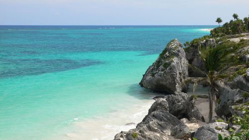
Sea lions, whale sharks and Isla Espíritu Santo

There are plenty of opportunities for fishing, diving and boat trips from La Paz, but it would be a shame to leave without visiting the azure waters of uninhabited Isla Espíritu Santo, a short boat ride north of the city. Protected within the Parque Nacional Archipiélago de Espíritu Santo (including the nearby Los Islotes, a small group of islands that hosts a colony of sea lions), snorkelling trips invariably encounter dolphins, manta rays, and depending on the time of year, fin whales and whale sharks (Nov–March) – the sea lions are a sure bet and always the most entertaining.

Loreto

Another popular escape for fishing and diving enthusiasts, LORETO was the site of the earliest permanent settlement in the Californias. Founded in 1697 by Juan María Salvatierra as the first Jesuit mission to the region, Loreto served as the administrative capital of the entire California territory until a devastating hurricane struck in 1829 and La Paz took on the role. Today Loreto is booming again; much of the centre is given over to craft shops and galleries, many selling silver, while the seafront malecón and central Plaza Cívica have been spruced up in recent years.

Some 8km south of town lies the largely expat community of Nopoló (aka Villages at Loreto Bay), one of the most ambitious residential developments in Mexico, and the posh Villa del Palmar resort. Construction has provided a massive economic boost to the entire region, but critics claim that the project threatens to overwhelm the already limited water supply and Loreto’s delicate natural assets: Mexico’s largest marine park, Parque Nacional Bahía de Loreto, lies just offshore, while the weathered landscapes of the Sierra de la Giganta provide a stunning backdrop.
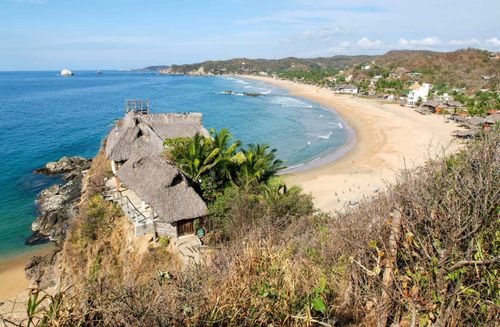
Los Cabos

South of La Paz, Baja California finally runs out of land where the Pacific Ocean and the Sea of Cortez come together in spectacular fashion. The ocean and sea meet at the sister towns of Cabo San Lucas and San José del Cabo, known collectively as Los Cabos – easily the most exclusive parcel of land in Baja California. Undeniably beautiful and home to the lion’s share of the peninsula’s lavish resorts, golf courses and oft-photographed beaches, the area is one of the fastest-developing regions in Mexico (despite being hammered by Hurricane Odile in 2014), supporting a sizeable North American expat population and hordes of time-share owners.

But Los Cabos is just a tiny part of the cape. Many of its most remarkable areas still require a great deal of time and preparation to access, and many travellers rent cars to drive the loop north of Cabo San Lucas: via the fast Hwy-19 running straight up the Pacific coast through historic Todos Santos; the older Transpeninsular Highway (Hwy-1) trailing north from San José del Cabo to La Paz; and the third, most exhausting route along the East Cape.

The East Cape

The East Cape region features 120km of wild coastline, littered with stunningly beautiful beaches, especially around Cabo Pulmo. There is only a handful of towns and villages, with far less development than Cabo San Lucas and San José del Cabo, though thanks to a major influx of North American “snowbirds”, US dollars are also widely accepted here, and English is often spoken.

The best of the East Cape is protected within Cabo Pulmo National Marine Park, with pristine beaches and a rare hard coral reef just offshore. The area is anchored by the off-the-grid village of CABO PULMO, which has a population of around 250, basic facilities (only solar power), no paragliders and no jet skis. The beach here is rocky with strong riptides, but just fifteen minutes’ drive south on a bumpy gravel road is Playa Los Arbolites (entry M$30), a gorgeous privately owned beach with palapas, toilets and showers, and decent snorkelling. About five minutes further south by car is Playa Los Frailes (free, no facilities), a picturesque cove with sensational snorkelling – it can be like swimming in a fish tank, with rays and turtles also gliding around. There’s also a sea lion colony about 1km further along the shore, accessed by boat, kayak or by a combination of wading and swimming (strong swimmers only). Rent snorkelling gear back in Cabo Pulmo.

The largest and most accessible resort town on the East Cape is LOS BARRILES, a sportfishing and windsurfing centre some 66km north of Los Cabos airport on Hwy-1 (beyond the turning to Cabo Pulmo). Though it gets busy in the winter, it retains a fairly laid-back scene, with low-key development along the shore.

Wine tasting in Todos

Visit La Bodega de Todos Santos (612 152 0181) on Hidalgo, between Militar and Juárez, for Baja wine tastings (mostly Valle de Guadalupe), every Monday 5–8pm. The wine shop is otherwise open Tuesday–Saturday noon–7pm, with red wine tasting (and Doña Guillermina’s tamales) on Wednesdays 5–8pm. Also sells its own olive oil from the Valle de Ensenada.

Surf and swim El Pescadero

Before heading further south consider stopping at El Pescadero, just 12km from Todos, a small dusty village close to some of the best surf breaks and beaches on the coast: Playa San Pedrito, a short walk from the village, and gorgeous Playa Los Cerritos, 1km south (look for the turn at km 65). Both beaches are good for swimming. Mario’s Surf School (612 142 6156) rents surf boards and offers lessons at Playa Los Cerritos, and there's a good choice of accommodation and eating options in the area. Most buses stop at Pescadero, on Hwy-19 (every 30min or so in both directions), but you really need a car to make the most of the area.

When to visit Los Cabos

High season in Los Cabos, as in the rest of Baja, is November through until May, though domestic tourists also provide a mini boom July and August. January and February is the best time to see whales. Avoid Christmas and Easter (packed) and spring break (Feb/March) if you want to sleep; the fishing competition season in October and November can be fun but also busy. In the summer and early autumn off-season (May–June and Sept–Oct), the heat (up to 42 °C) makes things less appealing (though the sea is warm; many locals swim at night). Whenever you visit, you can be assured that it rarely rains – all the fresh water comes from desalination plants.

Sand Falls and Neptune’s Finger

Dive trips are big business in Cabo. Experienced divers shouldn’t miss the rim of a marine canyon at a site known as Anegada, off Playa del Amor, where unusual conditions at 30m create the “Sand Falls” (famously discovered by Jacques Cousteau in the 1970s), with streams of sand starting their 2000m fall to the canyon bottom. Nearby, Neptune’s Finger is a rock pile smothered in sea sponges, gorgonias and sea fans.

The corridor’s best beaches

The distinction between Cabo San Lucas and San José del Cabo blurs further each year as new resorts are erected along the 33km Corredor Turístico (aka Hwy-1), or just the CORRIDOR, separating the two towns. As a general rule, Sea of Cortez beaches may be swimmable and Pacific beaches never are, but before you swim or surf anywhere in Los Cabos, ask a local and read any posted signs. Obey any signs warning you off wet sand and note that beaches deemed safe one season may not be safe year round – summer especially can be hazardous.

The good news is that every beach is free and open to the public, though getting to and from them can be a hassle without your own car. With the exception of Playa El Médano in Cabo San Lucas and Palmilla in San José, you can’t comfortably reach any of the beaches on foot unless you’re staying at one of the adjacent resorts. If you’ve got your own transport you can turn off Hwy-1 at any of the beaches and park in the sand; local buses (M$17–23) run up and down the highway every twenty to thirty minutes between around 5am and 10pm daily (just flag them down). There are no toilets or lifeguards at the beaches and if you want shade, food or drink, bring your own. All distances here are measured east from Cabo San Lucas towards San José del Cabo, 33km away.

Barco Varado, km 9. The remains of a Japanese trawler that sank in 1966 lie offshore here, making diving the main focus of this beach, though it’s also a popular surfing spot. Take the marked dirt access road off the highway; mind the rocks on your way down.

Bahía Santa María, km 13. You can scuba and snorkel on rock reefs (rays and turtles hang out here) at both ends of this horseshoe cove, and go swimming at the protected beach in the middle. There’s a secure parking lot ten minutes’ walk from the beach (signposted from the highway).

Bahía Chileno, km 14.5. There are toilets here (the only beach that has them) and a dive shop that rents watersports equipment (nothing with a motor, though), making Chileno one of the easiest beaches to enjoy. Definitely the best family beach; excellent for swimming, diving and snorkelling, or just relaxing along the well-packed sand – it’s also one of the few beaches with shady palm trees. Look for the signs to “Chileno Beach Club”. It’s popular, so go early.

Playa Palmilla, km 27. Good, safe 1.5km-long beach used by San José hotel residents needing escape from the strong riptide closer to home. Point and reef breaks when surf’s up. Popular for standup paddle boarding. Access the beach by following signs to One & Only Palmilla and taking the only dirt-road cut-off to the left, about 2km from Hwy-1.

Playa Acapulquito, km 28. AKA Old Man’s, this is a top surfing beach for beginners, blurring into Costa Azul. Also home to super-cool Cabo Surf.

Costa Azul, km 28.5. The region’s best surfing beach is known for the Zippers and La Roca breaks during the summer (look out for rocks at low tide). Board rentals available at the car park. Swimming is possible during the late winter and early spring, but ask at Zippers beach restaurant (daily 11am–10.30pm; T 624 172 6162) before you dip in.

Tijuana

American day-trippers have been coming to TIJUANA, the definitive booze-soaked border town, in significant numbers since the 1950s. Visits crashed ninety percent between 2005 and 2009 thanks to escalating drug-related violence and subsequent US travel warnings, but things are much improved since then, and the main commercial drag, Avenida Revolución, or La Revo, has recovered some of its former colour. Indeed, police crackdowns have left central Tijuana safer than ever before, and drug violence rarely affects tourist areas.

Founded in 1889, Tijuana now has a population of almost two million, and despite its often shabby appearance, the region’s duty-free status and its legion of maquiladores (assembly plants) have helped make it one of the richest cities in Mexico. The city has developed dynamic arts and culinary scenes, with institutions like Centro Cultural Tijuana (CECUT) emerging as a breeding ground for home-grown artistic and cultural movements. In the Zona Río, beyond the areas where most tourists venture, you’ll find sophisticated restaurants, clubs and modern concrete and glass buildings, offering the best glimpse of Tijuana’s other life – one that has more in common with San Diego than the adult-themed carnival atmosphere of La Revo. And the food is fabulous – Tijuana excels at tasty street snacks but also boasts some of the best restaurants in Mexico.

Lobster Town

Once not much more than a dusty roadside settlement between Rosarito and Ensenada at Hwy-1 km 44, Puerto Nuevo is nowadays known the length of the peninsula for its near-fanatical devotion to the local speciality that bears its name: Puerto Nuevo-style grilled Pacific lobster. Found off the coast and throughout the rest of the Pacific Rim, these lobsters don’t grow as large as their Atlantic counterparts (actually, they’re giant langoustines more closely related to shrimps) and they don’t have claws, but they’re just as delicious.

Choosing where to sample the revered dish is made easy enough by the town’s one-way street plan, which juts to the west from Hwy-1; almost every one of the more than thirty restaurants here serves lobsters the same way, grilled and split in half with beans, rice and warm flour tortillas (M$150–300 depending on the size of the lobster). Most restaurants open 10am to 8pm on weekdays, with some open until 11pm Friday and Saturday. Cash only.

Baja Legends: Halfway House and La Fonda

Some 25km south of Rosarito, the legendary Halfway House (“halfway” between Tijuana and Ensenada, at Hwy-1 km 53; 661 614 0372), opened as a cantina in 1922 on a cliff overlooking the ocean. Today the old-fashioned dining room may have changed little since the 1920s, but the menu certainly has: think quality seafood and the infamous “golden cadillac” margaritas.

A little further south, at km 59.5 in La Misión, La Fonda Hotel (646 155 0308) was established in 1962 by Eve Stocker. The ageing, rustic Mexican inn comes with ocean views, great Sunday brunches and easy access to the beach (one of the best surf breaks in Baja). Eclectic decor, handmade furniture, a breezy deck and decent Bloody Marys at the bar (all-you-can drink on Sun) enhance the experience.

The Transpeninsular Highway (Hwy-1)

The Transpeninsular Highway is one of North America’s great road trips. Part of the thrill comes from the long spaces separating major towns, the narrow segments of highway that snake along precarious cliffs and the animals and washouts that can block the road. But the biggest draw is the near-constant beauty of the desert, mountain, sea and ocean vistas and their illumination by brilliant blue skies and starry nights. The times here include necessary stops for petrol and army inspections; all cars and buses are searched at military checkpoints stationed between Tijuana and Ensenada (2); north of El Rosario; north of Guerrero Negro; north of San Ignacio; and north of La Paz.

Tijuana to Mexicali

1hr 50min

(198km)

Mexicali to San Felipe

2hr 15min

(195km)

San Felipe to Ensenada

3hr 10min

(245km)

Tijuana to Ensenada

55min

(109km)

Ensenada to San Quintín

3hr

(190km)

San Quintín to El Rosario

55min

(56km)

El Rosario to Cataviña

1hr 50min

(123km)

Cataviña to Parador Punta Prieta

1hr

(103km)

Parador Punta Prieta to Bahía de los Angeles

45min

(69km)

Parador Punta Prieta to Guerrero Negro

1hr 50min

(135km)

Guerrero Negro to San Ignacio

1hr 30min

(146km)

San Ignacio to Santa Rosalía

45min

(72km)

Santa Rosalía to Mulegé

40min

(62km)

Mulegé to Loreto

1hr 45min

(138km)

Loreto to Ciudad Insurgentes

1hr 20min

(141km)

Ciudad Insurgentes to La Paz

2hr 20min

(209km)

La Paz to Todos Santos

45min

(77km)

Todos Santos to Cabo San Lucas

55min

(77km)

Cabo San Lucas to San José del Cabo

25min

(32km)

Practicalities

Many Americans and Canadians take their cars to Baja; despite the scary headlines when it comes to drug violence along the US-Mexico border, this is generally easy and safe. If you intend to go on from Baja to mainland Mexico, you need to apply for a Temporary Importation of Vehicle Permit (see

"). Car insurance is not mandatory but is highly recommended. There are many companies along the US-Mexico border that sell Mexican car insurance by the day, week or month (most normal US insurance policies don’t provide coverage for driving in Mexico). Note also that in Tijuana, tinted windows are now banned. Other nationalities can always

rent cars

on arrival – easy enough in Los Cabos or Tijuana.

Planning your own trip? Prepare for your trip

Use Rough Guides' trusted partners for great rates

Andy Turner

written by Andy Turner

updated 26.04.2021

Ready to travel and discover
Mexico?

Get support from our local experts for
stress-free planning & worry-free travels

Plan my trip ⤍