The Central Highlands Travel Guide

Travelling through the Central Highlands, Kenya’s political and economic heartland, offers some great rewards. Mount Kenya, Africa’s second-highest peak, gave the colonial nation its name and presents plenty of scope for hiking. Walks lower down and in the Aberdare range are easier but still dramatic, with better chances of seeing wildlife. Travel itself is never dull here, and the range of scenery is a spectacular draw in its own right: primary-coloured jungle and shambas, pale, windswept moors and dense conifer plantations, all with a mountain backdrop. People everywhere are friendly and quick to strike up a conversation, the towns are animated and the markets colourfully chaotic. Most roads are in good shape, and bus and matatu journeys are invariably packed with interest and amusement.

After the main game-viewing areas and the coast, the circuit provided by the Mount Kenya ring road is one of the most travelled in Kenya, and there are always a few tourist vehicles to be seen. Apart from the high forests, moors and peaks, little of this remains wild country, with shambas steadily encroaching upon the ridges. The Kikuyu, Meru and Embu peoples have created an extraordinary spectacle of cultivation on the steep slopes, gashed by the road to reveal brilliant red earth.

As you travel, the mountain is a constant, looming presence, even if you can’t often see much of it. With a base 80km across, Mount Kenya is one of the largest free-standing volcanic cones in the world. The twin peaks are normally obscured by clouds, but early in the morning and just before sunset the shroud can vanish suddenly, leaving them magically exposed for a few minutes. To the east and south, the mountain drops steeply away to the broad expanse of Ukambani (Kamba-land) and the Tana River basin. Westwards, and to the north, it slopes away more gently to the rolling uplands of Laikipia.

The Aberdare range, which peaks at 4001m, is less well known than Mount Kenya. The lower, eastern slopes have long been farmed by the Kikuyu (and more recently by European tea and coffee planters), and the dense mountain forests covering the middle reaches are the habitat of leopard, buffalo, some six thousand elephants and a few small herds of critically endangered bongo antelope. Above about 3500m, lions and other open-country animals roam the cloudy moorlands. Melanistic forms, especially of leopard, but also of serval cat and even bushbuck, are also present.

The park stretches 60km along the length of the peaks, with the Salient on the lower slopes reaching out east. Like Mount Kenya National Park, it attracts the worst of the weather: rainfall up here is high, often closing the park to vehicles in the wet season, although in the Salient the “tree-hotel” game lodges – The Ark and Treetops – stay open all year. The towns of Naivasha and Nyeri are the usual bases. Nyahururu, the other important town in the region, has Thomson’s Falls as a postcard attraction, and is also the setting-off point for a wild cross-country journey to Lake Bogoria, 1500m below, in the Rift Valley. Also from Nyahururu begins the main route to Maralal and Loiyangalani on the eastern shore of Lake Turkana.

Brief history

The Central Highlands are utterly central to Kenyan history. The majority of British and European settlers carved their farms from the countryside around Mount Kenya. Later, and as a direct consequence, this was the region that saw the development of organized anti-colonial resistance culminating in Mau Mau.

Until independence, the fertile highland soils (“A more charming region is not to be found in all Africa,” thought Joseph Thomson, exploring in the 1880s) were reserved largely for Europeans and considered, in Governor Eliot’s breathtaking phrase, “White Man’s Country”. The Kikuyu peoples, skilled farmers and herders, had held the land for several centuries before the Europeans arrived. They were at first mystified to find themselves “squatters” on land whose ownership, in the sense of exclusive right, had never been an issue in traditional society. They were certainly not alone in losing land, but, by supplying most of the “Mau Mau” fighters for the Land and Freedom Army, they were placed squarely in the political limelight. In return, they received a large proportion of what used to be known as the “Fruits of Independence”. Today, most of the land is in African hands again, and it supports the country’s largest rural population. There’s intensive farming on almost all the lower slopes and much of the higher ground as well, beneath the national parks of Mount Kenya and the Aberdare.

Horseriding in Mount Kenya's foothills

Mount Kenya’s lush, green foothills are a beautiful place to go horseriding. A good option for a guided horseback tour is German family-run Sandai, 11km northeast of Mweiga (0733 734619), a charming and relaxing rural homestay, with comfortable and very attractive rooms. Besides horseriding, activities include day hikes to the Aberdares, overnight excursions, painting and yoga. The five self-catering cottages are also beautifully furnished, with fireplaces and kitchens. To get here from Mweiga, head north for 4.2km from the town centre – note the white tyre in the earth on the east side of the road, marked “Sandai 7km” (beneath a sign announcing “St Joseph Mahiga Secondary School”). Follow this for 5.3km, turn left and after a further 600m right onto a road marked by a white tyre planted in the earth, marked “Sandai 7km”.

Kenya’s highland forests and moors

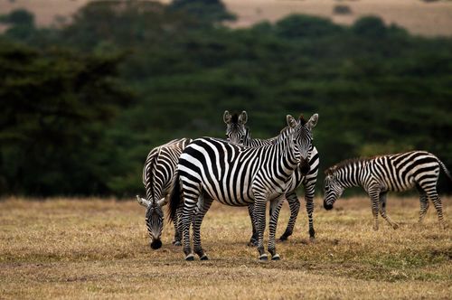
Kenya’s main highland forests are on Mounts Kenya, Elgon and Marsabit, on the Aberdare range and on the Mau Escarpment. The characteristic natural landscape in the highlands is patches of evergreen trees separated by vast meadows of grasses – often wire grass and Kikuyu grass. The true highland forest, typically found only above 1500m, contains different species of trees from lowland forest, and does not normally grow as tall or dense. Typical species include camphor, Juniperus procera (the East African “cedar”) and Podocarpus. The better-developed forests are found on the wetter, western slopes of the highlands. Above the forest line, at altitudes of 2500m and higher, you get stands of giant bamboo, while along the lower, drier edges of the highlands, the stands of trees tend to be interspersed with fields of tall grass, where you commonly also find various species of olive.

The Kikuyu

The ancestors of the Kikuyu migrated to the Central Highlands between the sixteenth and eighteenth centuries, from northeast of Mount Kenya. Stories describe how they found various hunter-gatherer peoples already in the region (the Gumba on the plains and the Athi in the forests), and a great deal of intermarriage, trade and adoption took place. The newcomers cleared the forests and planted crops, giving the hunters gifts of livestock, honey or wives in return for using the land.

Likewise, there was trade and intermarriage between the Kikuyu and the Maasai, both peoples placing high value on cattle ownership, with the Maasai depending entirely on livestock. During bad droughts, Maasai would raid Kikuyu herds, with retaliation at a later date being almost inevitable. But such intertribal warfare often had long-term benefits, as ancient debts were forever being renegotiated and paid off by both sides, thus sustaining the relationship. Married Kikuyu women enjoyed a special immunity that enabled them to organize trading expeditions deep into Maasai-land, often with the help of a hinga, a middleman, to oil the wheels.

Like the Maasai, the Kikuyu advanced in status as they grew older, through named age-sets and rituals still important today. For Kikuyu boys, circumcision marks the important transition into adulthood (female circumcision, or clitoridectomy, is illegal and rarely performed today). In the past, boys would grow their hair and dye it with ochre in the style of Maasai warriors (in fact, the Maasai got their ochre from the Kikuyu, so it may really have been the other way around). They also wore glass beads around their necks, metal rings on their legs and arms, and stretched their ear lobes with earplugs. Women wore a similar collection of ornaments and, between initiation and marriage, a headband of beads and discs, still worn today by most Maasai women.

Traditionally, the Kikuyu had no centralized authority. The elders of a district would meet as a council and disputes or important decisions would be dealt with in public, with a party to follow. After their deaths, elders – now known as ancestors – continued to be respected and consulted. Christianity has altered beliefs in the last few decades, though many churchgoers still believe strongly in an ancestor world where the dead have powers over their living descendants. The Kikuyu traditionally believed that the most likely abode of God (Ngai), or at least his frequent resting place, was Mount Kenya, which they called Kirinyaga (Place of Brightness). Accordingly, they used to build their houses with the door always looking out towards the mountain, hence the title of Jomo Kenyatta’s book, Facing Mount Kenya.

Today, the Kikuyu are at the forefront of Kenyan development and, despite entrenched nepotism, are accorded grudging respect as successful business people, skilled media operators and formidable politicians. There is considerable political rivalry between the Kiambu Kikuyu of the tea- and coffee-growing district north of Nairobi and the Nyeri Kikuyu, based in the fertile area of Othaya who rely on a more mixed economy.

The GEMA (Gikuyu, Embu and Meru Association), created in 1971 to further Kikuyu interests, at first concerned itself primarily with countering Daniel Arap Moi’s ascent to the presidency, and although it was banned in 1980, it is believed to continue to operate clandestinely throughout Kenya.

The emergence in Kikuyuland in the early 2000s of the secret and violent Mungiki cult, somewhat modelled after the colonial era’s Mau Mau independence movement but based primarily around extortion and gangster operations rather than emancipation, brought terror to slum districts in parts of Central Kenya. In a twist of jaw-dropping chutzpah, its leader escaped justice, declaring himself a born-again Christian. He is now wooed by mainstream politicians, while Mungiki has become a deeply corrupting force within the political process.

Miraa

Throughout Kenya, and especially in the Central Highlands and on the coast, you’ll often see people selling and chewing what looks like a bunch of twigs wrapped in a banana leaf. This is miraa, more commonly known abroad by its Somali name qat, a natural stimulant that is particularly popular among Somalis, Somali Kenyans and Yemenis. The shrub (Catha edulis) grows in the hills around Meru (the world centre for its production), and the red-green young bark from the shrub’s new shoots is washed, stripped with the teeth and chewed, with the bitter result being something of an acquired taste (it’s sometimes taken with bubble gum to sweeten it). Miraa contains an alkaloid called cathinone, a distant relative of amphetamine, with similar effects, though you have to chew it for some time before you’ll feel them. When they do kick in, they include a feeling of alertness, ease of conversation and loss of appetite. Long-term daily use can lead to addiction. It’s not always looked upon favourably, with signs prohibiting the chewing of it in many hotels and bars.

Miraa comes in bundles of a hundred sticks called “kilos” (not a reference to their weight) and various qualities, from long, twiggy kangeta, which is the ordinary, bog-standard version, to short, fat gisa kolombo, which is the strongest. As it loses its potency within 48 hours of picking, it’s wrapped in banana leaves and transported at speed. Street stalls selling it often display the banana leaves to show that they have it, and the best place to buy miraa in many towns is where the express matatus arrive from Meru. The use of miraa by bus, truck and matatu drivers goes a long way towards explaining why they have so many accidents. There are no legal restrictions on the use of miraa in Kenya, although imams have issued a fatwa (legal judgement) condemning it as an intoxicant, like alcohol, which means that it is forbidden to true believers. In fact, in most countries (but not the UK), miraa is a controlled narcotic, the possession of which is a criminal offence.

Nanyuki

North of Naro Moru, the A2 runs across the yellow-and-grey downs, scattered with stands of tall blue gums, roamed by cattle and overflown by brilliant roller birds, before dropping to NANYUKI, the gateway to Laikipia and parts of northern Kenya. You might be forgiven for expecting something momentous to take place at the equator, just south of town. There’s a sprouting of curio shops and signs (“This sign is on the Equator”) and even an “Equator Professor” who claims to demonstrate the Coriolis effect of the earth’s rotation using a bucket of water and a matchstick (aided by sleight of hand). In the northern hemisphere a large body of still water in a perfectly formed vessel would gurgle through a plug hole anticlockwise, whereas in the southern hemisphere it would flow clockwise – though in practice the direction of flow is controlled by the operator because the Coriolis effect is too tiny to have an impact, especially anywhere near the equator itself where the effect is zero. The demonstration is free; the “certificate” comes for a fee.

Nanyuki has the dual distinction of being Kenya’s air-force town and playing host to the British Army’s training and operations centre. And although in recent decades it has taken in thousands of refugees, escaping from rural poverty and ethnic violence, it remains very much a country town in atmosphere, and an oddly charming one.

A wide, tree-lined main street and the mild climate lent by its 2000m altitude bestow an unfamiliar, cool spaciousness that seems to reinforce its colonial character. Yet the town is becoming popular with foreign and Kenyan investors, and real-estate prices have doubled in recent years. The town’s modern Nakumatt supermarket and assorted new coffee shops and restaurants are a sign of things to come.

Brief history

The first party of settlers arrived in the district in 1907 to find “several old Maasai manyattas, a great deal of game and nothing else”. Nanyuki is still something of a settlers’ town and European locals are always around. The animals, sadly, are not. Although you may see a few grazers on the plains, the vast herds of zebra that once roamed the banks of the Ngare Nanyuki (Maasai for “Red River”) were decimated by hunters seeking hides, by others seeking meat (particularly during World War II, when eighty thousand Italian prisoners of war were fed a pound of meat each day), but most of all by ranchers protecting their pastures.

Mount Kenya Wildlife Conservancy

As the zebra herds dwindled, so lions became a greater threat to livestock and the predators retreated, under fire, to the mountain forests and moors. These days, the non-profit

Mount Kenya

Wildlife Conservancy

is doing good work with waifs and strays and has an active

bongo breeding programme

which is now working on reintroductions. The conservancy, resembling something out of

Dr. Doolittle

, hosts llamas, pygmy hippos, cheetahs, adorable patas monkeys and even the late William Holden’s 100-year-old tortoise.

Nyahururu (Thomson’s Falls)

Like Nanyuki, NYAHURURU is almost on the equator, and it shares much of Nanyuki’s character. It’s high up (at 2360m, Kenya’s highest town), cool and set on open savanna lands with patches of indigenous forest and plenty of coniferous plantation. Since the B5 road to Nyeri was completed, Nyahururu has been less cut off, but it’s still something of a frontier town for routes north to Lake Turkana and the desert. A tarmac road goes out as far as Rumuruti and then the fun begins.

Joseph Thomson gave the town its original name when he named the nearby waterfall after his father in 1883. Many still call it “T. Falls”, and not just the old settlers as you might expect. Thomson’s Falls was one of the last settler towns to be established. The first sign of urbanization was a hut built by the Narok Angling Club in the early 1920s to allow its members to fish for the newly introduced trout in the Ewaso Narok, Pesi and Equator rivers. In 1929, when the railway branch line arrived, the town began to take shape. The line has closed now, but the hotel built in 1931, Thomson’s Falls Lodge, is still going strong, and Nyahururu remains an important market town, and not really a tourist centre. The market is well worth a browse, especially on Saturdays. It sprawls out over most of the district west of the stadium, an indication of the town’s rapid growth over the last couple of decades.

The falls

On the northeast outskirts of town, Thomson’s Falls are pretty rather than spectacular, though they can be dramatic when the Ewaso Narok is in flood after heavy rain. The falls are a popular stopoff for tourists travelling between Samburu and Maasai Mara game reserves, and the hotel lawns above the falls get crowded with picnickers from town at weekends. Uniformed council officials have taken to extracting an “entrance fee” of Ksh200 from unwary tourists: only pay if they can give you an official ticket or receipt, otherwise tell them you have business at the hotel, whose grounds overlook the falls. The path leading down to the bottom of the 75m falls is somewhat dangerous, especially when wet, and you should ensure there have been no recent incidents of robbery. Don’t attempt to climb up again by any other route, because the cliffs are extremely unstable.

Nyeri

The self-styled capital of Kikuyu-land – a title the Kikuyu of Kiambu might dispute – NYERI is the administrative headquarters of Nyeri County and a lively, chaotic and friendly highland town, whose name derives from the Maa word nyiro, meaning “reddish brown”, after its earth. An attractive trading centre, it nestles in the green hills where the broad vale between Mount Kenya and the Aberdare range drops towards Nairobi. Tumultuous markets, scores of dukas, and even a few street entertainers, lend it an air of irrepressible commercialism.

Another former British military camp, Nyeri emerged as a market town for European coffee growers in the hills and for settlers on the ranching and wheat farms further north. Nyeri was also the last home of Robert Lord Baden-Powell, founder of the worldwide scouting movement, whose cryptically named Paxtu cottage, now a small museum, stands in the grounds of the Outspan Hotel and whose grave and memorial are to be found on the north side of town in the cemetery.

Whitewater rafting on the Sagana river

Test the class III, IV and V whitewater rapids of Kenya’s longest river, the Sagana, at Savage Wilderness Camp (0737 835963), an adventure activities base specializing in rafting. The camp also offers a 60m bungee jump over the river, nature walks, zipline and an artificial rock-climbing wall. The shaded, grassy campsite is entirely powered by a home-made hydroelectric system. There’s plenty of space to pitch your own tent; other options include renting a small tent (with bedding and mattress) or a large one (with bedding and two camp beds), or getting a double cottage.

Savage Wilderness Camp is based on the east bank of the Sagana river, 7km south of Sagana on the Nairobi road, signposted to the west.

Planning your own trip? Prepare for your trip

Use Rough Guides' trusted partners for great rates

Rough Guides Editors

written by
Rough Guides Editors

updated 26.04.2021

Ready to travel and discover
Kenya?

Get support from our local experts for
stress-free planning & worry-free travels

Plan my trip ⤍