Monasterboice
Monasterboice, 6km north of Drogheda, has an idyllic rural setting and the remains of its monastic settlement – founded in either the eighth or ninth century – include not only one of Ireland’s finest high-crosses, dating from the tenth century, but one of the best-preserved round towers in the country too. The stocky St Muiredach’s Cross, just inside the churchyard, is the better preserved of the pair. Its elaborate series of carved panels depict a variety of biblical events, loosely arranged in supposed chronological order. The base of its east face begins in the Garden of Eden, before moving upwards to the stories of Cain and Abel, David and Goliath, Moses bringing water to the Israelites and the Magi bearing gifts for the newborn Christ. Above these, the cross’s carved wheel depicts the Last Judgment and the risen multitudes pleading for entry into Heaven. The west face depicts events during the later life of Christ, ranging from his arrest at Gethsemane to the Ascension, though the hub of the cross’s wheel shows Moses with the Ten Commandments. Unusually, both flanks of the cross are also decorated and feature the Flight of the Israelites and saints Anthony and Paul.
The taller West Cross, unfortunately chipped at its top, features another array of biblical scenes, though erosion makes most of them indecipherable without the assistance of the adjacent display board. Certainly, its east face features David and the lion, and the west includes the Resurrection, but much of the remainder is difficult to discern. Adjacent to this cross is what’s reckoned to be the tallest round tower in Ireland, standing at some thirty metres, though it has long since lost its conical cap and cannot be entered for safety reasons. The two ruined churches within the enclosure, which date from the thirteenth century, probably had little connection with the, by then, defunct monastery.
Mellifont Abbey
Founded in 1142 by St Malachy, Mellifont, some 8km northwest of Drogheda, was the first and subsequently most important Cistercian foundation in Ireland, eventually heading an affiliation of more than twenty monasteries. Set in a tranquil spot by the River Mattock, Mellifont must once have been a hugely impressive complex, though its scant ruins leave much to the imagination.
Before touring the remains, take in the small exhibition in the visitor centre by the entrance, which details the foundation’s history and provides a scale model of the abbey’s layout. After the Reformation the abbey passed into the hands of Edward Moore, who converted its buildings into a fortified residence. Here in 1603, the great Irish chieftain Hugh O’Neill was besieged by Lord Mountjoy until starvation forced his surrender. During the Battle of the Boyne, William of Orange based himself at Mellifont, after which the property was abandoned and fell ultimately into dilapidation. It eventually passed into the hands of the Office of Public Works in the late twentieth century.
Entrance to the site is via the church’s north transept which features the remains of two stone piscinae, sinks for cleaning sacred serving vessels. As the church was built on sloping ground the broad nave has an uncommon feature, a crypt constructed to ensure it remained level. Next to the south transept stood the chapter house, whose floor features medieval glazed tiles, though some of these have been brought here from other parts of the abbey.
The tallest and finest remnant of the abbey stands in its expansive cloister garth, a remarkable octagonal arched lavabo, with fountains and basins where the monks would wash. The remaining ruins rarely rise above knee-height and you’ll need to consult the display-board map or buy the visitors’ guide to interpret them. Behind the lavabo, the southern ruins included both the calefactory (or warming house), the only heated room in the entire complex, and the refectory.
The Cooley Peninsula
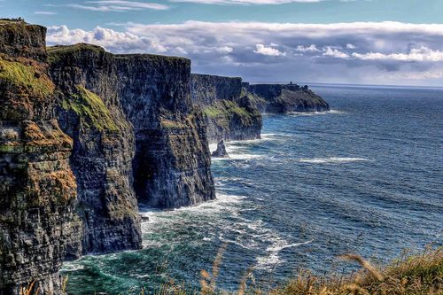
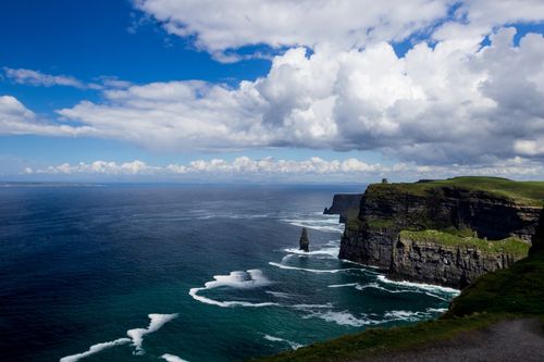
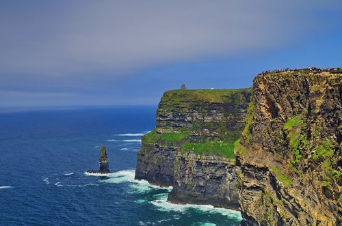
The Cooley Peninsula is Louth’s most hyped tourist destination – though all told it doesn’t quite match up to the glories often claimed in its name. It’s true that the mountains and surrounding rich verdure offer great walking territory and many a stunning seascape, but the countryside lacks the raw, rugged and often downright exhilarating feel of the Mournes over the other side of Carlingford Lough. That said, there’s still plenty here to delight, even if Carlingford village itself has somewhat meretriciously cashed in on its waterside location and, like much of the coast road, features unattractive modern housing developments. From Dundalk, off the N1 Newry road, the R173 skirts the southern slopes of the mountains, taking in flat, dull countryside on the way, while the approach from Newry on the same road, runs first beside the canal, before meeting the lough shore itself, with the peninsula’s mountains ascending to the south.
Book tickets and tours in Dundalk
Carlingford
Set a short distance back from the lough’s southern shore, the trim and charming former fishing village of CARLINGFORD is by far the best base for exploring the peninsula. Its tight and tortuous streets reflect its medieval origins and house a host of places where you can eat, drink and sleep. However, this is not a place for the light of purse or pocket: prices here are significantly higher than elsewhere in the county or across the water in Down.
Carlingford’s name is Old Norse in origin, deriving from “Kerlingfjörthr” (the fjord of the hag-shaped rock), and indicating that this was once a Viking settlement. By the lough shore stands the ruin of King John’s Castle, which served as an Anglo-Norman sentinel over the lough’s entrance. The village itself contains some impressive later buildings, including the fifteenth-century Mint, a fortified townhouse just off the main square. To learn more about Carlingford’s history, visit the Heritage Centre, housed in the restored medieval Holy Trinity church, whose displays document the village’s development from Norman times.
Walks on the Cooley Peninsula
The varied terrain of the peninsula offers a range of opportunities for walking, whether in the hills, offering often sumptuous views across the lough to the Mournes, by the shore or along lush valleys. The longest waymarked walk is the 26km Táin Trail, which takes a circular route around Slieve Foye (587m), up to the west above Carlingford village and includes much of the higher ground. Undertaking this requires proper walking equipment and clothing, and supplies of food and drink, as well as Ordnance Survey of Ireland Discovery map #36. However, there are plenty of less arduous walks, some of which, such as the eight-kilometre round-trip to Maeve’s Gap, are easily accessible from Carlingford village. For others you’ll need to head northwest to Omeath or east to Greenore.
Táin Bó Cúailnge (The Cattle Raid of Cooley)
The location of many an Irish legend is still immediately identifiable thanks to a wealth of extant place names, and perhaps no more so than in the case of the Táin Bó Cúailnge. Set around 500 BC, many of the events in perhaps the greatest of the Celtic epics clearly take place in the mountains of the Cooley Peninsula. The villainess of the tale is Medb, the great Queen of Connacht, who so envies her husband Aillil’s White Bull (Finnbenach) that she determines to capture the Brown Bull of Cooley (Donn Cúailnge). Drawing Aillil into her campaign she begins a war against the east of Ireland, targeting Ulster in particular. All the Ulster men are rendered immobile by a curse except the tale’s hero, Cúchullain, who is left to confront Medb’s armies single-handedly. Much of the plot concerns his feats and victories, often achieved in bloodthirsty fashion, and the text is also brought to life by vivid topographical detail. The first known written version of the saga was included in the twelfth-century Book of the Dun Cow, and Thomas Kinsella’s twentieth-century English translation encapsulates much of the vivacity of the Irish-language version. In 1973 the legend formed the basis for one of Ireland’s most successful concept albums, The Táin, by the traditional-rock pioneers Horslips.
Monaghan town and around
All the elements of post-Plantation urban planning are well to the fore in MONAGHAN town, which derived its prosperity from the linen industry and was long the base of a British garrison. To gain some understanding of the area’s development, the best starting-point is the Monaghan County Museum, just up Hill Street, which recounts local history through a varied selection of displays and interactive touch-screens, and features archeological finds, traditional crafts, railway memorabilia and an assortment of paintings, prints and photographs. The most exceptional exhibit is the Cross of Clogher, a glorious, finely worked silver cross dating from the early fifteenth century. The museum also hosts a changing programme of temporary exhibitions. Just downhill from here on Market Street is the late eighteenth-century Market House, a charming, arched limestone edifice whose exterior is embellished with exquisite carvings of oak apples and leaves, which hosts occasional arts and literary events.
County Monaghan’s other areas of interest are scattered around and about: Inniskeen in the southeast and, in the north and west respectively, Glaslough and Clones.
Inniskeen
Best accessed from Dundalk, a dozen kilometres east, the village of INNISKEEN was the birthplace of the influential poet and writer Patrick Kavanagh. His grave can be found beside St Mary’s Church, while the church annexe houses the Patrick Kavanagh Rural and Literary Resource Centre, which has stacks of memorabilia related to the poet, as well as a specially commissioned series of twelve paintings based upon his epic and extraordinarily emotive poem The Great Hunger. The centre stages several weekends devoted to poetry and writing, plus an annual weekend in late November celebrating Kavanagh’s life and work.
Glaslough
Eleven kilometres northeast of Monaghan lies the somewhat otherworldly estate village of GLASLOUGH, dominated by a lengthy Famine wall which surrounds the estate of Castle Leslie. The Leslie family can reputedly trace back its origins to Attila the Hun and arrived in Ireland in 1633 in the shape of John Leslie who had been appointed Bishop of Raphoe. A colourful character, Leslie became known as the “fighting bishop”, thanks to his victory as leader of an army over Cromwell at the Battle of Raphoe. When Charles II was restored to the throne, Leslie received £2000 as a reward for loyalty and used the sum to purchase Glaslough Castle and its demesne in 1665. His descendants have remained in occupation ever since and have included some equally intriguing figures. John Leslie’s son Charles was charged with high treason for arguing a little too strenuously against the penal laws, but escaped and fled to France. Subsequently pardoned by George I, he returned to Glaslough where his children often entertained Jonathan Swift, who was not always complimentary about them in return:
Here I am In Castle Leslie
With Rows And Rows Of Books Upon The Shelves
Written By The Leslies
All About Themselves.
The current and very grand castle was built in the late nineteenth century and the family became connected by marriage to the Churchills – both Randolph and Winston stayed here. Later owners included Desmond Leslie who authored Flying Saucers Have Landed, a supposedly factual account of the first alien contact with humans.
Nowadays Castle Leslie (wwww.castleleslie.com) is an utterly majestic, thoroughly relaxing place to stay, and is often patronized by the rich and famous. Even if you’re not planning to stay overnight, you can still enjoy the atmosphere here by taking afternoon tea, or sampling the evening menu. Otherwise you’re free to wander the estate, arrange fishing in the lake (renowned for its enormous pike), take a course at the cookery school, or book one of the many riding packages provided by the equestrian centre.
Clones
Near the border with Fermanagh, the lively town of CLONES (pronounced “clo-nez”) lies 20km southwest of Monaghan town, overlooking drumlin country from its hilltop perch. St Tiernach founded a monastery here in the sixth century and is supposedly buried in a reliquary stone coffin in a small graveyard off Ball Alley Lane, near which are the remains of a ninth-century round tower which was originally five storeys high. The monastic settlement was subsequently superseded by an Augustinian foundation and the sparse remains of the abbey are just a little way to the east, across MacCurtain Street. The town’s other significant relic is a richly carved high cross, which stands in the Diamond, somewhat overshadowed by the sombre shape of St Tiernach’s Church (Church of Ireland). The cross’s front panels depict scriptural scenes, such as the Garden of Eden, while the reverse is devoted to scenes from Christ’s life.
Just west of the town centre, above Cara Street, is the site of a Neolithic hill fort, which was used as the foundations for a short-lived twelfth-century Norman castle that was razed to the ground by local chieftains. Indeed the English did not regain control of Clones until 1601 and much of the contemporary town owes its layout to that period, while the presence of both Presbyterian and Methodist churches (John Wesley preached here several times in the 1770s) bears testament to the Plantation. In the nineteenth century prosperity arrived in Clones via the railways and the Ulster Canal, which connected Belfast to Lough Erne. At the bottom of Cara Street stands the Ulster Canal Stores, which at one time served as the distribution centre for wares arriving in Clones by water. Nowadays it houses small displays on the railways, lace-making and independence (Clones was a strong Republican base), as well as works by local artists.
Clones lace
The area around Clones has a strong tradition of lace-making, a generally home-based industry which, at its peak in the 1850s, saw more than 1500 workers supplying markets as far afield as Paris, Rome and New York. Passed on from mother to daughter, the lace-making craft was introduced to Clones by the wife of the local Church of Ireland rector, Cassandra Hands, as a means of supplying income in the desperate post-Famine times. Rather than following the time-consuming Venetian needlework style, Clones women opted for a crochet hook as a means of expediency, and began producing work embellished by the flora of their local environs, often characterized by the multi-twirled Clones knot. Clones lace was embroidered into blouses and dresses, but its own elaborate style was gradually replaced by simpler designs. Nevertheless, it remains an important local tradition and, in 1989, a co-operative was established to reinvigorate the craft. There are still several lace-makers in the area and some of their work is on display at the Ulster Canal Stores (wwww.cloneslace.com) where you can enquire about the possibility of purchasing their wares.