Discover more places in Guatemala
Planning your own trip? Prepare for your trip
Use Rough Guides' trusted partners for great rates
written by
Rough Guides Editors
The western highlands of Guatemala — stretching from just beyond Antigua to the Mexican border — are among the best places to visit in Guatemala. This region is all drama: towering volcanoes to the south, the rugged Cuchumatanes mountains to the north, and in between, a maze of forested ridges, deep valleys, fast-flowing rivers, and shimmering lakes.
It’s all shaped by altitude. At lower elevations, you’ll pass through lush coffee plantations, banana groves, and thick forest. Climb higher and the landscape shifts — pine and oak woods, maize fields, and cool, misty air. Up on the altiplano, things get stark: treeless hills, swirling clouds, and scattered herds of sheep and goats tough enough to handle the chill.
This region is predominantly peopled by the Maya, who have lived here continuously for the past two thousand years. Maya society, languages and traditions are markedly different from mainstream Latin American culture, and exploring their bewitchingly beautiful highland home is a highlight to any trip in Guatemala.
With stunning mountain scenery yielding colourful market towns and whitewashed colonial churches at every turn, you’re spoilt for places to visit. Lago de Atitlán, surrounded by volcanoes and with its idyllic shores harbouring some fascinating villages, is absolutely unmissable. To the north is the fabled market town of Chichicastenango and the wildly beautiful peaks and remote, intensely traditional communities of the Ixil, a region that is excellent for hiking.
Heading west, you’ll reach Guatemala’s second city, Quetzaltenango (Xela), an ideal base for visiting Maya villages, the hot springs of Fuentes Georginas and climbing the perfectly proportioned volcanic cone of Santa María. Beyond this, you start encountering the massive granite peaks of the Cuchumatanes; you’ll find excellent hiking trails around the spectacular Mam Maya village of Todos Santos Cuchumatán.
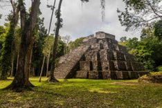
Historical sites, such as the pre-conquest cities of Iximché, K’umarkaaj and Zaculeu, are also worthy of your attention – although they don’t bear comparison to Tikal and the lowland ruins.
Start planning your trip to Guatemala by first finding out how many days are best to spend in Guatemala.
A peripheral area during the Classic Maya civilization (250–900 AD), the western highlands were colonized towards the end of the twelfth century by Toltecs from central Mexico. With the Toltecs established as overlords, local tribes bitterly contested regional hegemony. The most powerful tribes were the K’iche’, based at their capital K’umarkaaj, the Mam at Zaculeu and Kaqchikel at Iximché. Smaller tribal groups such as the Ixil also occupied clearly defined areas.
The serpentine Carretera Interamericana forms the main artery of transport in the highlands, and this highway and its junctions will inevitably become very familiar. Most of the route between Guatemala City and the turn-off for Quetzaltenango is now a smooth four-lane highway, though traffic is always heavy. The first of three major junctions you’ll get to know is Chimaltenango, from where you can make connections to Antigua. Continuing west, Los Encuentros is the next main junction, where one road heads off to the north for Chichicastenango and another branches south to Panajachel. Beyond this is Cuatro Caminos, from where side roads lead to Quetzaltenango, Totonicapán and San Francisco el Alto. The Carretera Interamericana continues on to Huehuetenango before it reaches the Mexican border at La Mesilla. Virtually every bus travelling along the highway will stop at all of these junctions.
Iximché, the pre-conquest capital of the Kaqchikel, is 5km south of the Interamericana on a beautiful exposed site, isolated on three sides by plunging ravines and surrounded by pine forests. The majority of the buildings, originally built of adobe, have disappeared but the site – which housed a population of about ten thousand – is very atmospheric.
Iximché was first established around 1470. From the early days of the conquest the Kaqchikel Maya allied themselves with the Spanish, in order to defeat their tribal enemies the K’iche’. Grateful for the assistance, the Spanish established their first headquarters near here on May 7, 1524. The Kaqchikel referred to Alvarado as Tonatiuh, the son of the sun, and as a mark of respect he was given the daughter of a Kaqchikel king as a gift.
But within months the Kaqchikel rebelled, outraged by Alvarado’s demands for tribute. The conquistador retaliated by burning Iximché and then moved operations to the greater safety of Ciudad Vieja, a short distance from Antigua.
George W. Bush stopped by Iximché in 2007 and was treated to a marimba display and a demonstration of the Maya ball game. Not everyone was pleased with his appearance, and Maya elders later held a ceremony to spiritually cleanse the site and the residual “bad energy”.
Heading west from the Los Encuentros junction to Cuatro Caminos, the Carretera Interamericana runs through some fantastic high-mountain scenery. The views alone are superb, and if you have time to spare it’s well worth dropping into Nahualá for the market.
The Cuchumatanes, rising to a frosty 3837m just to the north of Huehuetenango, are the largest non-volcanic peaks in Central America, stretching from the Mexican border to the highlands of Alta Verapaz.
The mountain scenery is magnificent, ranging from wild, exposed craggy outcrops to lush, tranquil river valleys. The upper parts of the slopes are barren, scattered with boulders and shrivelled cypress trees, while the lower levels, by contrast, are richly fertile, cultivated with corn, coffee and some sugar. Between the peaks, in the deep-cut valleys, are hundreds of tiny villages, isolated by the enormity of the landscape.
It’s an immensely rewarding area, offering a rare glimpse of Maya life and some of the country’s finest fiestas and markets. The mountains are also ideal for hiking, particularly if you’ve had enough of struggling up volcanoes.
The most accessible of the villages is Todos Santos Cuchumatán, which is also one of the most fascinating – its horse-race fiesta on November 1 has to be the most outrageous in Guatemala. North of here a remote road leads to Barillas through some of the most compelling Maya settlements in Guatemala; deeply traditional San Mateo Ixtatán is probably the most interesting place on the way. A trip into this mountainous area reveals an exceptional wealth of Maya culture. In this world of jagged peaks and deep-cut valleys Spanish is definitely the second language, and women rigidly adhere to traditional costume, offering you an ideal opportunity to witness Maya life at close quarters, and perhaps undertake a hike or two.
This area had little to entice the Spanish, and they only exercised vague control, occasionally disrupting things with bouts of religious persecution. The people were, for the most part, left to maintain their old ways, and their traditions are still very much evident in the fiestas, costumes and folk Catholicism.
In the 1970s and 1980s, the violence and terror of the civil war sent thousands fleeing across the border to Mexico. Most families returned from exile in the 1990s, settling back to life in their old communities, but the cycle of emigration has repeated itself again in recent years, as thousands of young villagers have sought work in the US.
Ethnographer Krystyna Deuss, author of Shamans, Witches, and Maya Priests: Native Religion and Ritual in Highland Guatemala, has been studying traditions in remote Cuchumatanes communities for decades, focusing her attention on the prayersayers, who occupy a position parallel to that of local priests. Here she explains their role and the key rituals.
Some of the purest Maya rituals remaining are found among the Q’anjob’al Maya of northwestern Cuchumatanes. The office of alcalde resador (chief prayersayer) still exists here and the 365-day Haab calendar is used in conjunction with the 260-day Tzolkin. The former ends with the five days of Oyeb’ ku’, when adult souls leave the body; the return of the souls on the fifth day brings in the new year. As this always falls on a day of Watan, Lambat, Ben or Chinax, these four-day lords are known as the “Year Bearers” or “Chiefs”. The Haab year begins either at the end of February or the beginning of March, coinciding with the corn-planting season.
The duty of the prayersayer is to protect his village from evil and ensure a good harvest by praying for rain at planting time and for protection against wind, pests and disease while the corn is maturing. He’s usually a man in his 60s or 70s, and his year of office – during which he and his wife must remain celibate – begins on January 1.
In Santa Eulalia, Soloma and San Miguel Acatán, where traditions are particularly strong, he lives in a purpose-built prayermakers’ house. Here he’s visited by traditionalists and left gifts of corn, beans, candles and money.
On the altar of the house stands the ordenanza, a chest that contains religious icons and ancient village documents. This chest serves as a symbol of authority and as a sacred object, and can only be opened by the alcalde resador, in private, once a year.
The resador’s whole day is spent in prayer: at his home altar before the ordenanza, in church and at sacred sites marked by crosses. Prayers for rain are often accompanied by the ritual sacrifice of turkeys, whose blood is poured over candles and incense, which is then burned at the sacred places the following day. These ceremonies are not open to the public.
Festivals more in the public domain happen on January 1 when the incumbent alcalde resador hands over his responsibilities to his successor. In Soloma, after an all-night vigil, the ordenanza is carried in procession to the middle of the market square and put on a makeshift altar under a pine arch. When the incoming group arrives there are prayers and ritual drinking, and they receive their wooden staffs of office; after this, the outgoing alcalde resador is free to leave for his own home. The new prayersayer’s group stays in the marketplace, collecting alms and drinking until 3pm, when they carry the ordenanza back to the official residence in a somewhat erratic procession. Notwithstanding a further night of vigil and ceremonial drinking, at 7am the following morning the alcalde resador sets out on his first prayer-round to the sacred mountains overlooking the town.
In San Juan Ixcoy the year-end ceremonies differ in that the new resador is not appointed in advance. Here the outgoing group carries the ordenanza to a small chapel on the night of the 31st and leaves it in the care of a committee of traditionalists. The usual all-night vigil with prayers, ritual drinking and collecting alms continues throughout the following day while everyone waits anxiously for a candidate to turn up. As the office of resador is not only arduous but also expensive, the post is not always filled. The ordenanza sometimes stays locked in the chapel for several days before a volunteer takes on the office again rather than let the ordenanza and the tradition be abandoned.
One spectacular annual event, which brings emigrants home from as far away as Canada, is the famous November 1 fiesta for All Saints (todos santos). For three days the village is taken over by unrestrained drinking, dance and marimba music. The festival starts with an all-day horse race, which begins as a massive stampede, as riders tear up the course, thrashing their horses, capes flowing behind them. At either end of the run they take a drink before burning back again. As the day wears on some riders retire, collapse, or tie themselves on their mounts, leaving only the toughest to continue.
On the second day, The Day of the Dead, the action moves to the cemetery, with marimba bands and drink stalls setting up amongst the graves for a day of intense ritual that combines grief and celebration. By the end of the fiesta, the streets are littered with collapsed villagers and the jail packed with brawlers
Organized trips to the Todos Santos fiesta are offered by tour agencies in Quetzaltenango and Lago de Atitlán.
Leaving Quetzaltenango you can head west to the little-visited department of San Marcos – home of the country’s highest volcano, Tajumulco, and some magnificent highland scenery. The route passes through Ostuncalco and then the twin towns of San Marcos and San Pedro Sacatepéquez (these form the main population centre in these parts but hold little interest for visitors).
Northwest of here there’s some magnificent high country, and a paved road that fringes the Tajumulco and Tacaná volcanoes. Continuing along this remote route you pass through the isolated villages of Tectitán and Cuilco, and can eventually loop up to the Carretera Interamericana.
At the heart of the western highlands, the department of El Quiché encompasses the full range of Guatemalan scenery. The south is fertile and heavily populated while to the north the landscape becomes increasingly dramatic, rising to the massive, rain-soaked peaks of the Cuchumatanes. For the traveller, El Quiché has a lot to offer, including Chichicastenango, the scene of a vast, twice-weekly market and still a pivotal centre of Maya religion. Beyond here are the ruins of K’umarkaaj and, further to the north, the extraordinary scale of the mountain scenery is exhilarating. Isolated villages set in superb highland bowls sustain a wealth of indigenous culture and occupy a misty, mysterious world of their own – above all in the land of the Ixil.
The department takes its name from the greatest of the pre-conquest tribal groups, the K’iche’, who overran much of the highlands by 1450 from their capital at K’umarkaaj. With little in the way of plunder, this remote, mountainous terrain remained an unimportant backwater for the Spanish. The region became a centre of intense guerrilla activity in the late 1970s and was the scene of unrivalled repression, as tens of thousands of villagers were wiped out by the military. Today these highlands remain a stronghold of Maya culture, and El Quiché, dotted with small villages and mountain towns, is the scene of some superb fiestas and markets.
North from Los Encuentros junction, the road drops down through dense pine forests into a deep ravine before beginning a tortuous ascent around a seemingly endless series of switchbacks until reaching CHICHICASTENANGO. Dubbed Guatemala’s “Mecca del Turismo”, Chichi is a compact and traditional town of cobbled streets, though the charming old adobe houses are now outnumbered by modern concrete structures. Twice a week the town’s highland calm is shattered by the Sunday and Thursday markets, which attract many tourists, traders and Maya weavers from throughout the central highlands.
The market is by no means all that sets Chichicastenango apart, for it’s an important centre of culture and religion. Over the years, Maya traditions and folk Catholicism have been treated with a rare degree of respect. Today the town has an important collection of Maya artefacts, parallel indigenous and ladino governments and two churches that make no effort to disguise their acceptance of unconventional pagan worship.
Locals adhere to the ways of traditional weaving, the women wearing superb huipiles with flower motifs. The men’s costume of short trousers and jackets of black wool embroidered with silk is highly distinguished, although it’s very expensive to make and these days almost all men opt for Western dress. For Sundays and fiestas, however, a handful of cofradres (elders of the religious hierarchy) still wear the traje clothing and parade through the streets bearing spectacular silver processional crosses and antique incense-burners.
There’s been a market at Chichicastenango for hundreds, if not thousands, of years and despite the touristy side of the event, local people continue to come twice a week to trade their wares. On Sundays and Thursdays, Chichicastenango’s streets are lined with stalls and packed with buyers, and the choice is overwhelming, ranging from superb-quality Ixil huipiles to wooden dance-masks and everything in between, including pottery, gourds, belts and blankets, plus a gaudy selection of fabrics. You can still pick up some authentic weaving, but you need to be prepared to wade through a lot of very average material – and haggle hard. Your chances of getting a good deal are better before the tourist buses arrive at 10am or in the late afternoon once things have started to quiet down. Prices are pretty competitive, but for a real bargain you need to head further into the highlands – or to Panajachel, which is a better bet for típica clothing.
For a brilliant vantage point over the vegetable market, head for the indoor balcony on the upper floor of the Centro Comercial building on the north side of the plaza. You’ll be able to gawk at the villagers below (as well as take photographs without fear of being intrusive) as they haggle and chat over bunches of carrots and onions. It’s possible to pick out costumes from all over the highlands, including huipiles from the Atitlán villages, and even from as far away as Chajul; the “space cowboy” shirts and pants are worn by men from the neighbouring Sololá area.
Chichicastenango’s appetite for religious fervour is especially evident during the fiesta of Santo Tomás, from December 14 to 21. It’s a spectacular occasion, with attractions including the Palo Volador, in which men dangle by ropes from a 20m pole, a live band or two, a massive procession, traditional dances, clouds of incense, gallons of chicha and deafening fireworks. On the final day, all babies born in the previous year are brought to the church for christening. Easter is also celebrated with tremendous energy and piety.
High up in the Cuchumatanes, in a landscape of steep hills, bowl-shaped valleys and gushing rivers, is the Ixil region. Here Nebaj, Chajul and Cotzal, three remote and extremely traditional towns, share a language spoken nowhere else in the country. These lush, rain-drenched highlands are hard to reach and have proved notoriously difficult to control, and today’s relaxed atmosphere of highland Maya colour and customs conceals a bitter history of protracted conflict.
The beauty of the landscape and the strength of indigenous culture in the Ixil are both overwhelming. When church leaders moved into the area in the 1970s, they found very strong communities in which the people were reluctant to accept new authority for fear that it would disrupt traditional structures, and where women were included in decision-making. Counterbalancing these strengths are the horrors of the human rights abuses that took place here during the civil war, which must rate as some of the worst anywhere in Central America. Despite this terrible legacy, however, the fresh green hills are some of the most beautiful in the country, and the towns are friendly and accommodating, with a relaxed and distinctive atmosphere in a misty world of their own.
Before the arrival of the Spanish, Nebaj was a sizeable centre, producing large quantities of jade. The Conquest was particularly brutal in these parts, however. After several setbacks, the Spaniards finally managed to take Nebaj in 1530, by which time they were so enraged that the settlement was burnt to the ground and the survivors enslaved as punishment. Things didn’t improve with the coming of independence: the Ixil people were regarded as a source of cheap labour and forced to work on the coastal plantations. Many never returned, and even today large numbers of local people still migrate to the coast, Guatemala City and the US in search of work.
In the late 1970s and 1980s, the area was hit by waves of horrific violence as it became the main theatre of operation for the Guerrilla Army of the Poor. Since the 1996 peace accords, normality steadily returned to the area, as villagers have returned to their ancestral settlements and rebuilt their homes.
The bitter civil war of the 1970s and 1980s ravaged the western highlands, and left the Ixil devastated by the conflict between the Guatemalan army and the insurgent Ejército Guerrillero de los Pobres (the EGP, or Guerrilla Army of the Poor). By 1996, when the guerrilla war officially ended, nearly all of the region’s smaller villages had been destroyed and fifteen thousand to twenty thousand people had been killed, with thousands more displaced. Most of the victims were villagers, dying not because of their political beliefs but because they had been caught between the army and the EGP, who saw the creation of a liberated zone in the Ixil as the springboard to national revolution. Investigations later found the Guatemalan military responisble for of over ninety per cent of civilian deaths in the Ixil.
The EGP first entered the area in 1972, when a small group of guerrilla fighters crossed the Mexican border and began building links with locals, impressing some villagers with plans for political and social revolution. The guerrillas opened their military campaign in 1975 with the assassination of Luis Arenas, a finca owner from near Chajul, who employed hundreds of labourers under a system of debt bondage. The EGP shot Arenas in front of hundreds of his employees as he was counting the payroll. According to the group, workers joined them with cries of “Long live the poor, death to the rich”. But other accounts describe how people walked for days to pay their last respects to Arenas.
These actions prompted a huge response from the armed forces, who began killing, kidnapping and torturing suspected guerrillas and sympathizers. The EGP was already well entrenched, however, and by late 1978 was regularly occupying villages, holding open meetings and tearing down debtors’ jails. In January 1979 they killed another local landowner, Enrique Brol, of Finca San Francisco near Cotzal. On the same day, the EGP also briefly took control of Nebaj itself, summoning the whole of the town’s population, as well as Western travellers, to the central plaza, where they denounced the barbaric inequalities of life in the Ixil.
The army responded with a wave of horrific attacks on the civilian population. Army units swept through the area, committing atrocities, burning villages and massacring thousands. Nevertheless, the strength of the guerrillas continued to grow, and in 1981 they again launched an attack on Nebaj, by then a garrison town. Shortly afterwards the army chief of staff, Benedicto Lucas García (the president’s brother), flew into Nebaj to threaten locals that if they didn’t “clean up their act” he’d bring five thousand men “and finish off the entire population”.
The army changed its tactics under new president Ríos Montt, using anti-Communist propaganda and conscripted civilian patrols (PACs) to ensure the loyalty of the people. Villagers were given ancient rifles and told to protect their communities from guerrillas. The army swept through the Ixil, razed fifty villages to the ground and settled the displaced in new “model” communities. With the EGP retreating to more remote terrain, Ixil people began to adapt to the army’s newfound dominance, many opting to reject contact with the guerrillas.
Hit hard, the EGP responded with desperate acts. On June 6, 1982, guerrillas stopped a bus near Cotzal and executed thirteen civil patrol leaders and their wives; eleven days later a guerrilla column entered the village of Chacalté, where the civil patrol had been particularly active, and killed a hundred people.
The army’s offer of amnesty soon drew refugees out of the mountains: between 1982 and 1984 some 42,000 people turned themselves in, fleeing a harsh existence under guerrilla protection. Others returned after years spent living like nomads, hunting animals in the jungles of the Ixcán to the north. By 1985 the guerrillas had been driven back into a handful of mountain strongholds.
Skirmishes continued until the mid-1990s, but ceased with the signing of peace accords. Since then, ex-guerrillas and former civil patrollers have resettled the old village sites and communities have been rebuilt.
Early in the fifteenth century, riding on a wave of successful conquest, the K’iche’ king Gucumatz (Feathered Serpent) founded a new capital, K’umarkaaj. A hundred years later the Spanish arrived, renamed the city Utatlán, and then destroyed it, leaving the ruins that can be visited today.
K’umarkaaj is nowhere near as grand as the large ruins of Petén, but its dramatic setting, surrounded by deep ravines and pine forests, is impressive, and its historical significance intriguing. Little restoration has taken place and once-grand temples and palaces are today just grassy mounds. The small museum has a scale model of what the original city may once have looked like.
The splendour of the city, once containing 23 palaces, signified the strength of the K’iche’ empire, which at its height boasted a population of around a million.
By the time of the Conquest, however, the K’iche’ empire was fractured. Their first encounter with the Spanish was a heavy defeat near Quetzaltenango, resulting in the loss of their leader Tecún Umán. The K’iche’ then invited the Spanish to their capital, but on seeing the fortified city, the conquistador feared a trap and captured K’iche’ leaders Oxib-Queh and Beleheb-Tzy. His next step was characteristically straightforward: “As I knew them to have such a bad disposition to service of his Majesty, and to ensure the good and peace of this land, I burnt them, and sent [soldiers] to burn the town and destroy it.”
Written in K’umarkaaj shortly after the arrival of the Spanish, the more than nine thousand lines of the Popol Vuh detail the cosmology, mythology and traditional history of the K’iche’. The first of the two parts of this sacred poem is an account of the K’iche’s creation by their god, who is known as Heart of Sky. According to the Popol Vuh, at first there was only water and sky; the creator then formed earth and mountains, plants and trees. Heart of Sky turned his attention to animals, and created creatures of the forest including deer, birds and jaguars. Unsatisfied with these animals, the creator fashioned humans from corn paste after twice failing to make man from mud and wood. The Popol Vuh then recounts the adventures of the ancestors of mankind, the hero twins (or wizard twins) Hunahpú and Xbalanqué, which culminate in an epic struggle with the death lords of Xibalbá, the Maya underworld. The twins ultimately triumph, and the cycle of creation is born.
The Popol Vuh’s second half describes the wanderings of the K’iche’ ancestors as they migrate south from the Toltec area of Mexico and settle in the highlands of Guatemala. Evidence gathered by archeologists and epigraphers strongly supports the accuracy of this part of the epic. The book concludes with a history of K’iche’ royalty, and suggests a shared lineage with these kings and their gods. Dennis Tedlock’s translation of the Popol Vuh (see Wildlife and the environment) is regarded as the definitive text.
At the foot of the mighty Cuchumatanes, HUEHUETENANGO is a departmental capital and the focus of trade and transport for a vast area of northwest Guatemala. Its atmosphere is provincial and pretty relaxed, though heavy traffic, much of which thunders through the town centre, reduces this appeal somewhat.
Before the arrival of the Spanish it was the site of one of the residential suburbs that surrounded the Mam capital of Zaculeu (the ruins of this site, just a few kilometres from town, are worth a visit). Under colonial rule it was a small regional centre with little to offer beyond a steady trickle of silver and a stretch or two of grazing land. Today the department is famous for its rich, complex high-quality coffee – which you’ll have ample opportunity to sample in the town’s cafés.
A few kilometres to the west of Huehuetenango are the ruins of ZACULEU, capital of the Mam, who were one of the principal pre-conquest highland tribes. The site includes several large temples, plazas and a ball court, but unfortunately it was restored pretty unsubtly by a latter-day colonial power, the United Fruit Company, in 1946 and 1947. The walls and surfaces were levelled off with a layer of thick white plaster, leaving them stark and undecorated. There are no roof-combs, carvings or stucco mouldings, and only in a few places does the original stonework show through. Even so, the site has a peculiar atmosphere of its own and is worth a look; surrounded by trees and neatly mown grass, with fantastic views of the mountains, it’s also an excellent spot for a picnic.
There’s a small museum on site with examples of some of the burial techniques used – bodies were crammed into great urns, interred in vaults and also cremated – and some interesting ceramics.
The site of Zaculeu, first occupied in the fifth century, is thought to have been a religious and administrative centre for the Mam, and the home to its elite; the bulk of the population most likely lived in small surrounding settlements. After a period of subjugation under the rival K’iche’ tribe in the fifteenth century, the Mam reasserted their independence, only for another expansionist empire, the Spanish – a yet more brutal alternative – to arrive. Following a massacre by the Spanish of five thousand Mam warriors to the south, Mam chief Kaibal Balam withdrew to the safety of Zaculeu, which was protected by ravines and walls. The Spanish army prepared for a lengthy siege, giving the Maya a choice: become Christians “peacefully” or face “death and destruction”.
Attracted by neither option, the Mam struggled to hold out against the invading force, but after about six weeks under siege, his army starving to death, Kaibal Balam surrendered. With the bitterest of ironies a bastardized version of his name has been adopted by one of Guatemala’s crack army regiments – the “Kaibiles”, who were responsible for numerous massacres during the 1970s and early 1980s.
Make an effort to catch as many market days as possible – they’re second only to local fiestas in offering a rich perspective of Maya life. These are some of the best:
San Juan Atitán; Zunil.
Chajul; Comalapa; Olintepeque; Sololá; Totonicapán.
Almolonga; Colotenango; Cotzal; Momostenango; Sacapulas.
Aguacatán; Chichicastenango; Jacaltenango; Nebaj; Panajachel; Sacapulas; San Juan Atitán; San Mateo Ixtatán; San Rafael La Independencia; Soloma; Tajumulco; Uspantán; Zacualpa.
Chajul; San Francisco el Alto; San Martín; Santiago Atitlán; Sololá.
Almolonga; Cotzal; Todos Santos Cuchumatán; Totonicapán.
Aguacatán; Chichicastenango; Jacaltenango; Joyabaj; Momostenango; Nahualá; Nebaj; Ostuncalco; Panajachel; Sacapulas; San Juan Comalapa; San Martín Jilotepeque; San Mateo Ixtatán; Santa Eulalia; Soloma; Uspantán; Zacualpa.
Guatemala’s second city, QUETZALTENANGO (XELA), is the natural hub of the western highlands. It can’t claim to be a tourist attraction in its own right, but the city’s ordinariness is in many ways its strength – it’s a resolutely Guatemalan place. Off the main gringo trail, it has a hospitality and friendliness that belies its size and a slightly subdued provincial atmosphere. Bizarre though it may seem, Quetzaltenango’s character and appearance is vaguely reminiscent of an industrial town in northern England – grey and cool with friendly, down-to-earth inhabitants, who have a reputation for formality and politeness. At an elevation of 2330m, Quetzaltenango is always cold in the early mornings, the city waking up slowly, getting going only once the warmth of the sun has made its mark.
The city is an important educational centre, its universities and colleges attracting students from all over the country, while its Spanish schools are internationally renowned. More and more development projects are also basing themselves here, and this growing outside influence is steadily adding a cosmopolitan feel to the city’s bars, restaurants and cultural life. Many overseas visitors settle easily into the relatively easy-going pace of the city; it also makes an excellent base for exploring this part of the country, making day-trips to villages, basking in hot springs like Fuentes Georginas, or hiking in the mountains. The city is divided into zones, although for the most part you’ll only be interested in zonas 1 and 3, which contain the city centre and the area around the Minerva bus terminal respectively. The centre, heavily indebted to Neoclassicism, is a monument to stability, with great slabs of grey stone belying a history of turbulence and struggle. Things deteriorate as you head away from the plaza, with thick traffic and fumes blighting the highland air, particularly around the main bus terminal. Locally, the city is usually referred to as Xela (pronounced “shey-la”). Meaning “under the ten”, the name is probably a reference to the surrounding peaks.
Brief history
Originally there was a walled city here called Xelajú, but it was destroyed during the conquest – Pedro de Alvarado is said to have killed the K’iche’ king, Tecún Umán, in hand-to-hand combat. The victorious Spanish founded a new town, Quetzaltenango, “the place of the quetzals”, the name probably chosen because of the brilliant green quetzal feathers worn by the K’iche’ nobles and warriors.
Under colonial rule Quetzaltenango flourished as a commercial centre, benefiting from the fertility of the surrounding farmland and good connections to the port at Champerico. When the prospect of independence eventually arose, the city was set on deciding its own destiny. After the Central American Federation broke with Mexico in 1820, Quetzaltenango declared itself the capital of the independent state of Los Altos, which incorporated most of the western highlands. But the separatist movement was put down by force and the city had to accept provincial status. Quetzaltenango remained an important centre of commerce and culture however, its wealth and population continued to grow, and it remained a potent rival to the capital.
All this, however, came to an abrupt end when the city was almost totally destroyed by the massive 1902 earthquake. Rebuilding took place in a mood of high hopes; all the grand Neoclassical architecture dates from this period. A new rail line was built to connect the city with the coast, but this was washed out in the early 1930s, and the town steadily fell further and further behind the capital.
Quetzaltenango boasts dozens of language schools, many of a very high standard, and makes an excellent place to really immerse yourself in Guatemalan culture. Its relatively large population means that you shouldn’t have to share a family home with other gringos. Few local people speak much English, so many students find the city is a good place to progress quickly in their language studies. An added benefit of choosing to study in Quetzaltenango is that most schools fund community development and environmental projects.
All of the schools listed here are well established and employ professional teachers, but they are only a selection.
Callejón 15, Diagonal 13–02, Zona 1 t 7761 5954, w casaxelaju.com.
6 C 14–55, Zona 1 (t 7761 4342, w celasmaya.edu.gt.
(CBA) 12 Av 10–27, Zona 1 t 7761 8535, w cbaspanishschool.com.
Av El Cenizal 0–58, Zona 5 t 5935 3815, w spanishschools.biz.
15A Av 4–59, Zona 1 t 7765 1308, w inepas.org.
Diagonal 12 4–46, Zona 1 t 7761 1636, w kiebalam.com.
2 C Callejon 16 2–47, Zona 1 t 4018 2180, w xelapages.com/lapaz.
13 Av 8–34, Zona 1 t 7761 6105, w madre-tierra.org.
12 Av 8–31, Zona 1 t 7765 5554, w learn2speakspanish.com.
28 Av 9–54, Zona 1 t 5606 1704, w languageselnahual.com.
1 C 17–72, Zona 1 t 7761 8286, w pop-wuj.org.
9 Callejón ‘A’ 11–49, Zona 1 t 7761 5275, w spanishschoolelportal.com.
5 C 2–40, Zona 1 t 7765 2140, w hermandad.com.
6 C 7–42, Zona 1 t 7763 0717, w sakribal.com.
15 Av 8–38, Zona 1 t 7765 1318, w https://sisaispanishschool.org.
The western highlands are the home of the traditional Guatemalan fiesta. These are some highlights.
San Sebastián Coatan
San Pablo La Laguna, main day 25th
San Pablo, department of San Marcos
Chiantla, main day 2nd
Jacaltenango
Ostuncalco
Santa Eulalia, main day 8th
Chajul, the second Friday in Lent marked by huge pilgrimages
Santiago Atitlán, Maximón paraded through the streets, usually on the Wednesday; San Cristóbal Tonicapán, the biggest processions in the Xela area
San Marcos, main day 25th
San Jorge La Laguna
San Marcos La Laguna
Barillas
Zacualpa and Aguacatán, fiestas to mark forty days from Holy Week
Uspantán, main day 8th
Santa Cruz La Laguna
San Antonio Palopó, Lago de Atitlán, main day 13th
San Juan Ixcoy, north of Huehuetenango
Olintepeque, just north of Quetzaltenango
Cotzal, main day 24th
San Juan Atitán, main day 24th
San Juan La Laguna, main day 24th
Comalapa
San Pedro Sacatepéquez
Soloma, main day 29th
San Pedro La Laguna, main day 29th
Almolonga, main day 29th
Huehuetenango
Momostenango, the 25th is a very important day in the Maya religious calendar, and the 1st is the main fiesta day
Chimaltenango, main day 26th
Santiago Atitlán, main day 25th
Sacapulas, main day 4th
Joyabaj, main day 15th. Superb fiesta; traditional dances here include the Palo Volador
Santa Clara La Laguna, main day 12th
Sololá, main day 15th
Nebaj, main day 15th
Santa Cruz del Quiché, main day 18th
Quetzaltenango, main day 15th
San Mateo Ixtatán, main day 21st
Totonicapán, main day 29th
San Miguel Acatán, main day 29th
Tecpán
San Francisco el Alto, main day 4th
Panajachel, main day 4th
San Lucas Tolimán, Lago de Atitlán, main day 18th
Todos Santos Cuchumatán, a wild, alcohol-infused horse race on the 1st, with everyone heading to the cemetery on the 2nd for All Souls’ Day
San Martín Jilotepeque, main day 11th
Zunil, main day 25th
Nahualá, main day 25th
Santa Catarina Palopó, Lago de Atitlán
San Andrés Xecul, main day 30th
Huehuetenango, main day 8th
The Burning of the Devil is celebrated in most highland towns with bonfires and men running around dressed as devils
Chichicastenango, very impressive fiesta, main day 21st
Top image © Chrsitian Hartmann/Shutterstock
Use Rough Guides' trusted partners for great rates
written by
Rough Guides Editors