Corsica Travel Guide

More than three million people visit Corsica each year, drawn by the mild climate and some of the most diverse landscapes in all Europe. Nowhere in the Mediterranean has beaches finer than the island’s perfect half-moon bays of white sand and transparent water, or seascapes more dramatic than the red porphyry Calanches of the west coast. Even though the annual visitor influx now exceeds the island’s population nearly ten times over, tourism hasn’t spoilt the place: there are a few resorts, but overdevelopment is rare and high-rise blocks are confined to the main towns.

Bastia, capital of the north, was the principal Genoese stronghold, and its fifteenth-century citadelle has survived almost intact. It’s first and foremost a Corsican city, and commerce rather than tourism is its main concern. Also relatively undisturbed, the northern Cap Corse harbours inviting sandy coves and fishing villages such as Macinaggio and Centuri-Port. Within a short distance of Bastia, the fertile region of the Nebbio contains a scattering of churches built by Pisan stoneworkers, the prime example being the Cathédral de Santa Maria Assunta at the appealingly chic little port of St-Florent.

To the west of here, L’Île-Rousse and Calvi, the latter graced with an impressive citadelle and fabulous sandy beach, are major targets for holiday-makers. The spectacular Scandola nature reserve to the southwest of Calvi is most easily visited by boat from the tiny resort of Porto, from where walkers can also strike out into the wild Gorges de Spelunca. Corte, at the heart of Corsica, is the best base for exploring the mountains and gorges of the interior which form part of the Parc Naturel Régional that runs almost the entire length of the island.

Sandy beaches and rocky headlands punctuate the west coast all the way down to Ajaccio, Napoleon’s birthplace and the island’s capital, where pavement cafés and palm-lined boulevards teem with tourists in summer. Slightly fewer make it to nearby Filitosa, greatest of the many prehistoric sites scattered across the south. Propriano, the area’s principal resort, lies close to stern Sartène, former seat of the wild feudal lords who once ruled this region and still the quintessential Corsican town.

More megalithic sites lie south of Sartène on the way to Bonifacio, a comb of ancient buildings perched atop furrowed white cliffs at the southern tip of the island. Equally popular, Porto-Vecchio provides a springboard for excursions to the amazing beaches of the south. The eastern plain has less to boast of, but the Roman site at Aléria is worth a visit for its excellent museum.


Brief history

Set on the western Mediterranean trade routes, Corsica has always been of strategic and commercial appeal. Greeks, Carthaginians and Romans came in successive waves, driving native Corsicans into the interior. The Romans were ousted by Vandals, and for the following thirteen centuries the island was attacked, abandoned, settled and sold as a nation state, with generations of islanders fighting against foreign government. In 1768 France bought Corsica from Genoa, but nearly two-and-half centuries of French rule have had a limited effect and the island’s Baroque churches, Genoese fortresses, fervent Catholic rituals and a Tuscan-influenced indigenous language and cuisine show a more profound affinity with Italy.


Corsica’s uneasy relationship with the mainland has worsened in recent decades. Economic neglect and the French government’s reluctance to encourage Corsican language and culture spawned a nationalist movement in the early 1970s, whose clandestine armed wing – the FLNC (Fronte di Liberazione Nazionale di a Corsica) – and its various offshoots were until recently engaged in a bloody conflict with the state.

Relations between the island’s hardline nationalists and Paris may be perennially fraught, but there’s little support among ordinary islanders for total independence. Bankrolled by Paris and Brussels, Corsica is the most heavily subsidized region of France. Moreover, Corsicans are exempt from social security contributions and the island as a whole enjoys preferential tax status, with one-third of the permanent population employed in the public sector.

Opinion, however, remains divided on the best way forward for the island. While centre-right parties push for an all-out promotion of tourism as a socio-economic cure-all, local nationalist groups resist large-scale development, claiming it will irrevocably damage the pristine environment visitors come to enjoy. Meanwhile, bombings of second homes – a feature of island life since the 1980s – has given way to a marked increase in assassinations and counter killings, most of them linked to organized crime and corruption rather than feuds between nationalist factions, as in the past. Corsica now suffers the highest per capita murder rate of any European region – a statistic attributed by locals to the failure of the French government to address ingrained social and economic problems, but which has roots deep in the island’s cultural DNA.

The extent to which violence is nowadays a symptom of mob influence rather than part of the liberation struggle was dramatically underlined in June 2014, when the FLNC announced a definitive end to its armed conflict with the French state. The announcement came in the wake of a particularly bloody period for the island, during which several prominent figures, including politicians, lawyers and civil servants, were gunned down.

Corsica’s troubled underbelly, however, is largely invisible to visitors. Political graffiti and bullet-scarred signposts, which used to be ubiquitous, are fast becoming a thing of the past, while the drive-by shootings and mafia assassinations which dominate the local press tend to occur well away from the resorts.


Ajaccio (Aiacciu)

Edward Lear claimed that on a wet day it would be hard to find so dull a place as Ajaccio, a harsh judgement with an element of justice. The town has none of Bastia’s sense of purpose and can seem to lack a definitive identity of its own, but it is a relaxed and good-looking place, with an exceptionally mild climate, and a wealth of smart cafés, restaurants and shops.


Although it’s an attractive idea that Ajax, hero of the Trojan War, once stopped here, the name of Ajaccio actually derives from the Roman Adjaccium (place of rest), a winter stop-off point for shepherds descending from the mountains to stock up on goods and sell their produce. This first settlement was destroyed by the Saracens in the tenth century, and modern Ajaccio grew up around the citadelle founded in 1492. Napoleon gave the town international fame, but though the self-designated Cité Impériale is littered with statues and street names related to the Bonaparte family, you’ll find that the Napoleonic cult has a less dedicated following here than you might imagine: the emperor is still considered by many Ajacciens as a self-serving Frenchman rather than as a Corsican.

Since the early 1980s, Ajaccio has gained an unwelcome reputation for nationalist violence. The most infamous terrorist atrocity of recent decades was the murder, in February 1998, of the French government’s most senior official on the island, Claude Erignac, who was gunned down as he left the opera. However, separatist violence rarely (if ever) affects tourists here, and for visitors Ajaccio remains memorable for the things that have long made it attractive – its battered old town, relaxing cafés and the encompassing view of its glorious bay.

The core of the old town – a cluster of ancient streets spreading north and south of place Foch, which opens out to the seafront by the port and the marina – holds the most interest. Nearby, to the west, place de Gaulle forms the modern centre and is the source of the main thoroughfare, cours Napoléon, which extends parallel to the sea almost 2km to the northeast. West of place de Gaulle stretches the modern part of town fronted by the beach, overlooked at its eastern end by the citadelle.


Aléria

Built on the estuary at the mouth of the River Tavignano on the island’s east coast, 40km southeast of Corte along the N200, Aléria was first settled in 564 BC by a colony of Greek Phocaeans as a trading port for copper and lead, as well as wheat, olives and grapes. After an interlude of Carthaginian rule, the Romans arrived in 259 BC, built a naval base and re-established its importance in the Mediterranean. Aléria remained the east coast’s principal port right up until the eighteenth century. Little is left of the historic town except Roman ruins and a thirteenth-century Genoese fortress, which stands high against a background of chequered fields and green vineyards. To the south, a strip of modern buildings straddling the main road makes up the modern town, known as Cateraggio, but it’s the village set on the hilltop just west of here that’s the principal focus for visitors.


The Balagne (A Balagna)

The Balagne, the region stretching west from the Ostriconi valley as far as the red-cliffed wilderness of Scandola, has been renowned since Roman times as “Le Pays de l’Huile et Froment” (Land of Oil and Wheat). Backed by a wall of imposing, pale grey mountains, the characteristic outcrops of orange granite punctuating its spectacular coastline shelter a string of idyllic beaches, many of them sporting ritzy marinas and holiday complexes. These, along with the region’s two honeypot towns, L’Île Rousse and Calvi, get swamped in summer, but the scenery more than compensates. In any case, Calvi, with its cream-coloured citadelle, breathtaking white-sand bay and mountainous backdrop, should not be missed.


Calvi

Seen from the water, Calvi is a beautiful spectacle, with its three immense bastions topped by a crest of ochre buildings, sharply defined against a hazy backdrop of mountains. Located twenty kilometres west along the coast from L’Île Rousse, the town began as a fishing port on the site of the present-day ville basse below the citadelle, and remained just a cluster of houses and fishing shacks until the Pisans conquered the island in the tenth century. Not until the arrival of the Genoese, however, did the town become a stronghold when, in 1268, Giovaninello de Loreto, a Corsican nobleman, built a huge citadelle on the windswept rock overlooking the port and named it Calvi. A fleet commanded by Nelson launched a brutal two-month attack on the town in 1794; he left saying he hoped never to see the place again, and very nearly didn’t see anywhere else again, having sustained the wound that cost him his sight in one eye.


The French concentrated on developing Ajaccio and Bastia during the nineteenth century, and Calvi became primarily a military base. A hangout for European glitterati in the 1950s, the town these days has the ambience of a slightly kitsch Côte d’Azur resort, whose glamorous marina, souvenir shops and fussy boutiques jar with the down-to-earth villages of its rural hinterland. It’s also an important base for the French Foreign Legion’s parachute regiment, the 2e REP, and immaculately uniformed legionnaires are a common sight around the bars lining avenue de la République.

Social life in Calvi focuses on the restaurants and cafés of the quai Landry, a spacious seafront walkway linking the marina and the port. This is the best place to get the feel of the town, but the majority of Calvi’s sights are found within the walls of the citadelle.


Calvi beach

Calvi’s beach sweeps round the bay from the end of quai Landry, but most of the first kilometre or so is owned by bars which rent out sunloungers for a hefty price. To avoid these, follow the track behind the sand, which will bring you to the start of a more secluded stretch. The sea might not be as sparklingly clear as at many other Corsican beaches, but it’s warm, shallow and free of rocks.


The citadelle

“Civitas Calvis Semper Fidelis” – always faithful – reads the inscription of the town’s motto, carved over the ancient gateway into the fortress. The best way of seeing the citadelle is to follow the ramparts connecting the three immense bastions, the views from which extend out to sea and inland to Monte Cinto. Within the walls the houses are tightly packed along tortuous stairways and narrow passages that converge on the place d’Armes. Dominating the square is the Cathédrale St-Jean-Baptiste, set at the highest point of the promontory. This chunky ochre edifice was founded in the thirteenth century, but was partly destroyed during the Turkish siege of 1553 and then suffered extensive damage twelve years later, when the powder magazine in the governor’s palace exploded. It was rebuilt in the form of a Greek cross. The church’s great treasure is the Christ des Miracles, which is housed in the chapel on the right of the choir; this crucifix was brandished at marauding Turks during the 1553 siege, an act which reputedly saved the day.


L’Île Rousse

Developed by Pascal Paoli in the 1760s as a “gallows to hang Calvi”, the port of L’Île Rousse (Isula Rossa) simply doesn’t convince as a Corsican town, its palm trees, smart shops, neat flower gardens and colossal pink seafront hotel creating an atmosphere that has more in common with the French Riviera. Pascal Paoli had great plans for his new town on the Haute-Balagne coast, which was laid out from scratch in 1758 as a port to export the olive oil produced in the region. A large part of it was built on a grid system, quite at odds with the higgledy-piggledy nature of most Corsican villages and towns. Thanks to the busy trading of wine and oil, it soon began to prosper and, two and a half centuries later, still thrives as a successful port. These days, however, the main traffic consists of holiday-makers, lured here by brochure shots of the nearby beaches. This is officially the hottest corner of the island, and the town is deluged by sun-worshippers in July and August. Given the proximity of Calvi, and so much unspoilt countryside, it’s hard to see why you should want to stop here for longer than it takes to have lunch or a coffee on the square.


Bastia

The dominant tone of Corsica’s most successful commercial town, Bastia, is one of charismatic dereliction, as the city’s industrial zone is spread onto the lowlands to the south, leaving the centre of town with plenty of aged charm. The old quarter, known as the Terra Vecchia, comprises a tightly packed network of haphazard streets, flamboyant Baroque churches and lofty tenements, their crumbling golden-grey walls set against a backdrop of maquis-covered hills.


The city dates from Roman times, when a base was set up at Biguglia to the south, beside a freshwater lagoon. Little remains of the former colony, but the site merits a day-trip for the well-preserved pair of Pisan churches at Mariana, rising from the southern fringes of Poretta airport. Bastia began to thrive under the Genoese, when wine was exported to the Italian mainland from Porto Cardo, forerunner of Bastia’s Vieux Port, or Terra Vecchia. Despite the fact that in 1811 Napoleon appointed Ajaccio capital of the island, initiating a rivalry between the two towns which exists to this day, Bastia soon established a stronger trading position with mainland France. The Nouveau Port, created in 1862 to cope with the increasing traffic with France and Italy, became the mainstay of the local economy, exporting chiefly agricultural products from Cap Corse, Balagne and the eastern plain.

The centre of Bastia is not especially large, and all its sights can easily be seen in a day without the use of a car. The spacious place St-Nicolas is the obvious place to get your bearings: open to the sea and lined with shady trees and cafés, it’s the main focus of town life. Running parallel to it on the landward side are boulevard Paoli and rue César-Campinchi, the two main shopping streets, but all Bastia’s historic sights lie within Terra Vecchia, the old quarter immediately south of place St-Nicolas, and Terra Nova, the area surrounding the citadelle. Tucked away below the imposing, honey-coloured bastion is the much-photographed Vieux Port, with its boat-choked marina encircled by crumbling eighteenth-century tenement buildings.

Bonifacio (Bonifaziu) and Around

Bonifacio enjoys a superbly isolated location at Corsica’s southernmost point, a narrow peninsula of dazzling white limestone creating a townsite unlike any other. The much-photographed haute ville, a maze of narrow streets flanked by tall Genoese tenements, rises seamlessly out of sheer cliffs that have been hollowed and striated by the wind and waves, while on the landward side the deep cleft between the peninsula and the mainland forms a perfect natural harbour.

A haven for boats for centuries, this inlet is nowadays a chic marina that attracts yachts from around the Med. Its geography has long enabled Bonifacio to maintain a certain temperamental detachment from the rest of Corsica, and the town today remains distinctly more Italian than French in the atmosphere. It retains Renaissance features found only here, and its inhabitants have their own dialect based on Ligurian, a legacy of the days when this was practically an independent Genoese colony.

A view of Bonifacio port and old town, Corsica island, France

Bonifacio port and old town © Pawel Kazmierczak / Shutterstock

Things to do in Bonifacio

Bonifacio's charming marina and beautiful waters make it no surprise that the best things to do in the area involve boats and beaches. However, the old town forms one of the most arresting spectacles in the Mediterranean, and warrants at least a day-trip. If you plan to come in peak season, try to get here early in the day before the bus parties arrive at around 10 am.

Although Bonifacio has its inevitable drawbacks; exorbitant prices, overwhelming crowds in July and August and a commercial cynicism that’s atypical of Corsica as a whole, it has an unexpected charm that is well worth exploring.

Boat Trips

There are impressive views of the citadel from the cliffs at the head of the Montée Rastello (reached via the pathway running left from the top of the steps), but they’re not a patch on the spectacular panorama from the sea. Throughout the day, a flotilla of excursion boats ferries visitors out to the best vantage points, taking in a string of caves and other landmarks only accessible by water en route, including the Îles Lavezzi, the scattering of small islets where the troopship Sémillante was shipwrecked in 1855, now designated as a nature reserve.

The whole experience of bobbing around to an amplified running commentary is about as touristy as Bonifacio gets, but it’s well worth enduring just to round the mouth of the harbour and see the vieille ville, perched atop the famous chalk cliffs. The Lavezzi islets themselves are surrounded by wonderfully clear sea water, offering Corsica’s best snorkelling. On your way back, you skirt the famous Île Cavallo, or “millionaire’s island”, where the likes of Princess Caroline of Monaco and other French and Italian glitterati have luxury hideaways.

Beaches

The beaches within walking distance of Bonifacio are generally smaller and less appealing than most in southern Corsica. For a dazzling splash of turquoise, you’ll have to follow the narrow, twisting lane east of town in the direction of Pertusatu lighthouse, turning left when you see signs for Piantarella, Corsica’s kitesurfing hotspot. A twenty-minute walk south around the shore from there takes you past the remains of a superbly situated Roman villa to a pair of divine little coves, Grand Sperone and Petit Sperone – both shallow and perfect for kids.

Another superb beach in the area is Rondinara, a perfect shell-shaped cove of turquoise water enclosed by dunes and a pair of twin headlands. Located 10km north (east of N198), it’s sufficiently off the beaten track to remain relatively peaceful (outside school holidays). Facilities are minimal, limited to a smart wooden beach restaurant, paying car park and campsite. Shade is at a premium, so come armed with a parasol.

Bonifacio, Corsica, France

Aerial of Bonifacio © LuckyViks / iStock

Top Image: Bonifacio (Bonifaziu) © Andrea Sirri / Shutterstock

Boat trips from Bonifacio

From the moment you arrive in Bonifacio, you’ll be pestered by touts from the many boat companies running excursions out of the harbour. There are more than a dozen of these, but they all offer more or less the same routes, at the same prices.

Lasting between thirty and forty-five minutes, the shorter trips take you out along the cliffs to the grottes marines (sea caves) and calanches (inlets) below the old town.

Longer excursions head out to the Îles Lavezzi, part of the archipelago to the east of the straits of Bonifacio. Most companies offer a shuttle (navette) service, allowing you to spend as much time as you like on the islands before returning. Boats go out past the Grain de Sable and Phare du Pertusato and then moor at the main island of Lavezzi, beside the cimetière Achiarino. Buried in two walled cemeteries are the victims of the Sémillante shipwreck of 1855, in which 773 crew members and soldiers bound for the Crimean War were drowned after their vessel was blown onto the rocks.

Classified as a nature reserve since 1982, the islets are home to several rare species of wild flower, and offer fabulous snorkelling and some exquisite shell-sand beaches. A network of footpaths runs between them, well waymarked, as you’re not permitted to wander off into the fragile vegetation.

Cap Corse

Until Napoléon III had a coach road built around Cap Corse in the nineteenth century, the promontory was effectively cut off from the rest of the island, and relied on Italian maritime traffic for its income – hence its distinctive Tuscan dialect. Many Capicursini later left to seek their fortunes in the colonies of the Caribbean, which explains the distinctly ostentatious mansions, or palazzi, built by the successful émigrés (nicknamed “les Américains”) on their return. For all the changes brought by the modern world, Cap Corse still feels like a separate country, with wild flowers in profusion, vineyards and quiet, traditional fishing villages.

Forty kilometres long and only fifteen across, the peninsula is divided by a spine of mountains called the Serra, which peaks at Cima di e Folicce, 1324m above sea level. The coast on the east side of this divide is characterized by tiny ports, or marines, tucked into gently sloping river-mouths, alongside coves which become sandier as you go further north. The villages of the western coast are sited on rugged cliffs, high above the rough sea and tiny rocky inlets that can be glimpsed from the corniche road.

Centuri-Port

When Dr Johnson’s biographer, James Boswell, arrived here from England in 1765, the former Roman settlement of Centuri-Port was a tiny fishing village, recommended to him for its peaceful detachment from the dangerous turmoil of the rest of Corsica. Not much has changed since Boswell’s time: Centuri-Port exudes tranquillity despite a serious influx of summer residents, many of them artists who come to paint the fishing boats in the slightly prettified harbour, where the grey-stone wall is highlighted by the green serpentine roofs of the encircling cottages, restaurants and bars. The only drawback is the beach, which is disappointingly muddy and not ideal for sunbathing.

Macinaggio

A port since Roman times, well-sheltered Macinaggio, 20km north of Erbalunga, was developed by the Genoese in 1620 for the export of olive oil and wine to the Italian peninsula. The Corsican independence leader, Pascal Paoli, landed here in 1790 after his exile in England, whereupon he kissed the ground and uttered the words “O ma patrie, je t’ai quitté esclave, je te retrouve libre” (“Oh my country, I left you as a slave, I rediscover you a free man”). There’s not much of a historic patina to the place nowadays, but with its packed marina and line of colourful seafront awnings, Macinaggio has a certain appeal, made all the stronger by its proximity to some of the wildest landscape on the Corsican coast.

Another reason to linger is to sample the superb Clos Nicrosi wines, grown in the terraces above the village, which you can taste at the domaine’s little shop on the north side of the Rogliano road, opposite the U Ricordu hotel.

North of the town lie some beautiful stretches of sand and clear sea – an area demarcated as the Site Naturel de la Capandula. A marked footpath, known as Le Sentier des Douaniers because it used to be patrolled by customs officials, threads its way across the hills and coves of the reserve, giving access to an area that cannot by reached by road.

Central Corsica

Central Corsica is a nonstop parade of stupendous scenery, and the best way to immerse yourself in it is to get onto the region’s ever-expanding network of trails and forest tracks. The ridge of granite mountains forming the spine of the island is closely followed by the epic GR20 footpath, which can be picked up from various villages and is scattered with refuge huts, most of them offering no facilities except shelter. For the less active there are also plenty of roads penetrating deep into the forests of Vizzavona, La Restonica and Rospa Sorba, crossing lofty passes that provide exceptional views across the island. The most popular attractions in the centre, though, are the magnificent gorges of La Restonica and Tavignano, both within easy reach of Corte.

Corte (Corti)

Stacked up the side of a wedge-shaped crag against a spectacular backdrop of granite mountains, Corte epitomizes l’âme corse, or “Corsican soul” – a small town marooned amid a grandiose landscape, where a spirit of dogged patriotism is never far from the surface. Corte has been the home of Corsican nationalism since the first National Constitution was drawn up here in 1731, and was also where Pascal Paoli, “U Babbu di u Patria” (“Father of the Nation”), formed the island’s first democratic government later in the eighteenth century. Self-consciously insular and grimly proud, it can seem an inhospitable place at times, although the presence of the island’s only university lightens the atmosphere noticeably during termtime, when the bars and cafés lining its long main street fill with students. For the outsider, Corte’s charm is concentrated in the tranquil haute ville, where the forbidding citadelle – site of a modern museum – presides over a warren of narrow, cobbled streets.

Corsican food and drink

It’s the herbs – thyme, marjoram, basil, fennel and rosemary – of the maquis (the dense, scented scrub covering lowland Corsica) that lend the island’s cuisine its distinctive aromas.

You’ll find the best charcuterie in the hills of the interior, where pork is smoked and cured in the cold cellars of village houses – it’s particularly delicious in Castagniccia, where wild pigs feed on the chestnuts which were once the staple diet of the locals. Here you can also taste chestnut fritters (fritelli a gaju frescu) and chestnut porridge (pulenta) sprinkled with sugar or eau de vie. Brocciu, a soft mozzarella-like cheese made with ewe’s milk, is found everywhere on the island, forming the basis for many dishes, including omelettes and cannelloni. Fromage corse is also very good – a hard cheese made in the sheep- and goat-rearing central regions, where cabrettu à l’istrettu (kid stew) is a speciality.

Game – mainly stews of hare and wild boar but also roast woodcock, partridge and wood pigeon – features throughout the island’s mountain and forested regions. Here blackbirds (merles) are made into a fragrant pâté, and eel and trout are fished from the unpolluted rivers. Sea fish like red mullet (rouget), bream (loup de mer) and a great variety of shellfish is eaten along the coast – the best crayfish (langouste) comes from around the Golfe de St-Florent, whereas oysters (huîtres) and mussels (moules) are a speciality of the eastern plain.

Corsica produces some excellent, and still little-known, wines, mostly from indigenous vine stocks that yield distinctive, herb-tinged aromas. Names to look out for include: Domaine Torraccia (Porto-Vecchio); Domaine Fiumicicoli (Sartène); Domaine Saparale (Sartène); Domaine Gentille (Patrimonio); Domaine Leccia (Patrimomio); and Venturi-Pieretti (Cap Corse). In addition to the usual whites, reds and rosés, the last of these makes the sweet muscat for which Cap Corse was renowned in previous centuries. Another popular aperitif is the drink known as Cap Corse, a fortified wine flavoured with quinine and herbs. Note that tap water is particularly good quality in Corsica, coming from the fresh mountain streams.

The GR20

Winding some 170km from Calenzana (12km from Calvi) to Conca (22km from Porto-Vecchio), the GR20 is Corsica’s most demanding long-distance footpath. Only one-third of the 18,000 to 20,000 hikers who start it each season complete all sixteen stages, which can be covered in ten to twelve days if you’re in good physical shape – if you’re not, don’t even think about attempting this route. Marked with red-and-white splashes of paint, it comprises a series of harsh ascents and descents, sections of which exceed 2000m and become more of a scramble than a walk, with stanchions, cables and ladders driven into the rock as essential aids. The going is made tougher by the necessity of carrying a sleeping bag, all-weather kit and two or three days’ food with you. That said, the rewards more than compensate. The GR20 takes in the most spectacular mountain terrain in Corsica and along the way you can spot the elusive mouflon (mountain sheep), glimpse lammergeier (a rare vulture) wheeling around the crags, and swim in ice-cold torrents and waterfalls.

The first thing you need to do before setting off is get hold of the Parc Régional’s indispensable Topo-guide, published by the Fédération Française de la Randonnée Pédestre, which gives a detailed description of the route, along with relevant sections of IGN contour maps, lists of refuges and other essential information. Most good bookshops in Corsica stock them, or call at the park office in Ajaccio.

The route can be undertaken in either direction, but most hikers start in the north at Calenzana, tackling the most demanding étapes early on. The hardship is alleviated by extraordinary mountainscapes as you round the Cinto massif, skirt the Asco, Niolo, Tavignano and Restonica valleys, and scale the sides of Monte d’Oro and Rotondo. At Vizzavona on the main Bastia–Corte–Ajaccio road, roughly the halfway mark, you can call it a day and catch a bus or train back to the coast, or press on south across two more ranges to the needle peaks of Bavella.

Accommodation along the route is provided by refuges, where, for around €13–17, you can take a hot shower, use an equipped kitchen and bunk down on mattresses. Usually converted bergeries, these places are staffed by wardens during the peak period (June–Sept). Advance reservations can be made online via the national park (PNRC) website, parc-corse.org, for an advance payment of €5 per bed; any un-booked places are allocated on a first-come-first-served basis, so be prepared to bivouac if you arrive late. Another reason to be on the trail soon after dawn is that it allows you to break the back of the étape before 2pm, when clouds tend to bubble over the mountains and obscure the views.

The weather in the high mountains is notoriously fickle. A sunny morning doesn’t necessarily mean a sunny day, and during July and August violent storms can envelop the route without warning. It’s therefore essential to take good wet-weather gear with you, as well as a hat, sunblock and shades. In addition, make sure you set off on each stage with adequate food and water. At the height of the season, most refuges sell basic supplies (alimentation or ravitaillement), but you shouldn’t rely on this service; ask hikers coming from the opposite direction where their last supply stop was and plan accordingly (basic provisions are always available at the main passes of Col de Vergio, Col de Vizzavona, Col de Bavella and Col de Verde). The refuge wardens (gardiens) will be able to advise you on how much water to carry at each stage.

Finally, a word of warning: each year, injured hikers have to be air-lifted to safety off remote sections of the GR20, normally because they strayed from the marked route and got lost. Occasionally, fatal accidents also occur for the same reason, so always keep the paint splashes in sight, especially if the weather closes in – don’t rely purely on the many cairns that punctuate the route, as these sometimes mark more hazardous paths to high peaks.

In June 2015, a landslide caused by a violent storm in the notorious Cirque de la Solitude, between Asco Stagnu and the Tighjettu refuge, killed five trekkers and forced the closure of this part of the route. At the time of writing, minibuses were being used to shuttle walkers between the valleys instead, while the PNRC were equipping an alternative high-level “variant” route to bypass the cirque, which is expected to remain closed for the foreseeable future. Full details on the new variant are posted on the PNRC website.

Le Golfe de Valinco

From Ajaccio, the vista of whitewashed villas and sandy beaches lining the opposite side of the gulf may tempt you out of town when you first arrive. On closer inspection, however, Porticcio turns out to be a faceless string of leisure settlements for Ajaccio’s smart set, complete with tennis courts, malls and flotillas of jet-skis. Better to skip this stretch and press on south along the route nationale (RN194) which, after scaling the Col de Celaccia, winds down to the stunning Golfe de Valinco. A vast blue inlet bounded by rolling, scrub-covered hills, the gulf presents the first dramatic scenery along the coastal highway. It also marks the start of militant and Mafia-ridden south Corsica, more closely associated with vendetta, banditry and separatism than any other part of the island. Many of the mountain villages glimpsed from the roads hereabouts are riven with age-old divisions, exacerbated in recent years by the spread of organized crime and nationalist violence. But the island’s seamier side is rarely discernible to the hundreds of thousands of visitors who pass through each summer, most of whom stay around the small port of Propriano, at the eastern end of the gulf. In addition to offering most of the area’s tourist amenities, this busy resort town lies within easy reach of the menhirs at Filitosa, one of the western Mediterranean’s most important prehistoric sites.

Filitosa

Set deep in the countryside of the fertile Vallée du Taravo, the extraordinary Station Préhistorique de Filitosa, 17km north of Propriano, comprises a wonderful array of statue-menhirs and prehistoric structures encapsulating some eight thousand years of history. There’s no public transport to the site; vehicles should be parked in the small car park five-minutes’ walk from the entrance in the village.

Filitosa was settled by Neolithic farming people who lived here in rock shelters until the arrival of navigators from the east in about 3500 BC. These invaders were the creators of the menhirs, the earliest of which were possibly phallic symbols worshipped by an ancient fertility cult. When the seafaring people known as the Torréens (after the towers they built on Corsica) conquered Filitosa around 1300 BC, they destroyed most of the menhirs, incorporating the broken stones into the area of dry-stone walling surrounding the site’s two torri, or towers, examples of which can be found all over the south of Corsica. The site remained undiscovered until a farmer stumbled across the ruins on his land in the late 1940s.

Propriano (Pruprià)

Tucked into the narrowest part of the Golfe de Valinco, the small port of Propriano, 57km southeast of Ajaccio, centres on a fine natural harbour that was exploited by the ancient Greeks, Carthaginians and Romans, but became a prime target for Saracen pirate raids in the sixteenth century, when it was largely destroyed. Redeveloped in the 1900s, it now boasts a thriving marina, and handles ferries to Toulon, Marseille and Sardinia.

During the summer, tourists come here in droves for the area’s beaches. The nearest of these, plage de Lido, lies 1km west, just beyond the Port de Commerce, but it’s nowhere near as pretty as the coves strung along the northern shore of the gulf around Olmeto plage. You can reach Olmeto on the three daily buses from Propriano to Porto.

Napoleon and Corsica

Napoleon Bonaparte was born in Ajaccio in 1769, a year after the French took over the island from the Genoese. They made a thorough job of it, crushing the Corsican leader Paoli’s troops at Ponte Nuovo and driving him into exile. Napoleon’s father Carlo, a close associate of Paoli, fled the scene of the battle with his pregnant wife in order to escape the victorious French army. But Carlo’s subsequent behaviour was quite different from that of his former leader – he came to terms with the French, becoming a representative of the newly styled Corsican nobility in the National Assembly, and using his contacts with the French governor to get a free education for his children.

At the age of 9, Napoleon was awarded a scholarship to the Brienne military academy, an institution specially founded to teach the sons of the French nobility the responsibilities of their status, and the young son of a Corsican Italian-speaking household used his time well, leaving Brienne to enter the exclusive École Militaire in Paris. At the age of 16 he was commissioned into the artillery. When he was 20 the Revolution broke out in Paris and the scene was set for a remarkable career.

Always an ambitious opportunist, Napolean obtained leave from his regiment, returned to Ajaccio, joined the local Jacobin club and – with his eye on a colonelship in the Corsican militia – promoted enthusiastically the interests of the Revolution. However, things did not quite work out as he had planned, for Pascal Paoli had also returned to Corsica.

Carlo Bonaparte had died some years before, and Napoleon was head of a family that had formerly given Paoli strong support. Having spent the last twenty years in London, Paoli was pro-English and had developed a profound distaste for revolutionary excesses. Napoleon’s French allegiance and his Jacobin views antagonized the older man, and his military conduct didn’t enhance his standing at all. Elected second-in-command of the volunteer militia, Napoleon was involved in an unsuccessful attempt to wrest control of the citadelle from royalist sympathizers. He thus took much of the blame when, in reprisal for the killing of one of the militiamen, several people were gunned down in Ajaccio, an incident which engendered eight days of civil war. In June 1793, Napoleon and his family were chased back to the mainland by the Paolists.

Napoleon promptly renounced any special allegiance he had ever felt for Corsica. He Gallicized the spelling of his name, preferring Napoléon to his baptismal Napoleone. And, although he was later to speak with nostalgia about the scents of the Corsican countryside, he put the city of his birth fourth on the list of places he would like to be buried.

The Nebbio (U Nebbiu)

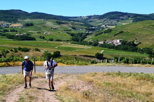
Taking its name from the thick mists that sweep over the region in winter, the Nebbio has for centuries been one of the most fertile parts of the island, producing honey, chestnuts and some of the island’s finest wine. An amphitheatre of rippled chalk hills, vineyards and cultivated valleys surrounds the area’s main town, St-Florent, half an hour’s drive west over the mountain from Bastia at the base of Cap Corse. Aside from EU subsidies, the major money earner here is viticulture: the village of Patrimonio is the wine-growing hub, with caves offering dégustations lined up along its main street.

St-Florent is the obvious base for day-trips to the beautifully preserved Pisan church of Santa Maria Assunta, just outside the town, and the Désert des Agriates, a wilderness of parched maquis-covered hills across the bay whose rugged coastline harbours one of Corsica’s least accessible, but most picturesque, beaches.

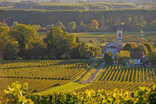
Patrimonio (Patrimoniu)

Some 6km from St-Florent lies PATRIMONIO, centre of the first Corsican wine region to gain appellation contrôlée status. Apart from the renowned local muscat, which can be sampled in the village or at one of the caves along the route from St-Florent, Patrimonio’s chief asset is the sixteenth-century church of St-Martin, occupying its own little hillock and visible for kilometres around. The colour of burnt sienna, it stands out vividly against the rich green vineyards and chalk hills. In a garden 200m south of the church stands a limestone statue-menhir known as U Nativu, a late megalithic piece dating from 900–800 BC. A carved T-shape on its front represents a breastbone, and two eyebrows and a chin can also be made out.

The U Nativu menhir takes pride of place next to the stage at Patrimonio’s annual open-air guitar festival, held in the last week of July next to the church, when performers and music aficionados from all over Europe converge on the village.

St-Florent

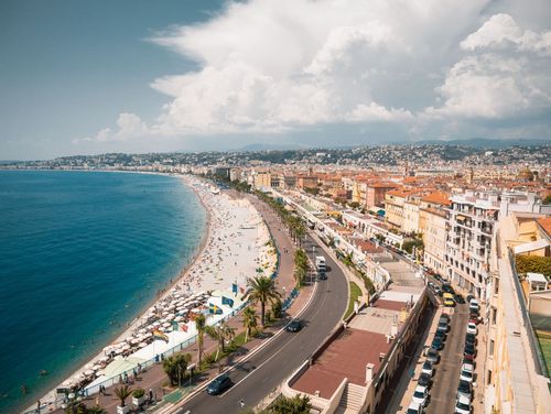
Viewed from across the bay, St-Florent (San Fiurenzu) appears as a bright line against the black tidal wave of the Tenda hills, the pale stone houses seeming to rise straight out of the sea, overlooked by a squat circular citadelle. It’s a relaxing town, with a decent beach and a good number of restaurants, but the key to its success is the marina, which is jammed with expensive boats throughout the summer. Neither the tourists, however, nor indeed St-Florent’s proximity to Bastia, entirely eclipse the air of isolation conferred on the town by its brooding backdrop of mountains and scrubby desert.

In Roman times, a settlement called Cersunam – referred to as Nebbium by chroniclers from the ninth century onwards – existed a kilometre east of the present village. The ancient port was eclipsed by the harbour that developed around the new Genoese citadelle in the fifteenth century, which prospered as one of Genoa’s strongholds, and it was from here that Paoli set off for London in 1796, never to return.

The Désert des Agriates

Extending westwards from the Golfe de St-Florent to the mouth of the Ostriconi River, the Désert des Agriates is a vast area of uninhabited land, dotted with clumps of cacti and scrub-covered hills. It may appear inhospitable now, but during the time of the Genoese this rocky moonscape was, as its name implies, a veritable breadbasket (agriates means “cultivated fields”). In fact, so much wheat was grown here that the Italian overlords levied a special tax on grain to prevent any build-up of funds that might have financed an insurrection. Fires and soil erosion eventually took their toll, however, and by the 1970s the area had become a total wilderness.

Numerous crackpot schemes to redevelop the Désert have been mooted over the years – from atomic weapon test zones to concrete Club-Med-style resorts – but during the past few decades the government has gradually bought up the land from its various owners (among them the Rothschild family) and designated it as a protected nature reserve.

A couple of rough pistes wind into the desert, but without some kind of 4WD vehicle the only feasible way to explore the area and its rugged coastline, which includes two of the island’s most beautiful beaches, is on foot. From St-Florent, a pathway winds northwest to plage de Perajola, just off the main Calvi highway (N1197), in three easy stages. The first takes around 5hr 30min, and leads past the famous Martello tower and much-photographed plage de Loto to plage de Saleccia, a huge sweep of soft white sand and turquoise sea that was used as a location for the invasion sequences in the film The Longest Day.

Porto (Portu) and around

The overwhelming proximity of the mountains, combined with the pervasive eucalyptus and spicy scent of the maquis, give Porto, 30km south of Calvi, a uniquely intense atmosphere that makes it one of the most interesting places to stay on the west coast. Except for a watchtower erected here by the Genoese in the second half of the sixteenth century, the site was only built upon with the onset of tourism since the 1950s; today the village is still so small that it can become claustrophobic in July and August, when overcrowding is no joke. Off season, the place becomes eerily deserted, so you’d do well to choose your times carefully; the best months are May, June and September.

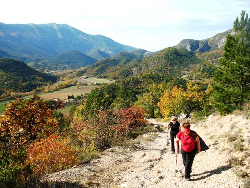
The crowds and traffic jams tend to be most oppressive passing the famous Calanches, a huge mass of weirdly eroded pink rock just southwest of Porto, but you can easily sidestep the tourist deluge in picturesque Piana, which overlooks the gulf from its southern shore, or by heading inland from Porto through the Gorges de Spelunca. Forming a ravine running from the sea to the watershed of the island, this spectacular gorge gives access to the equally grandiose Forêt d’Aïtone, site of Corsica’s most ancient Laricio pine trees and a deservedly popular hiking area. Throughout the forest, the river and its tributaries are punctuated by strings of piscines naturelles (natural swimming pools) – a refreshing alternative to the beaches hereabouts. If you’re travelling between Porto and Ajaccio, a worthwhile place to break the journey is the clifftop village of Cargèse where the two main attractions are the Greek church and spectacular beach.

Accommodation

Competition between hotels is more cut-throat in Porto than in any other resort on the island. During slack periods towards the beginning and end of the season, most places engage in a full-on price war, pasting up cheaper tariffs than their neighbours – all of which is great for punters. In late July and August, however, the normal high rates prevail.

The Calanches

The UNESCO-protected site of the Calanches, 5km southwest of Porto, takes its name from calanca, the Corsican word for creek or inlet, but the outstanding characteristics here are the vivid orange and pink rock masses and pinnacles which crumble into the dark blue sea. Liable to unusual patterns of erosion, these tormented rock formations and porphyry needles, some of which soar 300m above the waves, have long been associated with different animals and figures, of which the most famous is the Tête de Chien (Dog’s Head) at the north end of the stretch of cliffs. Other figures and creatures conjured up include a Moor’s head, a monocled bishop, a bear and a tortoise.

One way to see the fantastic cliffs of the Calanches is by boat from Porto. Alternatively, you could drive along the corniche road that weaves through the granite archways on its way to Piana. Eight kilometres along the road from Porto, the Roches Bleues café is a convenient landmark for walkers.

Picturesque Piana occupies a prime location overlooking the Calanches, but for some reason does not suffer the deluge of tourists that Porto endures. Retaining a sleepy feel, the village comprises a cluster of pink houses ranged around an eighteenth-century church and square, from the edge of which the panoramic views over the Golfe de Porto are sublime.

Calanches walks

The rock formations visible from the road are not a patch on what you can see from the waymarked trails winding through the Calanches, which vary from easy ambles to strenuous stepped ascents. An excellent leaflet highlighting the pick of the routes is available free from tourist offices. Whichever one you choose, leave early in the morning or late in the afternoon to avoid the heat in summer, and take plenty of water.

Walk one: The most popular walk is to the Château Fort (1hr), which begins at a sharp hairpin in the D81, 700m north of the Café Roches Rouges (look for the car park and signboard at the roadside). Passing the famous Tête de Chien, it snakes along a ridge lined by dramatic porphyry forms to a huge square chunk of granite resembling a ruined castle. Just before reaching it there’s an open platform from where the views of the gulf and Paglia Orba, Corsica’s third-highest mountain, are superb – one of the best sunset spots on the island – but bring a torch to help find the path back.

Walk two: For a more challenging extension to Walk one, begin instead at the Roches Rouges Café. On the opposite side of the road, two paths strike up the hill: follow the one on your left (nearest the stream, as you face away from the café), which zigzags steeply up the rocks, over a pass and down the other side to rejoin the D81 in around 1hr 15min. About 150m west of the spot where you meet the road is the trailhead for the Château Fort walk, with more superb views.

Walk three: A small oratory niche in the cliff by the roadside, 500m south of Café Roches Rouges, contains a Madonna statue, Santa Maria, from where the wonderful sentier muletier (1hr) climbs into the rocks above. Before the road was blasted through the Calanches in 1850, this old paved path, an extraordinary feat of workmanship supported in places by dry-stone banks and walls, formed the main artery between the villages of Piana and Ota. After a very steep start, the route contours through the rocks and pine woods above the restored mill at Pont de Gavallaghiu, emerging after one hour back on the D81, roughly 1.5km south of the starting point. Return by the same path.

Cargèse (Carghjese)

Sitting high above a deep blue bay on a cliff scattered with olive trees, Cargèse, 20km southwest of Porto, exudes a lazy charm that attracts hundreds of well-heeled summer residents to its pretty white houses and hotels. The full-time locals, half of whom are descendants of Greek refugees who fled the Turkish occupation of the Peloponnese in the seventeenth century, seem to accept with nonchalance this inundation – and the proximity of a large Club Med complex – but the best times to visit are May and late September, when Cargèse is all but empty.

Eating and drinking

A fair number of restaurants are scattered about the village, as well as the standard crop of basic pizzerias, but the most tempting places to eat are down in the harbour.

Eating and drinking

The overall standard of restaurants in Porto is poor, with overpriced food and indifferent service the norm, particularly during high season. There are, however, three noteworthy exceptions:

The Gorges de Spelunca

Spanning the 2km between the villages of Ota and Évisa, a few kilometres inland from Porto, the Gorges de Spelunca are a formidable sight, with bare orange granite walls, 1km deep in places, plunging into the foaming green torrent created by the confluence of the rivers Porto, Tavulella, Onca, Campi and Aïtone. The sunlight, ricocheting across the rock walls, creates a sinister effect that’s heightened by the dark jagged needles of the encircling peaks. The most dramatic part of the gorge can be seen from the road, which hugs the edge for much of its length.

Porto-Vecchio

Set on a hillock overlooking a beautiful deep blue bay, Porto-Vecchio, 25km north of Bonifacio, was rated by James Boswell as one of “the most distinguished harbours in Europe”. It was founded in 1539 as a second Genoese stronghold on the east coast, Bastia being well established in the north. The site was perfect: close to the unexploited and fertile plain, it benefited from secure high land and a sheltered harbour, although the mosquito population spread malaria and wiped out the first Ligurian settlers within months. Things began to take off mainly thanks to the cork industry, which still thrived well into the twentieth century. Today most revenue comes from tourists, the vast majority of them well-heeled Italians who flock here for the fine outlying beaches. To the northwest, the little town of Zonza makes a good base for exploring the dramatic forest that surrounds one of Corsica’s most awesome road trips, the route de Bavella.

Around the centre of town there’s not much to see, apart from the well-preserved fortress and the small grid of ancient streets backing onto the main place de la République. East of the square you can’t miss the Porte Génoise, which frames a delightful expanse of sea and saltpans and through which you’ll find the quickest route down to the modern marina, which is lined with cafés and restaurants.

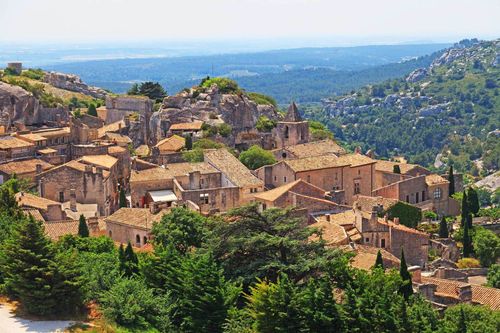
Sartène (Sartè) and around

Prosper Mérimée famously dubbed Sartène“la plus corse des villes corses” (“the most Corsican of Corsican towns”), but the nineteenth-century German chronicler Gregorovius put a less complimentary spin on it when he described it as a “town peopled by demons”. Sartène hasn’t shaken off its hostile image, despite being a smart, better-groomed place than many small Corsican towns. The main square, place Porta, doesn’t offer many diversions once you’ve explored the enclosed vielle ville, and the only time of year Sartène teems with tourists is at Easter for U Catenacciu, a Good Friday procession that packs the main square with onlookers.

Close to Sartène are some of the island’s best-known prehistoric sites, most notably Filitosa, the megaliths of Cauria and the Alignement de Palaggiu – Corsica’s largest array of prehistoric standing stones – monuments from which are displayed in the town’s excellent museum.

The megalithic sites

Sparsely populated today, the rolling hills of the southwestern corner of Corsica are rich in prehistoric sites. The megaliths of Cauria, standing in ghostly isolation 10km southwest from Sartène, comprise the Dolmen de Fontanaccia, the best-preserved monument of its kind on Corsica, while the nearby alignments of Stantari and Renaggiu have an impressive congregation of statue-menhirs.

More than 250 menhirs can be seen northwest of Cauria at Palaggiu, another rewardingly remote site. Equally wild is the coast hereabouts, with deep clefts and coves providing some excellent spots for diving and secluded swimming.

As you snake your way through the maquis, the Dolmen de Fontanaccia eventually comes into view on the horizon, crowning the crest of a low hill amid a sea of vegetation. A blue sign at the parking space indicates the track to the dolmen, a fifteen-minute walk away. Known to the locals as the Stazzona del Diavolu (Devil’s Forge), a name that does justice to its enigmatic power, the Dolmen de Fontanaccia is in fact a burial chamber from around 2000 BC. This period was marked by a change in burial customs – whereas bodies had previously been buried in stone coffins in the ground, they were now placed above, in a mound of earth enclosed in a stone chamber. What you see today is a great stone table, comprising six huge granite blocks nearly 2m high, topped by a stone slab that remained after the earth eroded away.

The twenty “standing men” of the Alignement de Stantari, 200m to the east of the dolmen, date from the same period. All are featureless, except two which have roughly sculpted eyes and noses, with diagonal swords on their fronts and sockets in their heads where horns would probably have been attached.

Across a couple of fields to the south is the Alignement de Renaggiu, a gathering of forty menhirs standing in rows amid a small shadowy copse, set against the enormous granite outcrop of Punta di Cauria. Some of the menhirs have fallen, but all face north to south, a fact that seems to rule out any connection with a sun-related cult.

The Réserve Naturel de Scandola

The extraordinary Réserve Naturel de Scandola takes up the promontory dividing the Balagne from the Golfe de Porto. Composed of striking red porphyry granite, its sheer cliffs and gnarled claw-like outcrops were formed by Monte Cinto’s volcanic eruptions 250 million years ago, and subsequent erosion has fashioned shadowy caves, grottoes and gashes in the rock. Scandola’s colours are as remarkable as the shapes, the hues varying from the charcoal grey of granite to incandescent rusty purple.

The headland and its surrounding water were declared a nature reserve in 1975 and now support significant colonies of seabirds, dolphins and seals, as well as 450 types of seaweed and some remarkable fish such as the grouper, a species more commonly found in the Caribbean. In addition, nests belonging to the rare Audouin’s gull are visible on the cliffs, and you might see the odd fish eagle (Balbuzard pêcheur) – there used to be only a handful of nesting pairs at one time, but careful conservation has increased their numbers considerably over the past two decades.

Girolata

Connected by a mere mule track to the rest of the island (1hr 30min on foot from the nearest road), the tiny fishing haven of Girolata, immediately east of Scandola, has a dreamlike quality that’s highlighted by the vivid red of the surrounding rocks. A short stretch of stony beach and a few houses are dominated by a stately watchtower, built by the Genoese in the seventeenth century in the form of a small castle on a bluff overlooking the cove. For most of the year, this is one of the most idyllic spots on the island, with only the odd yacht and party of hikers to threaten the settlement’s tranquillity. From June to September, though, daily boat trips from Porto and Calvi ensure the village is swamped during the middle of the day, so if you want to make the most of the scenery and peace and quiet, walk here and stay a night in one of the gîtes.

Planning your own trip? Prepare for your trip

Use Rough Guides' trusted partners for great rates

Rough Guides Editors

written by Rough Guides Editors

updated 11.10.2023

Ready to travel and discover
France?

Get support from our local experts for
stress-free planning & worry-free travels

Plan my trip ⤍