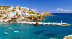
Véria and Vergina
West of Thessaloníki, VÉRIA (ancient Berrhoea or Berea) is one of the more interesting northern Greek communities, thanks to its mixed Jewish, Muslim and Christian heritage. In the nineteenth century the town became an important industrial centre, growing prosperous from flour and sesame milling as well as hide tanning. The pleasant modern town boasts an excellent new Byzantine Museum and a smattering of appealing religious edifices. There are also enough facilities to make it a reasonable base for visits to the excavations of ancient Aegae at Vergina.
Vergina: Ancient Aegae
The site of VERGINA, 16km southeast of Véria, undoubtedly qualifies as one of Greece’s most memorable attractions. This was the site of Aegae, the original Macedonian royal capital before the shift to Pella, and later the sanctuary and royal burial place of the Macedonian kings. It was here that Philip II, father of Alexander the Great, was assassinated, cremated and buried; tradition maintained that the dynasty would be destroyed if any king were buried elsewhere, as indeed happened after the death of Alexander in Asia. Until the site was unearthed in 1977 after decades of work by Professor Manolis Andronikos, Aegae had long been assumed to be lost beneath modern Édhessa. The ruins of the Palace of Palatítsia are currently closed for renovations until at least 2017.
The Royal Tombs
Under a tumulus, then just outside modern Veryína, Andronikos discovered several large Macedonian chamber tombs, known simply as the Royal Tombs. From outside, all that’s visible is a low hillock with skylights and long ramps leading inside, but once underground in the climate-controlled bunker you can admire the facades and doorways of the tombs in situ, well illuminated behind glass. Finds from the site and tombs, the richest Greek trove since the discovery of Mycenae, are exhibited in the complex along with erudite texts in Greek and English. It’s best to try and get here very early or visit at siesta time in order to avoid the crowds.
A clockwise tour takes you round the tombs in the order IV-I-II-III. Tomb IV, the so-called Doric, was looted in antiquity; so too was Tomb I, or the Persephone tomb, but it retained a delicate and exquisitely crafted mural of the rape of Persephone by Hades, the only complete example of an ancient Greek painting that has yet been found. Tomb II, that of Philip II, is a much grander vaulted affair with a Doric facade adorned by a sumptuous painted frieze of Philip, Alexander and their retinue on a lion hunt. Incredibly, the tomb was discovered intact. Among its treasures on display are a marble sarcophagus containing a gold ossuary (larnax), its cover embossed with the sixteen-pointed star symbol of the royal line, and, more significantly, five small ivory heads, among them representations of both Philip II and Alexander. It was this clue, as well as the fact that the skull bore marks of a facial wound Philip was known to have sustained, that led to the identification of the tomb as his. Also on view are a fabulous gold oak-leaf wreath – so delicate it quivers – and a modest larnax (small coffin) found in the antechamber, presumed to contain the carefully wrapped bones and ashes of a Thracian queen or concubine.
Tomb III is thought to be that of Alexander IV, “the Great’s” son, murdered in adolescence – thus the moniker Prince’s Tomb. His bones were discovered in a silver vase. From the tomb frieze, a superb miniature of Dionysos and his consort is highlighted. You should also spare a moment or two to view the excellent video, subtitled in English, which brings the archeological finds to life.
The Macedonian Tomb
The so-called Macedonian Tomb, actually five adjacent tombs, can also be visited after a fashion. They are about 500m uphill, above the large parking lot, left of the main road. Like the Royal Tombs, they lie well below ground level, protected by a vast tin roof. Excavated by the French in 1861, the most prominent one, thought to be that of Philip’s mother Eurydike, is in the form of a temple, with an Ionic facade of half-columns breached by two successive marble portals opening onto ante- and main chambers. Inside you can just make out an imposing marble throne with sphinxes carved on the sides, armrests and footstool. The neighbouring two pairs of tombs, still undergoing snail-paced excavation, are said to be similar in design.
Northwest Macedonia
This intriguing corner of the province includes the handsome towns of Édhessa and Kozáni. West of Édhessa is the handsome mountain village of Nymféo, where some of the attractive stone houses have been converted into classy accommodation, and the bird-rich Préspa lakes, both of which nestle in a strategic spot where Greece, Albania and the Republic of Macedonia meet. Flórina, the area’s main urban centre, is of limited appeal but does have two notable museums. Seeing the area properly is really only viable if you have your own transport.
Édhessa
The main gateway to northwest Macedonia, ÉDHESSA is a delightful place atop an escarpment. Its modest fame is attributed to the waters that flow through the town; descending from the mountains to the north, which eventually cascade down a dramatic ravine, luxuriant with vegetation, to the plain below. Most of the town’s architecture is humdrum, but the various stream-side parks and wide pedestrian pavements are a rare pleasure in Greece (Édhessa was a pioneer in pedestrianization) and it’s an increasingly important centre for regional tourism.
Édhessa aquarium
This unusual freshwater aquarium is the centrepiece of a so-called open-air water museum, built from converted watermills in the Varósi district just west of the waterfalls. The surrounding mills and Balkan-style houses, some decorously decaying, others tastefully renovated, reward aimless wanderings – though everything is well signposted.
The folklore museum
The only real sight as such is a delightful little folklore museum near Ayía Paraskeví church; it displays various household objects and other traditional items of the kind that would once have graced every home in the district.
The Préspa lakes
A shimmering expanse of water riven by islets and ridges, the PRÉSPA LAKES are one of the Balkans’ most important wildlife sanctuaries. Though not postcard-pretty, the basin, in the far northwest of Macedonia, has an eerie beauty that grows on you with further acquaintance. It also has a surprisingly turbulent history as a place of exile for troublesome noblemen during the Byzantine era and the scene of vicious local battles during the 1947–49 Greek civil war.
Mikrí Préspa, the southerly lake, is mostly shallow (9m maximum depth) and reedy, with a narrow fjord curling west and just penetrating Albanian territory. The borders of Greece, Albania and the Republic of Macedonia meet in the middle of deeper Megáli Préspa and, especially during the early 1990s, it became a major exit corridor into Greece for Albanian refugees, who found work as illegal agricultural workers in the local bean and hay industry.
The core of the national park, established in 1971, barely encompasses Mikrí Préspa and its shores, but the peripheral zone extends well into the surrounding mountains, affording protection of sorts to foxes, wolves and even bears, which inhabit the area. The lakes have a dozen resident fish species, including tsiróni, a sort of freshwater sardine, and grivádhi, a kind of carp, but it’s birdlife for which the Préspa basin is most famous.
Mikrolímni
MIKROLÍMNI, 5km up a side road off the main route into the valley, is an extremely sleepy hamlet that might be your first conceivable stop. In the evening, you can look towards sunsets over reedbeds and the snake-infested Vidhronísi (or Vitrinítsi) islet, though swimming isn’t good here, or anywhere else on Mikrí Préspa for that matter.
Return to the main road, which reaches a T-junction 16km from the main Flórina–Kastoriá highway, on the spit which separates the larger and smaller lakes. It’s probable that at one time there was just one lake here, but now there’s a 4m elevation difference. Bearing right at the junction leads within 4km to Áyios Yermanós; the left option splits again at the west end of the spit, bearing south towards the islet of Áyios Ahíllios or northwest towards the hamlet of Psarádhes.
Áyios Yermanós
ÁYIOS YERMANÓS, 4km to the right at the T-junction when the main road reaches Megáli Préspa, is a large village of tile-roofed houses, overlooking a patch of the lake in the distance and adjoining the hamlet of Lemós. It’s worth making the trip up just to see two tiny late Byzantine churches, whose frescoes, dating from the time when the place belonged to the bishopric of Ohrid, display a marked Macedonian influence. Inside the lower church, Áyios Athanásios, seldom open, you can glimpse a dog-faced St Christopher among a line of saints opposite the door. Far more impressive, however, is the tiny, eleventh-century parish church of Áyios Yermanós up on the square, hidden behind a new monster awkwardly tacked onto it in 1882. The Byzantine structure has its own entrance, and the frescoes, skilfully retouched in 1743, can be lit; the switch is hidden in the narthex.
Koúla beach
At the far end of the wide causeway dividing the two lakes, 4km to the left from the T-junction, is Koúla beach, a motley cluster of what passes for tourist development hereabouts: a patch of reed-free sand from where you can swim in Megáli Préspa; a free but basic camping area, now bereft of its water tap; plus an army post.
Psarádhes
Reached by 6km of panoramic corniche road from a signposted turning near Koúla beach, the rickety village of PSARÁDHES makes for a pleasant stroll. Unfortunately, the wonderful old houses lining the lanes are increasingly derelict. It is sometimes possible to take a short boat excursion out onto the lake to see some of the lakeside monuments and churches, but this is not the best way to spot birdlife; there is no fixed schedule, so ask around.
Áyios Ahíllios
Two kilometres directly south of Koúla beach, the road soon brings you to a floating footbridge, 1500m in length, which leads across to the islet of Áyios Ahíllios and its impoverished, almost deserted hamlet. A five-minute walk from the footbridge is the ruined Byzantine basilica of Áyios Ahíllios, while another ruin, a sixteenth-century monastery, Panayía Porfaras, lies at the southern end of the islet. For unrivalled views of Mikrí Préspa climb up to the summit of the islet’s hill.
The birds of Préspa
The lakes are home to relatively few birds of prey but you should see a fair number of egrets, cormorants, crested grebes and pelicans. This is one of the few breeding sites of both the white and Dalmatian pelican, which nest in the spring, with the chicks out and about by summer. They feed partly on the large numbers of snakes, which include vipers, whip snakes and harmless water snakes which you may encounter while swimming. Observation towers are available at Vromolímni and near Áyios Ahíllios, but dawn spent anywhere at the edge of the reedbeds with a pair of binoculars will be immensely rewarding, though bear in mind that you are not allowed to boat or wade into the reeds.
Halkidhikí
HALKIDHIKÍ begins at a perforated edge of shallow lakes east of Thessaloníki, then extends into three prongs of land – Kassándhra, Sithonía and Athos – trailing like tentacles into the northern Aegean Sea. Kassándhra and Sithonía host some of the busiest holiday resorts in Greece, drawing hordes from Thessaloníki and other parts of the north, as well as increasing numbers from eastern Europe. The beaches themselves consist of white sand, ranging in consistency from powder to coarse-grained.
Mount Athos, the easternmost peninsula, is in all ways separate, a “Holy Mountain” whose monastic population, semi-autonomous within the Greek state, excludes all females – even as visitors. The most that women can do is to glimpse the buildings from offshore cruise kaïkia sailing from the two small resorts on the periphery of the peninsula – Ierissós and Ouranoúpoli – on the “secular” part of the Athos peninsula.
Macedonian Cavemen
Fifty kilometres southeast of Thessaloníki, en route to the Kassándhra peninsula, and set among handsome mountain scenery, is the cave of Kókkines Pétres. The name means “Red Stones”, and they were discovered in 1959 by villagers from nearby Petrálona looking for water. Besides an impressive display of stalagmites and stalactites, the villagers – and, later, academics – found the fossilized remains of prehistoric animals and, most dramatic of all, a Neanderthal skull, all of which are displayed in a decent museum near the cave entrance. No photography is allowed, but there is a small museum and onsite café.
Northeast Macedonia
Few people ever venture into the arable plains of northeastern Macedonia, where attractions are sparsely spread among golden fields of corn and tobacco and incredible numbers of storks’ nests. Up near the craggy mountains that form the frontier with Bulgaria, artificial Lake Kerkíni is home to masses of birds, some of them extremely rare in Europe, making it as interesting to ornithologists as the Préspa lakes much farther west. The tranquil setting and rich flora mean it is not only for avid twitchers.
An alternative route to the Egnatía Odhós for reaching Kavála is the scenic route that climbs northeast out of Thessaloníki, first taking you via Sérres before passing Alistráti, worth visiting for its memorable caves, and then heading towards Dhráma and ancient Philippi along a quieter road that offers majestic panoramas of Mount Meníkio (1963m), Mount Pangéo (1956m) and Mount Falakró (2230m). Regular buses from Thessaloníki and between Sérres and Dhráma ply this road.
The Kerkíni Wetlands
Artificial, marsh-fringed Lake Kerkíni, tucked up near the mountainous Bulgarian border some 80km northeast of Thessaloníki, enjoys international protected status, thanks to the 300-plus species of birds that spend at least part of the year here, some of them on the endangered species list. Huge expanses of water lilies stretch across the large anvil-shaped lake, out of which the River Strymónas flows to the northern Aegean near ancient Amphipolis, while a herd of water buffalo wallows and grazes the eastern banks, and local fishermen compete with every type of heron known to inhabit Europe. Other birds breeding in the Kerkíni wetlands include various species of grebes, terns, egrets, ducks, geese, ibis, spoonbills, avocets and pelicans, plus raptors such as the black kite, the short-toed eagle and the Levant sparrowhawk.
Kerkíni
Two kilometres from the lake’s northern shore lies the village of KERKÍNI, where you will find the Kerkíni Wetlands Information Centre (kerkini@otenet.gr). You can also negotiate birdwatching trips in a pláva, a traditional punt-like fishing boat. The surroundings reward exploration with their abundance of flora and fauna, with huge numbers of wildflowers in the spring and early summer.
Philippi
Just 14km short of Kavála on the busy road from Dhráma, you come to PHILIPPI (Filippoi on some maps and signs), a famous battlefield during the civil wars of Ancient Rome and the subject of one of St Paul’s Epistles. Apart from the scattered Roman ruins, the principal remains of the site are several impressive, although derelict, basilican churches.
Brief history
Philippi was named after Philip II of Macedon, who wrested it from the Thracians in 356 BC for the sake of nearby gold mines on Mount Pangéo. However, it owed its later importance and prosperity to the Roman construction of the Via Egnatía. With Kavála/Neapolis as its port, Philippi was essentially the easternmost town of Roman-occupied Europe. Here, as at Actium, the fate of the Roman Empire was decided, at the Battle of Philippi in 42 BC. After assassinating Julius Caesar, Brutus and Cassius had fled east of the Adriatic and, against their better judgement, were forced into confrontation on the Philippi plains with the pursuing armies of Antony and Octavian and were comprehensively beaten in two successive battles.
St Paul landed at Kavála and visited Philippi in 49 AD, and so began his religious mission in Europe. Despite being cast into prison, he retained a special affection for the Philippians, his first converts, and the congregation that he established was one of the earliest to flourish in Greece.
The site
The most conspicuous of the churches at the site is the Direkler (Turkish for “columns” or “piers”), to the south of the modern road which here follows the line of the Via Egnatía. Also known as Basilica B, this was an unsuccessful attempt by its sixth-century architect to improve the basilica design by adding a dome. The central arch of its west wall and a few pillars of reused antique drums stand amid remains of the Roman forum. A line of second-century porticoes spreads outwards in front of the church, and on their east side are the foundations of a colonnaded octagonal church, which was approached from the Via Egnatía by a great gate. Behind the Direkler and, perversely, the most interesting and best-preserved building of the site, is a huge monumental public latrine with nearly fifty of its original marble seats still intact.
Across the road on the northern side, stone steps climb up to a terrace, passing on the right a Roman crypt, reputed to have been the prison of St Paul and appropriately frescoed. The terrace flattens out onto a huge paved atrium that extends to the foundations of another extremely large basilica, designated Basilica A. Continuing in the same direction around the base of a hill you emerge above a theatre cut into its side. Though dating from the same period as the original town, it was heavily remodelled as an amphitheatre by the Romans – the bas-reliefs of Nemesis, Mars and Victory all belong to this period. It is now used for performances during the annual summer Philippi-Thássos Festival. The best general impression of the site – which is extensive despite a lack of obviously notable buildings – and of the battlefield behind it can be gained from the acropolis, whose own remains are predominantly medieval. This can be reached by a steep climb along a path from the museum.