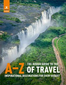
Alexander von Humboldt, 1802
Almost opposite the Ilinizas, the snowcapped, perfectly symmetrical Volcán Cotopaxi (5897m) forms the centrepiece of Ecuador’s most-visited mainland national park, Parque Nacional Cotopaxi, covering 330 square kilometres of the eastern cordillera. With its broad, green base and graceful slopes tapering to the lip of its crater, Cotopaxi is the most photogenic of the country’s thirty or so volcanoes, and on a clear day makes a dizzying backdrop to the stretch of highway between Quito and Latacunga. One of the highest active volcanoes in the world, it’s also one of Ecuador’s most destructive, with at least ten major eruptions since 1742 responsible for repeatedly destroying the nearby town of Latacunga. It’s been fairly quiet since its last burst of activity in 1904, and today Cotopaxi is the most popular climb in Ecuador. Although the volcano dominates everything around it, and the aim of most visitors is simply to get a close-up view before turning home, a number of other attractions make a visit to the park very rewarding – namely the starkly beautiful páramo, all rolling moorland streaked by wispy clouds and pockets of mist. At an altitude of some 3500–4500m, the air here is thin and crisp, and the tundra-like vegetation is made up principally of cropped pajonales (straw-like grass) and shrubs, lichens and flowers adapted to harsh climates. Over ninety species of birds inhabit the park, including the tury hummingbird, Andean hillstar and Andean lapwing, while mammals include white-tailed deer, rabbits, Andean foxes and pumas.
Less inspiring are the stuffed animals on display at the Museo Mariscal Sucre, 10km from the main entrance checkpoint and often the first stop on a Cotopaxi tour. Outside the museum there’s a short self-guided trail to introduce you to the páramo, but a more satisfying way to explore this habitat is on the one-hour footpath around the Lago Limpiopungo around 5km further up the road – a long, shallow lake lying at 3800m, surrounded by boggy reeds that provide a habitat for numerous birds. When the clouds part, its waters present a striking reflection of the 4712-metre peak of Cerro Rumiñahui, looming over it to the northwest, whose lower slopes can be reached by a path branching off the north shore of the lake. Most visitors continue a further 13km from here as far as the parking area, known as the Parqueador del Refugio, sitting at 4600m on the slopes of Cotopaxi. From here, a footpath leads steeply up a scree slope to the José F. Ribas refuge (4800m), a popular target for day visitors. It looks tantalizingly close, but if you’re not acclimatized it can be a real struggle; count on taking 45 minutes to an hour to reach it. Once there, you can warm yourself with hot tea and snacks.
From a junction near the lake, one track goes to the northern park control, and another skirts northeast around Cotopaxi passing by several archeological sites, most notably El Salitre, the remains of an Inca pucará, or fortress, used to control access down to the Amazon basin. Apart from the atmospheric scenery, there’s not a great deal to see here, though you can see some of the pieces recovered from the sites at the Museo.